


| | | | |||
| orchidas : dev / LCCCI / CCI classes | Site Map |
ESA CCI LC maps aggregated at 0.25 resolution
| CCI CLASS | MAPS and AREA (Mkm2) | ||||
| 1992 | 2000 | 2010 | 2019 | Time-series | |
| 0 No data |  |  |  |  |  |
| 0 (0%) | 0 (0%) | 0 (0%) | 0 (0%) | ||
| 10 Cropland, rainfed |  | 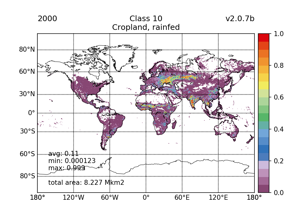 |  |  | 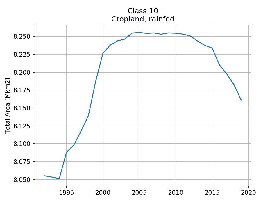 |
| 8.055 (1.58%) | 8.227 (1.61%) | 8.254 (1.62%) | 8.161 (1.6%) | ||
| 11 Cropland, rainfed, herbaceous cover | 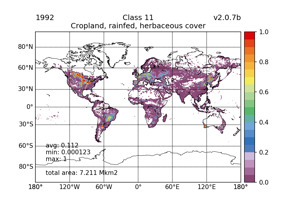 | 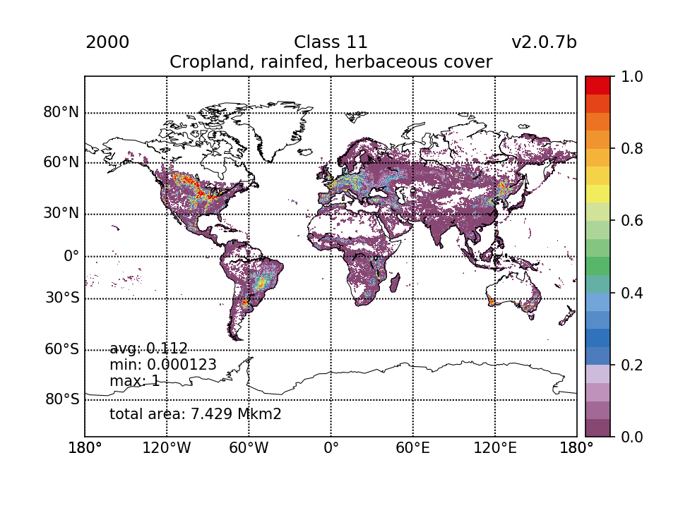 |  | 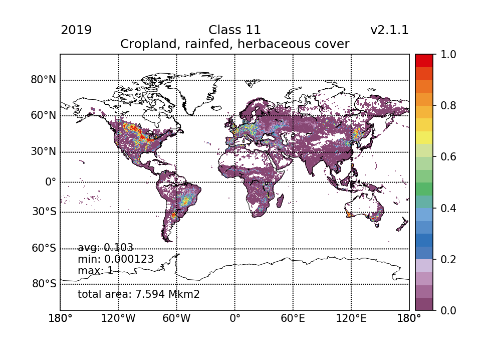 |  |
| 7.211 (1.41%) | 7.429 (1.46%) | 7.534 (1.48%) | 7.594 (1.49%) | ||
| 12 Cropland, rainfed, tree or shrub cover |  |  | 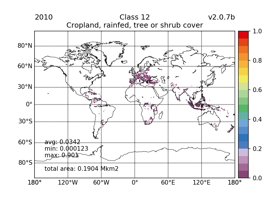 | 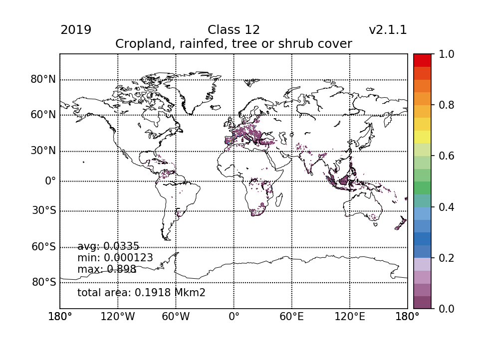 | 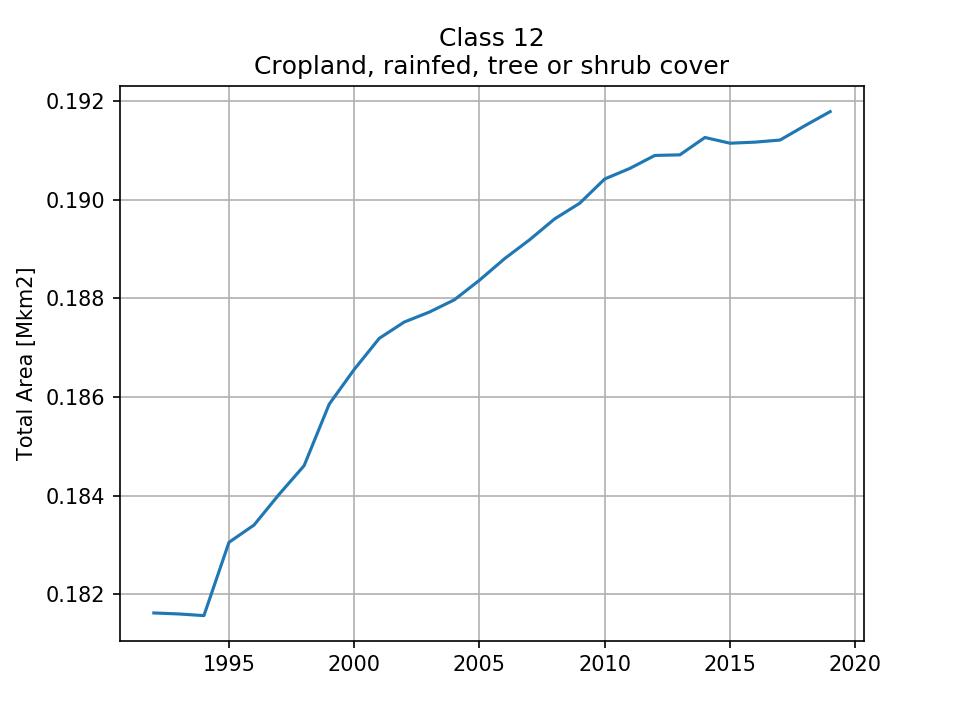 |
| 0.1816 (0.0356%) | 0.1866 (0.0366%) | 0.1904 (0.0373%) | 0.1918 (0.0376%) | ||
| 20 Cropland, irrigated or post-flooding |  |  |  | 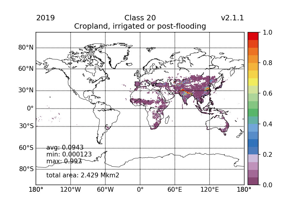 | 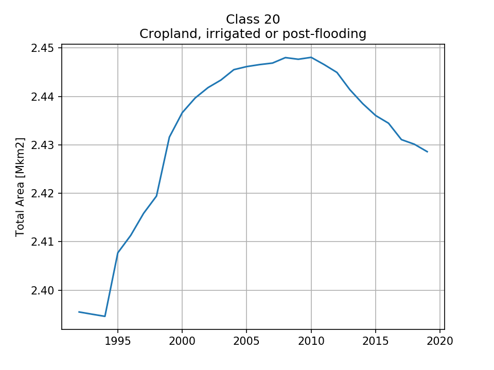 |
| 2.396 (0.47%) | 2.437 (0.478%) | 2.448 (0.48%) | 2.429 (0.476%) | ||
| 30 Mosaic cropland (>50%) / natural vegetation (tree, shrub, herbaceous cover) (<50%) |  | 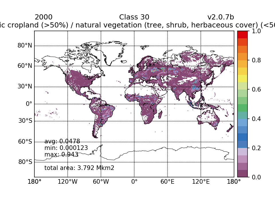 | 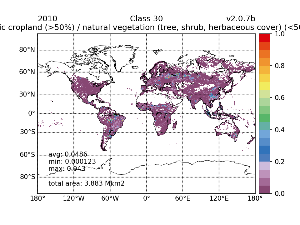 |  | 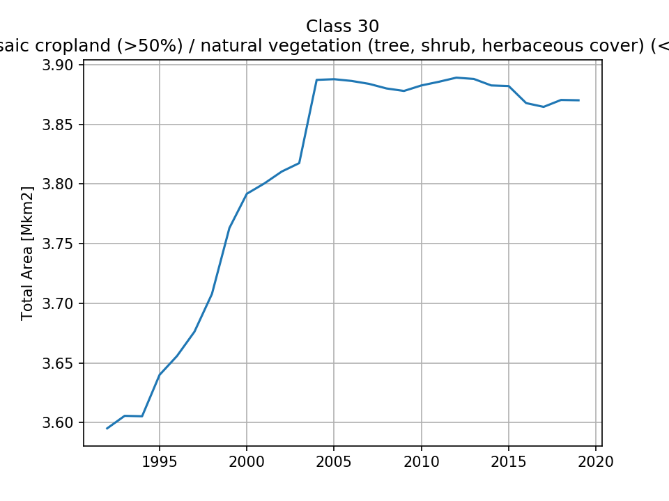 |
| 3.595 (0.705%) | 3.792 (0.743%) | 3.883 (0.761%) | 3.87 (0.759%) | ||
| 40 Mosaic natural vegetation (tree, shrub, herbaceous cover) (>50%) / cropland (<50%) |  | 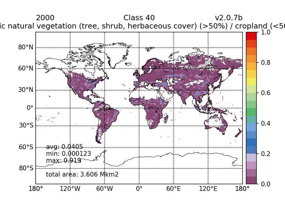 |  |  | 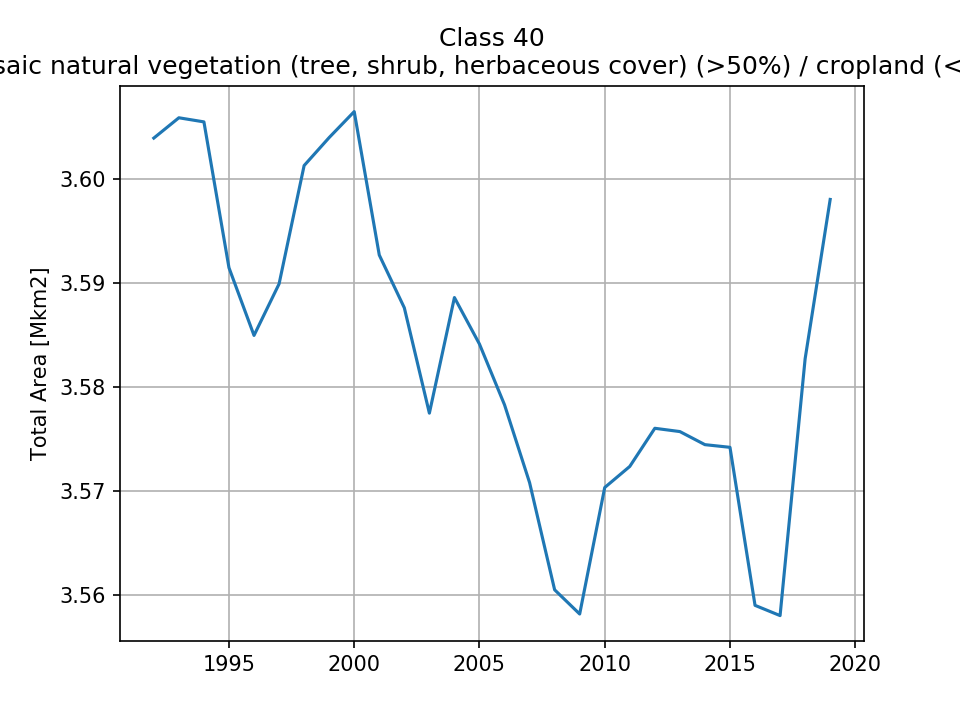 |
| 3.604 (0.707%) | 3.606 (0.707%) | 3.57 (0.7%) | 3.598 (0.705%) | ||
| 50 Tree cover, broadleaved, evergreen, closed to open (>15%) |  |  |  | 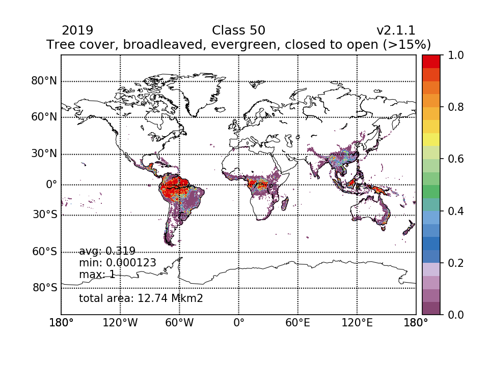 | 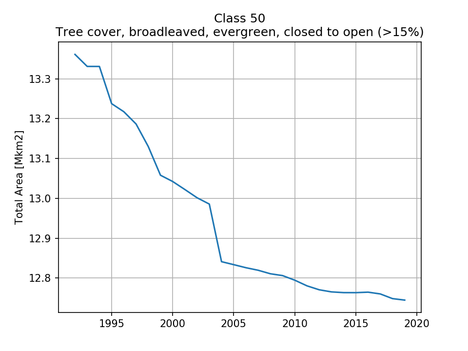 |
| 13.36 (2.62%) | 13.04 (2.56%) | 12.79 (2.51%) | 12.74 (2.5%) | ||
| 60 Tree cover, broadleaved, deciduous, closed to open (>15%) |  |  | 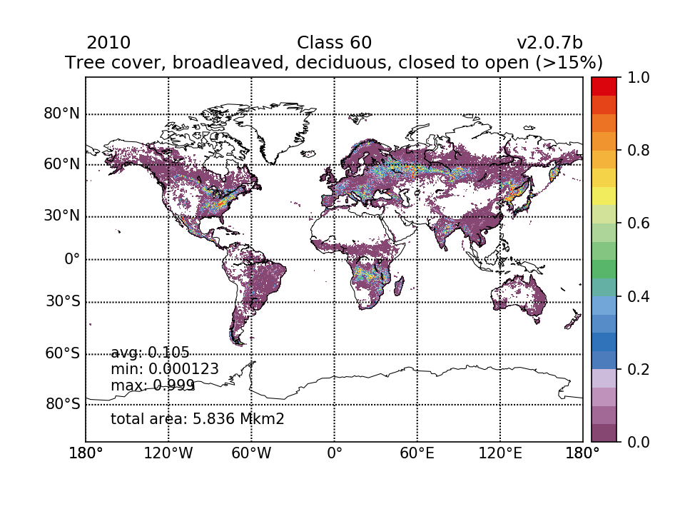 | 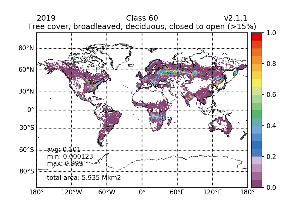 |  |
| 6.097 (1.2%) | 5.897 (1.16%) | 5.836 (1.14%) | 5.935 (1.16%) | ||
| 61 Tree cover, broadleaved, deciduous, closed (>40%) |  |  | 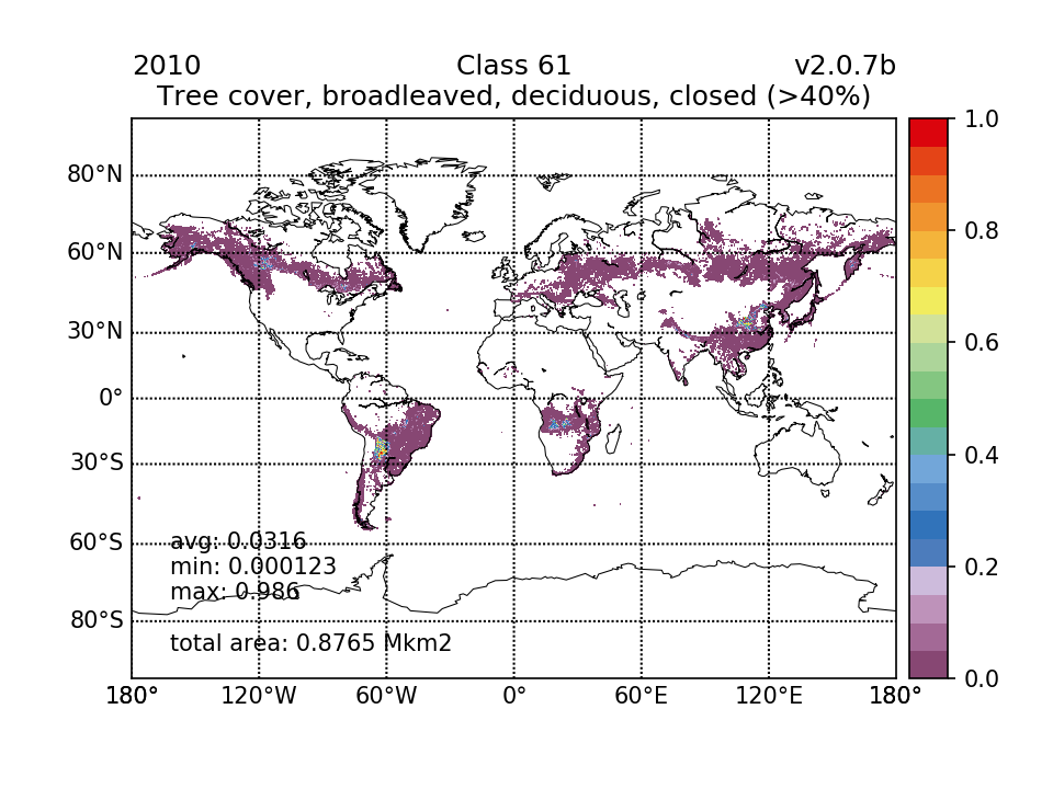 |  | 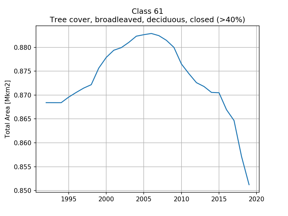 |
| 0.8684 (0.17%) | 0.8779 (0.172%) | 0.8765 (0.172%) | 0.8512 (0.167%) | ||
| 62 Tree cover, broadleaved, deciduous, open (15-40%) |  |  | 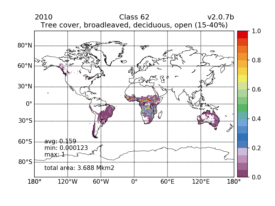 |  |  |
| 3.55 (0.696%) | 3.618 (0.709%) | 3.688 (0.723%) | 3.66 (0.718%) | ||
| 70 Tree cover, needleleaved, evergreen, closed to open (>15%) |  |  |  | 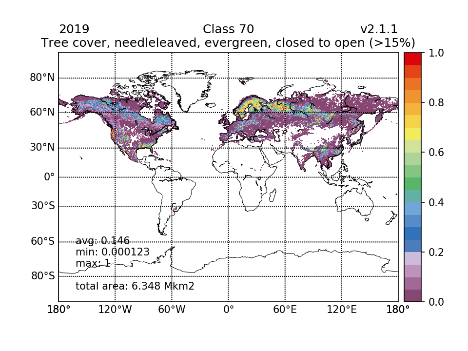 |  |
| 6.616 (1.3%) | 6.536 (1.28%) | 6.473 (1.27%) | 6.348 (1.24%) | ||
| 71 Tree cover, needleleaved, evergreen, closed (>40%) | 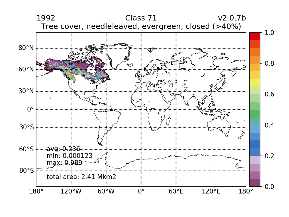 | 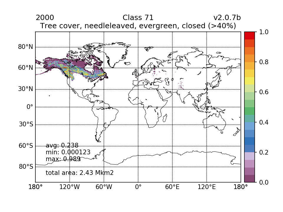 |  | 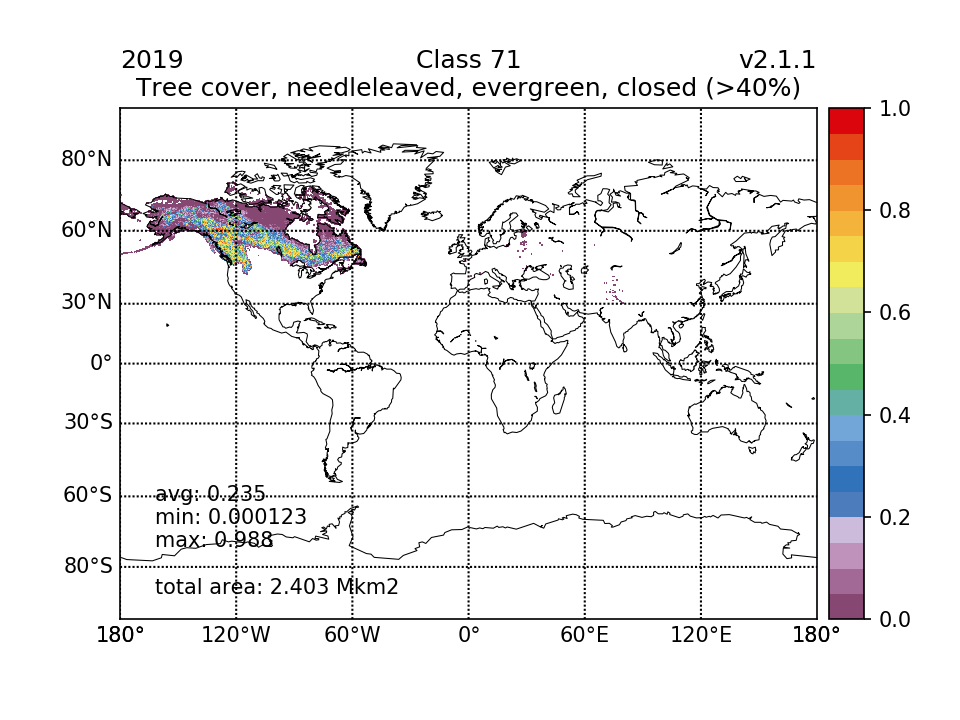 | 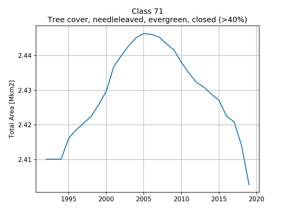 |
| 2.41 (0.472%) | 2.43 (0.476%) | 2.438 (0.478%) | 2.403 (0.471%) | ||
| 72 Tree cover, needleleaved, evergreen, open (15-40%) |  | 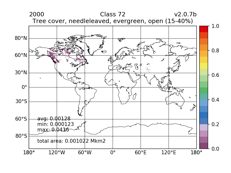 |  |  | 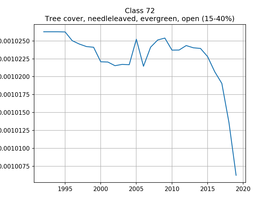 |
| 0.001026 (0.000201%) | 0.001022 (0.0002%) | 0.001024 (0.000201%) | 0.001006 (0.000197%) | ||
| 80 Tree cover, needleleaved, deciduous, closed to open (>15%) | 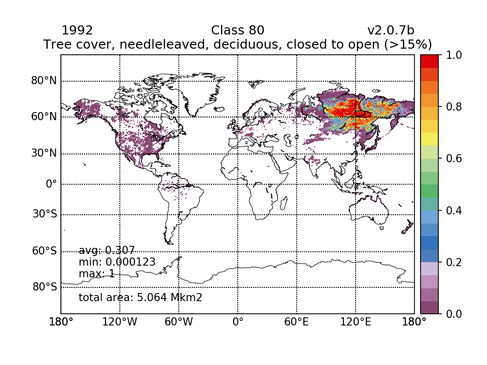 | 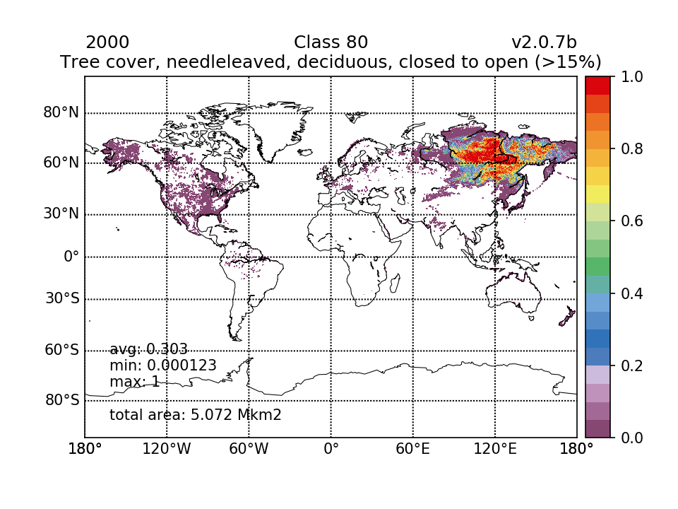 |  |  | 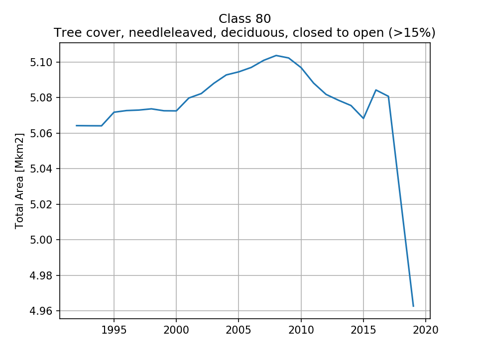 |
| 5.064 (0.993%) | 5.072 (0.994%) | 5.097 (0.999%) | 4.963 (0.973%) | ||
| 81 Tree cover, needleleaved, deciduous, closed (>40%) | 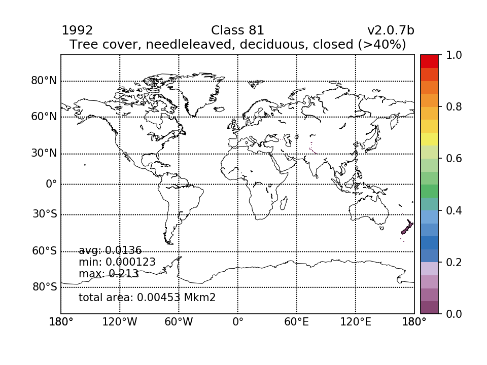 |  |  |  | 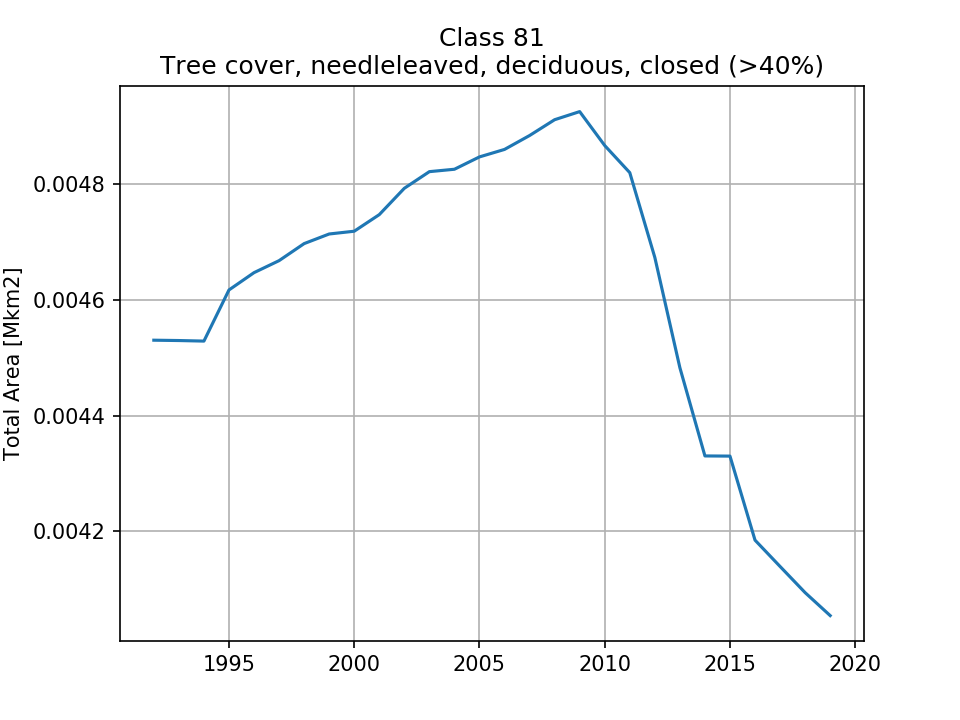 |
| 0.00453 (0.000888%) | 0.004719 (0.000925%) | 0.004867 (0.000954%) | 0.004054 (0.000795%) | ||
| 82 Tree cover, needleleaved, deciduous, open (15-40%) |  | 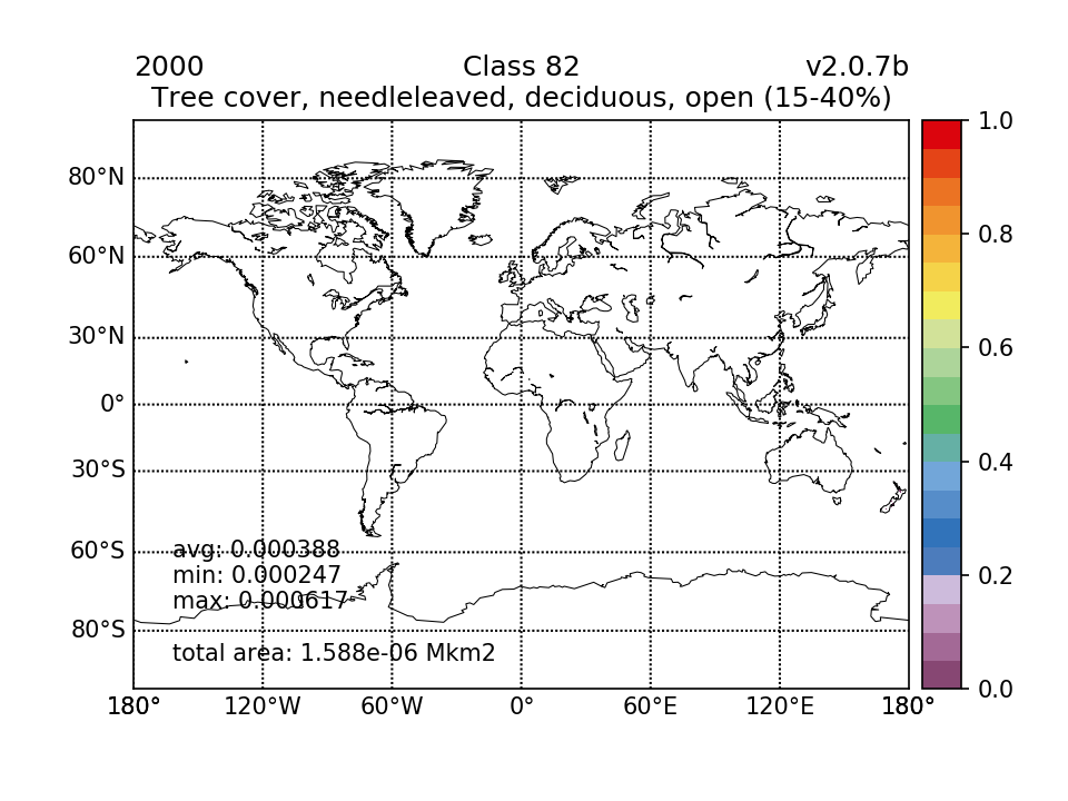 | 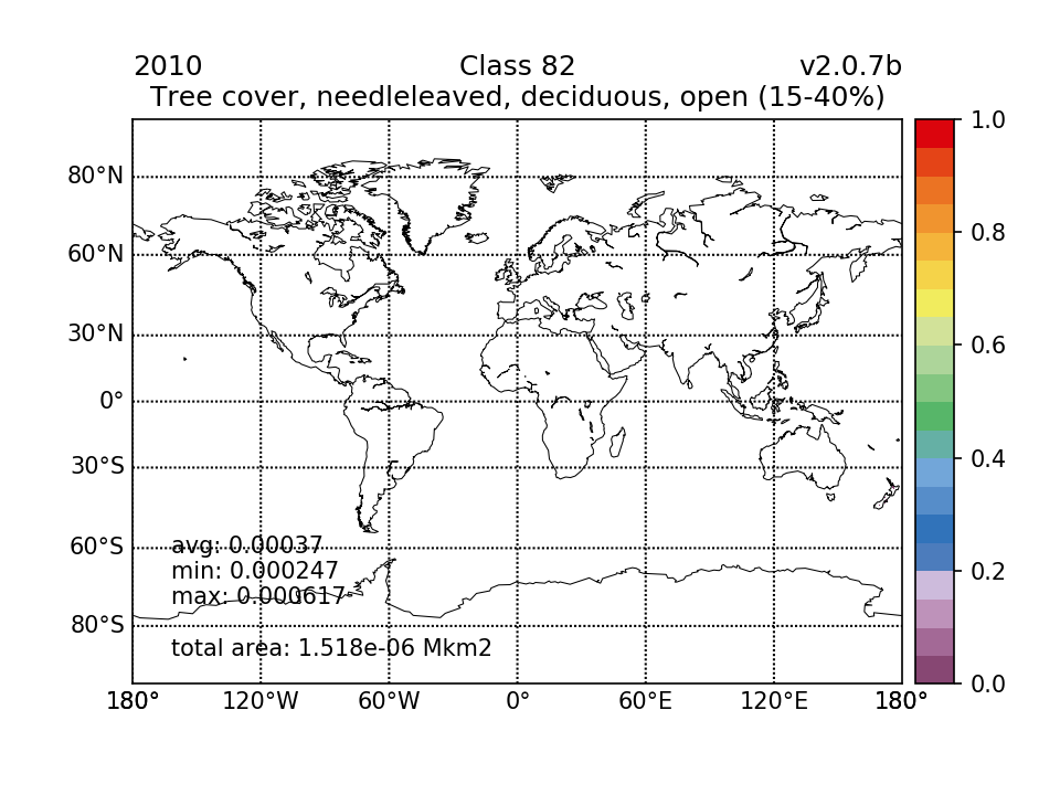 |  | 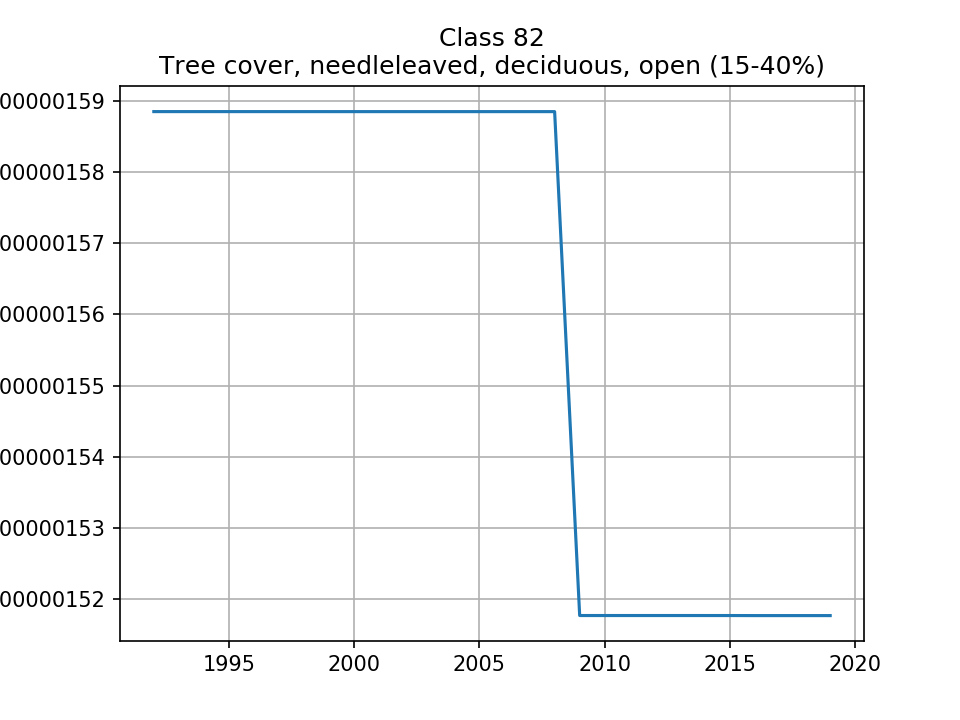 |
| 1.588e-06 (3.11e-07%) | 1.588e-06 (3.11e-07%) | 1.518e-06 (2.98e-07%) | 1.518e-06 (2.98e-07%) | ||
| 90 Tree cover, mixed leaf type (broadleaved and needleleaved) | 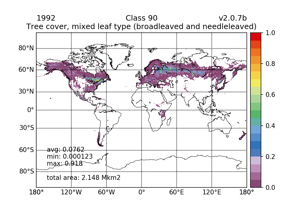 | 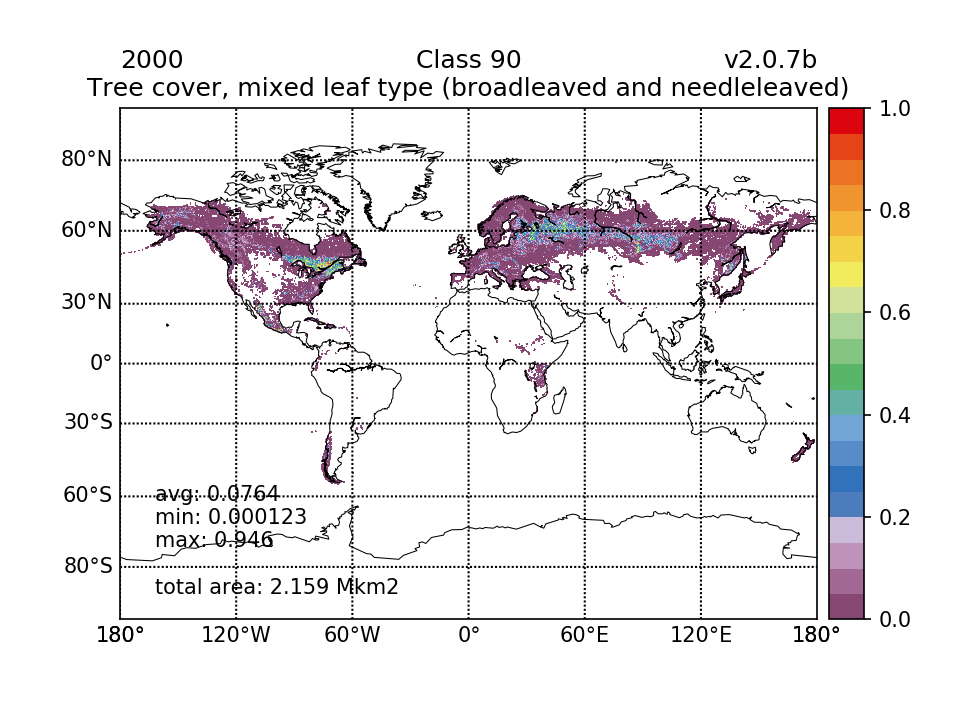 |  |  | 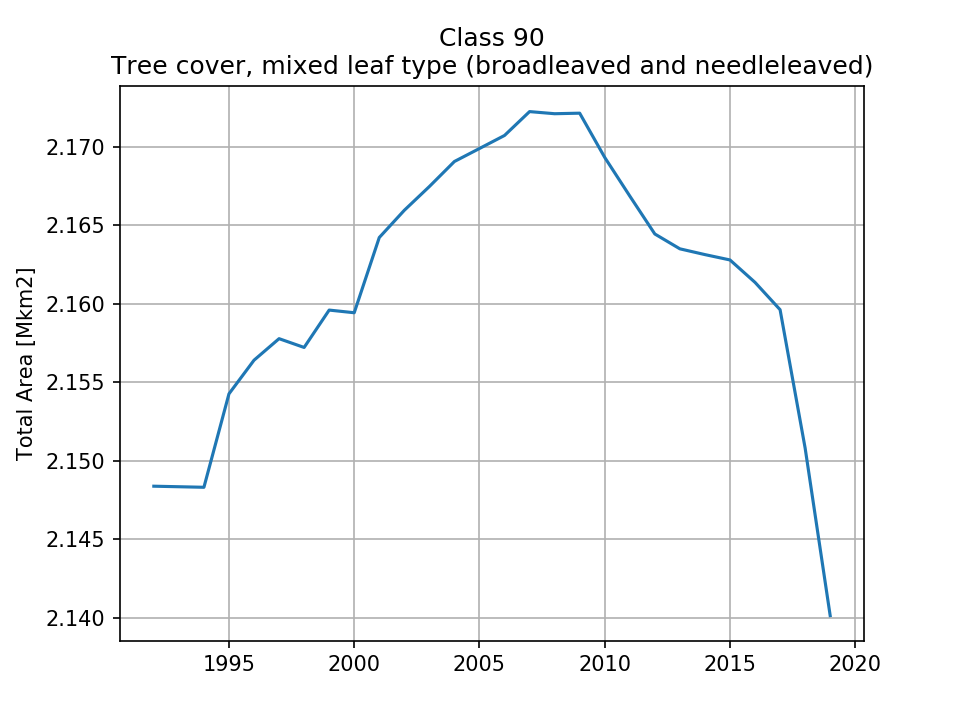 |
| 2.148 (0.421%) | 2.159 (0.423%) | 2.169 (0.425%) | 2.14 (0.42%) | ||
| 100 Mosaic tree and shrub (>50%) / herbaceous cover (<50%) |  |  |  |  | 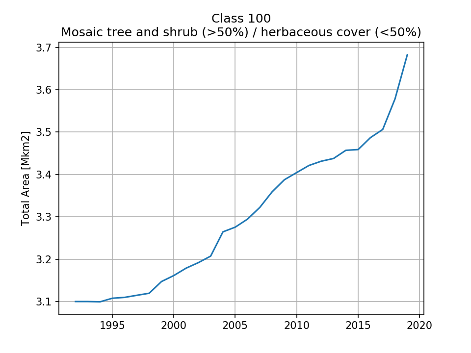 |
| 3.1 (0.608%) | 3.162 (0.62%) | 3.405 (0.667%) | 3.683 (0.722%) | ||
| 110 Mosaic herbaceous cover (>50%) / tree and shrub (<50%) |  |  | 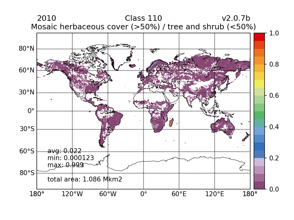 |  | 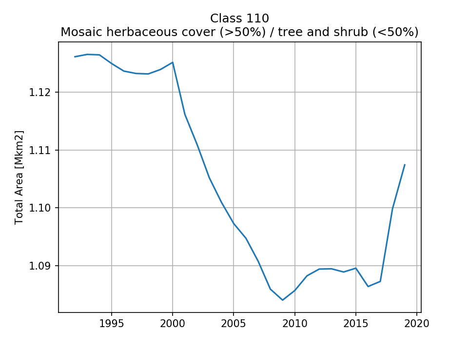 |
| 1.126 (0.221%) | 1.125 (0.221%) | 1.086 (0.213%) | 1.107 (0.217%) | ||
| 120 Shrubland | 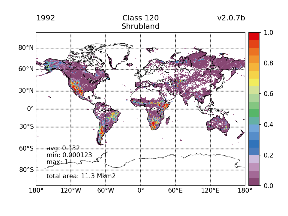 |  | 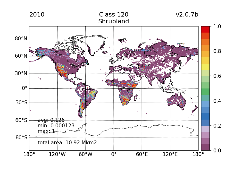 | 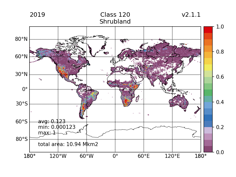 | 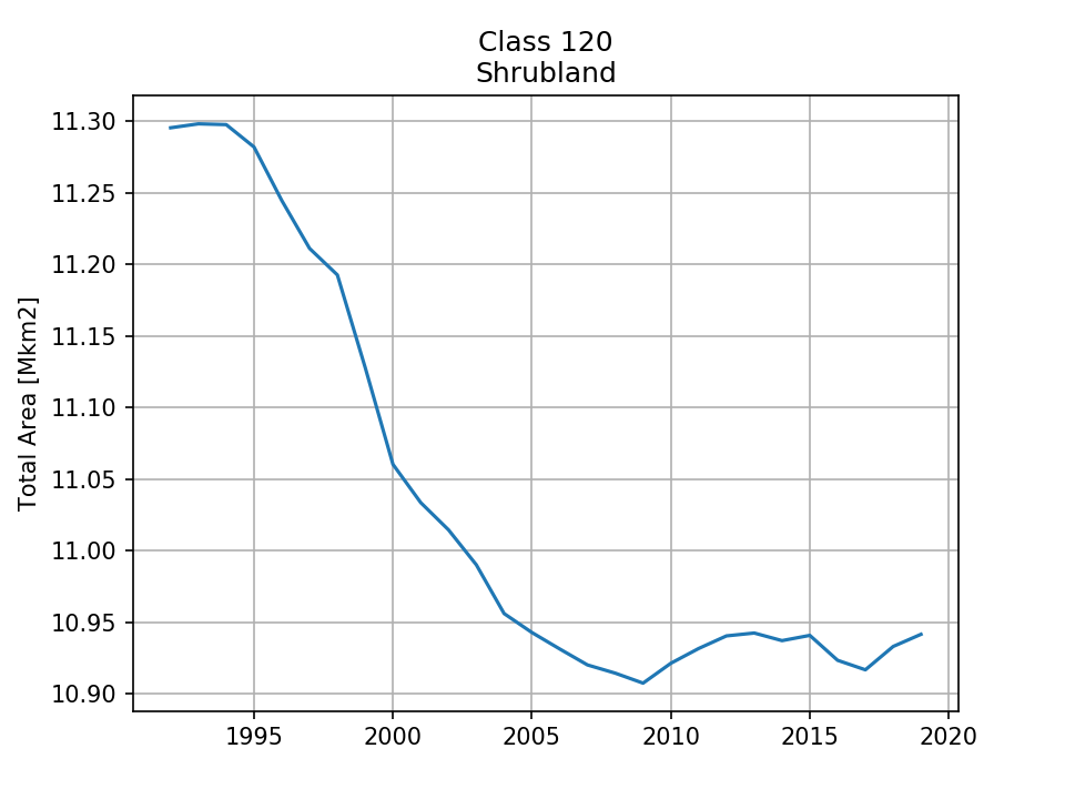 |
| 11.3 (2.21%) | 11.06 (2.17%) | 10.92 (2.14%) | 10.94 (2.15%) | ||
| 121 Shrubland, evergreen |  | 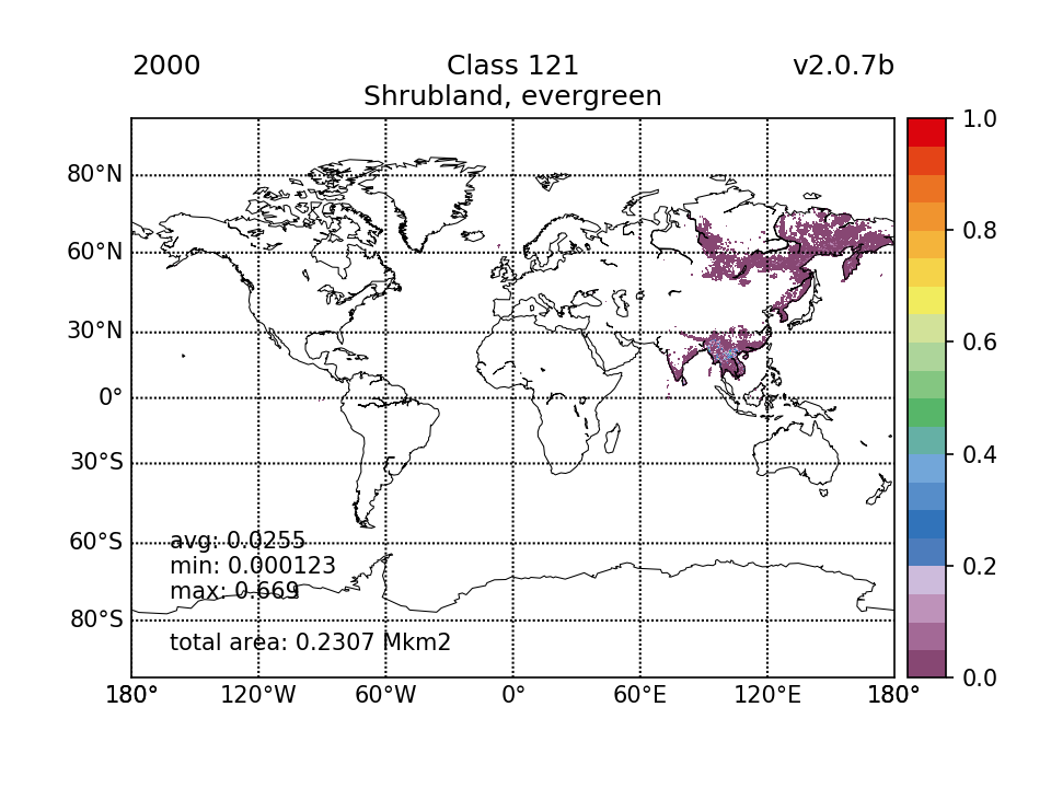 |  |  | 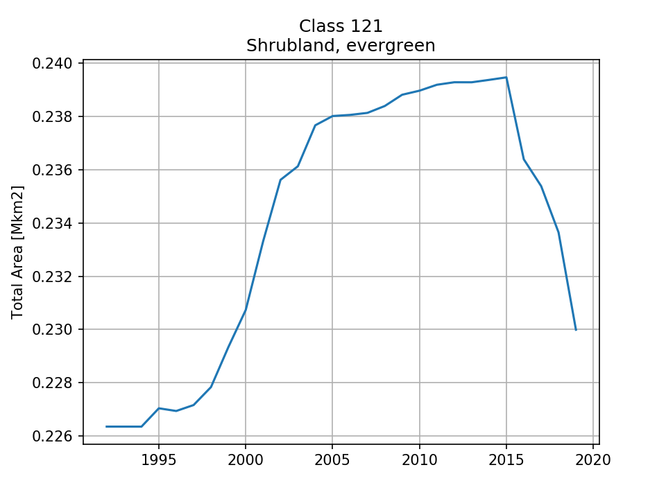 |
| 0.2264 (0.0444%) | 0.2307 (0.0452%) | 0.239 (0.0468%) | 0.23 (0.0451%) | ||
| 122 Shrubland, deciduous |  | 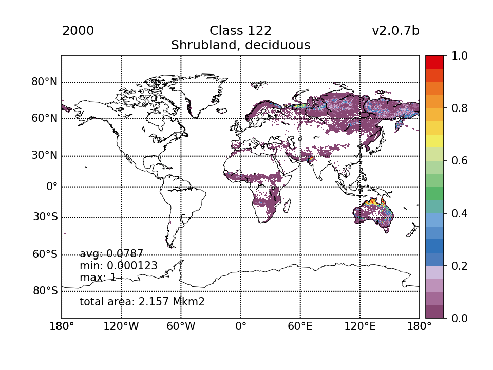 |  | 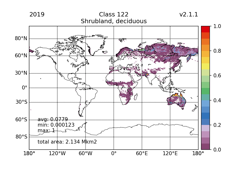 |  |
| 2.133 (0.418%) | 2.157 (0.423%) | 2.166 (0.425%) | 2.134 (0.418%) | ||
| 130 Grassland |  | 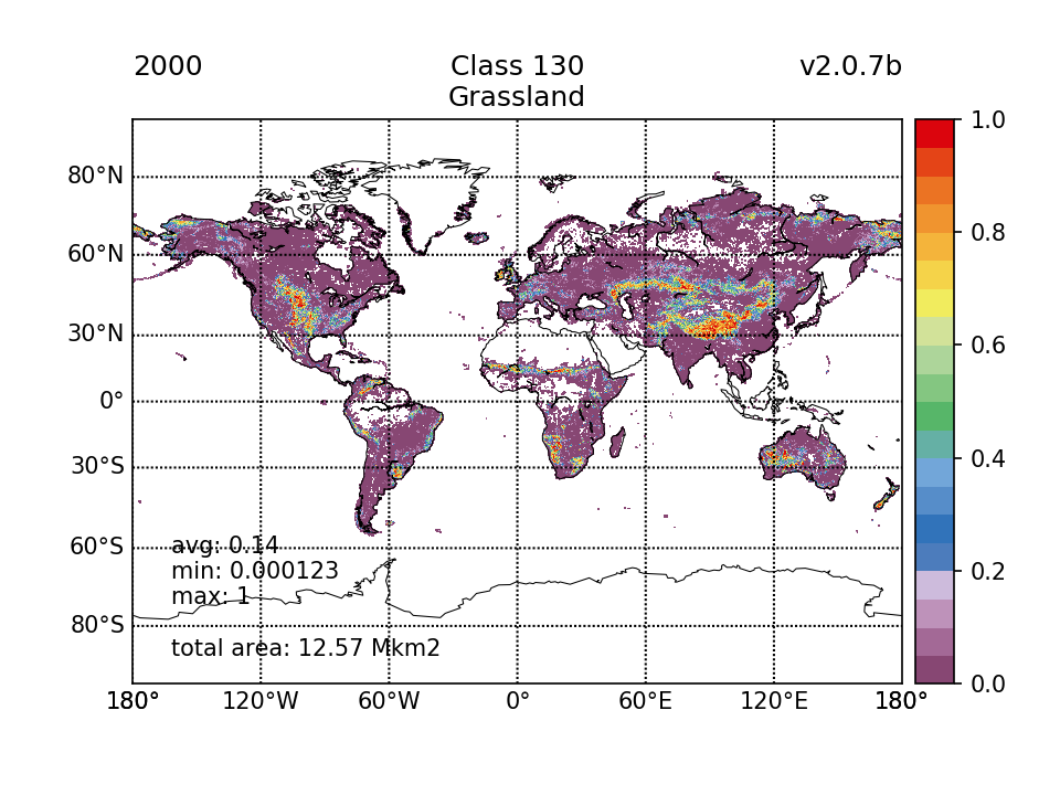 | 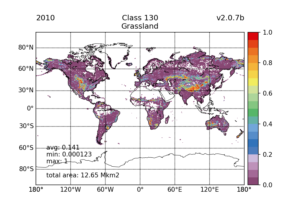 |  | 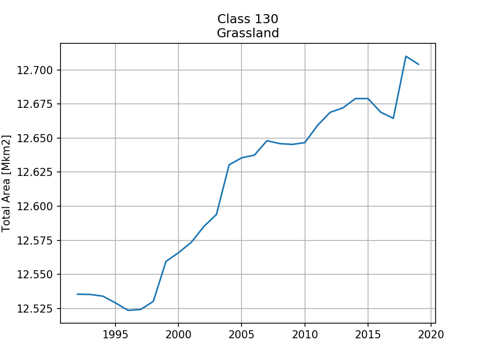 |
| 12.54 (2.46%) | 12.57 (2.46%) | 12.65 (2.48%) | 12.7 (2.49%) | ||
| 140 Lichens and mosses |  |  | 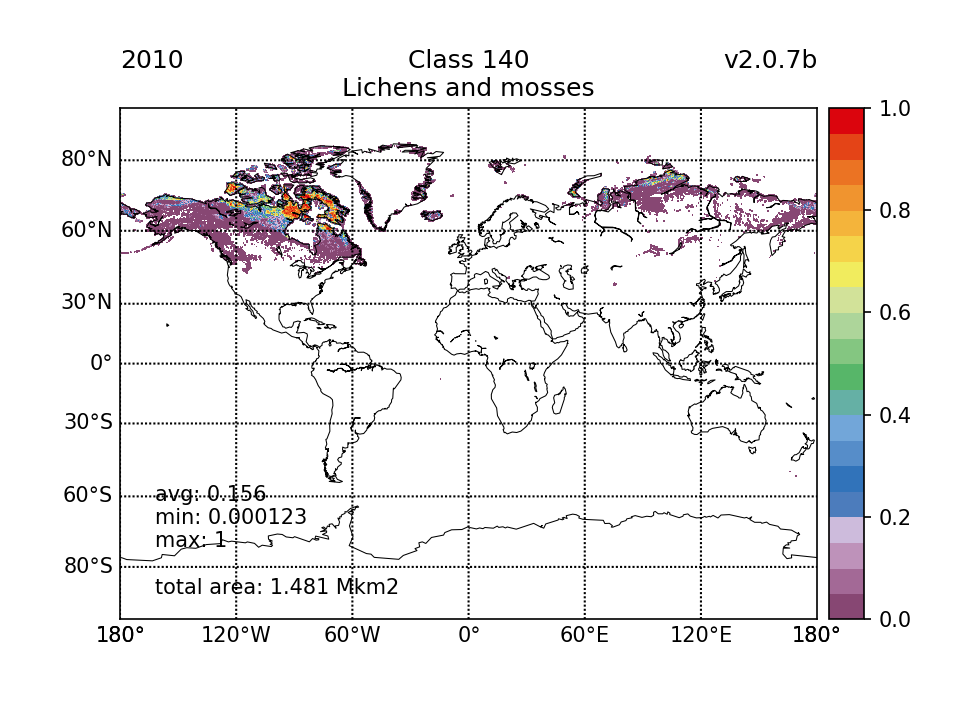 |  | 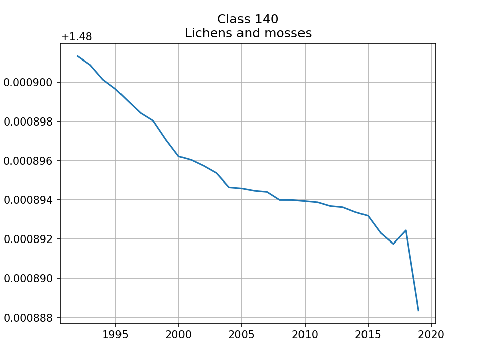 |
| 1.481 (0.29%) | 1.481 (0.29%) | 1.481 (0.29%) | 1.481 (0.29%) | ||
| 150 Sparse vegetation (tree, shrub, herbaceous cover) (<15%) |  | 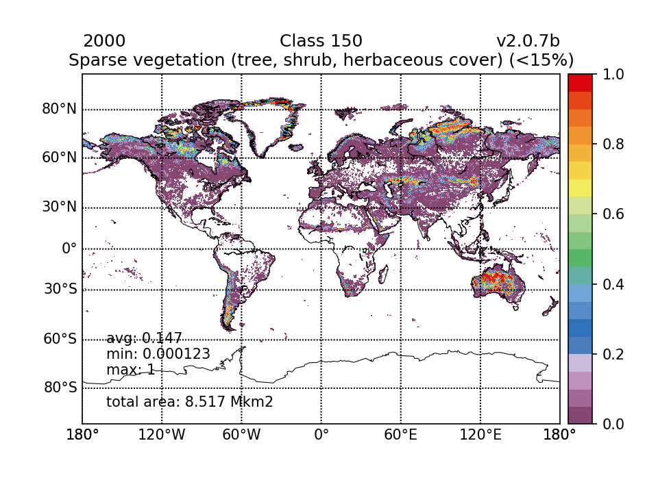 | 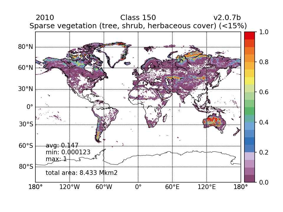 |  | 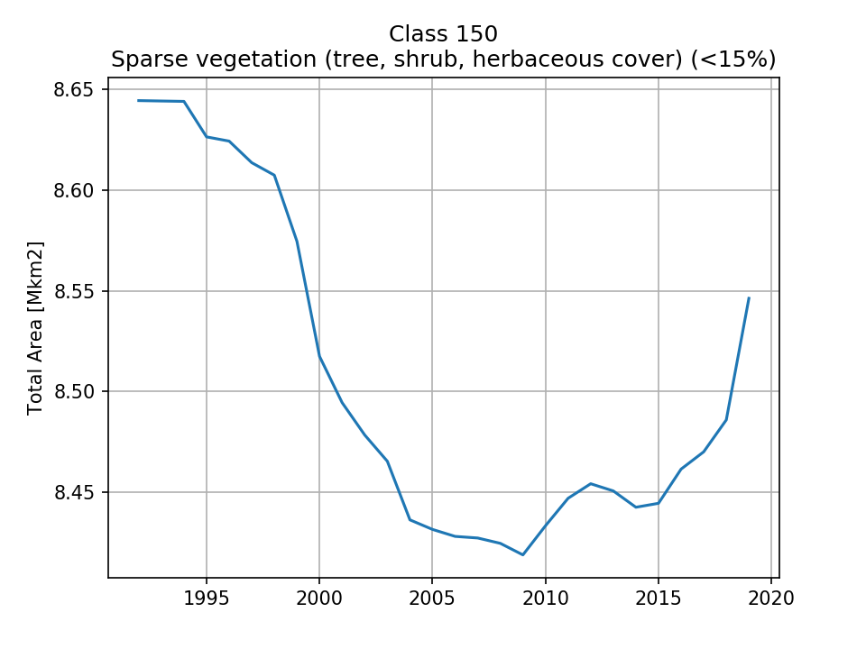 |
| 8.644 (1.69%) | 8.517 (1.67%) | 8.433 (1.65%) | 8.546 (1.68%) | ||
| 151 Sparse trees (<15%) |  |  |  | 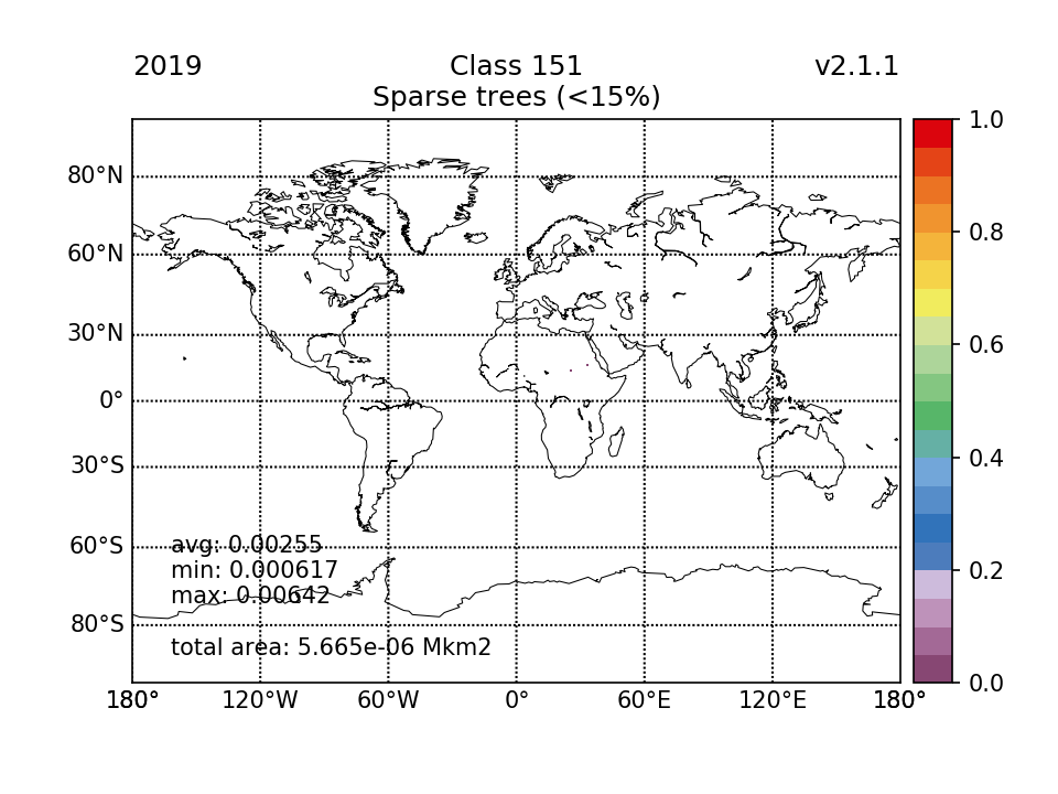 | 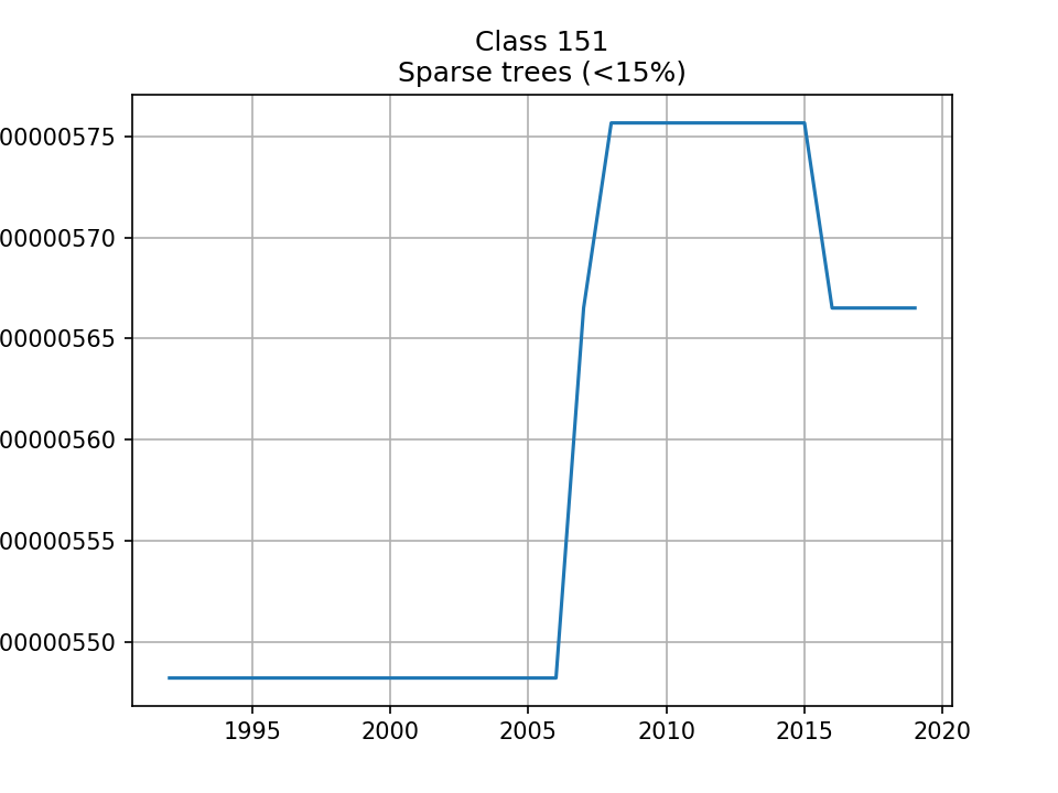 |
| 5.482e-06 (1.07e-06%) | 5.482e-06 (1.07e-06%) | 5.757e-06 (1.13e-06%) | 5.665e-06 (1.11e-06%) | ||
| 152 Sparse shrub (<15%) | 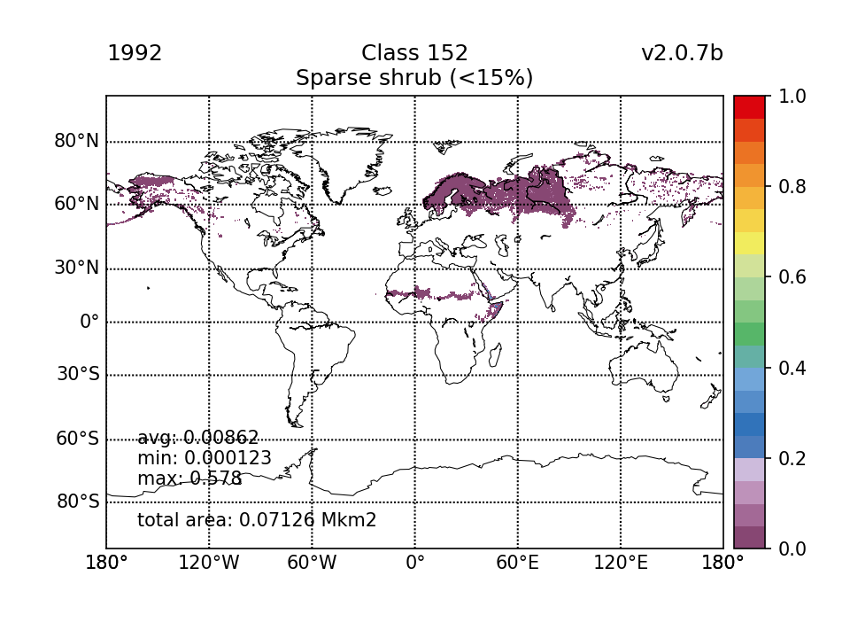 | 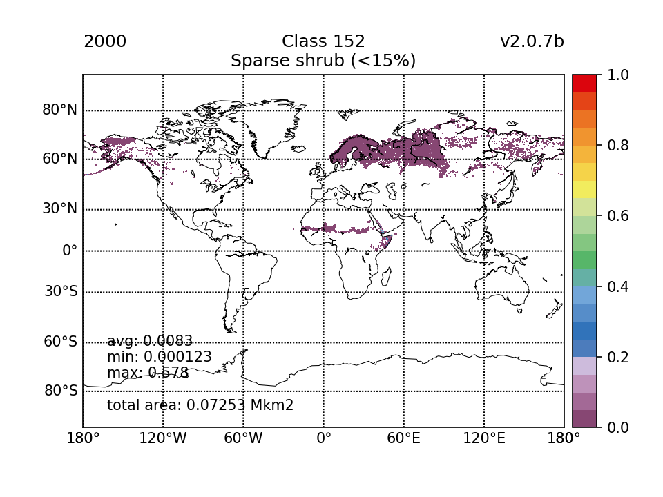 |  | 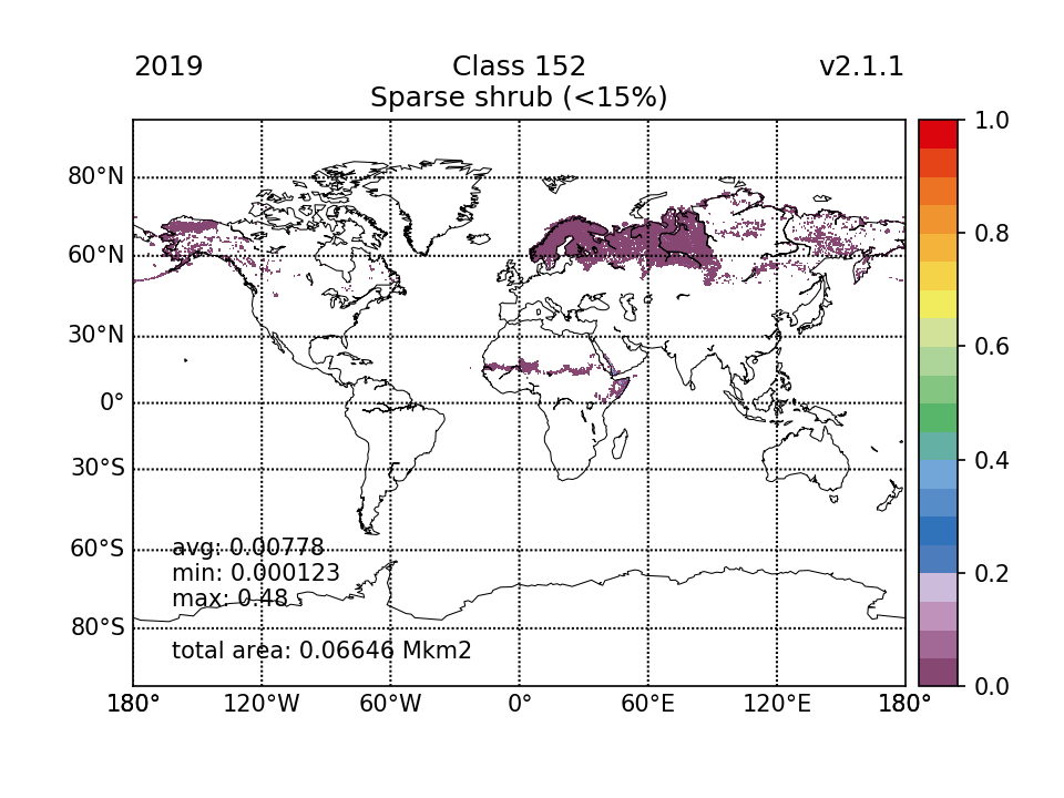 | 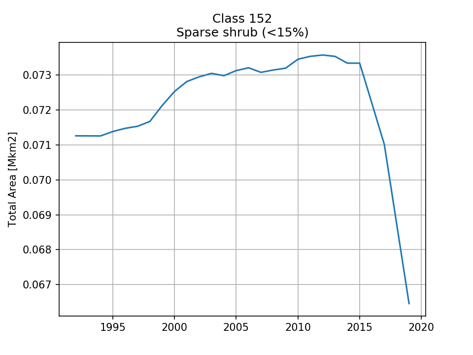 |
| 0.07126 (0.014%) | 0.07253 (0.0142%) | 0.07345 (0.0144%) | 0.06646 (0.013%) | ||
| 153 Sparse herbaceous cover (<15%) |  |  | 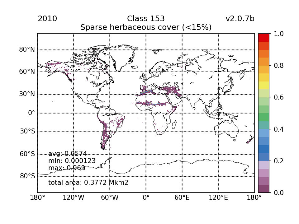 | 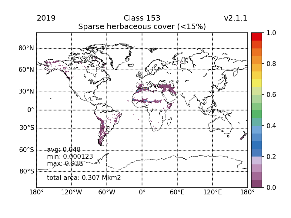 |  |
| 0.3519 (0.069%) | 0.3618 (0.0709%) | 0.3772 (0.074%) | 0.307 (0.0602%) | ||
| 160 Tree cover, flooded, fresh or brakish water | 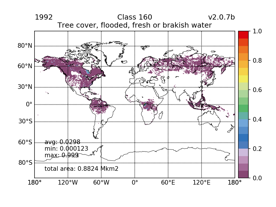 |  |  | 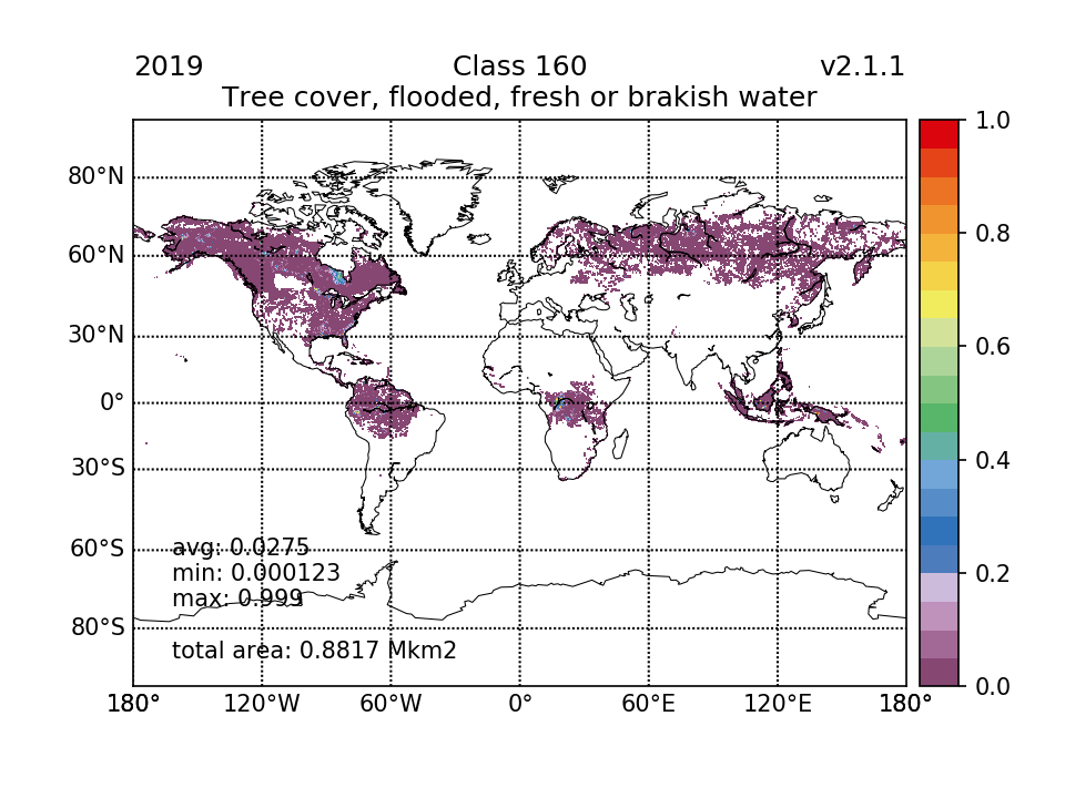 | 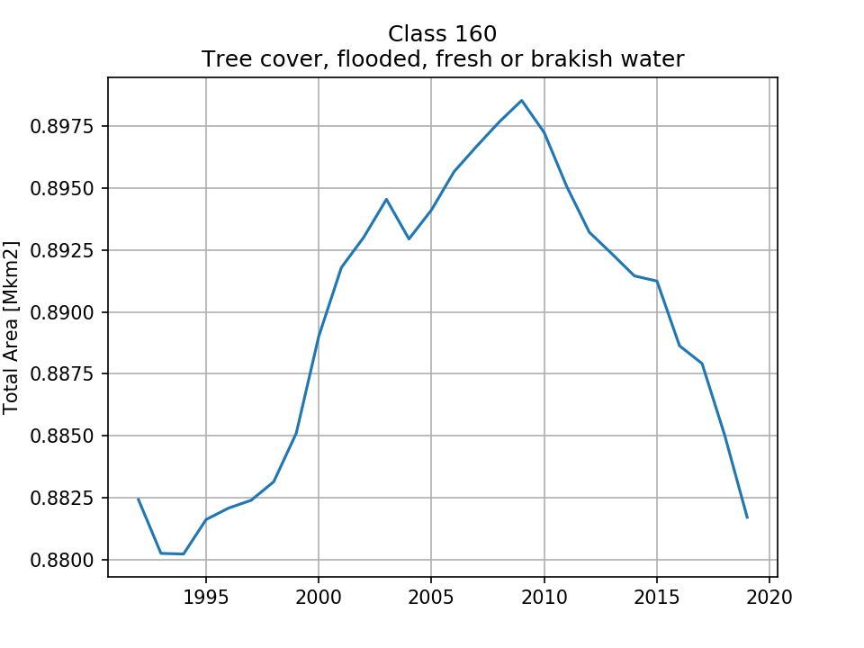 |
| 0.8824 (0.173%) | 0.889 (0.174%) | 0.8972 (0.176%) | 0.8817 (0.173%) | ||
| 170 Tree cover, flooded, saline water |  |  | 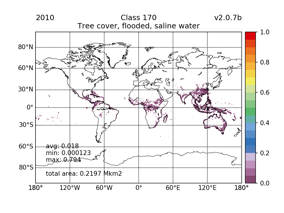 |  | 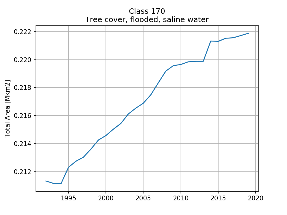 |
| 0.2113 (0.0414%) | 0.2146 (0.0421%) | 0.2197 (0.0431%) | 0.2219 (0.0435%) | ||
| 180 Shrub or herbaceous cover, flooded, fresh/saline/brakish water | 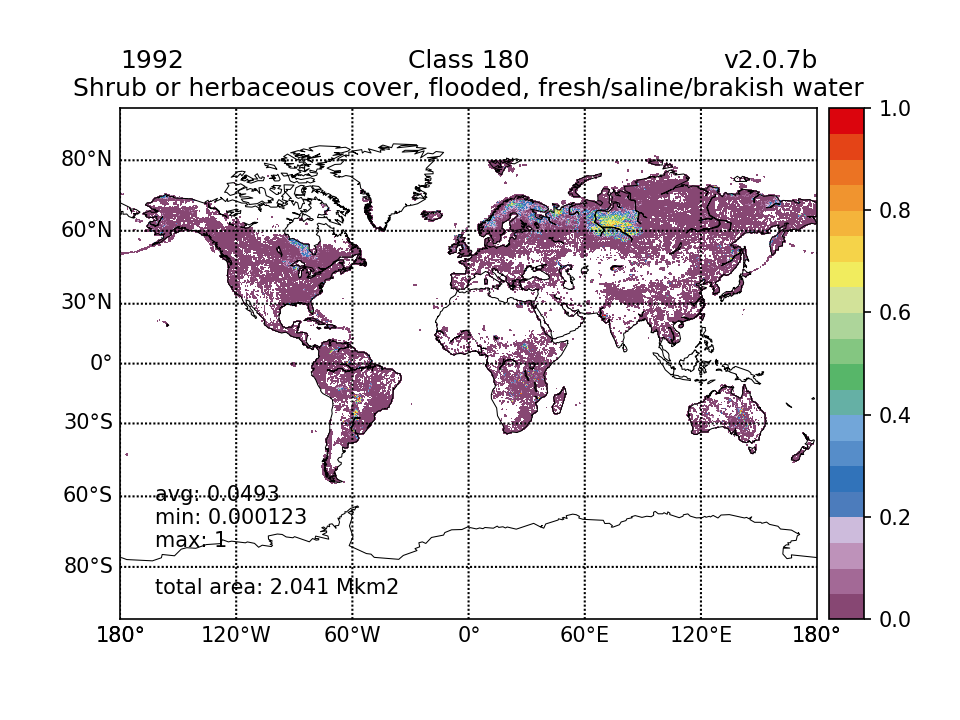 |  |  |  | 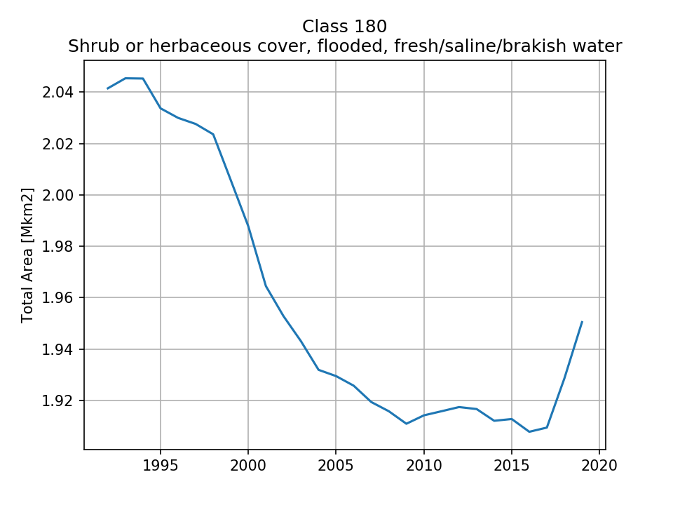 |
| 2.041 (0.4%) | 1.988 (0.39%) | 1.914 (0.375%) | 1.95 (0.382%) | ||
| 190 Urban areas |  |  | 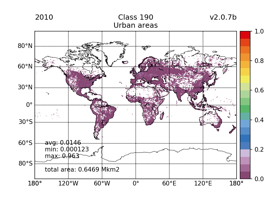 | 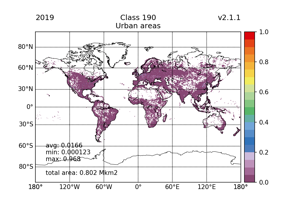 | 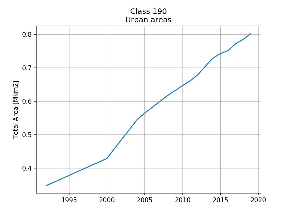 |
| 0.3482 (0.0683%) | 0.4295 (0.0842%) | 0.6469 (0.127%) | 0.802 (0.157%) | ||
| 200 Bare areas | 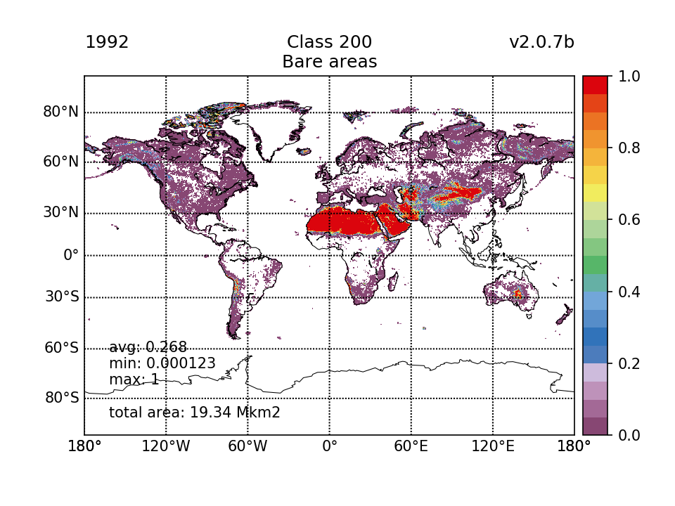 |  |  |  | 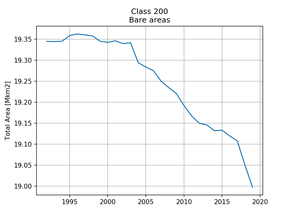 |
| 19.34 (3.79%) | 19.34 (3.79%) | 19.19 (3.76%) | 19 (3.72%) | ||
| 201 Bare areas, consolidated |  |  | 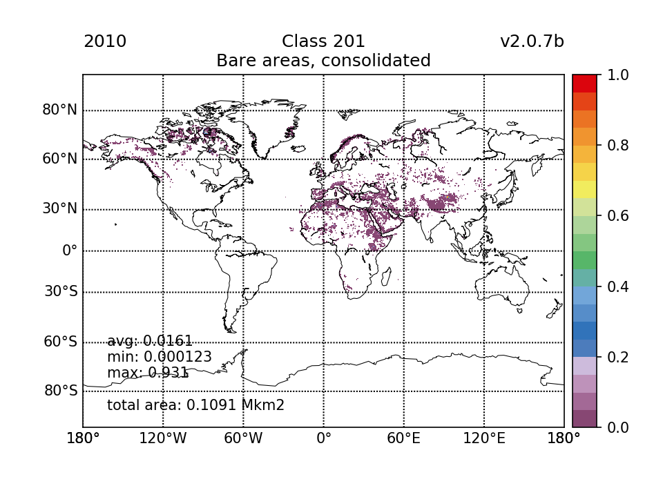 |  | 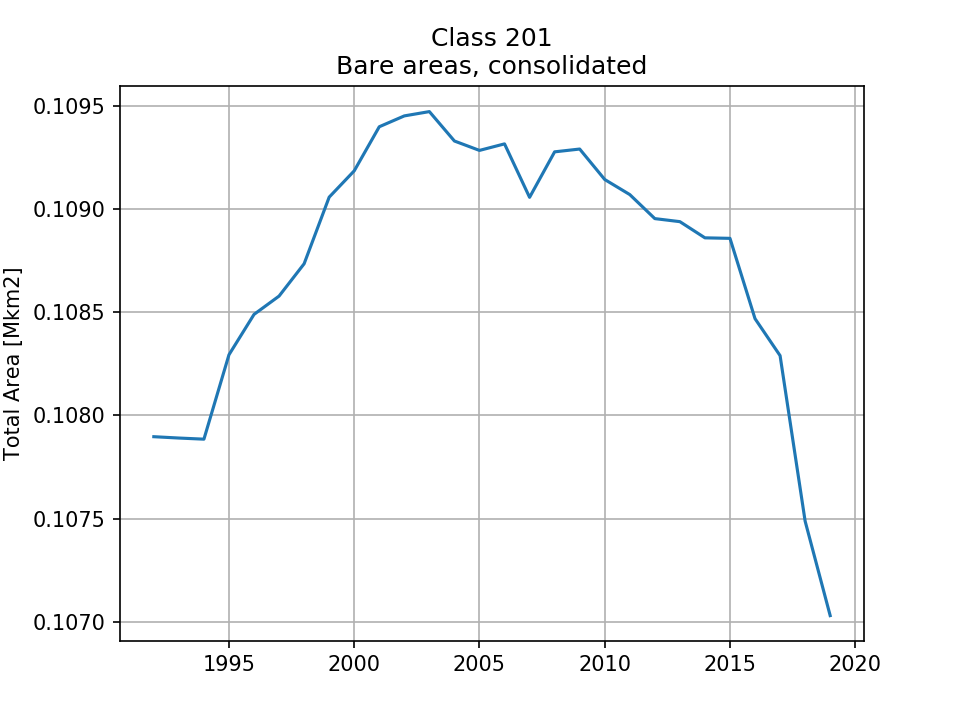 |
| 0.1079 (0.0212%) | 0.1092 (0.0214%) | 0.1091 (0.0214%) | 0.107 (0.021%) | ||
| 202 Bare areas, unconsolidated |  | 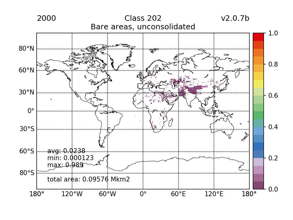 |  | 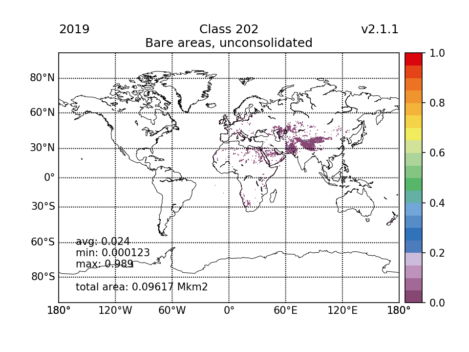 | 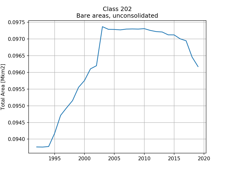 |
| 0.09377 (0.0184%) | 0.09576 (0.0188%) | 0.09731 (0.0191%) | 0.09617 (0.0189%) | ||
| 210 Water bodies |  |  | 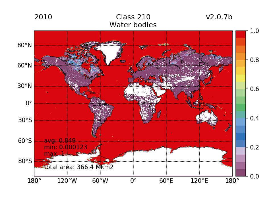 |  | 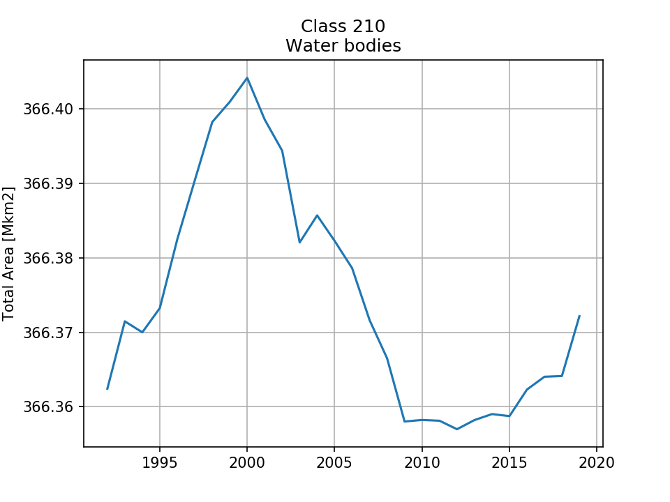 |
| 366.4 (71.8%) | 366.4 (71.8%) | 366.4 (71.8%) | 366.4 (71.8%) | ||
| 220 Permanent snow and ice |  |  | 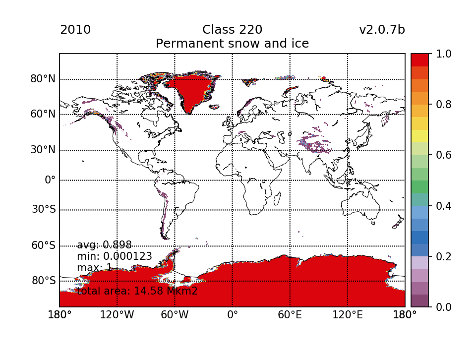 |  |  |
| 14.58 (2.86%) | 14.58 (2.86%) | 14.58 (2.86%) | 14.58 (2.86%) | ||
| TOTAL | 510.1 | 510.1 | 510.1 | 510.1 | |
| Last modified: 19/01/2023 14:48:51 |
| ← Tools | Generic PFTs → |