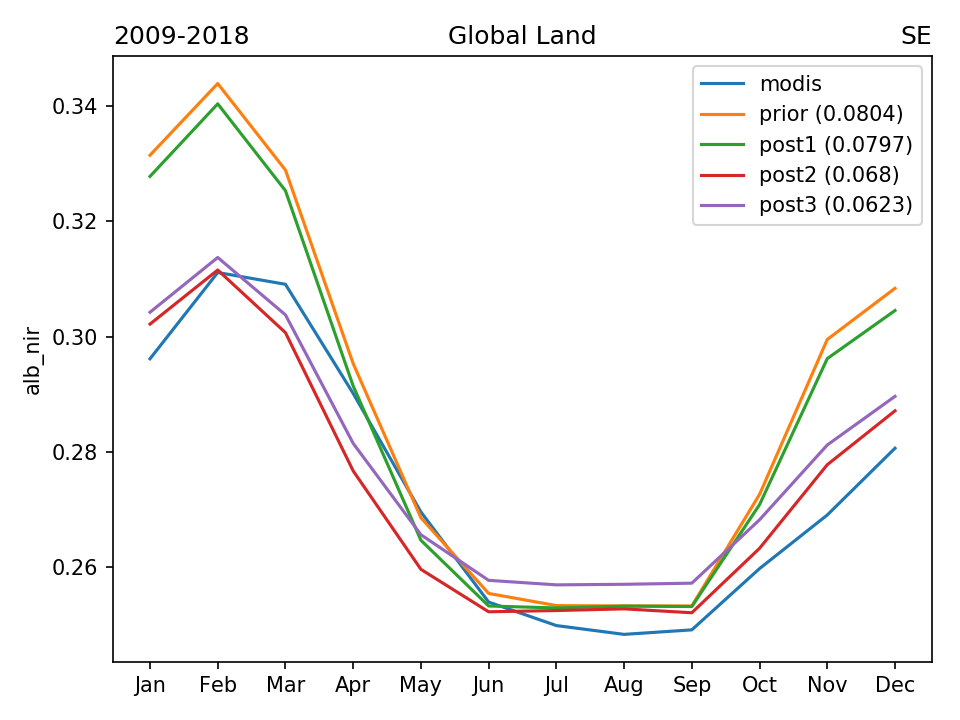
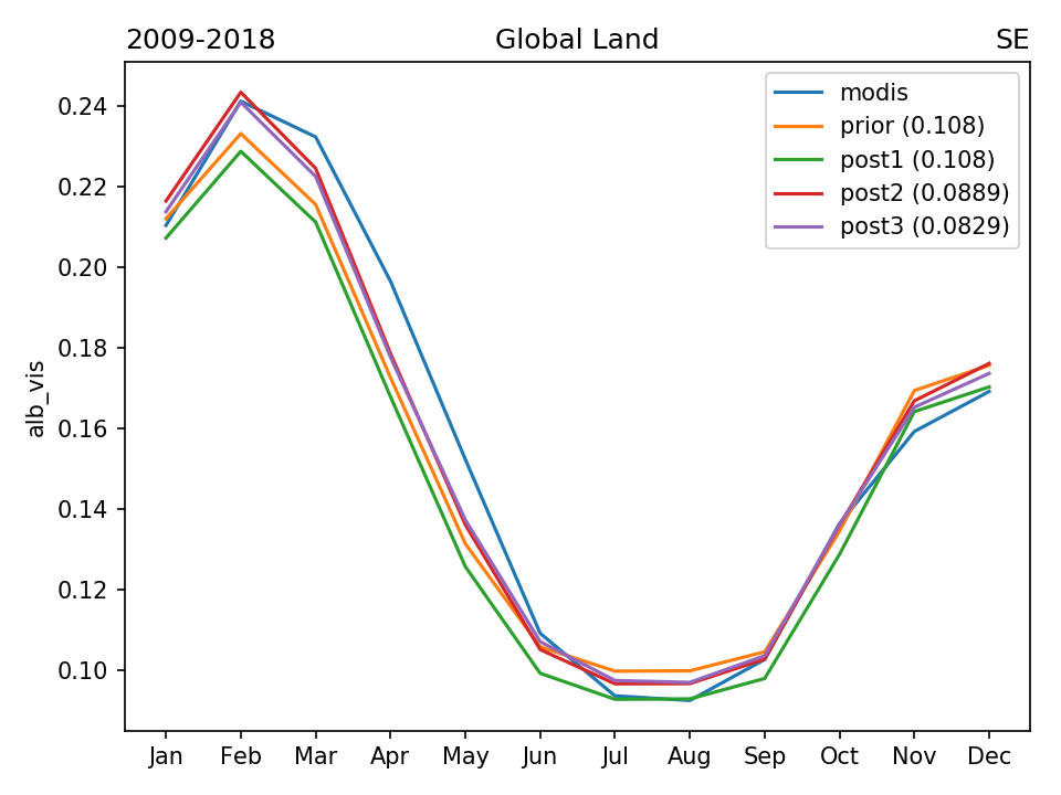
ALBEDO OPTIMIZATION
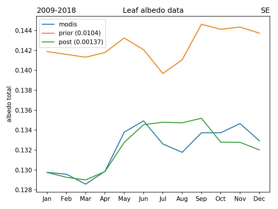
STEP 1 : LEAF ALBEDO OPTIMIZATION
Data points selection (month-pixels from climatology 2009-2018) :
- MODIS is valid (not masked)
- ORCHIDEE is valid (not masked)
- Snow fraction = 0
- Total bare soil fraction < 0.5
- Continental fraction > 0.99
- Inland water fraction < 0.1
Optimization method: global L-BFGS-B with analytical gradient calculation (14 optimized parameters)
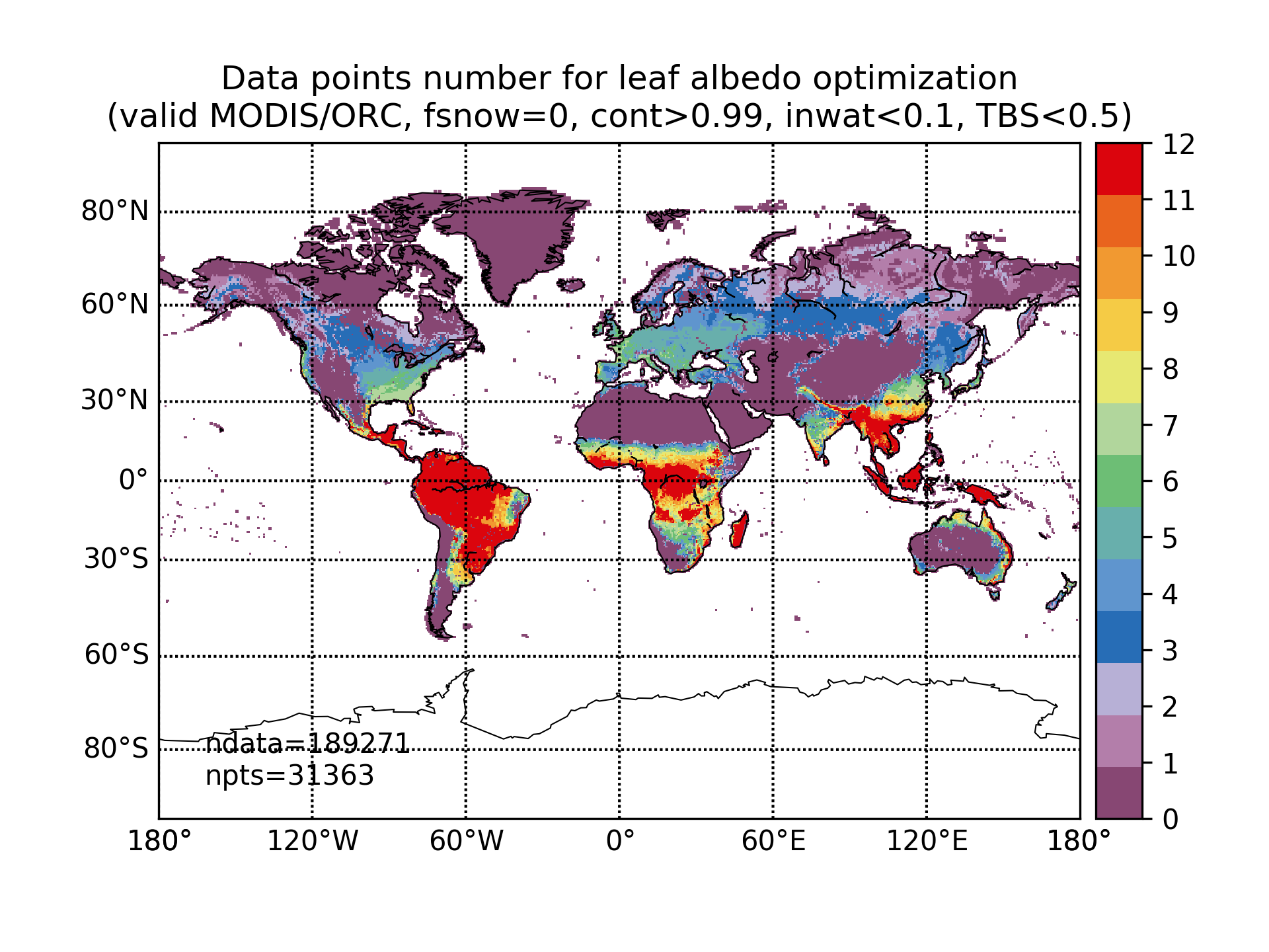
ndata - total number of used month-pixels, npts - total number of used grid pixels
| LEAF_ALB_NIR | PFT2 | PFT3 | PFT4 | PFT5 | PFT6 | PFT7 | PFT8 | PFT9 | PFT10 | PFT11 | PFT12 | PFT13 | PFT14 | PFT15 |
| prior | 0.23 | 0.18 | 0.18 | 0.2 | 0.24 | 0.15 | 0.26 | 0.2 | 0.24 | 0.27 | 0.28 | 0.26 | 0.24 | 0.24 |
| min | 0.17 | 0.17 | 0.1 | 0.1 | 0.16 | 0.1 | 0.1 | 0.16 | 0.1 | 0.17 | 0.1 | 0.15 | 0.1 | 0.2 |
| max | 0.25 | 0.24 | 0.23 | 0.24 | 0.24 | 0.19 | 0.33 | 0.23 | 0.36 | 0.36 | 0.46 | 0.36 | 0.29 | 0.35 |
| post | 0.204 | 0.189 | 0.15 | 0.176 | 0.228 | 0.129 | 0.263 | 0.178 | 0.296 | 0.258 | 0.259 | 0.292 | 0.222 | 0.323 |
| LEAF_ALB_VIS | PFT2 | PFT3 | PFT4 | PFT5 | PFT6 | PFT7 | PFT8 | PFT9 | PFT10 | PFT11 | PFT12 | PFT13 | PFT14 | PFT15 |
| prior | 0.04 | 0.04 | 0.04 | 0.04 | 0.03 | 0.03 | 0.03 | 0.03 | 0.06 | 0.06 | 0.06 | 0.06 | 0.06 | 0.06 |
| min | 0.02 | 0.02 | 0.01 | 0.01 | 0.02 | 0.01 | 0.02 | 0.02 | 0.02 | 0.04 | 0.02 | 0.05 | 0.02 | 0.04 |
| max | 0.06 | 0.08 | 0.09 | 0.08 | 0.07 | 0.05 | 0.04 | 0.04 | 0.18 | 0.18 | 0.23 | 0.15 | 0.16 | 0.1 |
| post | 0.0225 | 0.02 | 0.0231 | 0.0231 | 0.02 | 0.0234 | 0.02 | 0.02 | 0.0464 | 0.0485 | 0.0513 | 0.0606 | 0.02 | 0.04 |
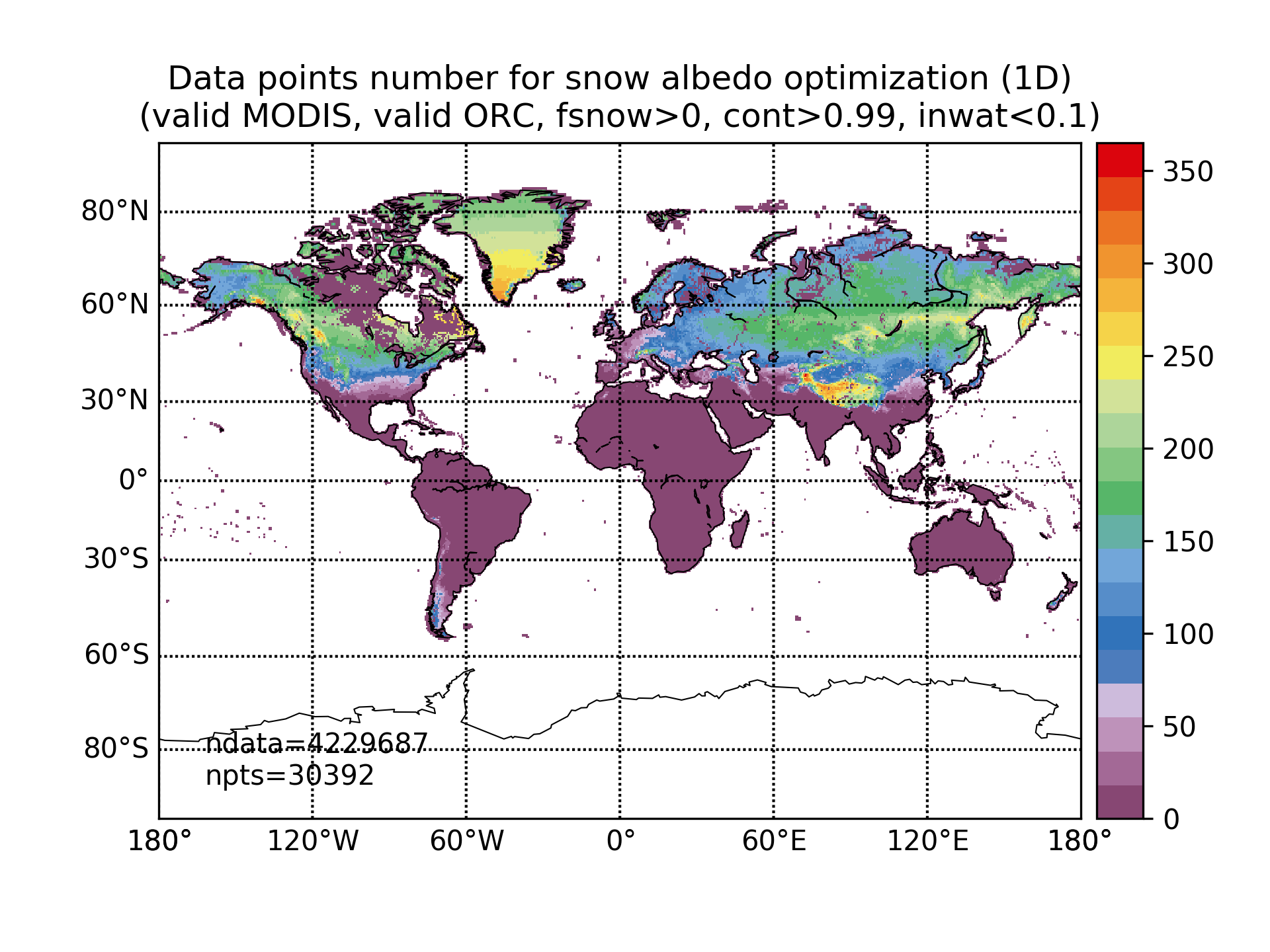
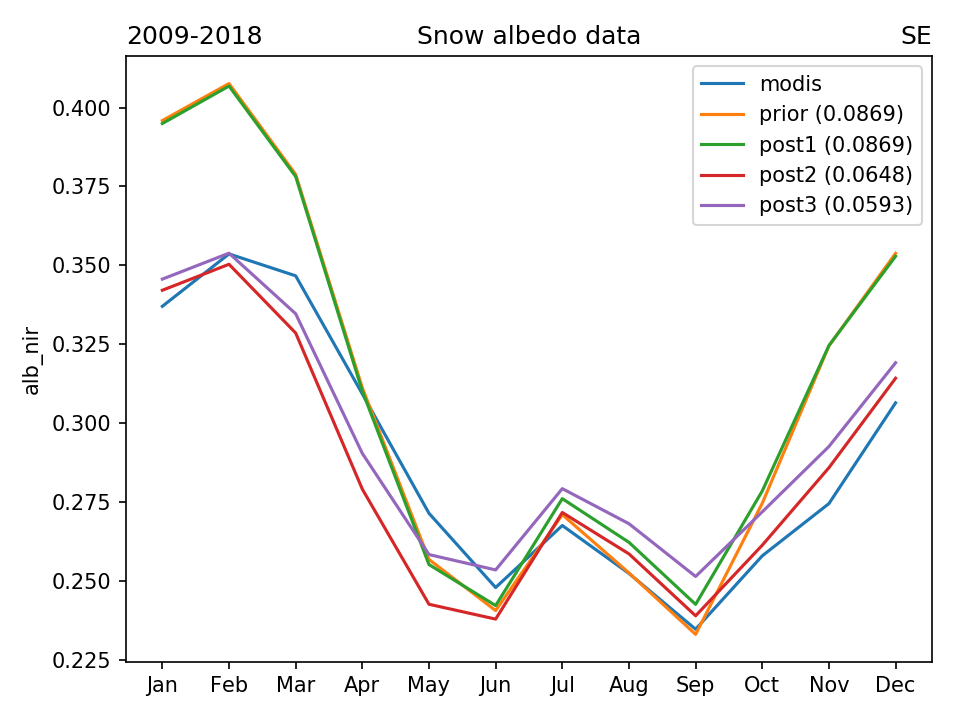
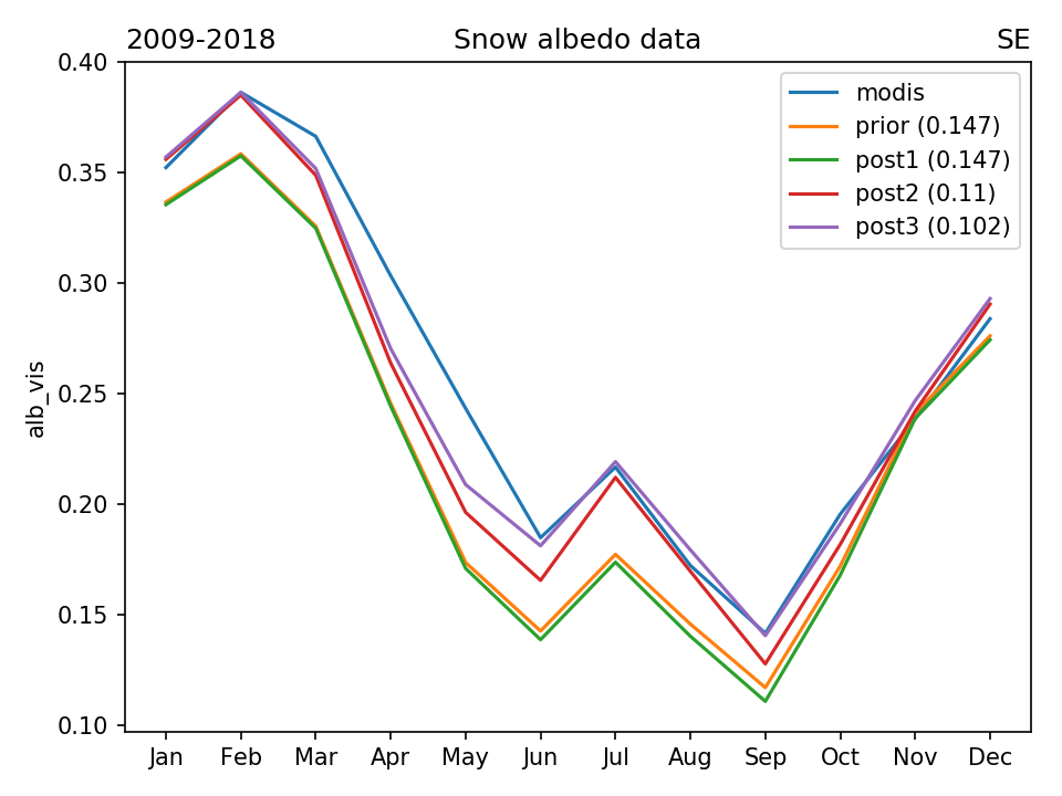
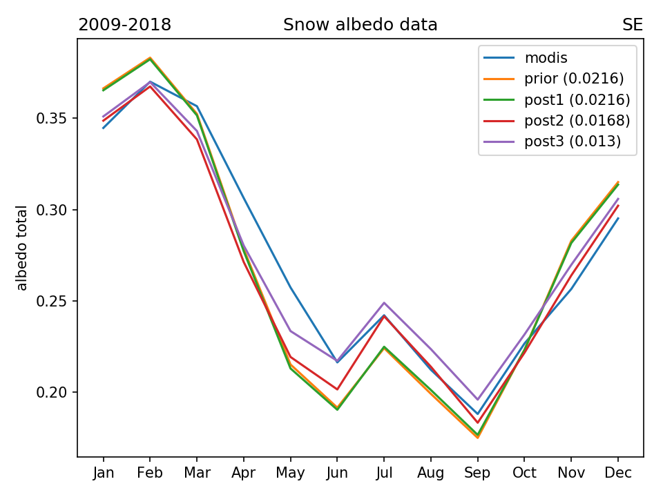
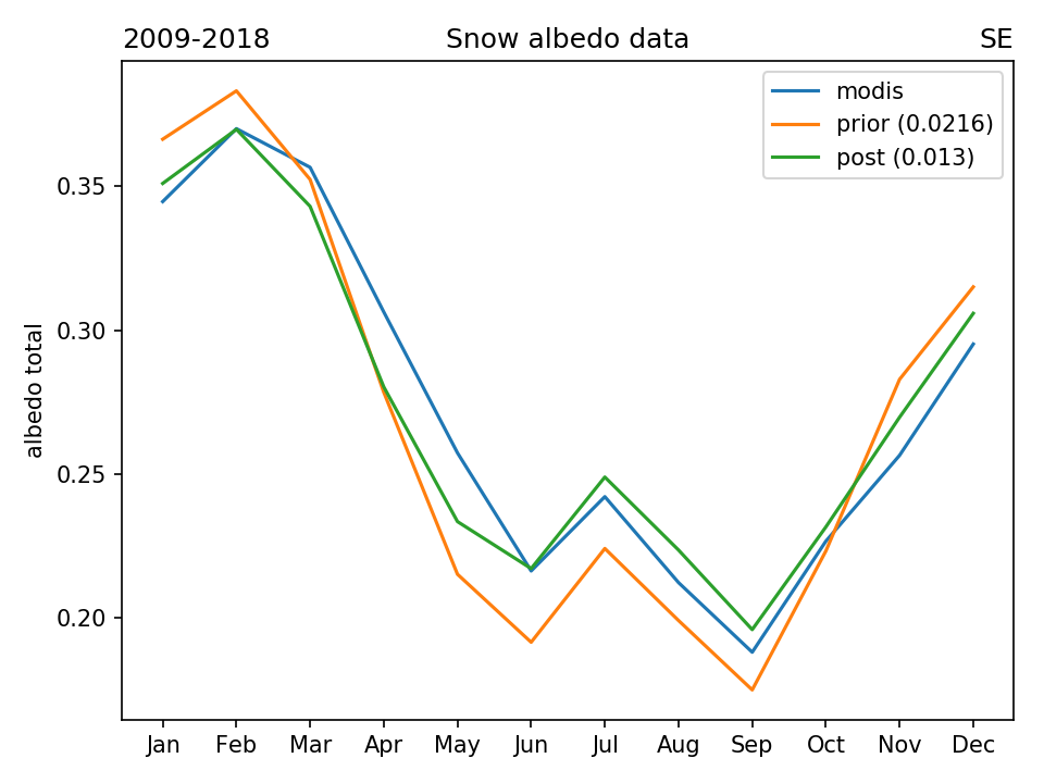
STEP 2 : SNOW ALBEDO OPTIMIZATION
Data points selection (day-pixels from 2018) :
- MODIS is valid (not masked)
- ORCHIDEE is valid (not masked)
- Snow fraction > 0
- Continental fraction > 0.99
- Inland water fraction < 0.1
Optimization method: global L-BFGS-B with analytical gradient calculation (8 optimized parameters)
ndata - total number of used month-pixels, total npts - number of used grid pixels
| SNOW_ALB_NIR | PFT1 | PFT4/5/7 | PFT6/8/9 | PFT10-15 | | snowa_aged_prior | 0.5 | 0.3 | 0.3 | 0.5 | | snowa_aged_min | 0.3 | 0.1 | 0.1 | 0.3 | | snowa_aged_max | 0.7 | 0.5 | 0.5 | 0.7 | | snowa_aged_post | 0.492 | 0.165 | 0.279 | 0.525 | | snowa_dec_prior | 0.15 | 0.15 | 0.15 | 0.15 | | snowa_dec_min | 0.05 | 0.01 | 0.01 | 0.05 | | snowa_dec_max | 0.3 | 0.3 | 0.3 | 0.3 | | snowa_dec_post | 0.122 | 0.0164 | 0.0435 | 0.054 |
| | SNOW_ALB_NIR | PFT1 | PFT4/5/7 | PFT6/8/9 | PFT10-15 | | snowa_aged_prior | 0.5 | 0.3 | 0.3 | 0.5 | | snowa_aged_min | 0.3 | 0.1 | 0.1 | 0.3 | | snowa_aged_max | 0.7 | 0.5 | 0.5 | 0.7 | | snowa_aged_post | 0.489 | 0.171 | 0.269 | 0.527 | | snowa_dec_prior | 0.15 | 0.15 | 0.15 | 0.15 | | snowa_dec_min | 0.05 | 0.01 | 0.01 | 0.05 | | snowa_dec_max | 0.3 | 0.3 | 0.3 | 0.3 | | snowa_dec_post | 0.12 | 0.021 | 0.038 | 0.0555 | | tcst_snowa_prior | 10 | | tcst_snowa_post | 13.02 |
|
| SNOW_ALB_VIS | PFT1 | PFT4/5/7 | PFT6/8/9 | PFT10-15 | | snowa_aged_prior | 0.5 | 0.3 | 0.3 | 0.5 | | snowa_aged_min | 0.3 | 0.1 | 0.1 | 0.3 | | snowa_aged_max | 0.7 | 0.5 | 0.5 | 0.7 | | snowa_aged_post | 0.7 | 0.137 | 0.365 | 0.7 | | snowa_dec_prior | 0.15 | 0.15 | 0.15 | 0.15 | | snowa_dec_min | 0.05 | 0.01 | 0.01 | 0.05 | | snowa_dec_max | 0.3 | 0.3 | 0.3 | 0.3 | | snowa_dec_post | 0.229 | 0.01 | 0.01 | 0.125 |
| | SNOW_ALB_VIS | PFT1 | PFT4/5/7 | PFT6/8/9 | PFT10-15 | | snowa_aged_prior | 0.5 | 0.3 | 0.3 | 0.5 | | snowa_aged_min | 0.3 | 0.1 | 0.1 | 0.3 | | snowa_aged_max | 0.7 | 0.5 | 0.5 | 0.7 | | snowa_aged_post | 0.7 | 0.137 | 0.364 | 0.7 | | snowa_dec_prior | 0.15 | 0.15 | 0.15 | 0.15 | | snowa_dec_min | 0.05 | 0.01 | 0.01 | 0.05 | | snowa_dec_max | 0.3 | 0.3 | 0.3 | 0.3 | | snowa_dec_post | 0.218 | 0.01 | 0.01 | 0.119 | | tcst_snowa_prior | 10 | | tcst_snowa_post | 15 |
|
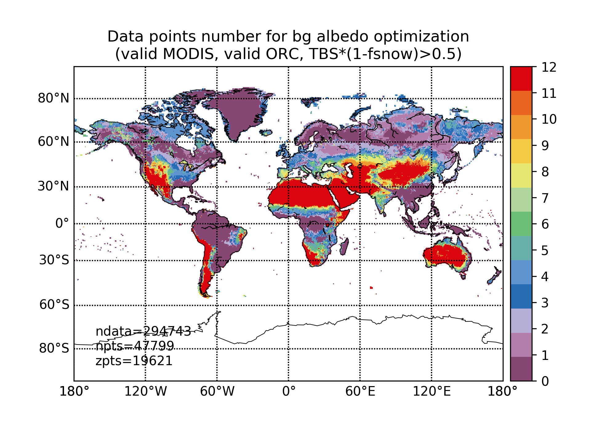
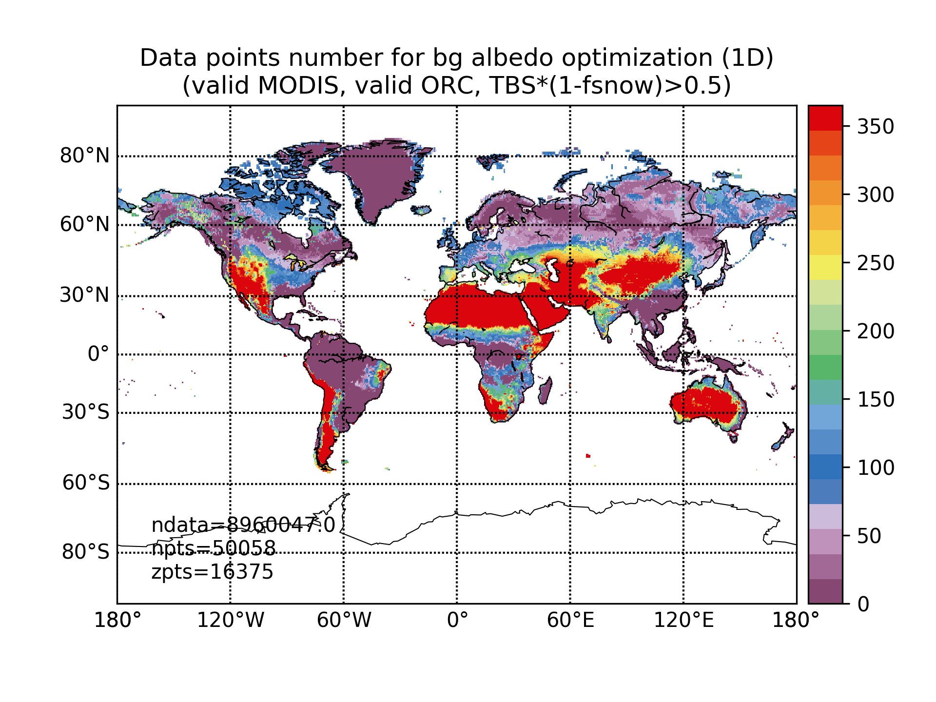
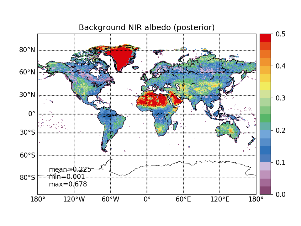
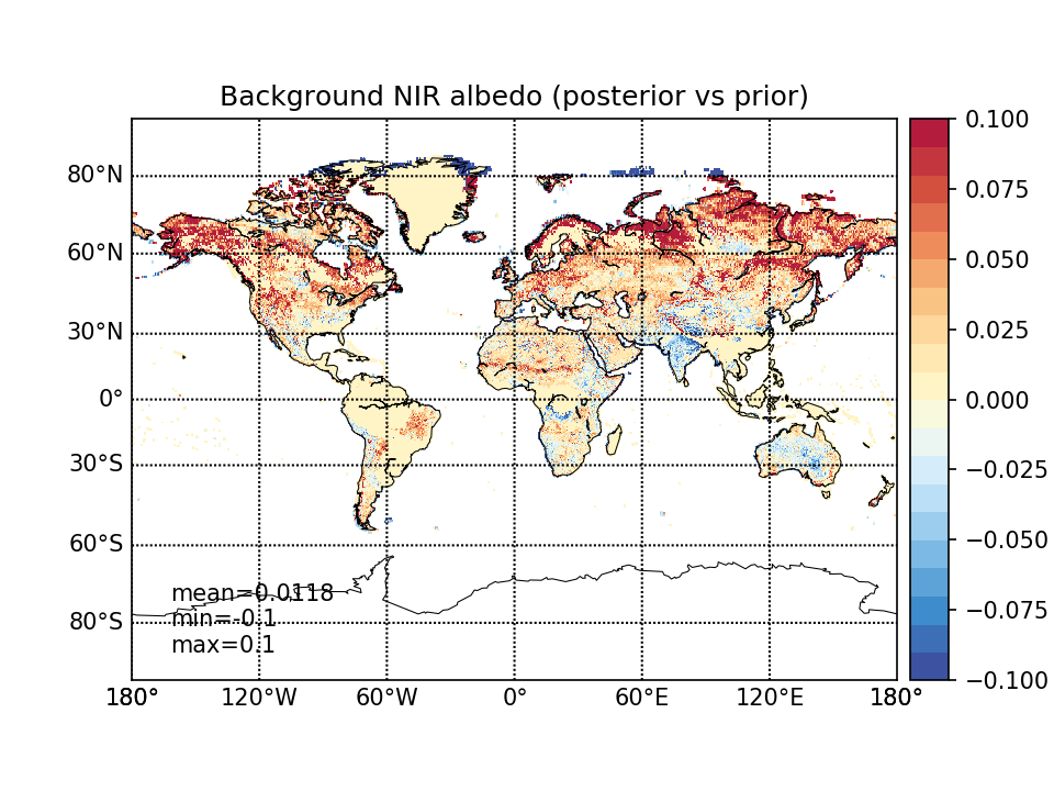
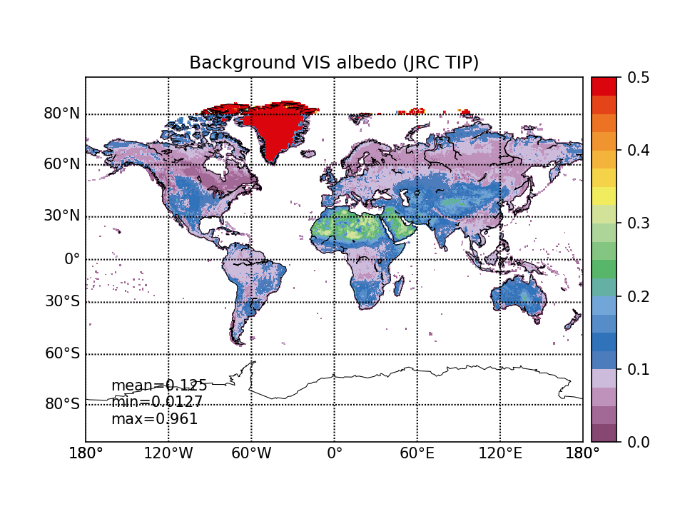
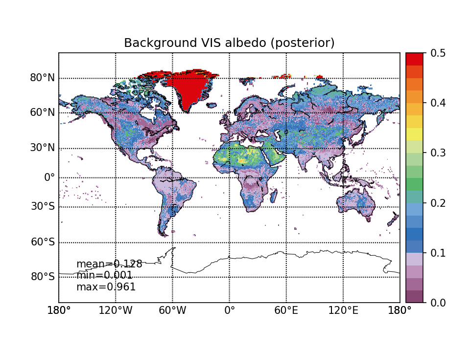
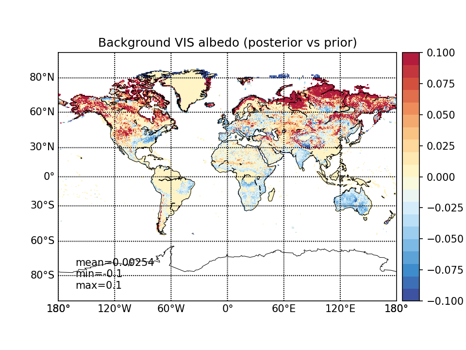
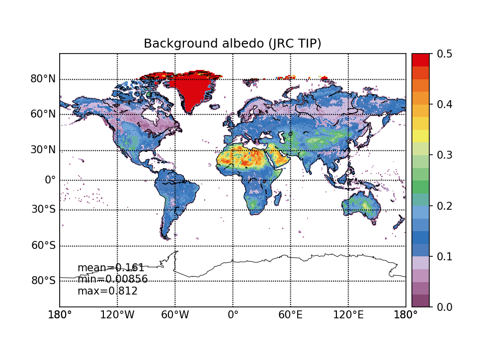
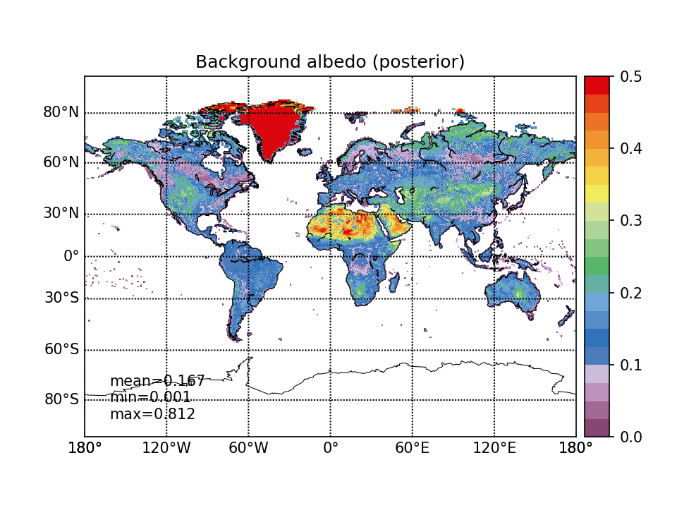
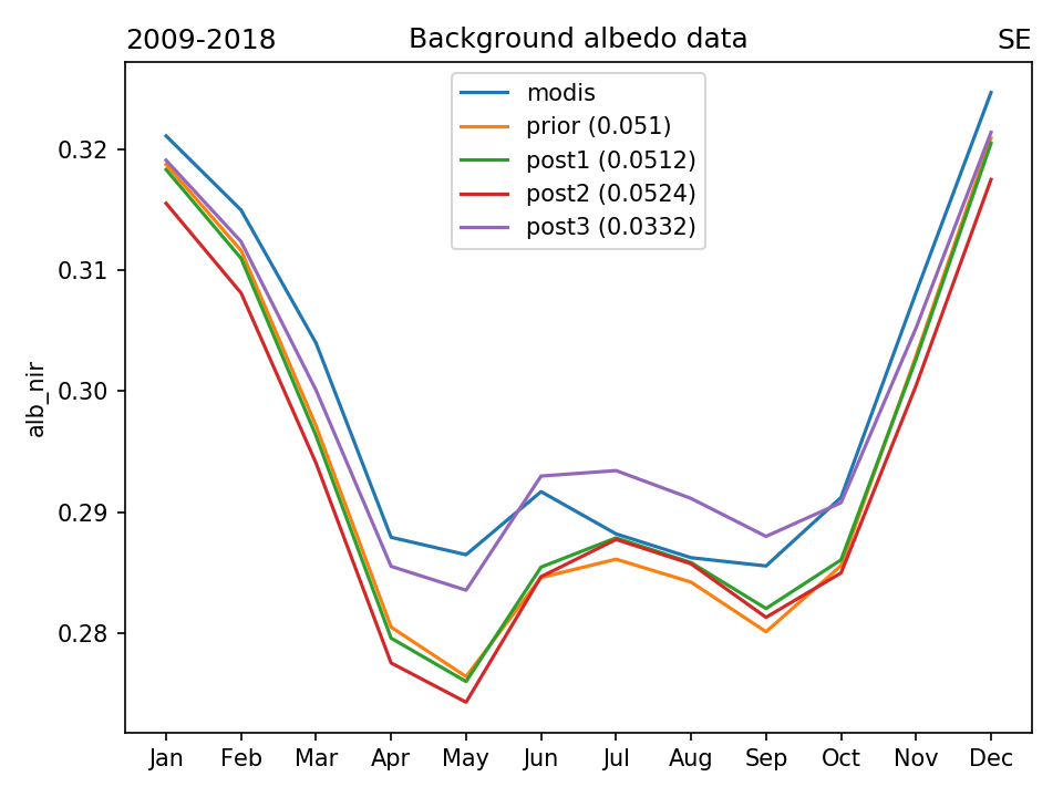
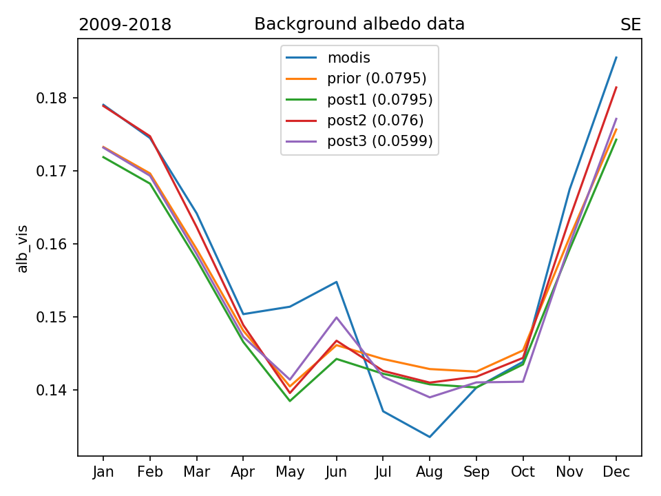
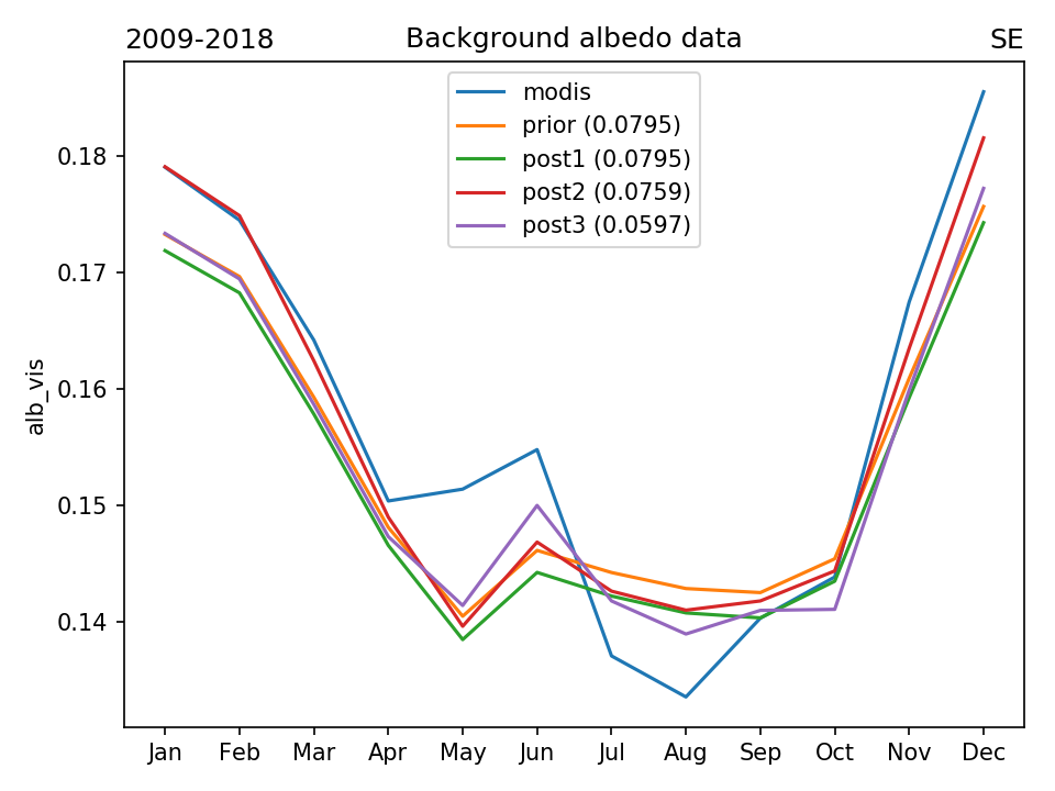
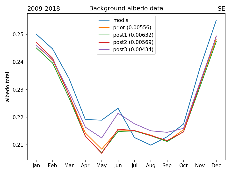
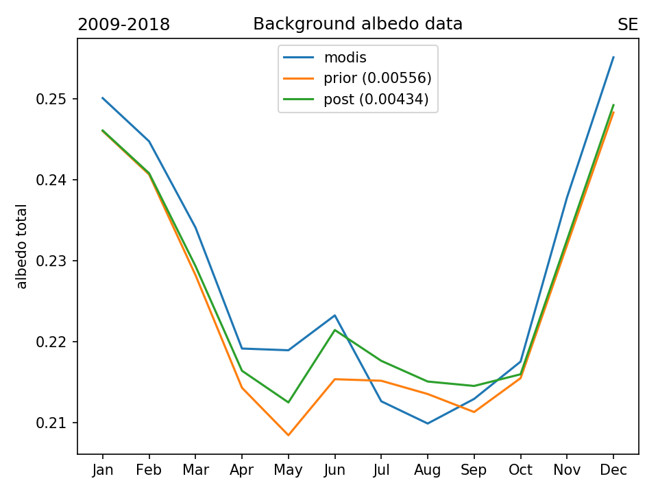
STEP 3 : BACKGROUND ALBEDO OPTIMIZATION
Data points selection (month-pixels from climatology 2009-2018) :
- MODIS is valid (not masked)
- ORCHIDEE is valid (not masked)
- Total_bare_soil * (1 - snow_fraction) > 0.5
Optimization method: pixel-level L-BFGS-B with analytical gradient calculation (1 optimized parameter at each pixel, varying albedo by ±0.1 from the prior)
Post-processing: filling non-optimized pixels (having small bare soil fraction and not covered with snow throughout the year) with the average value from 10 closest pixels (where contfrac > 0.99 and inlandwater < 0.1)
ndata - total number of used month-pixels (or day-pixels on the right graph), npts - total number of used grid pixels, zpts - total number of not used grid pixels
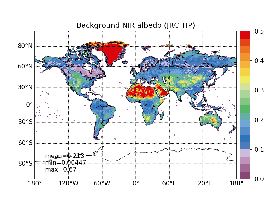
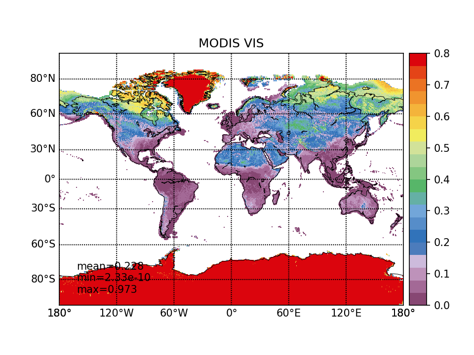
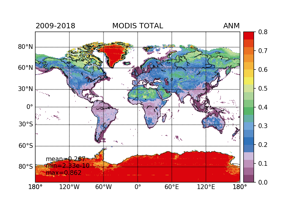
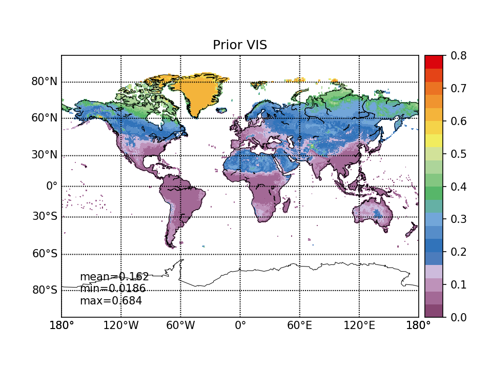
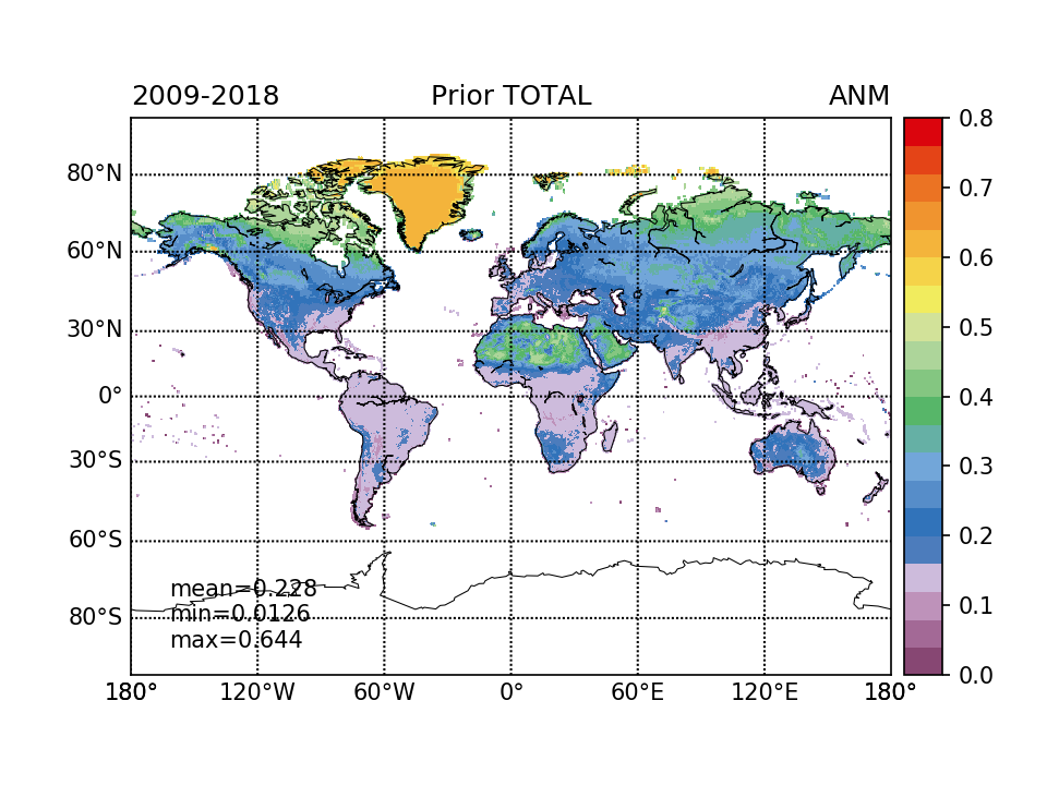
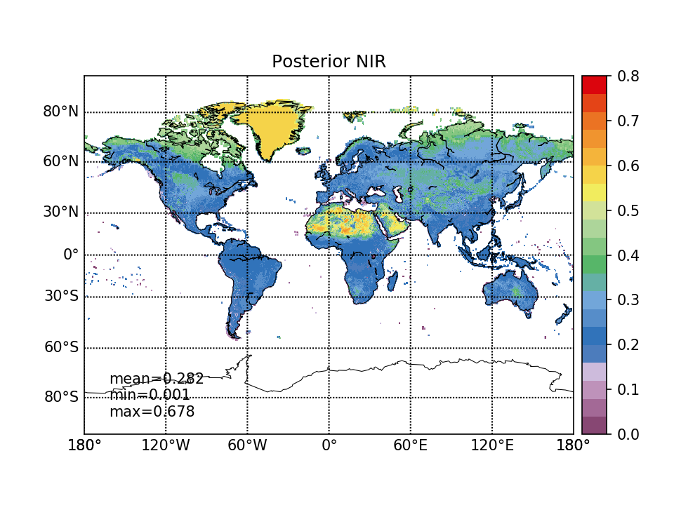
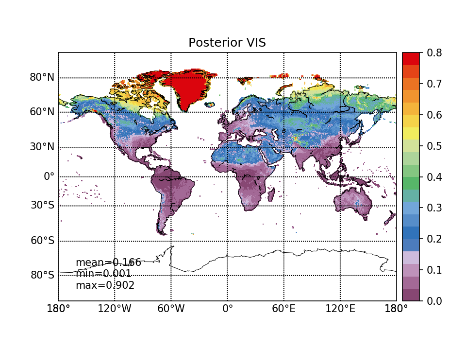
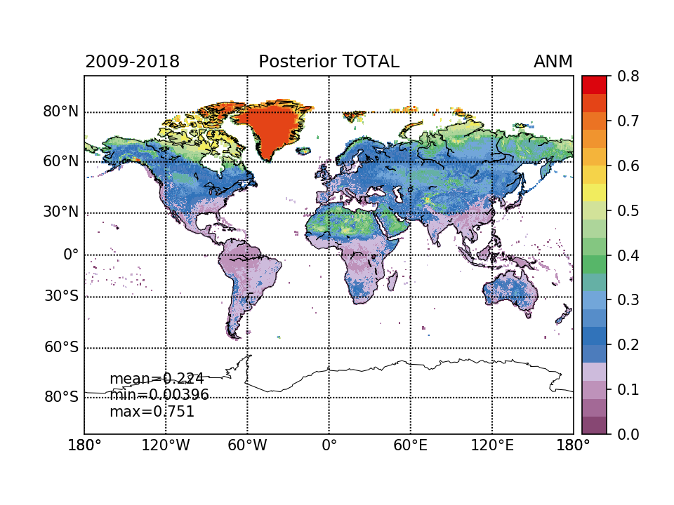
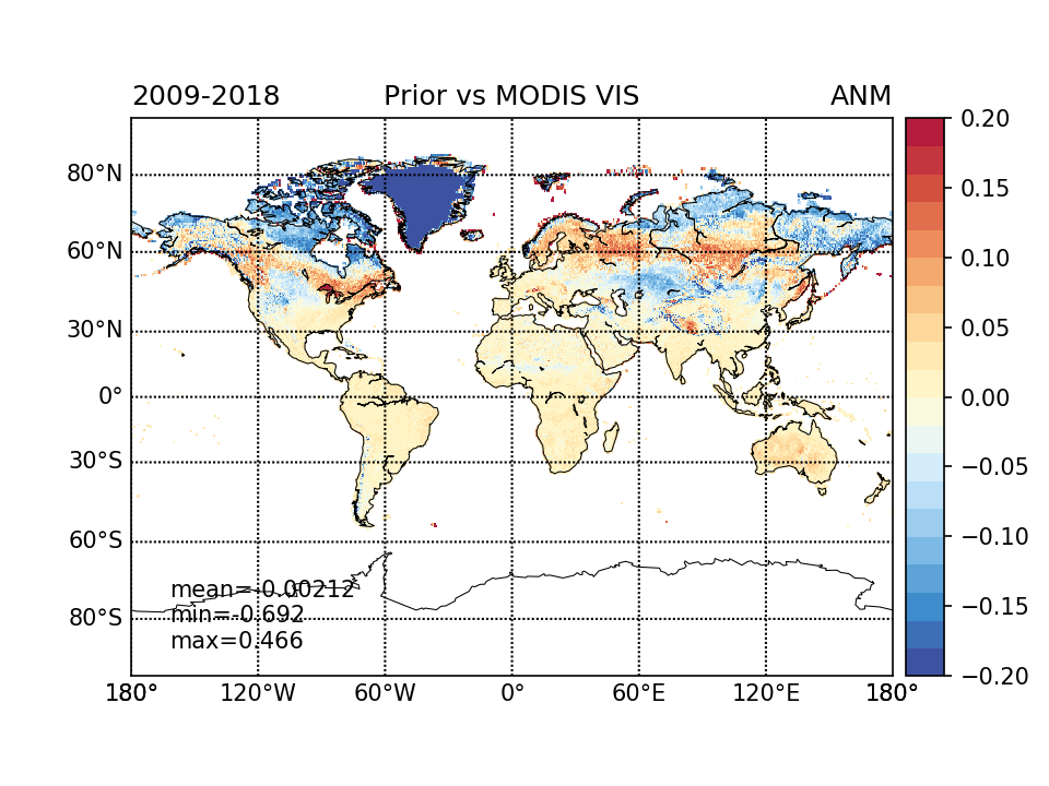
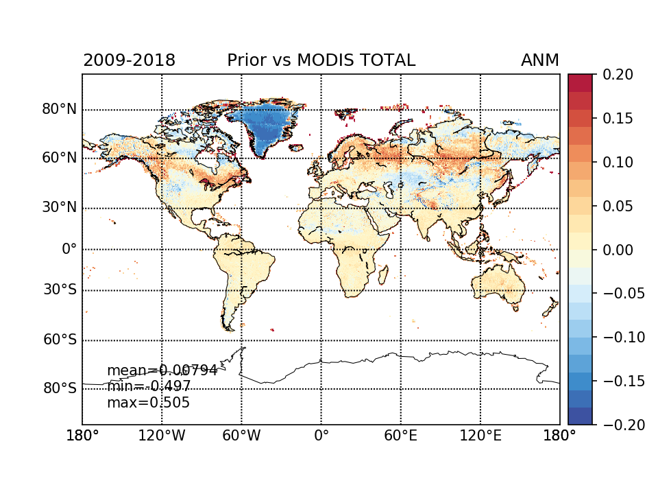
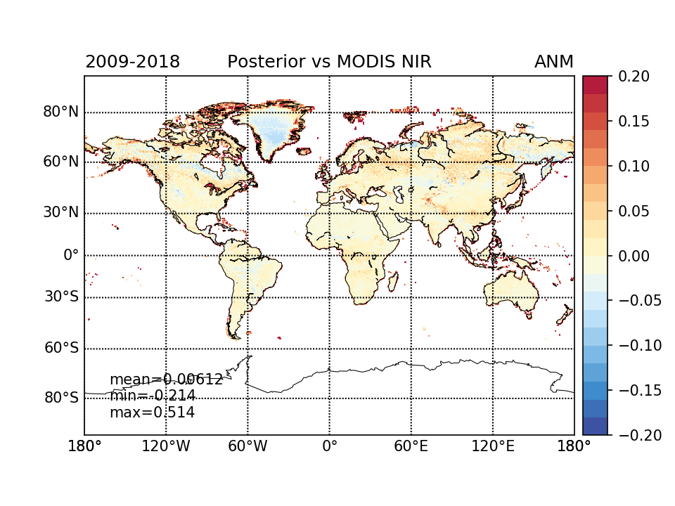
RESULTS (maps)
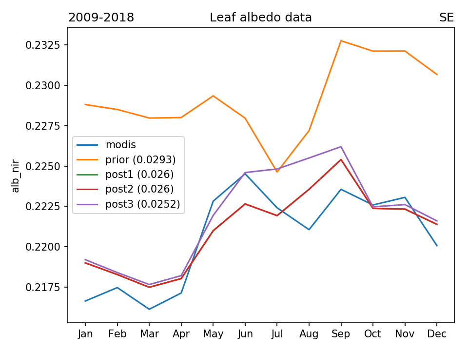
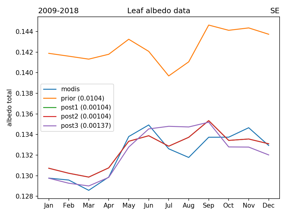
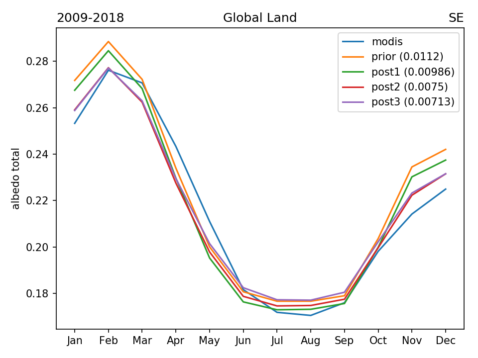
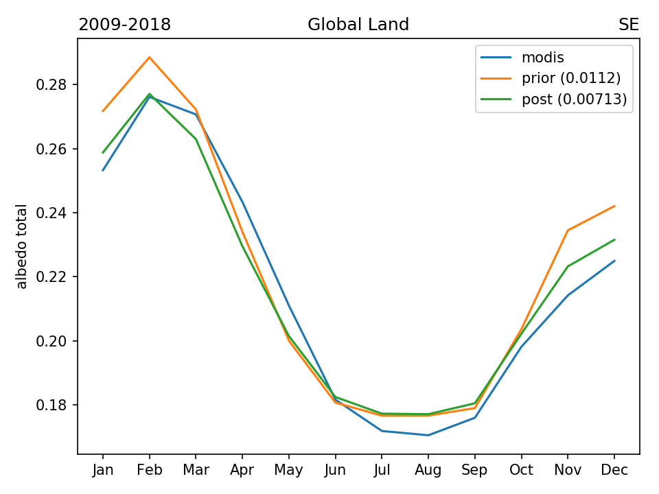
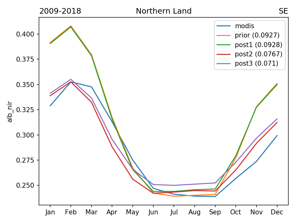
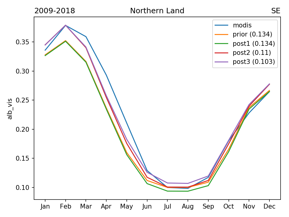
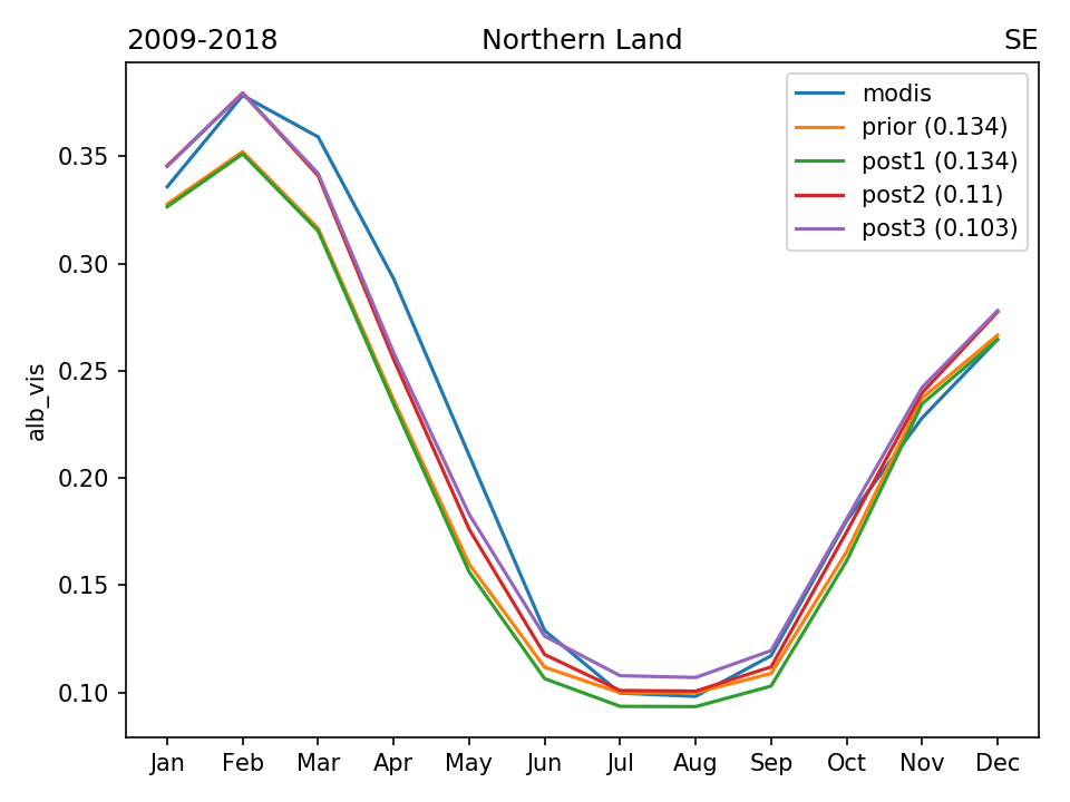
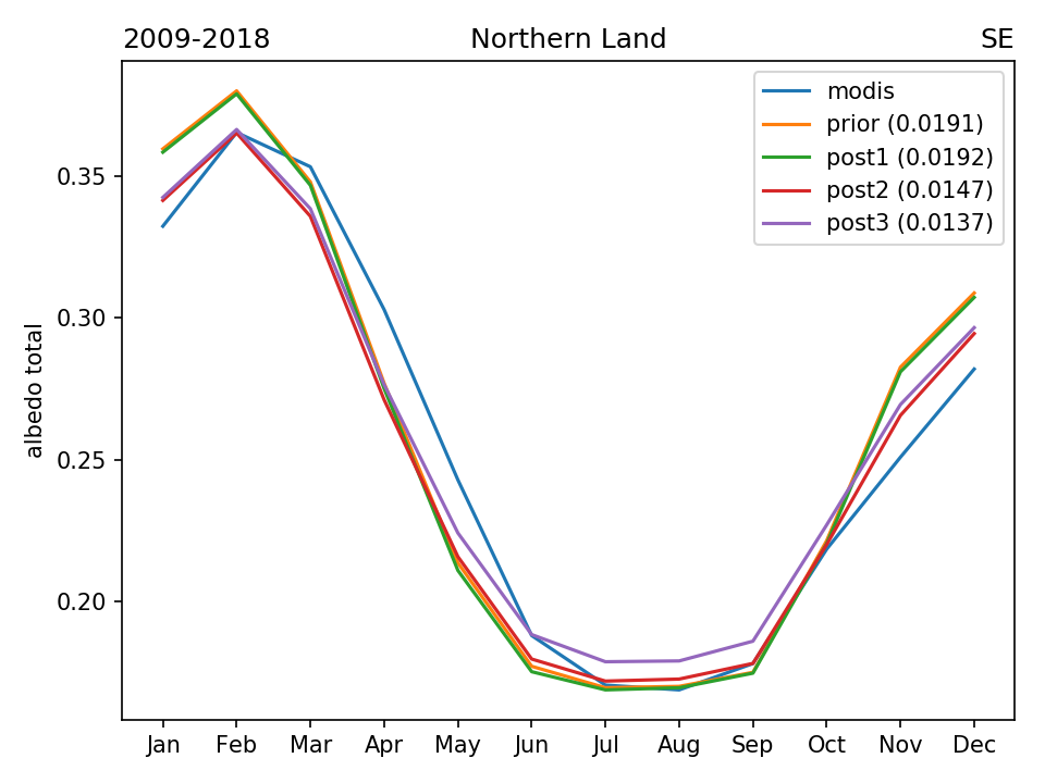
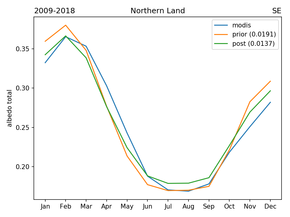
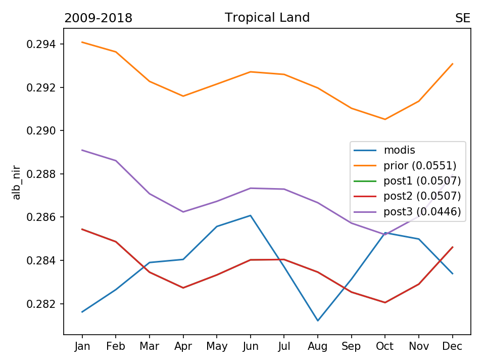
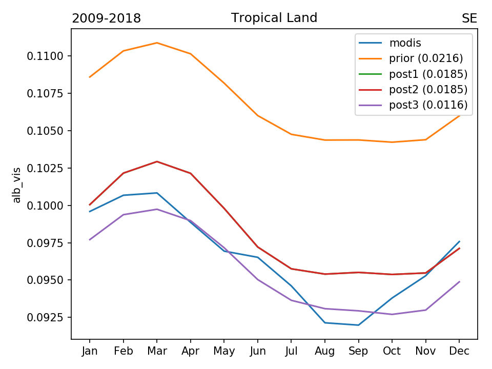
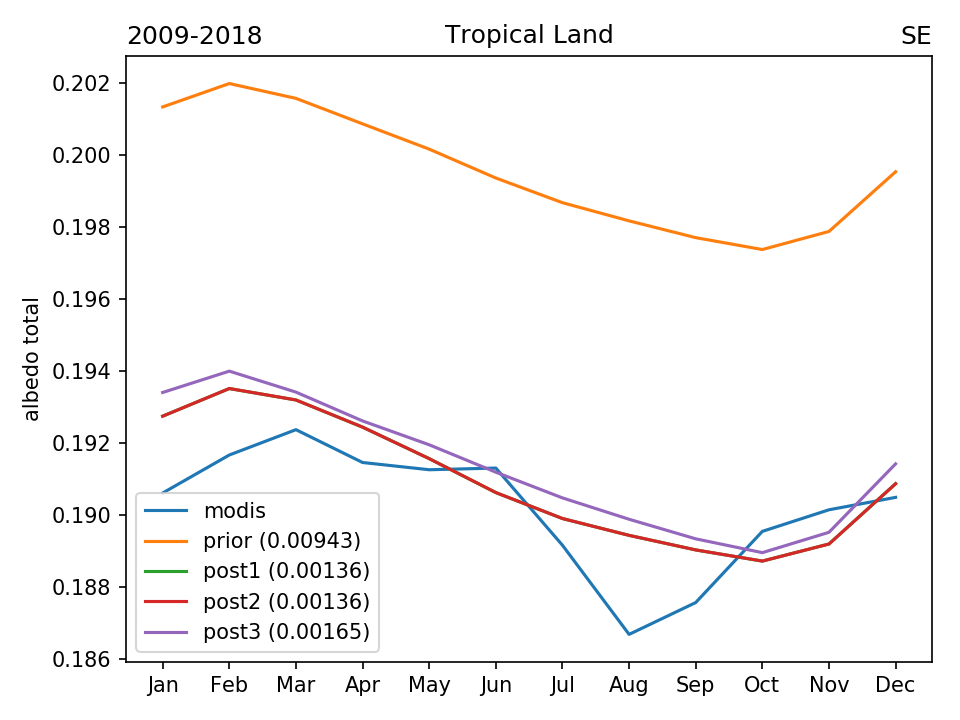
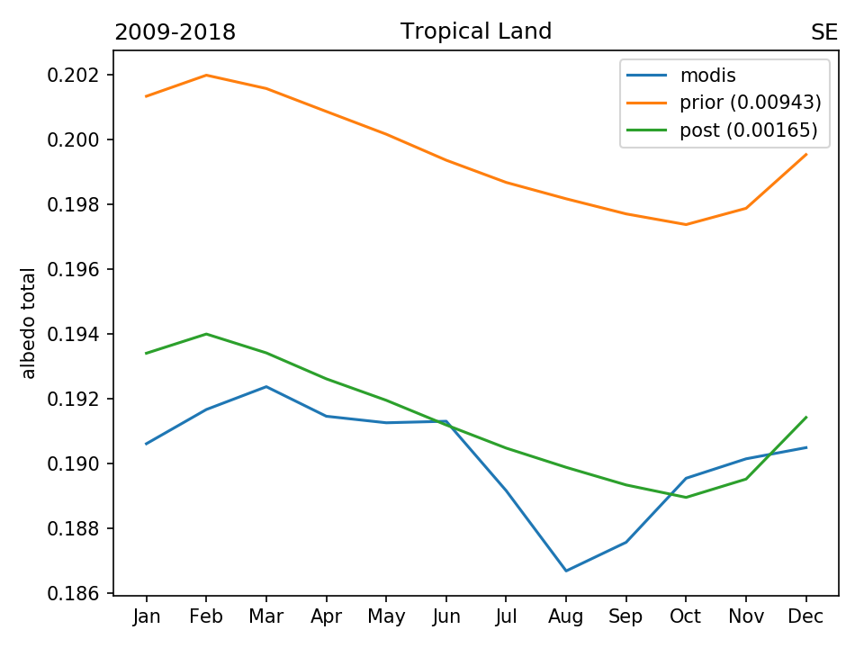
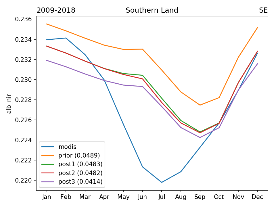
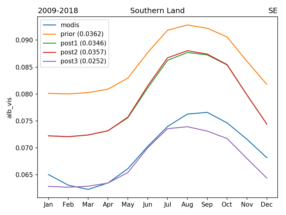
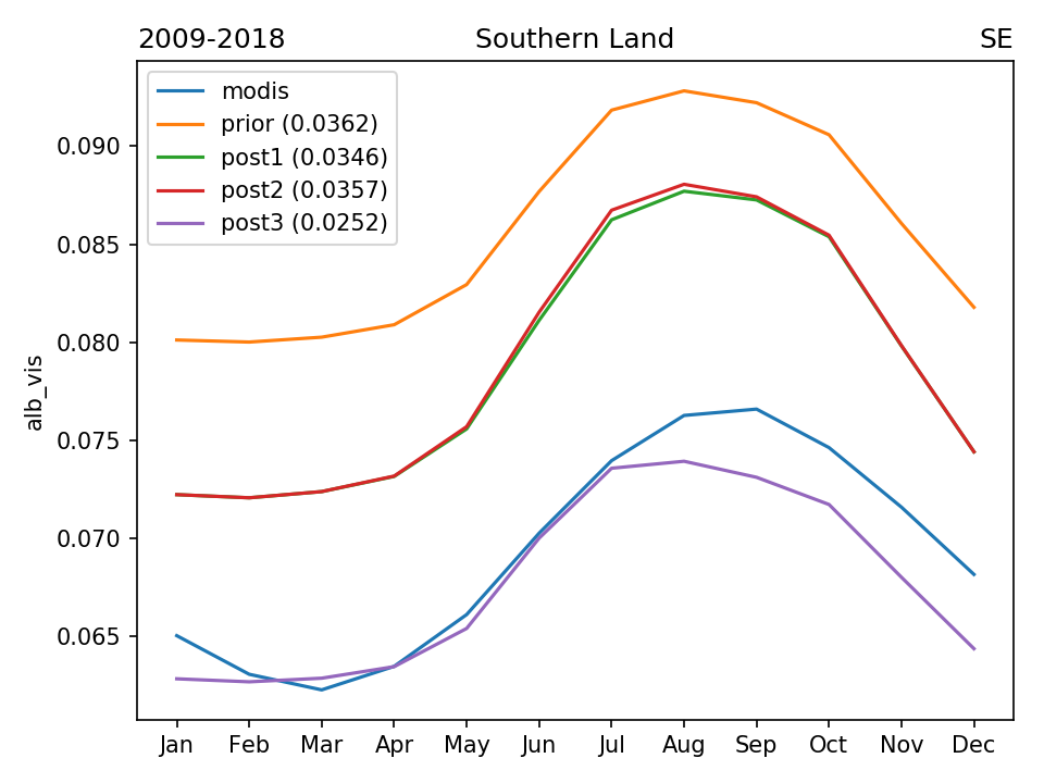
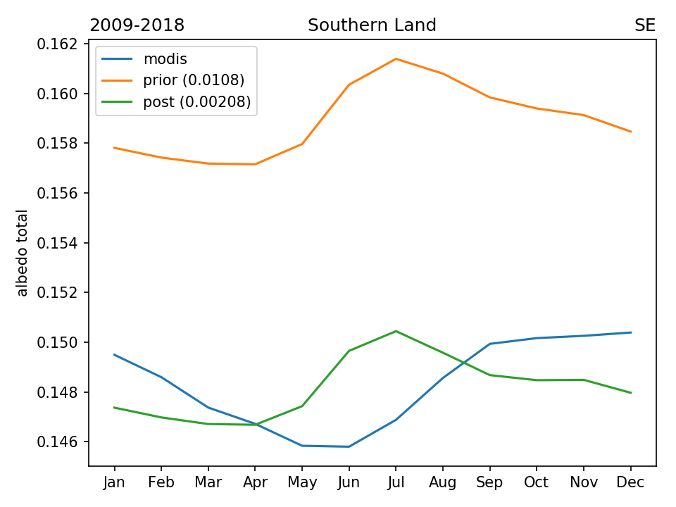
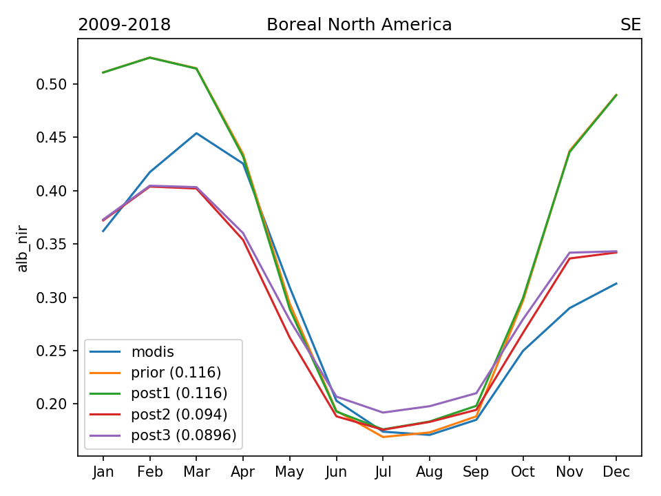
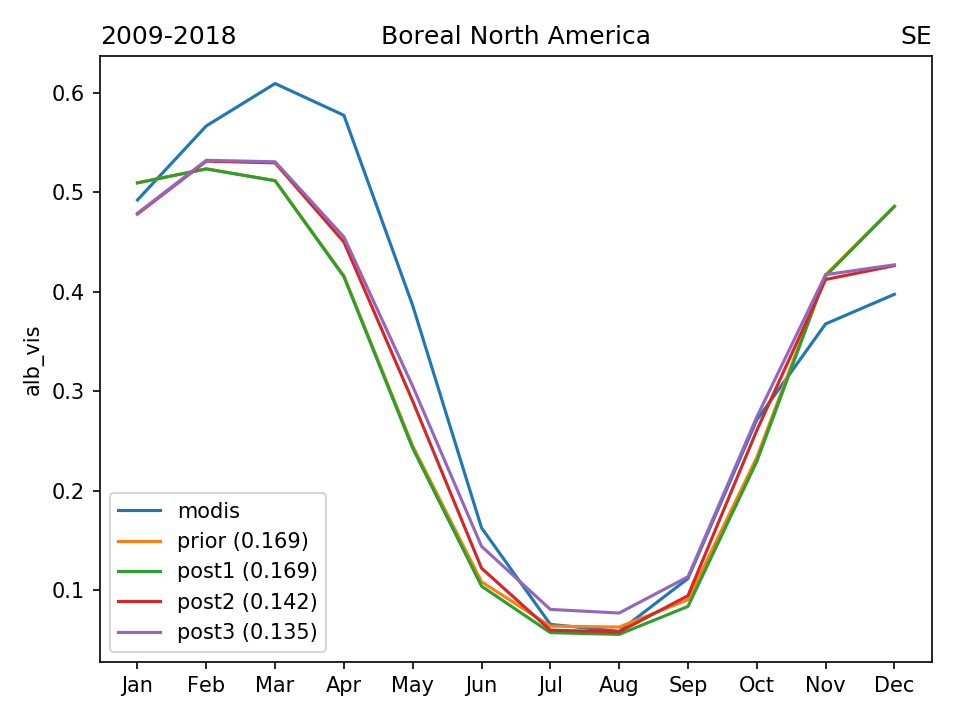
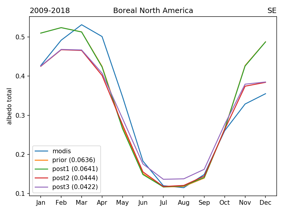
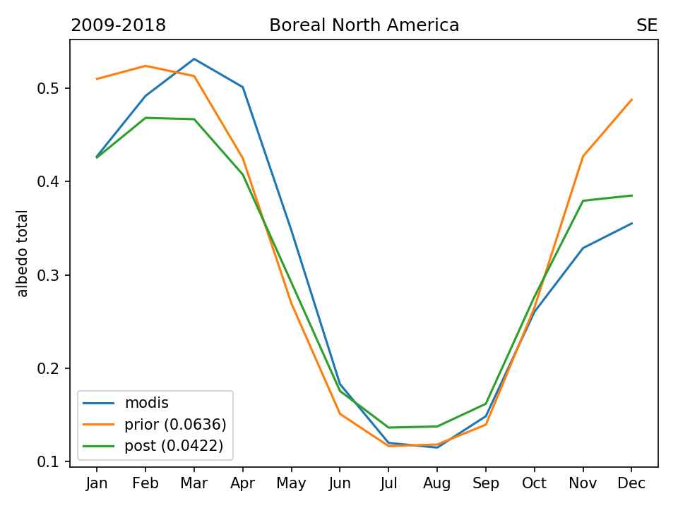
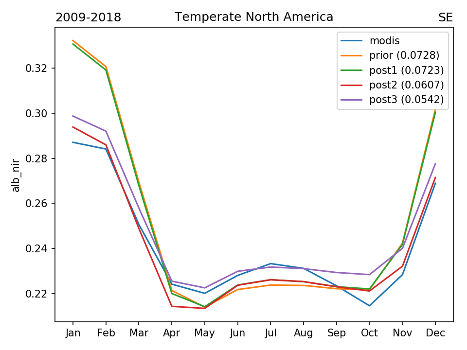
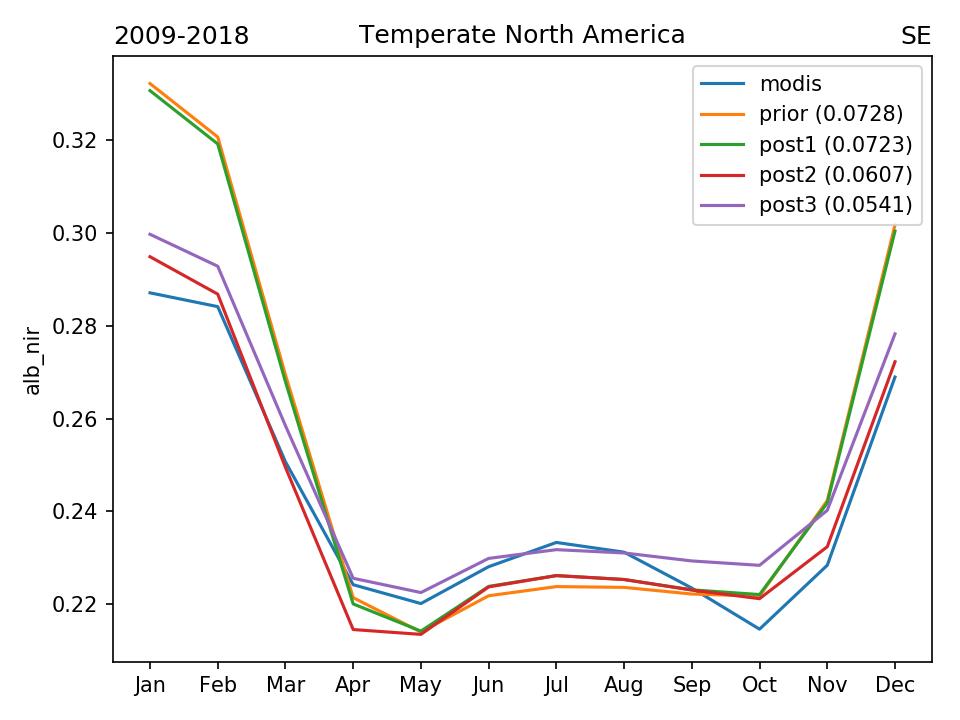
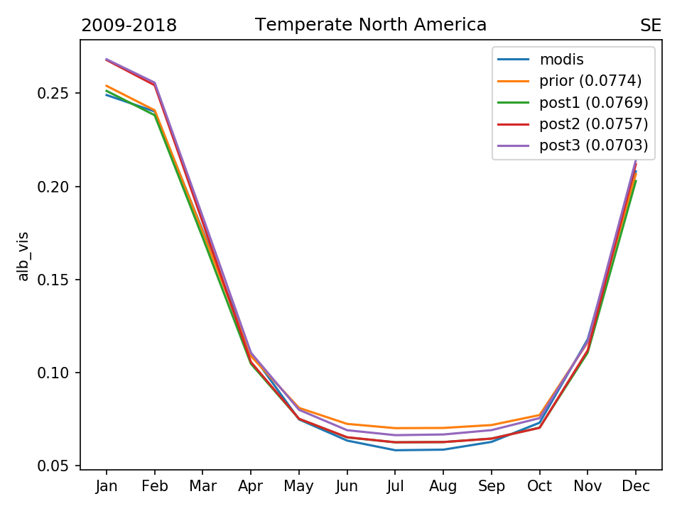
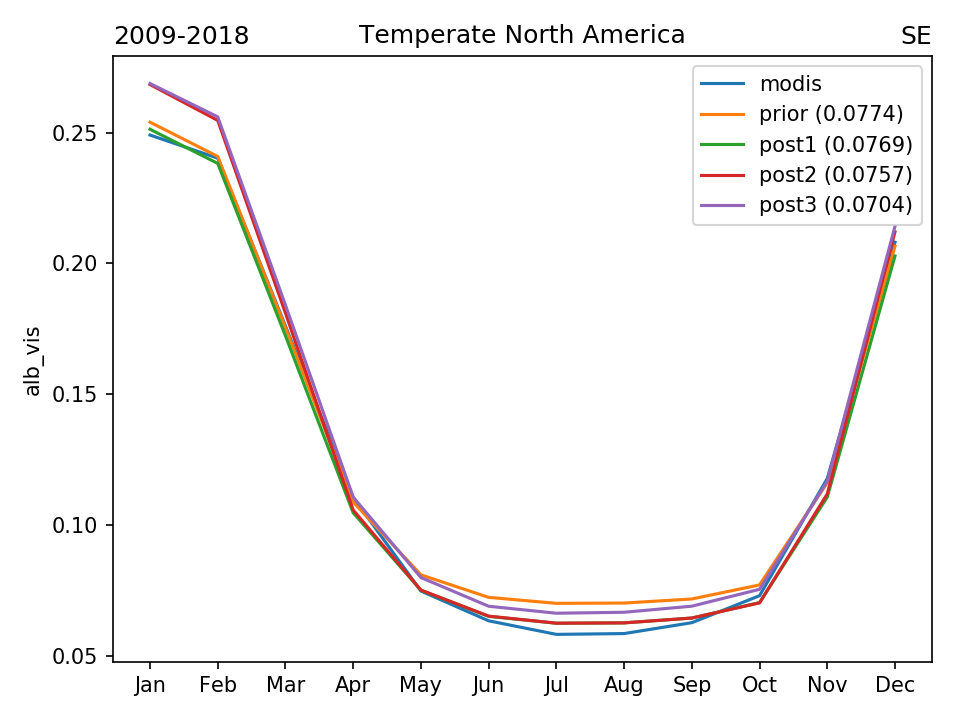
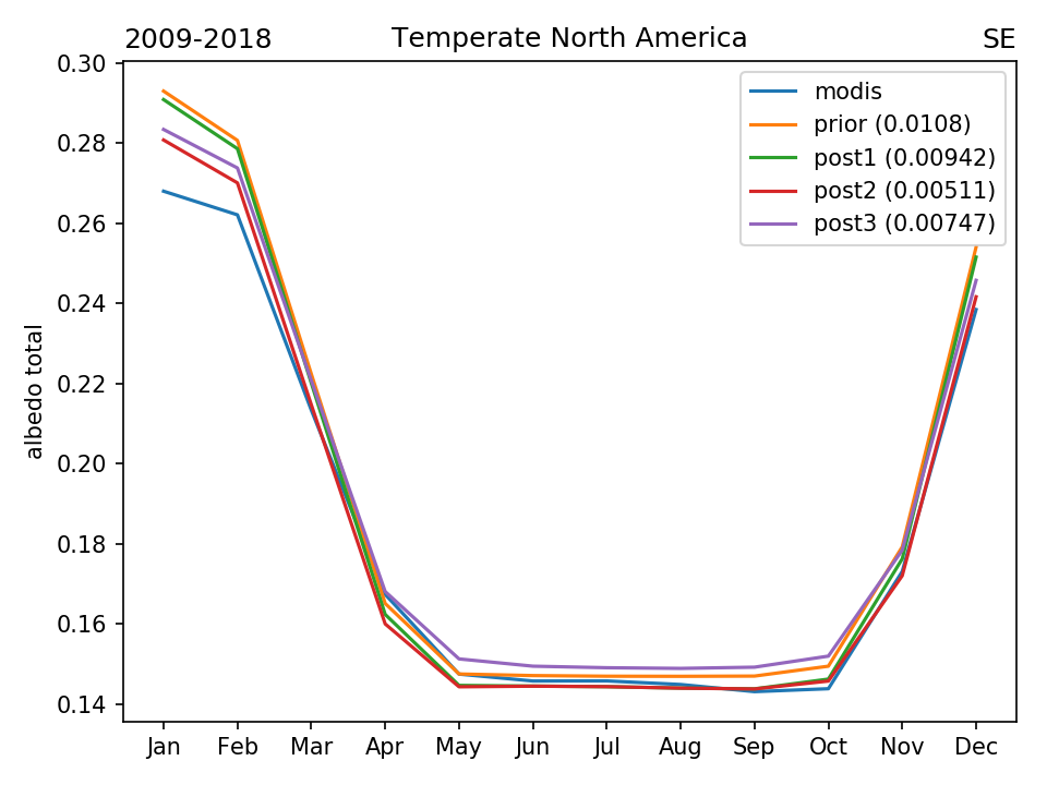
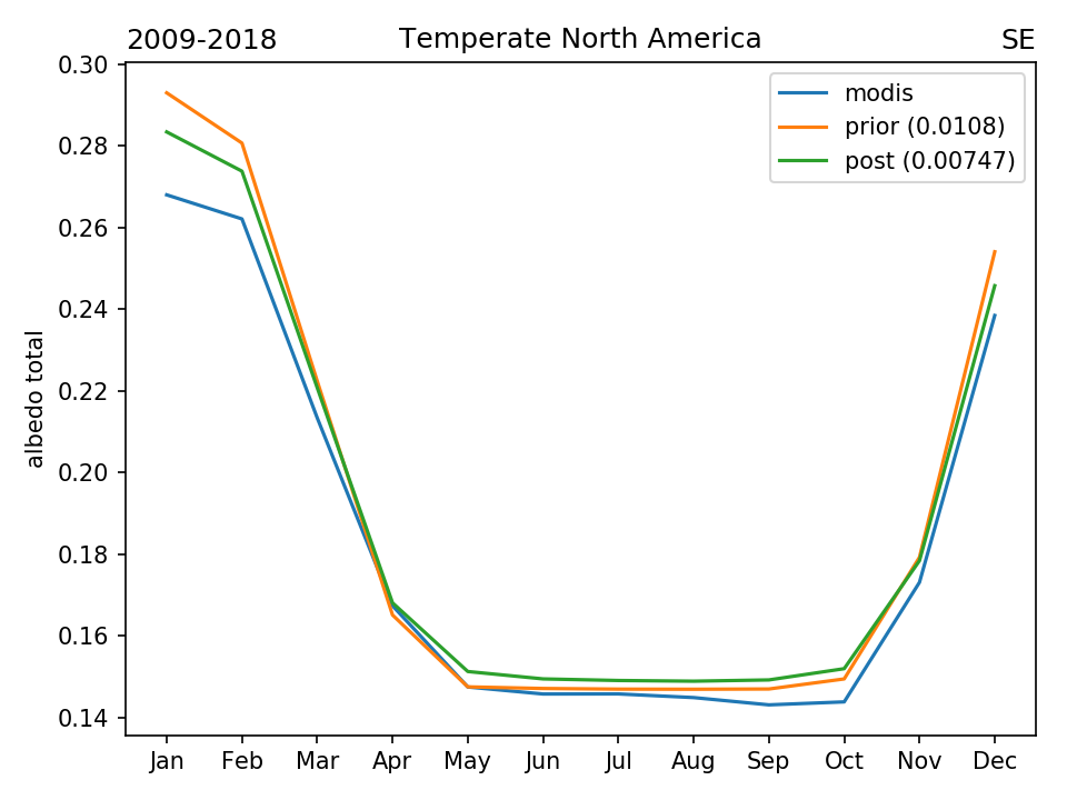
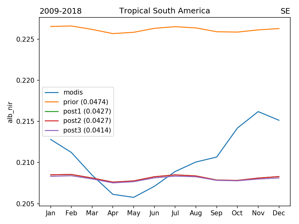
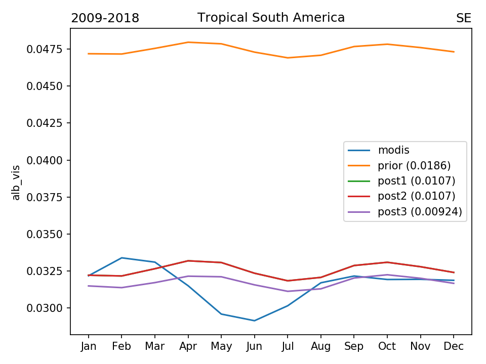
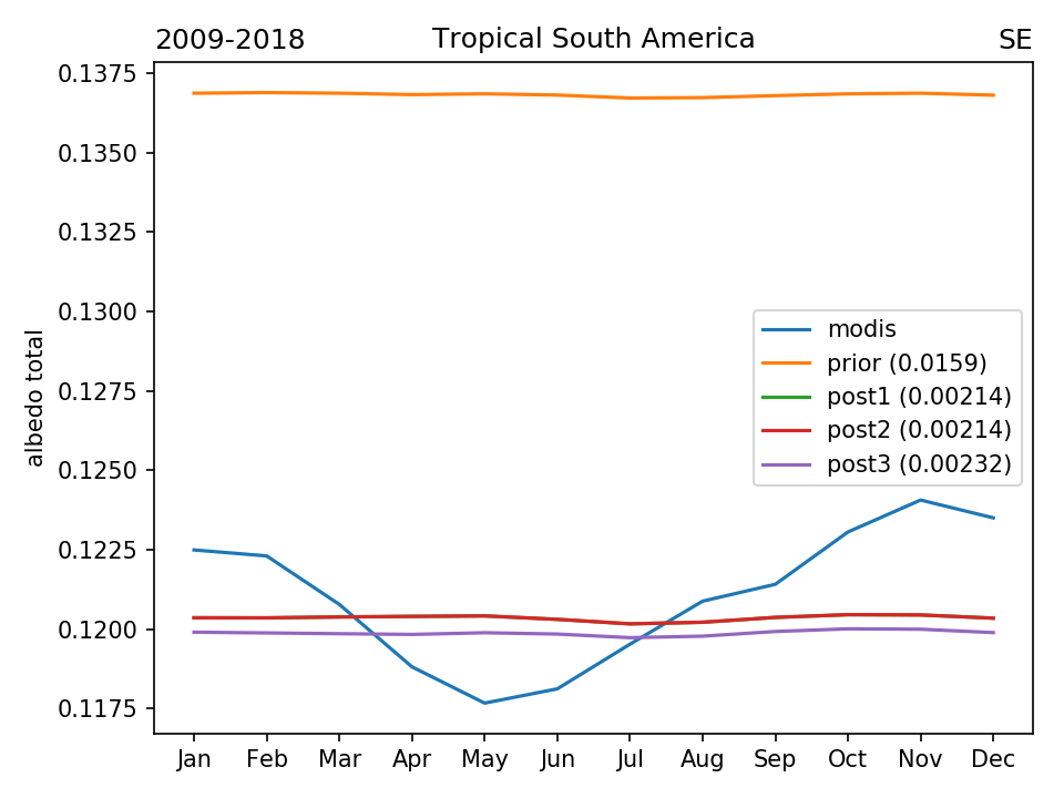
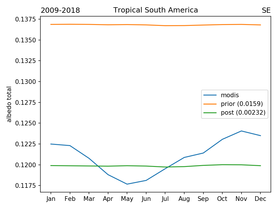
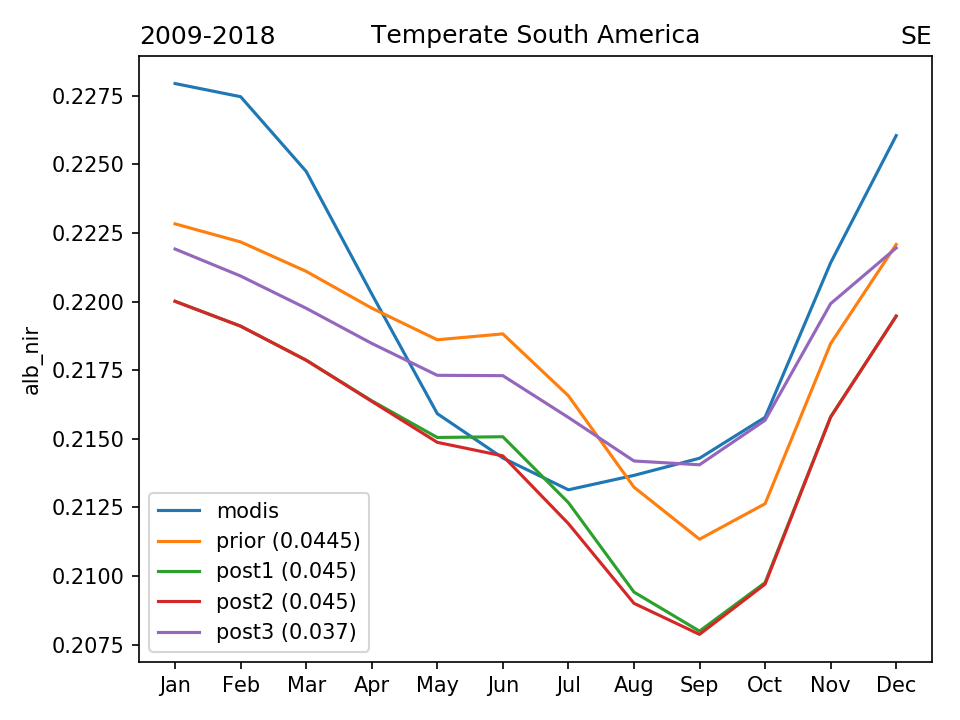
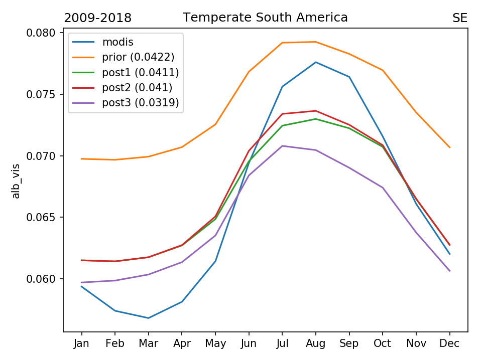
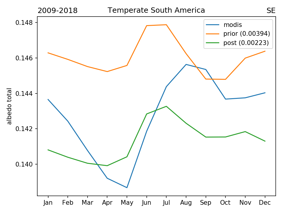
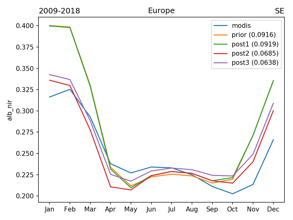
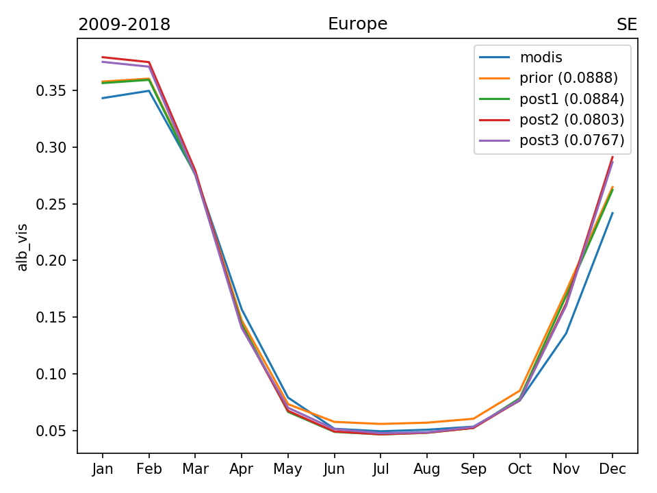
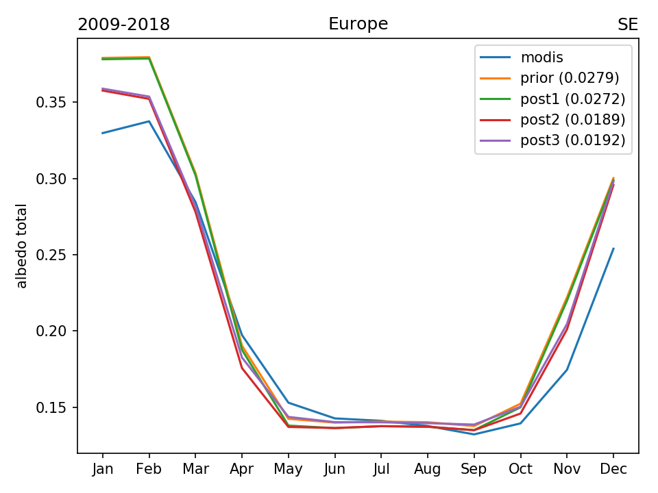
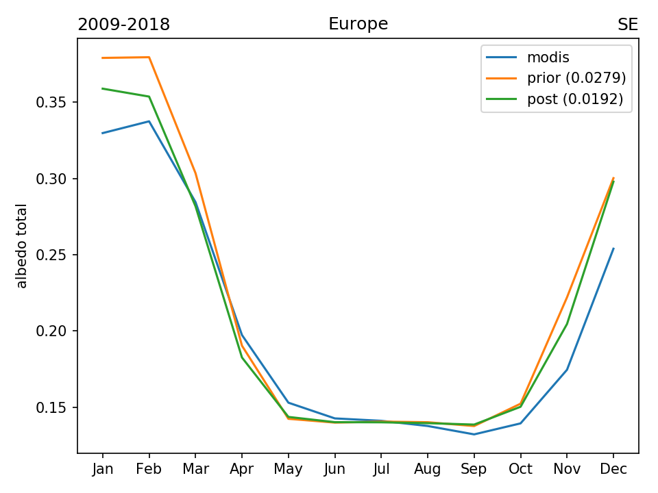
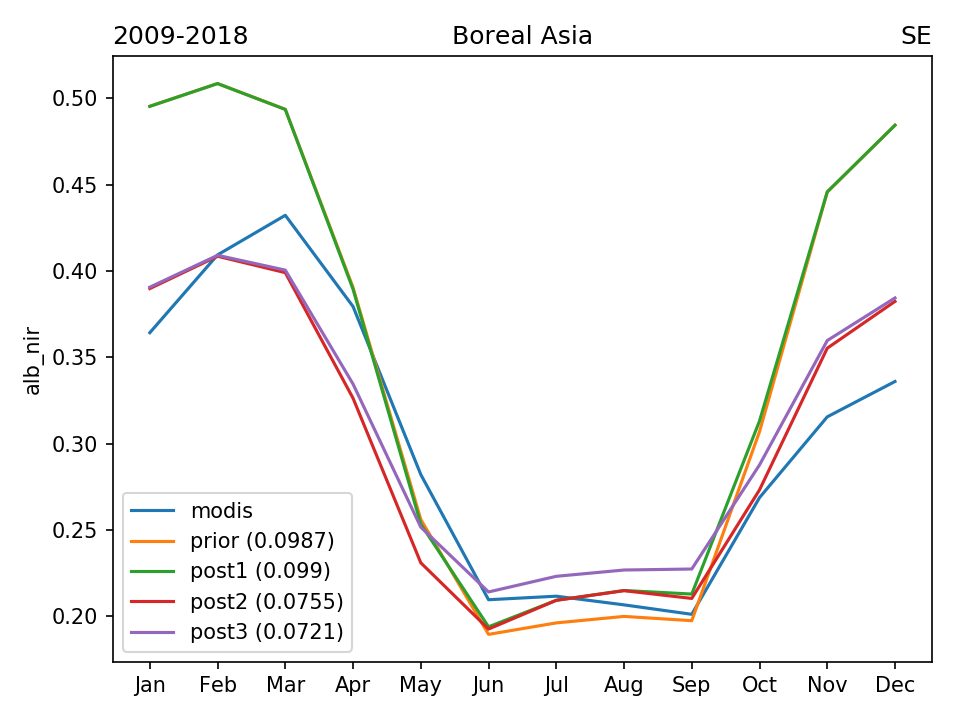
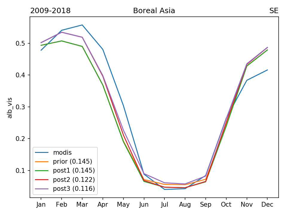
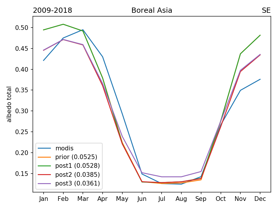
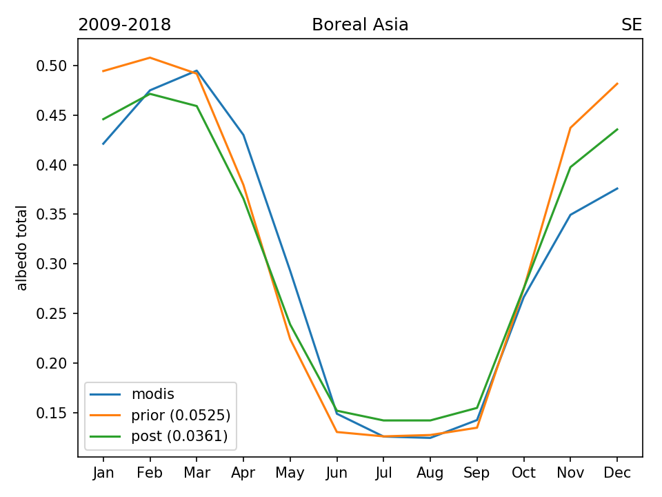
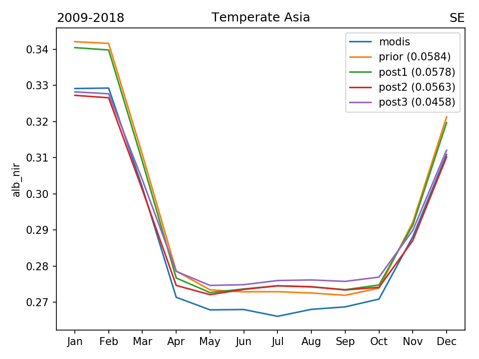
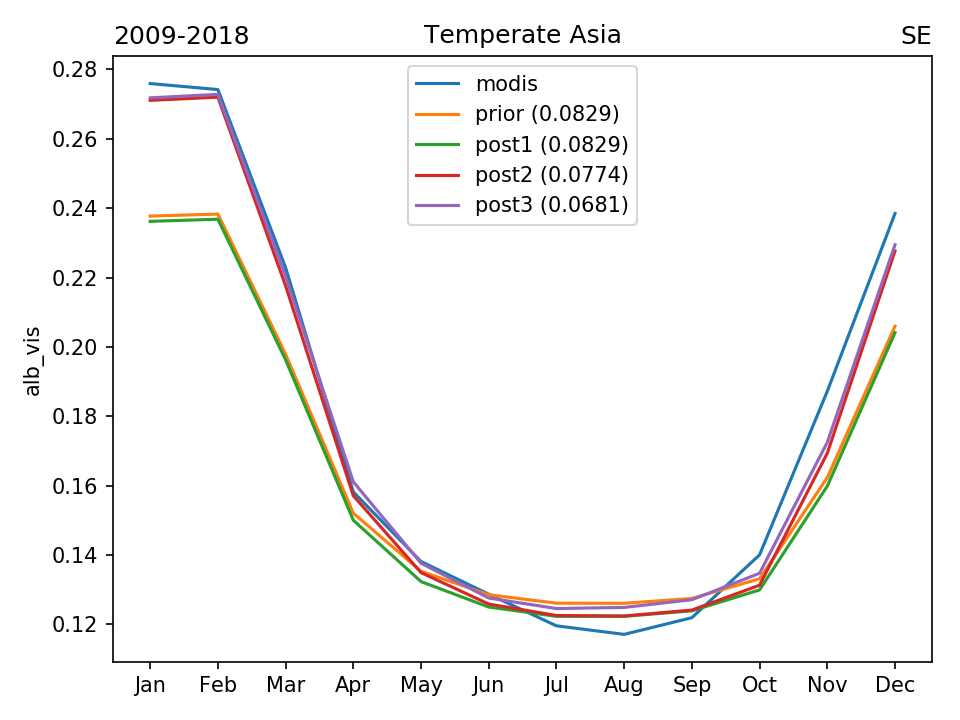
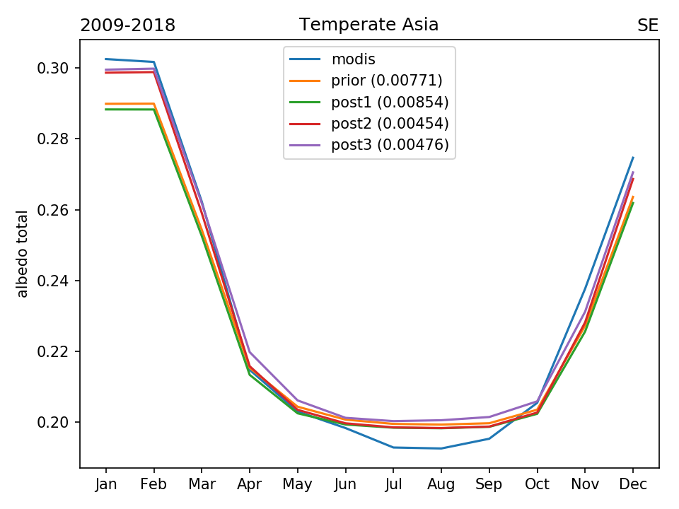
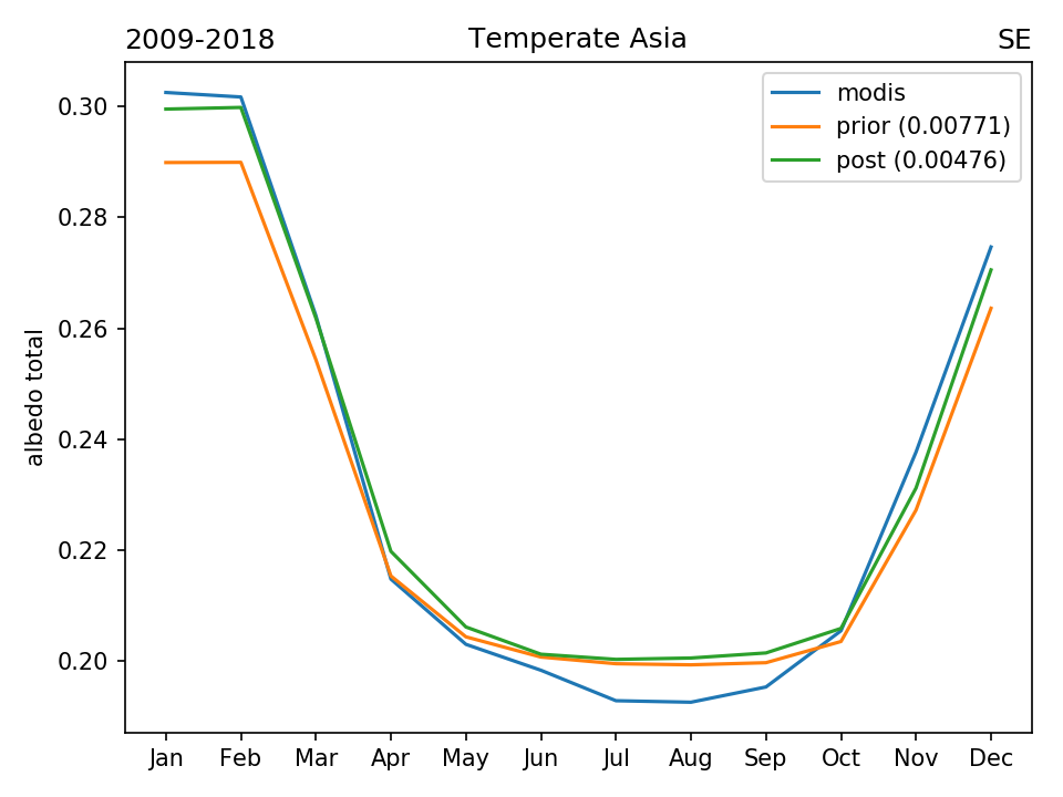
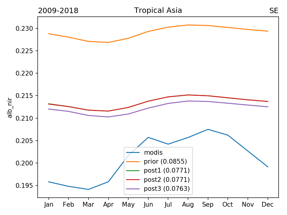
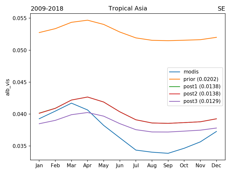
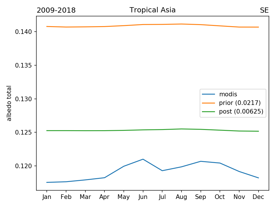
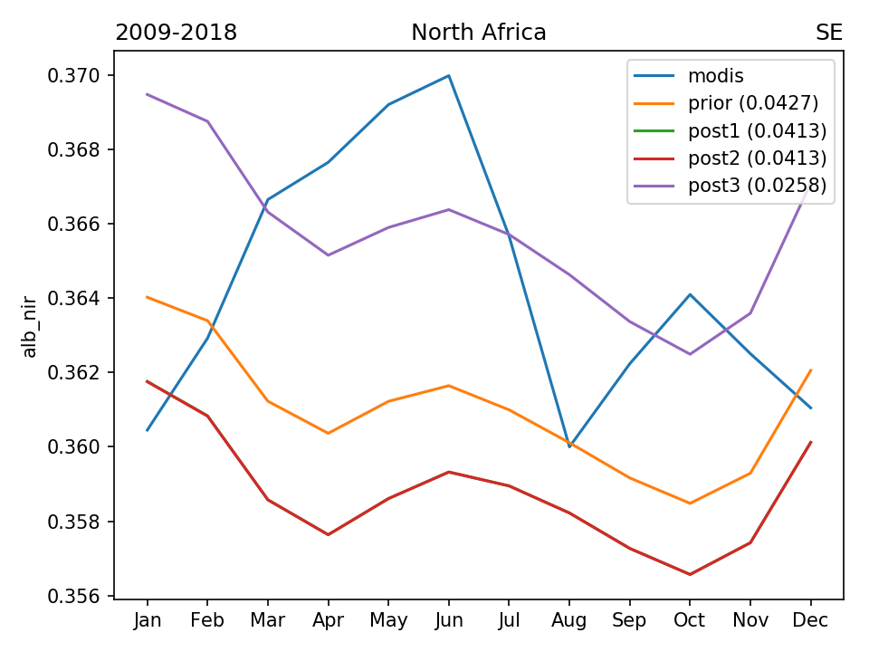
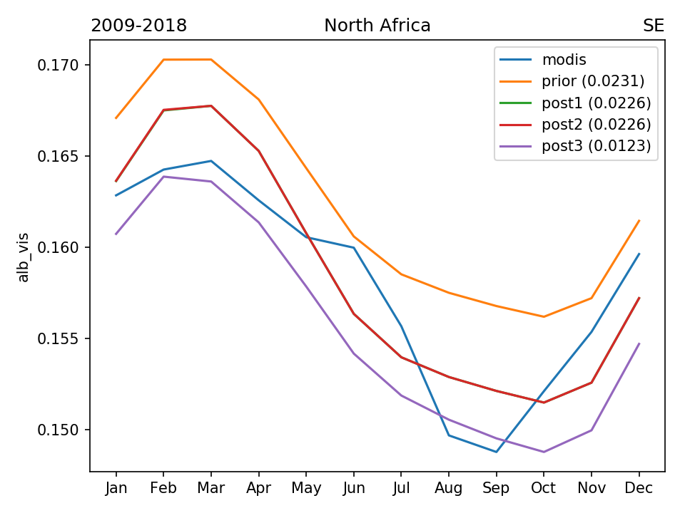
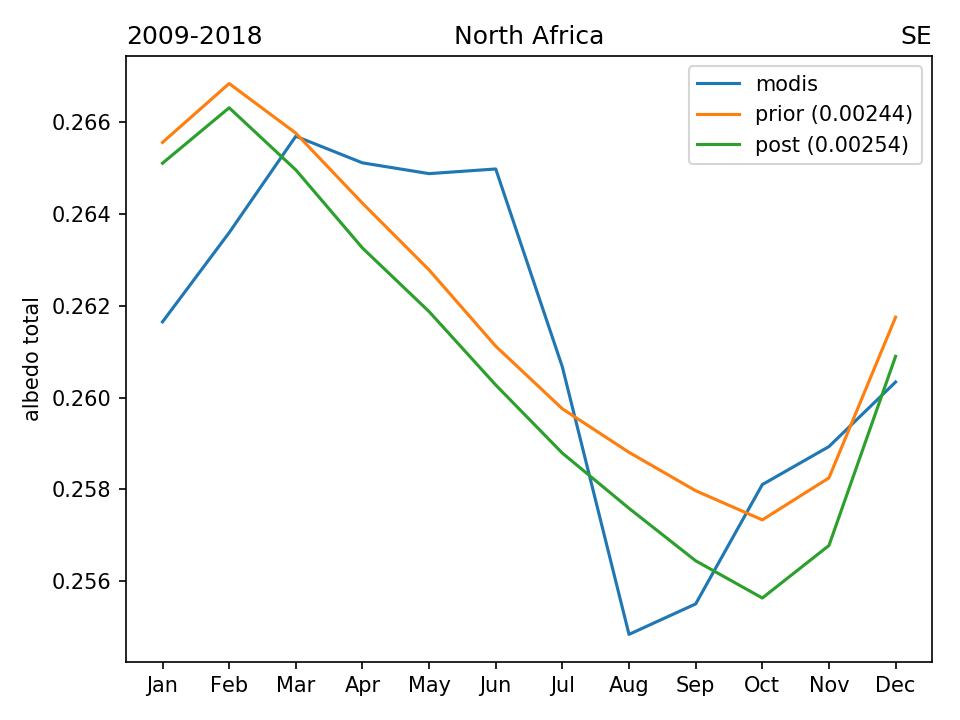
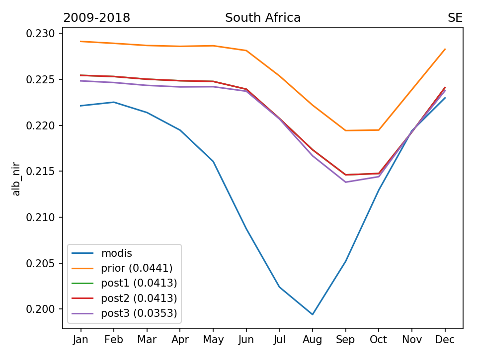
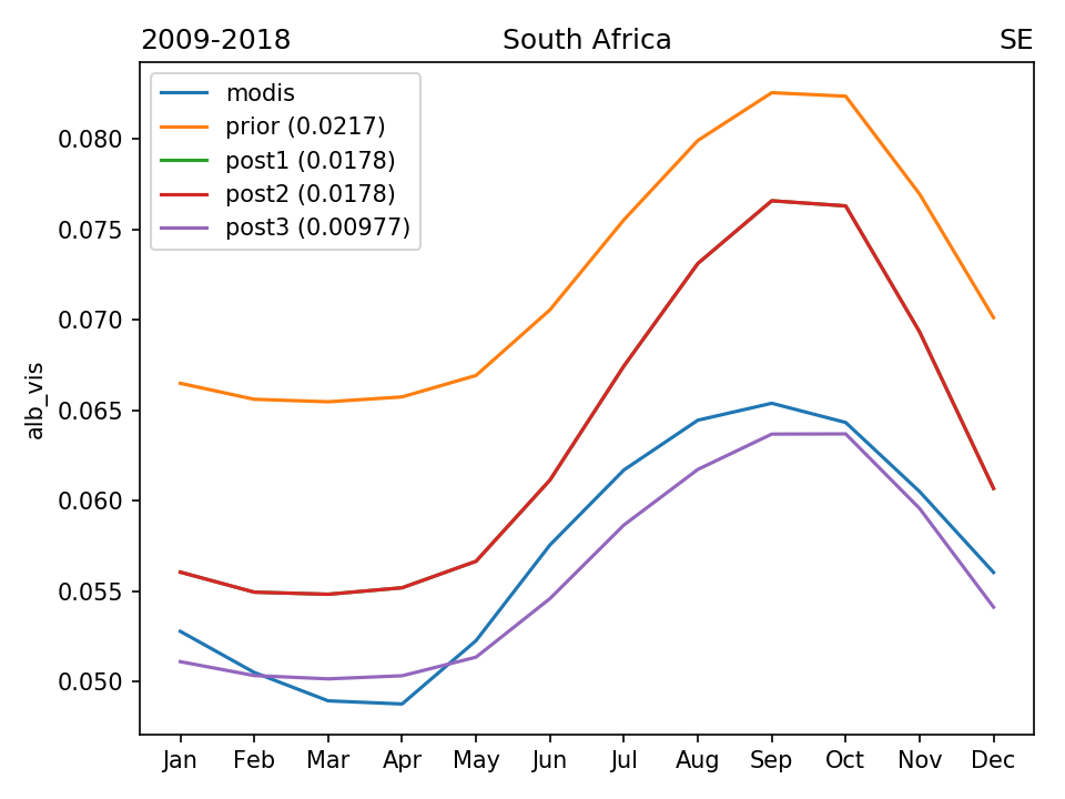
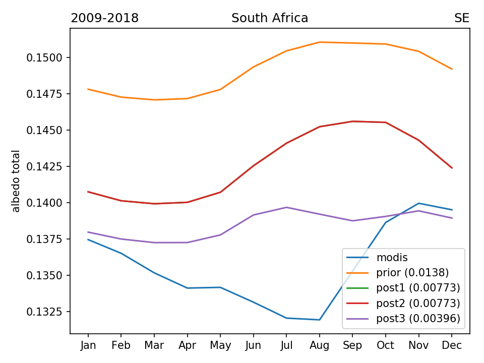
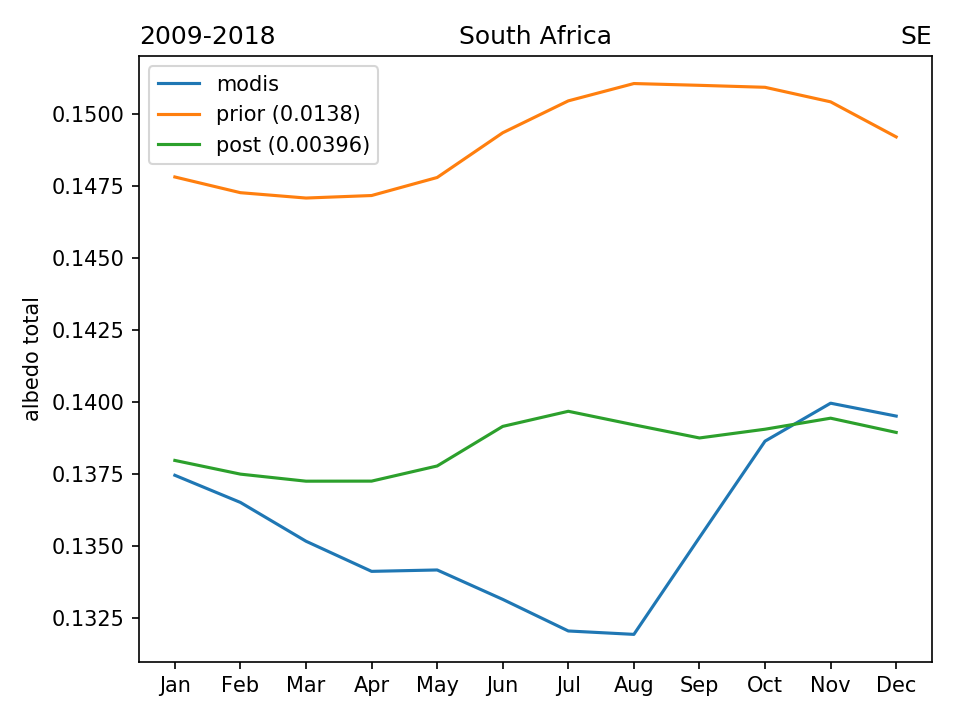
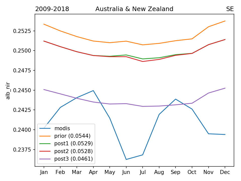
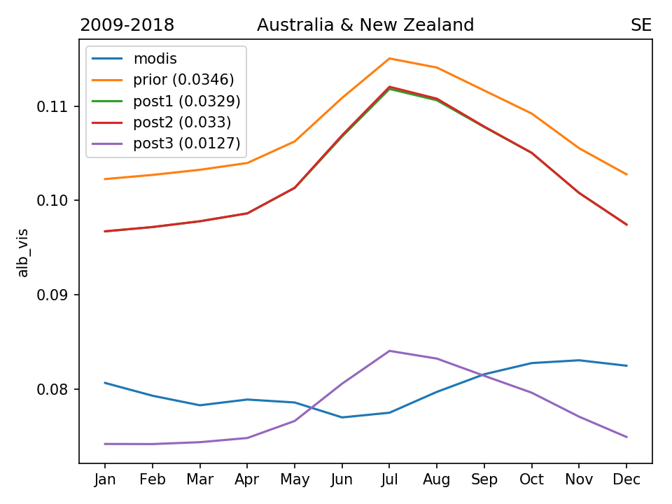
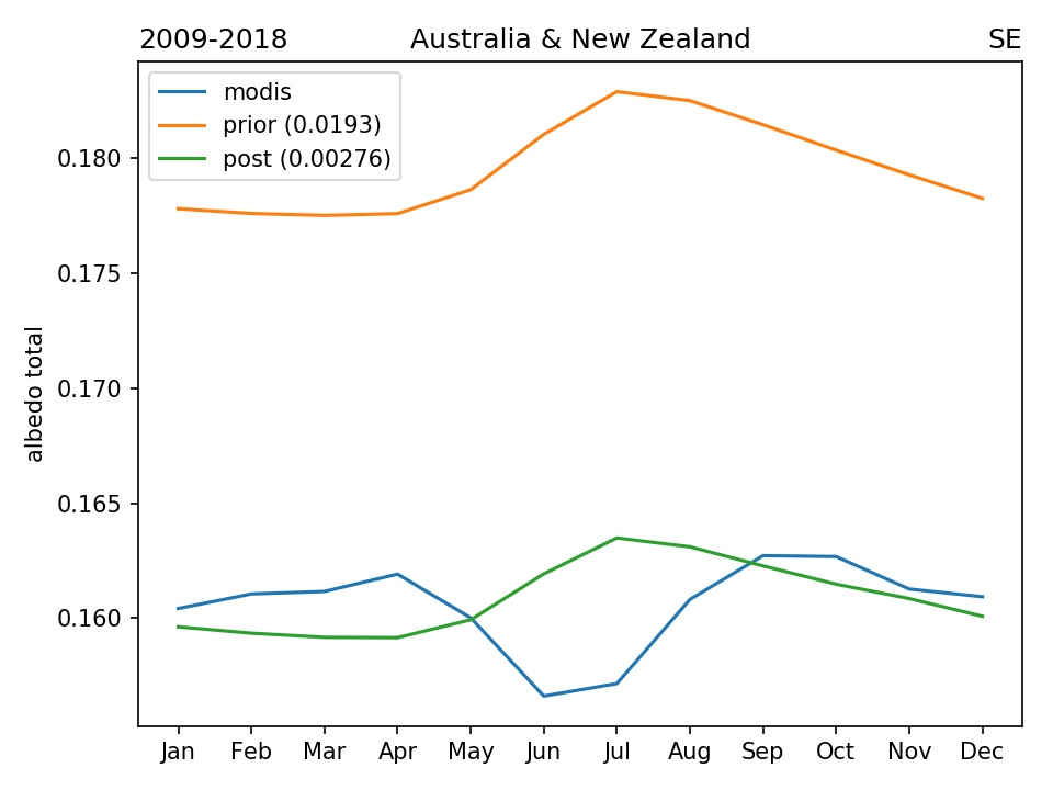
RESULTS (seasonal cycle across different regional masks)