

CTESSEL developments


 |  | CTESSEL developments |  |  | ||
| orchidas : cams / CAMS52-CH4 / WetExtent | Site Map |
Project CAMS52a
Wetland Extent Fraction
Re-calibrating scaling factor with different wetland extent products
| Parameter | Standard | CAMA | SWAMPS | SWAMPS (filtered when tsoil < 0) |
| s_global | 0.00333 | 0.047 | 0.0158 | 0.0164 |
| s_north | 0.00422 | 0.117 | 0.0139 | 0.0154 |
| s_tropics | 0.00301 | 0.0357 | 0.0176 | 0.0176 |
| s_south | 0.00326 | 0.09 | 0.00864 | 0.00864 |
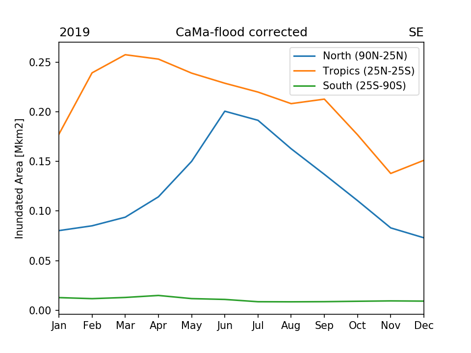
Cama-flood model (2018) and corrected version (2019)
Distributed by J. McNorton
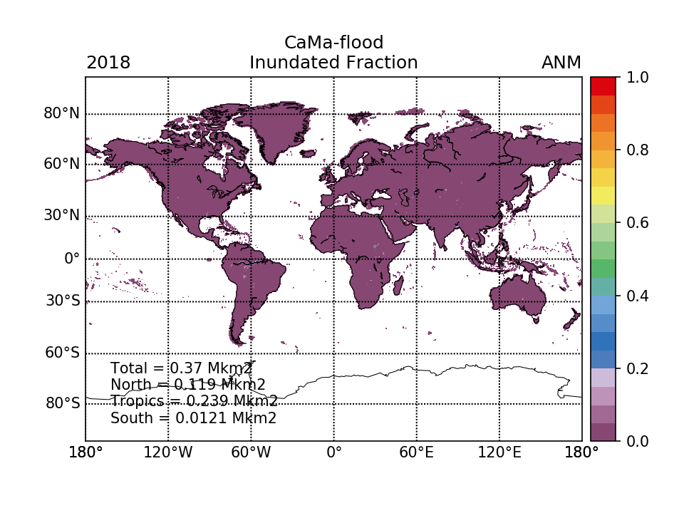 |  |  | 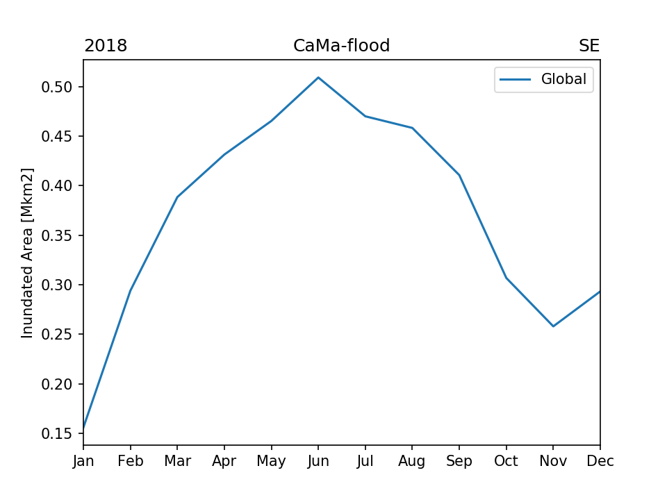 |  |
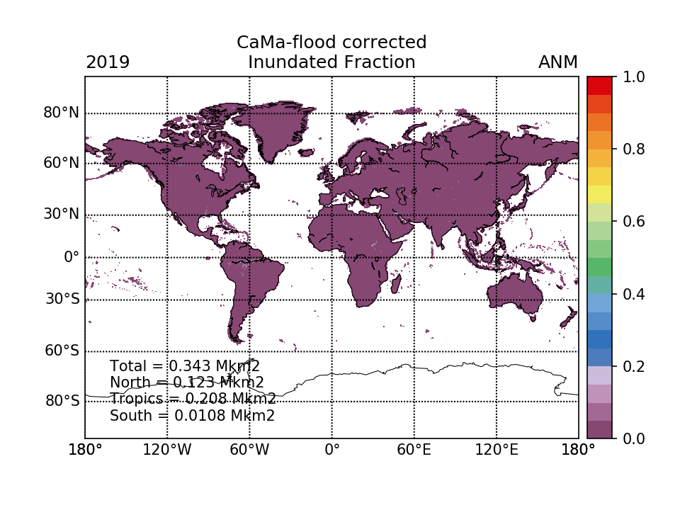 |  |  | 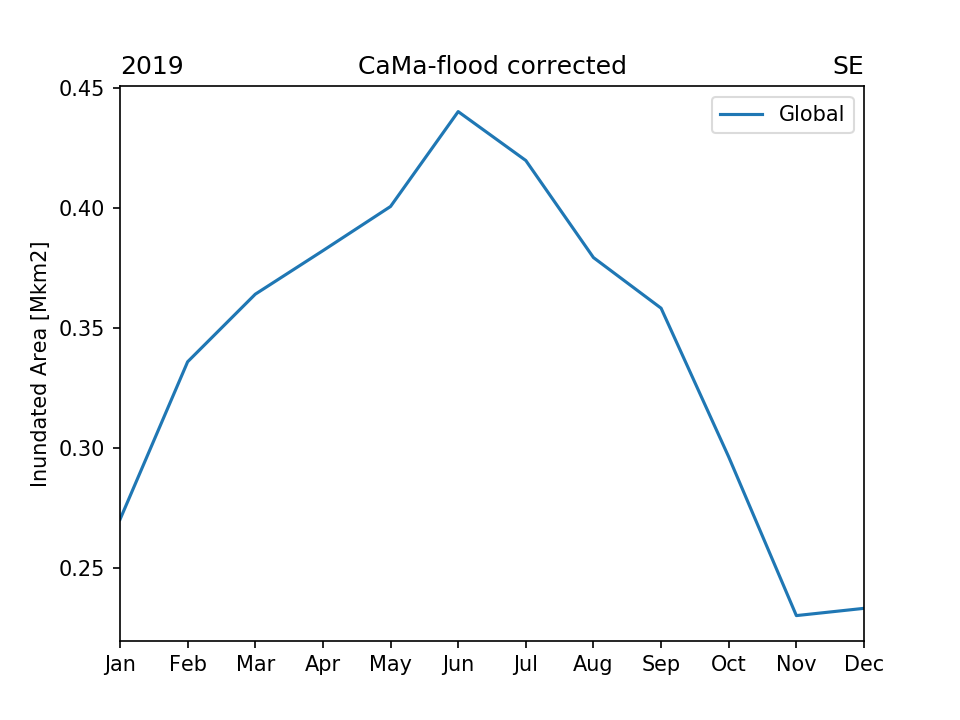 |  |
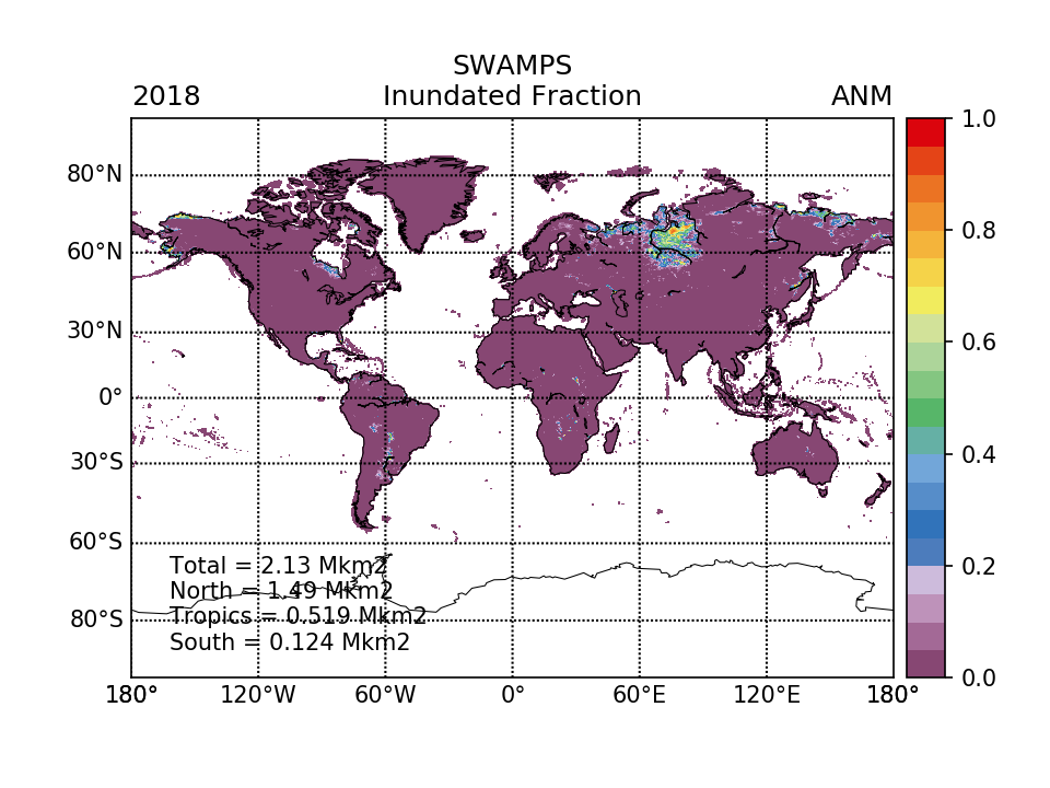
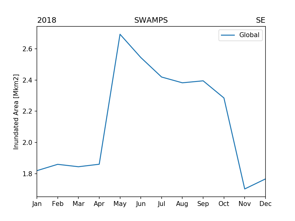
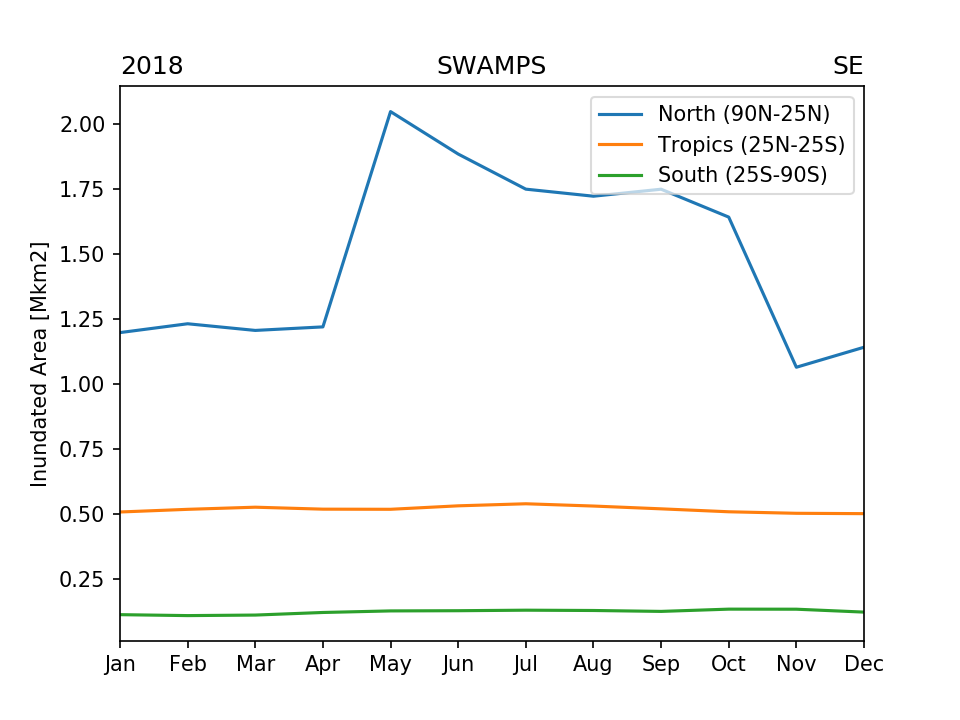
Copernicus-SWAMPS (monthly climatology)
Copernicus annual fixes map merged with SWAMPS EO product
Frozen wetlands are present, emissions should be removed where Tsoil < 0°C
Distributed by J. McNorton
 |  |  |  |  |
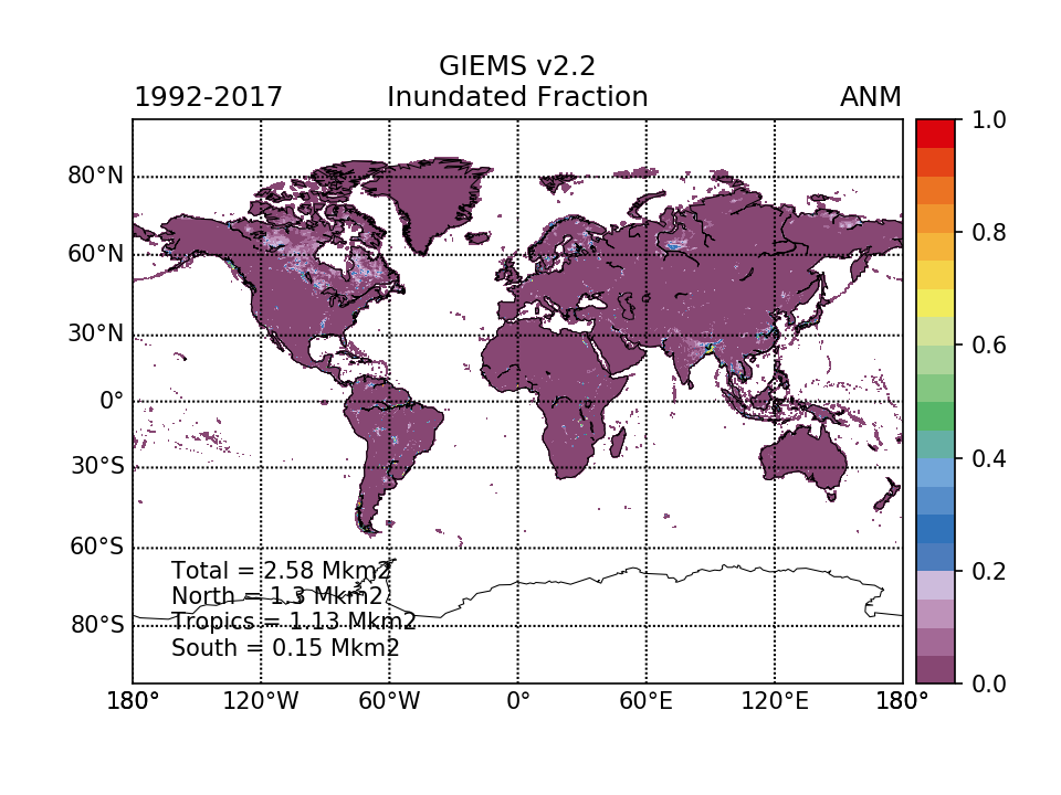
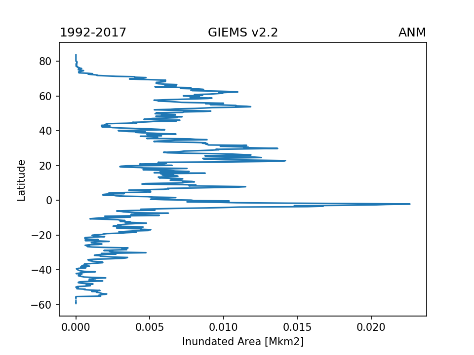
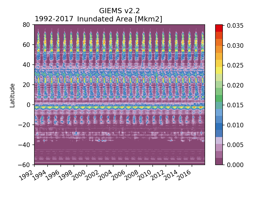
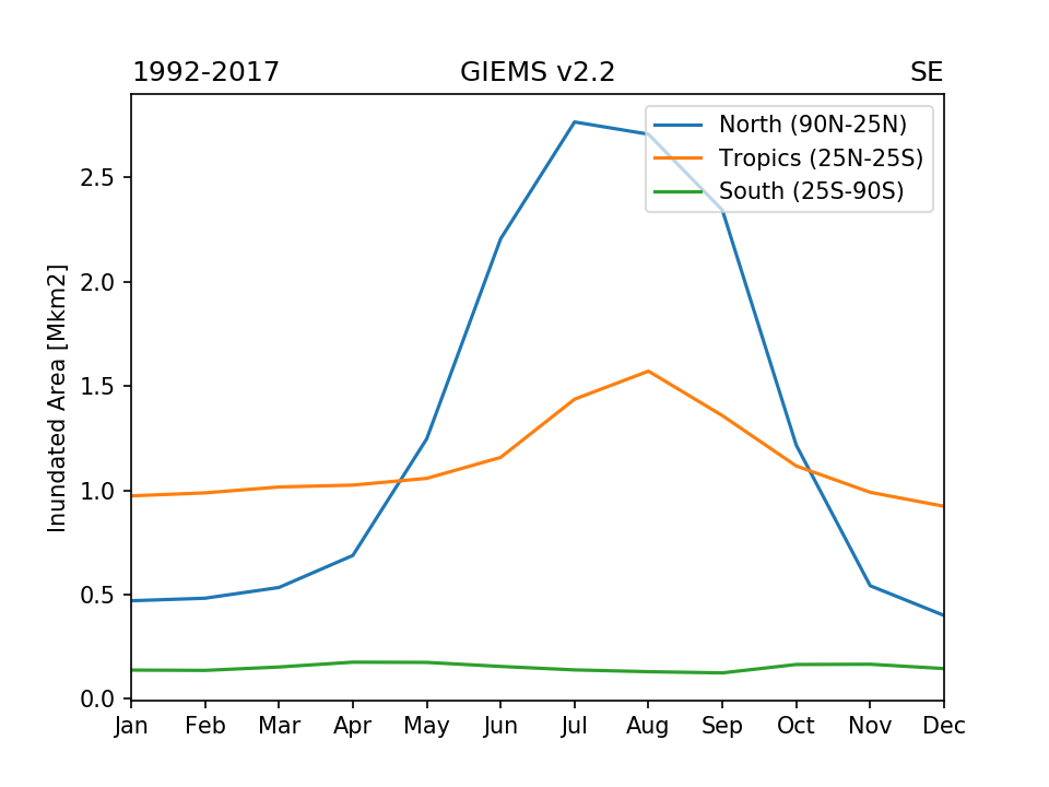
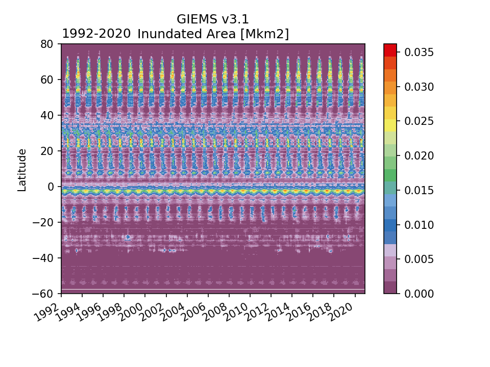
GIEMS v2.2 (0.25°, 1992-2017) and v3.1 (0.25°, 1992-2020)
The Global Inundation Estimate from Multi-Satellites
Distributed by C. Prigent and C. Jimenez
Climatology files:
 |  |  |  |  |
 |  |  |  |  |
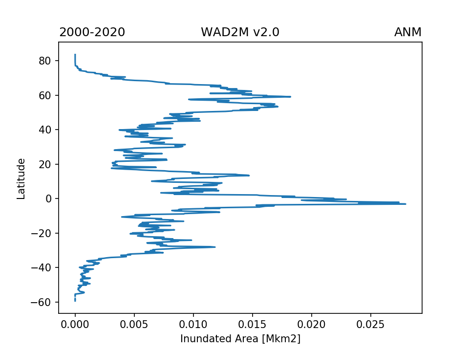
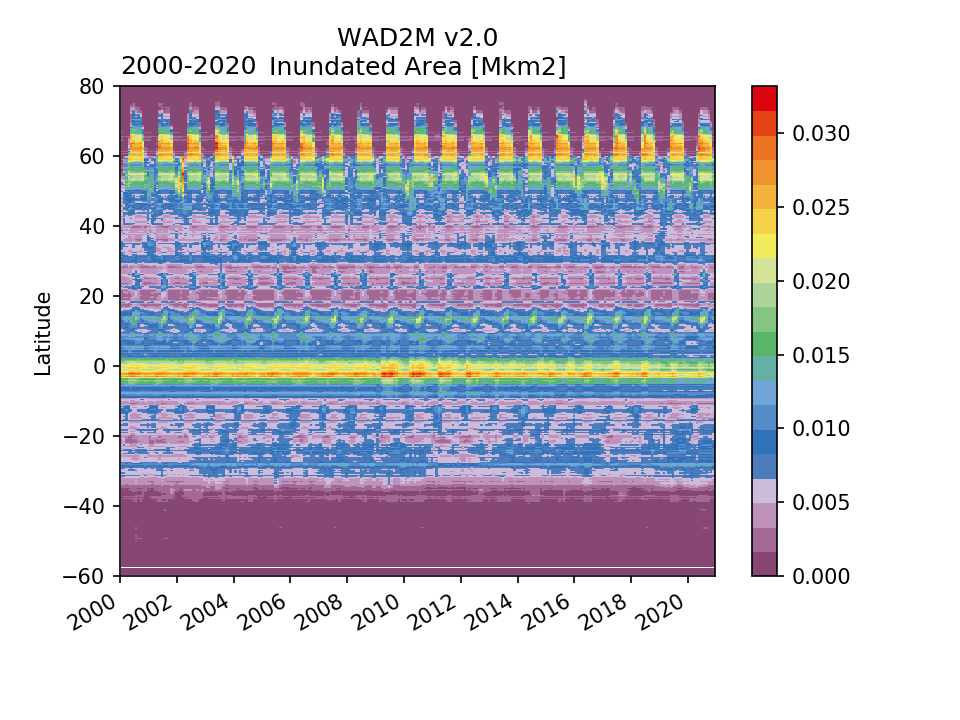
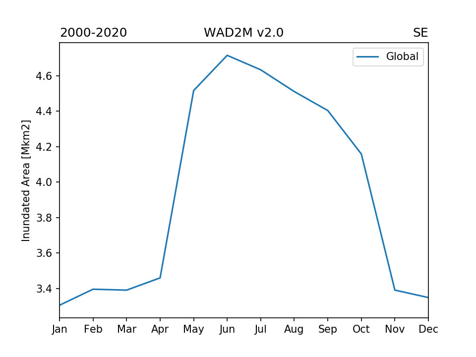
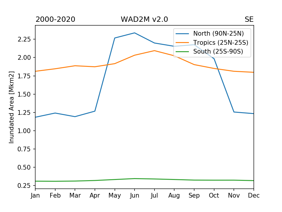
WAD2M (0.25°, 2000-2020)
The global Wetland Area and Dynamics for Methane Modelling
Climatology files:
 |  |  |  |  |
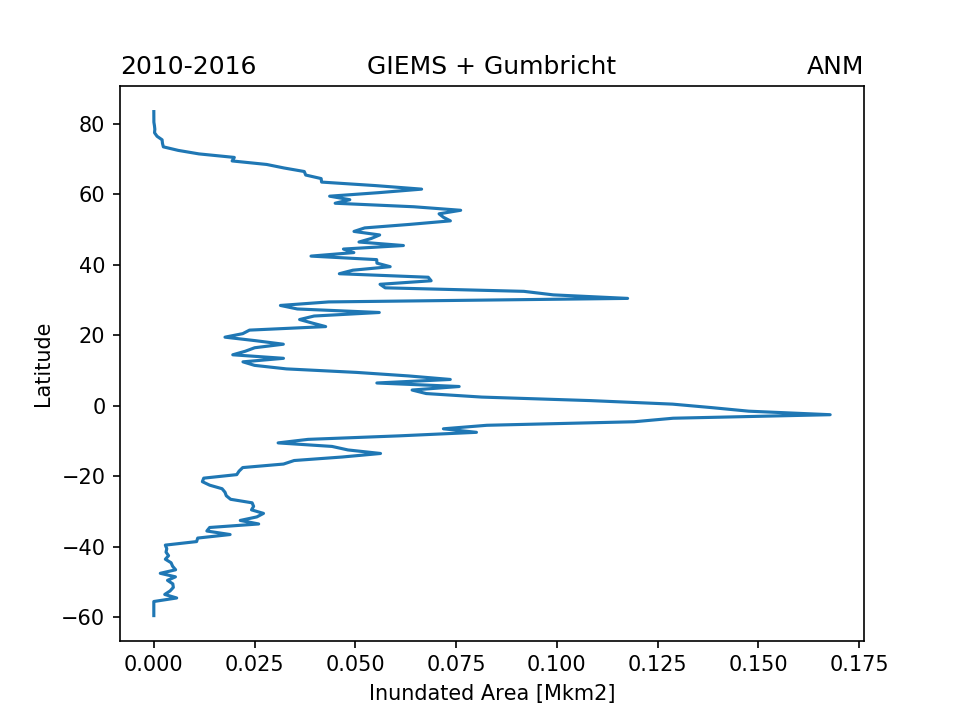
GIEMS+Gumbricht (1°, 2010-2016)
Fraction of wetland with calibrated parameters from GIEMS (Global Inundation Extent from Multi-Satellites) and Gumbricht et al. (2017).
 |  |  | 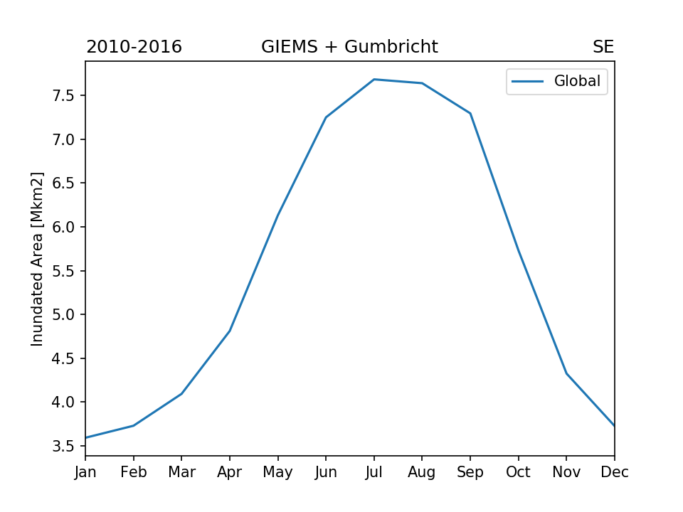 | 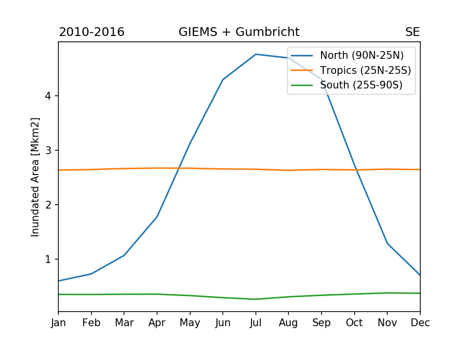 |
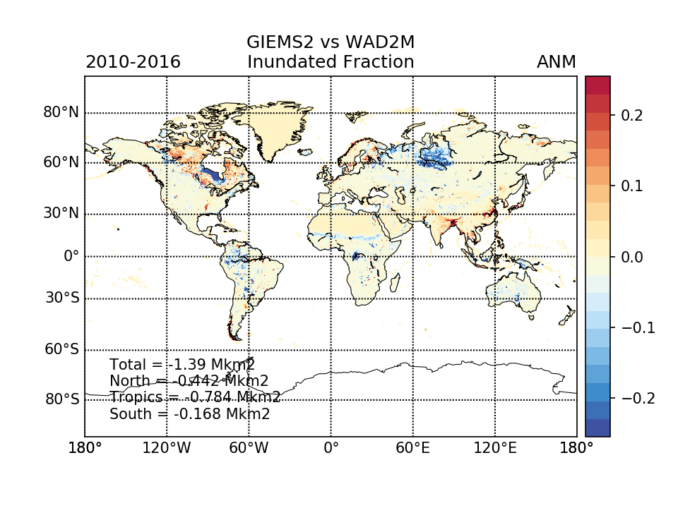
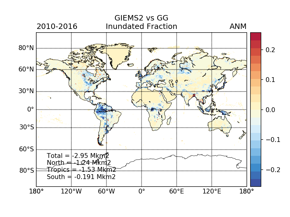
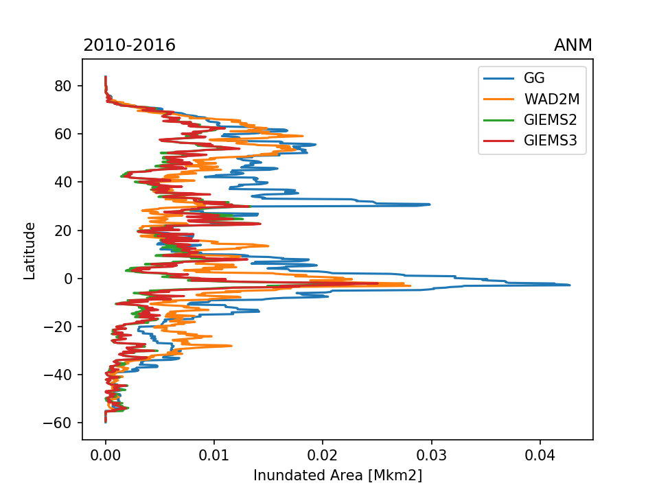
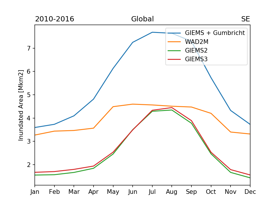
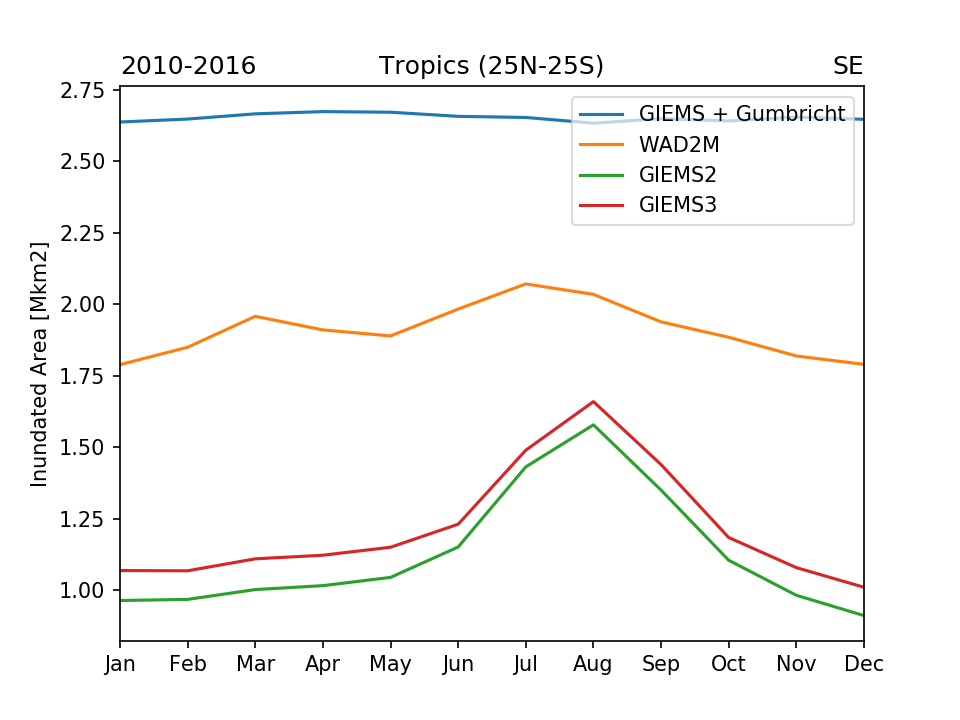
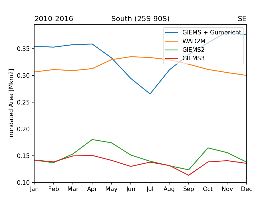
Comparison for matching years (2010-2016) between GIEMS, WAD2M and GIEMS+Gumbricht (regridded to 0.25°)
 |  |  |  |
 |  |  |  |
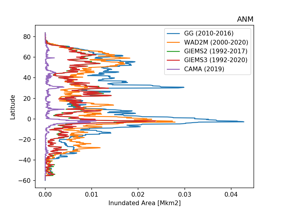
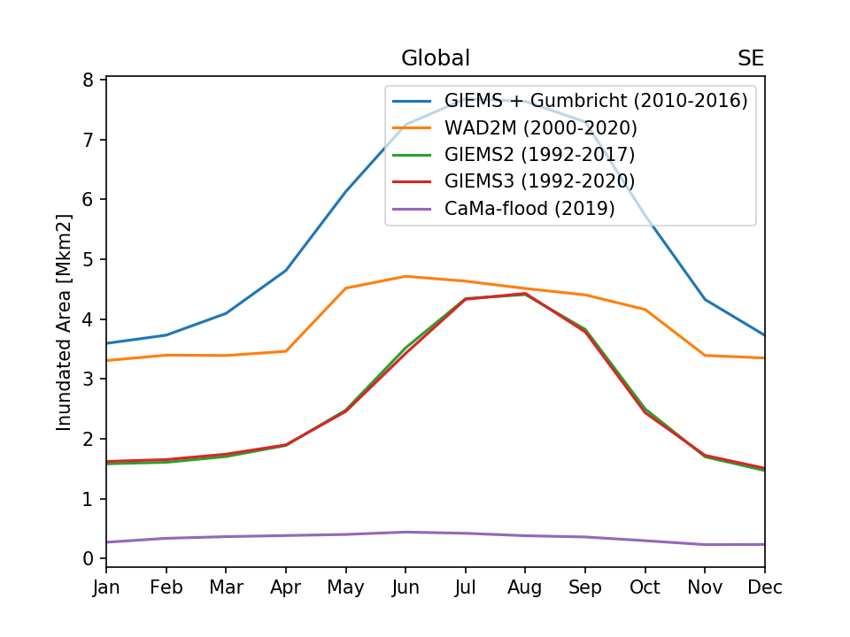
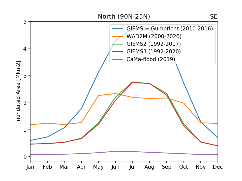
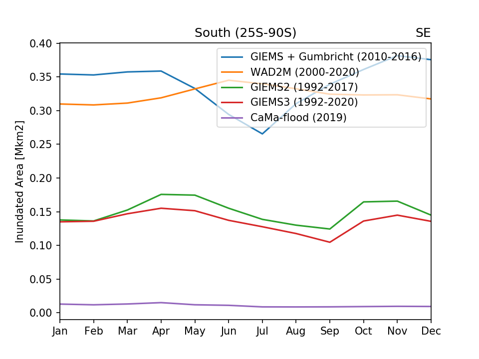
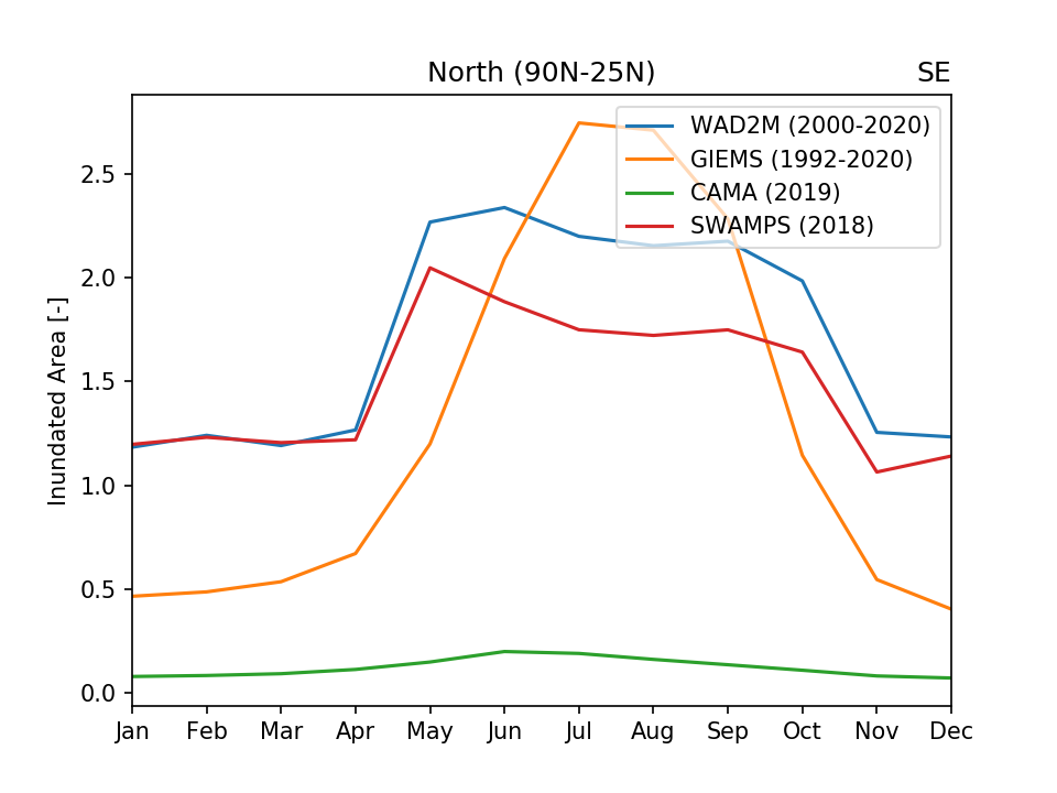
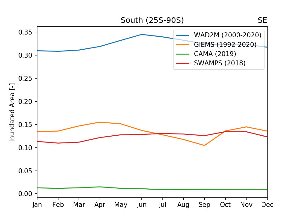
Comparison between CAMA, SWAMPS, GIEMS, WAD2M and GIEMS+Gumbricht (regridded to 0.25°)
 |  |  |  |  |
 |  |  |  |  |
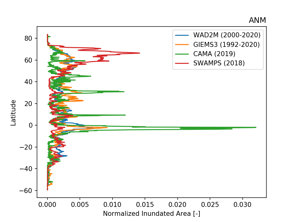 | 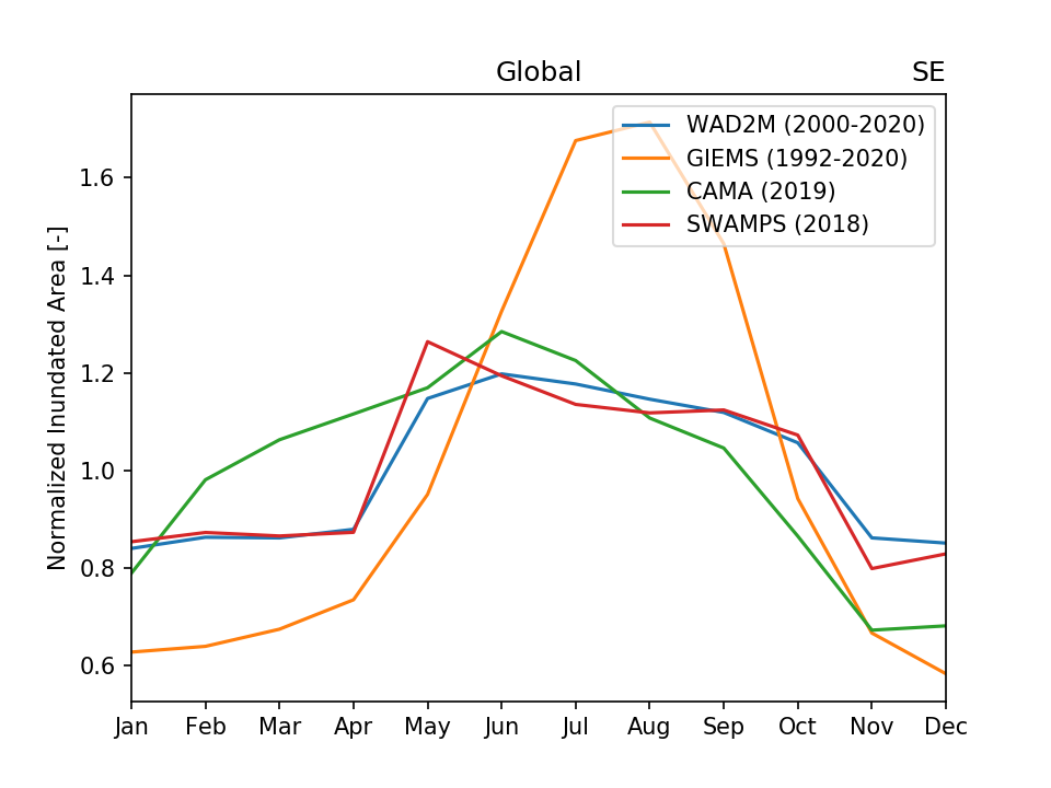 | 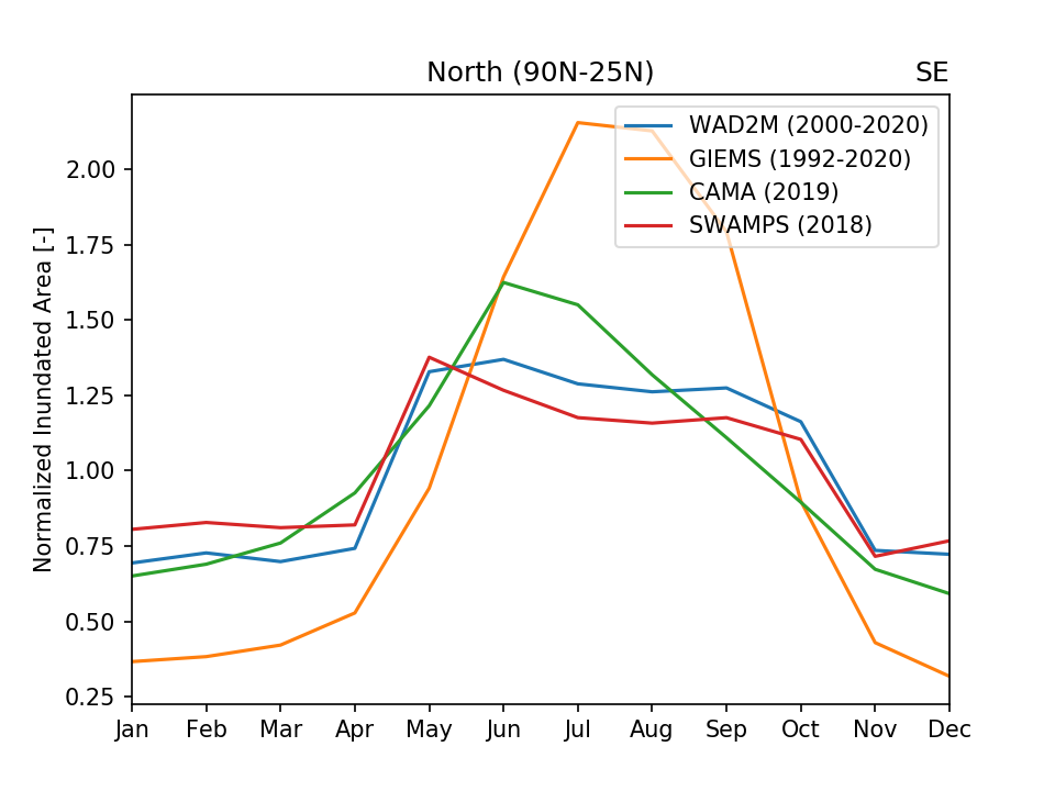 | 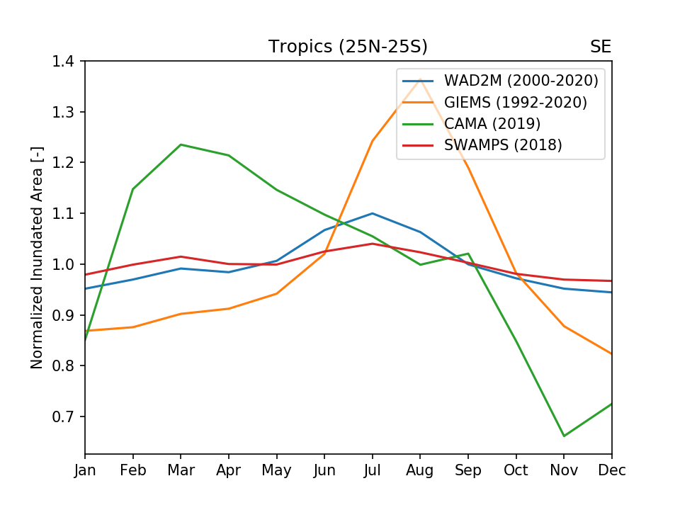 | 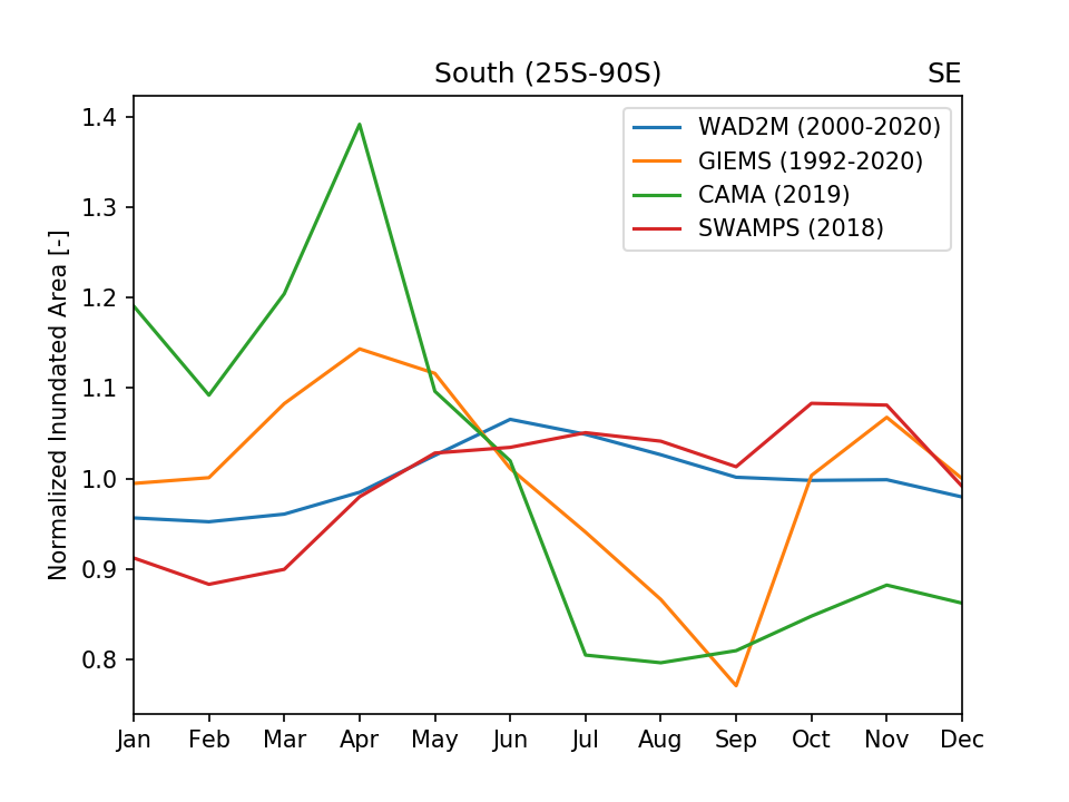 |
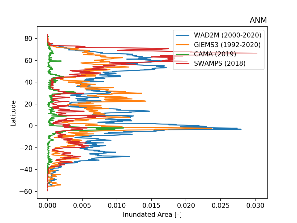
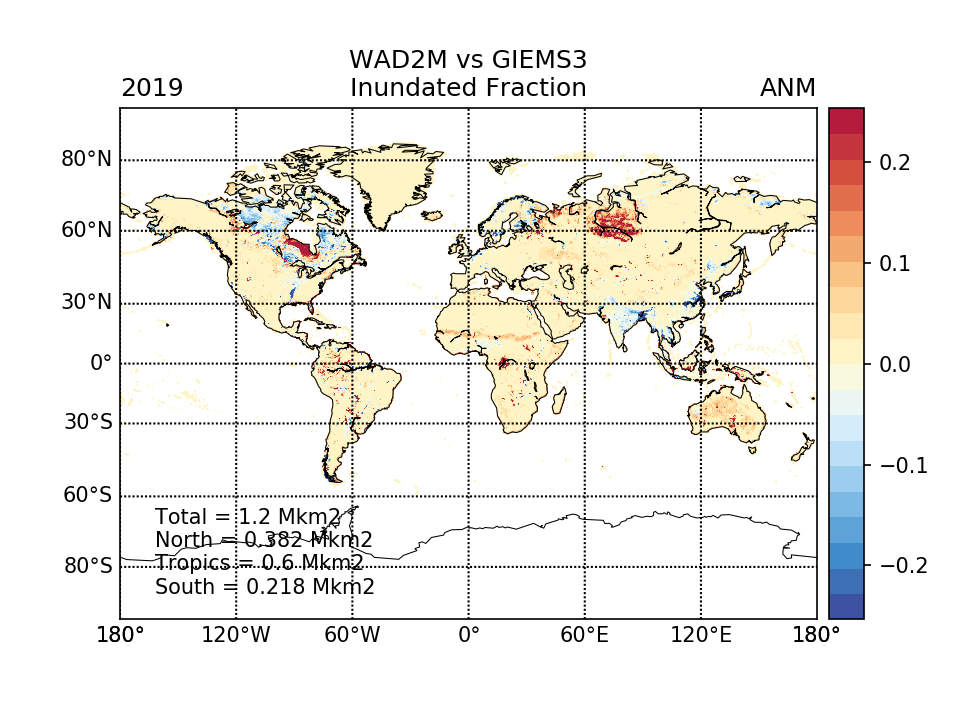
Comparison between CAMA-GIEMS3-WAD2M for 2019 and SWAMPS for 2018
 | 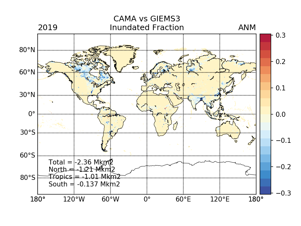 |  |
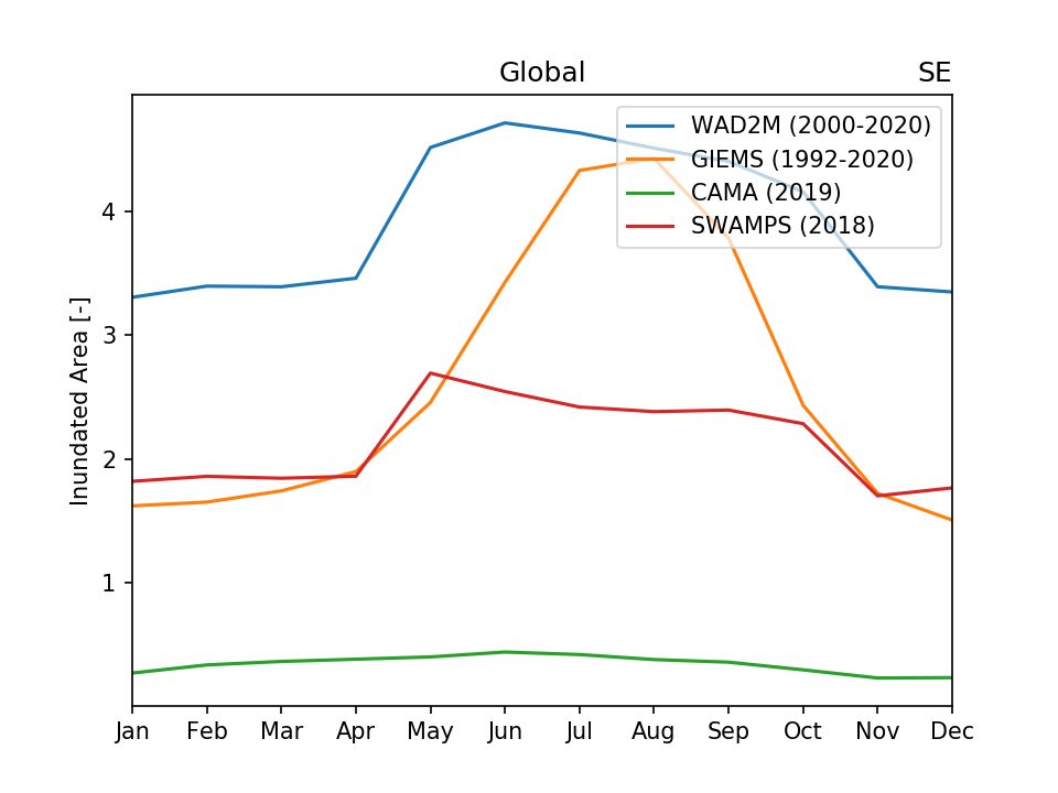
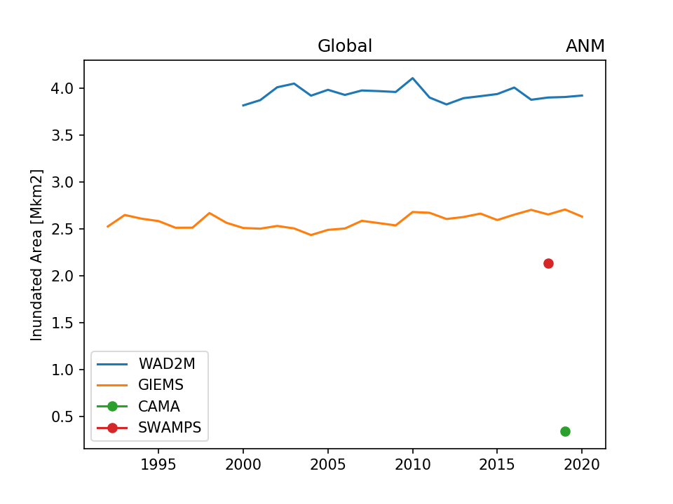
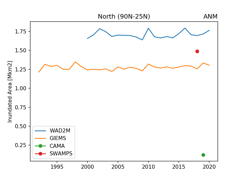
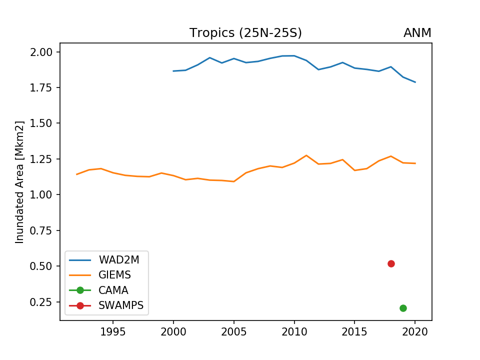
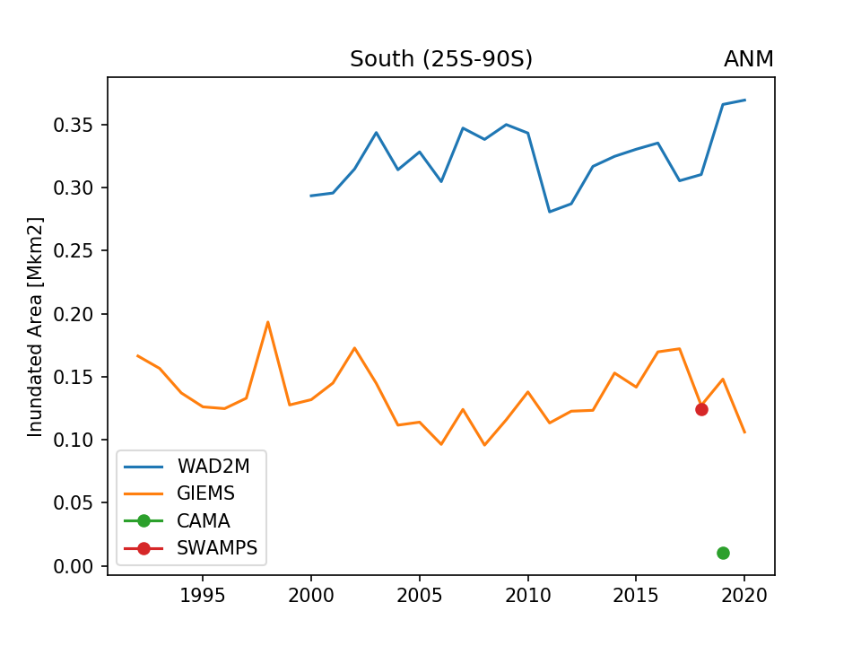
Annual time-series for CAMA, SWAMPS, GIEMS3, WAD2M
 |  |  |  |
| Last modified: 07/10/2022 09:27:15 |
| ← GIEMS-CAMA |