


CTESSEL developments


| | CTESSEL developments | | | ||
| orchidas : cams / CAMS41-CH4 / Fluxnet-CH4a | Site Map |
Project CAMS41 Phase 2
Optimization of CH4 wetland emissions in CTESSEL model using FLUXNET-CH4 dataset
Description of data:
| USAGE | MAP | SIM/OBS time-series | Single-site optimization (FWET=1) | Multi-site optimization (FWET=1) | Soil Temperature (first layer) | Heterotropic Respiration | Wetland Extent Fraction (from global simulation) |
| USE | 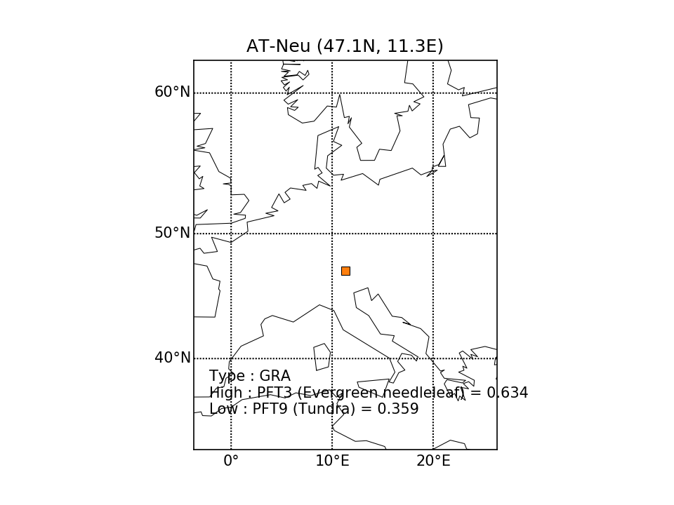 | 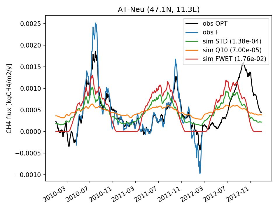 | 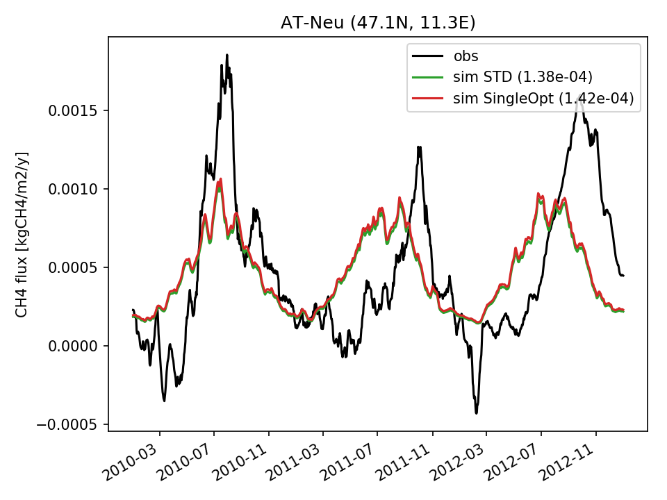 |  | 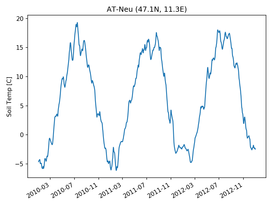 | 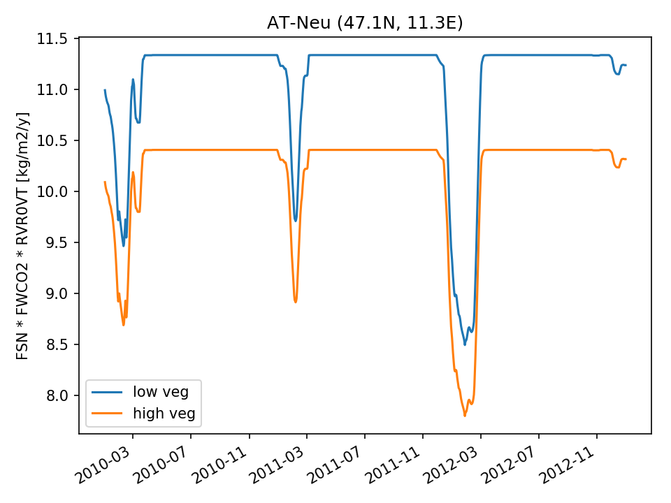 | 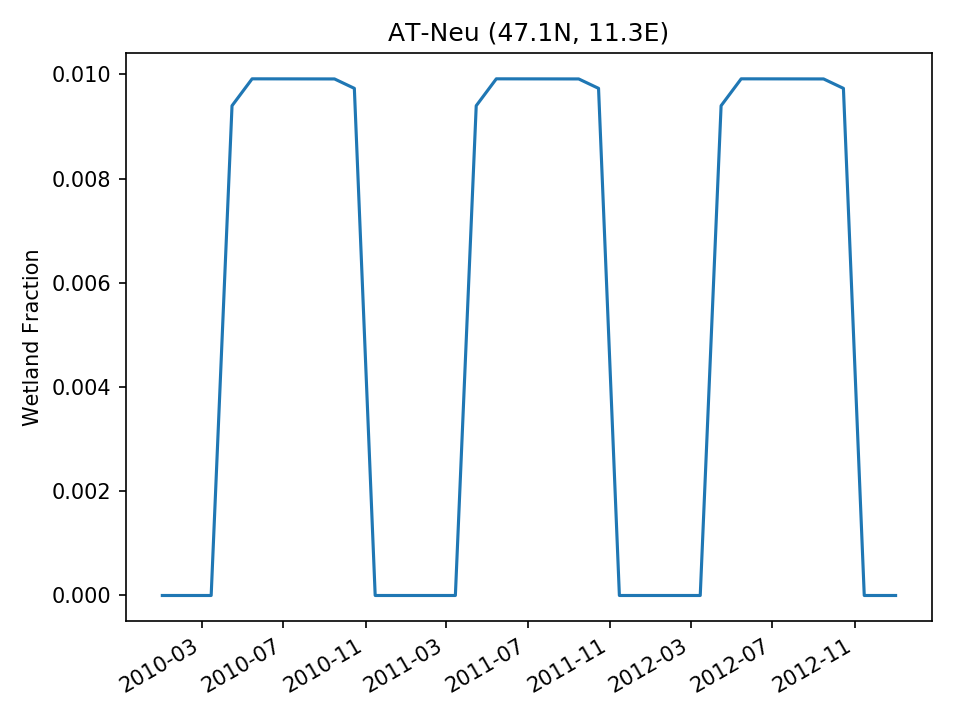 |
| DROP |  | 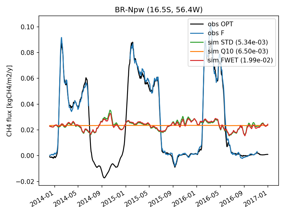 | 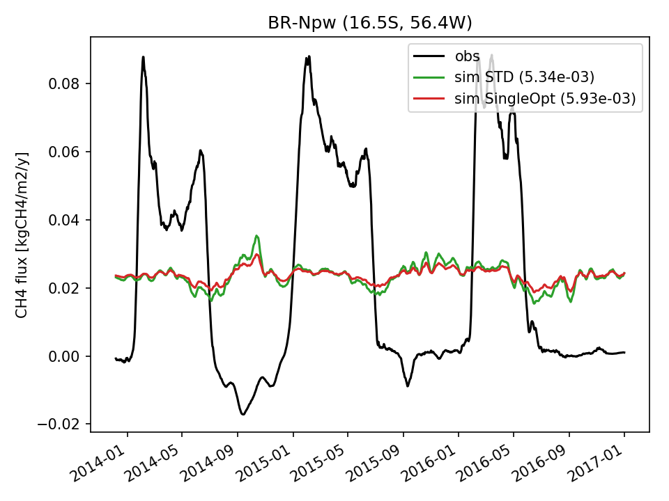 | 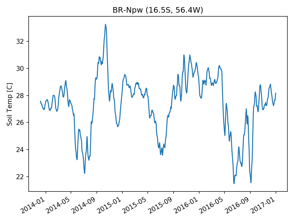 | 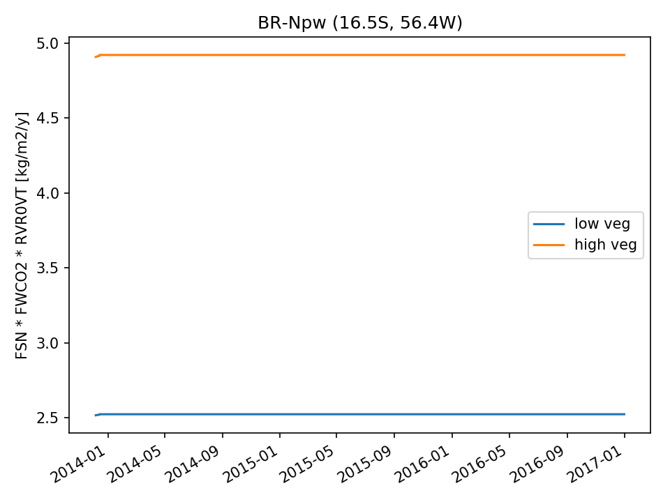 | 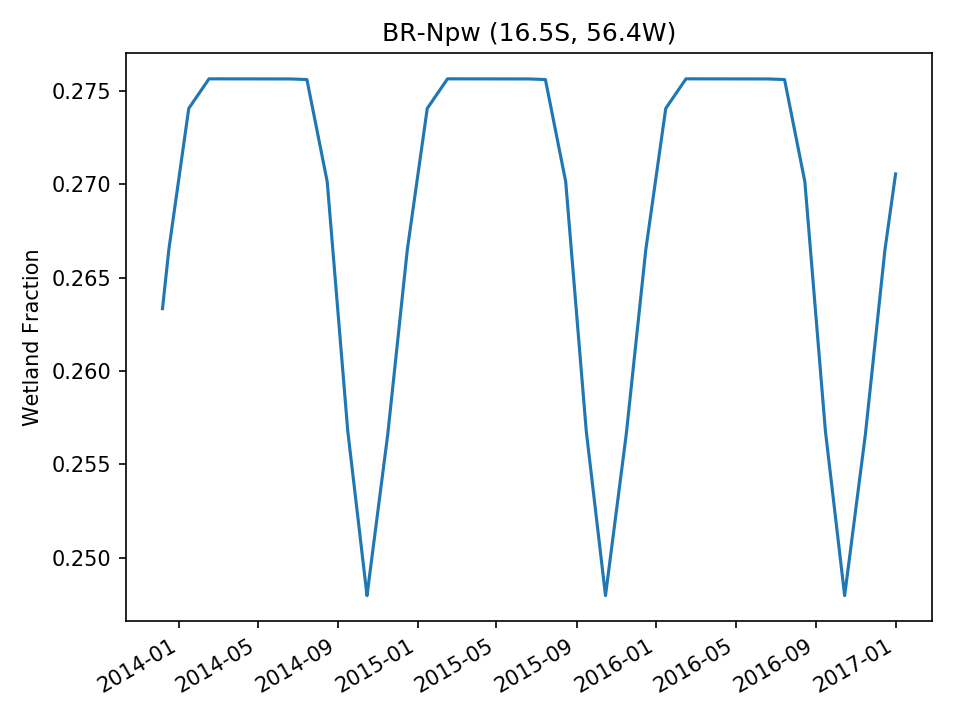 | |
| USE |  | 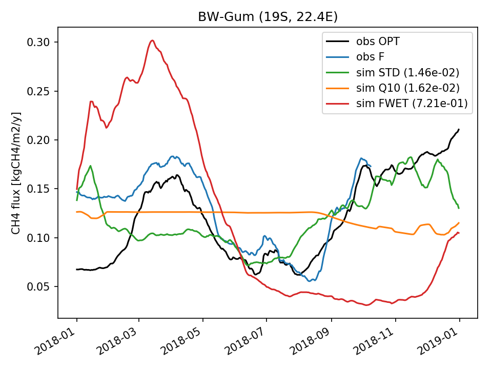 |  |  | 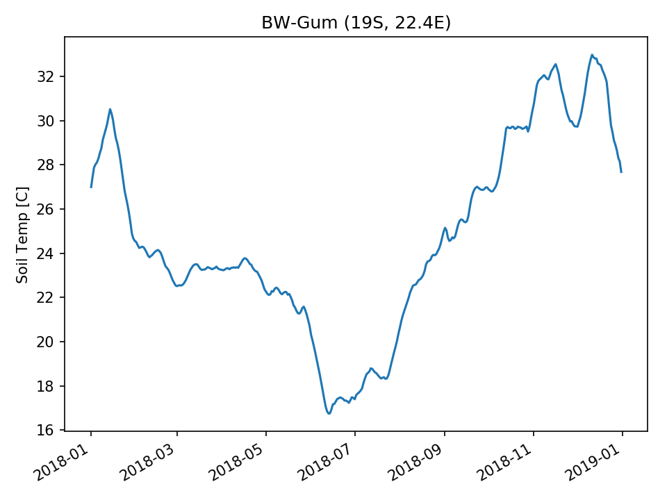 | 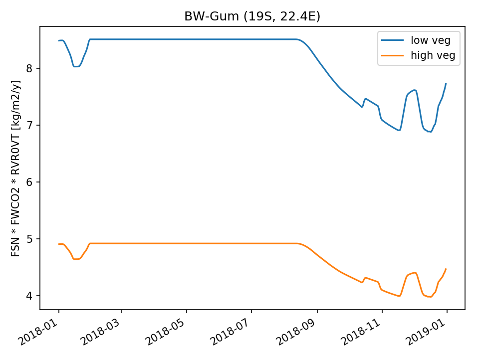 |  |
| USE | 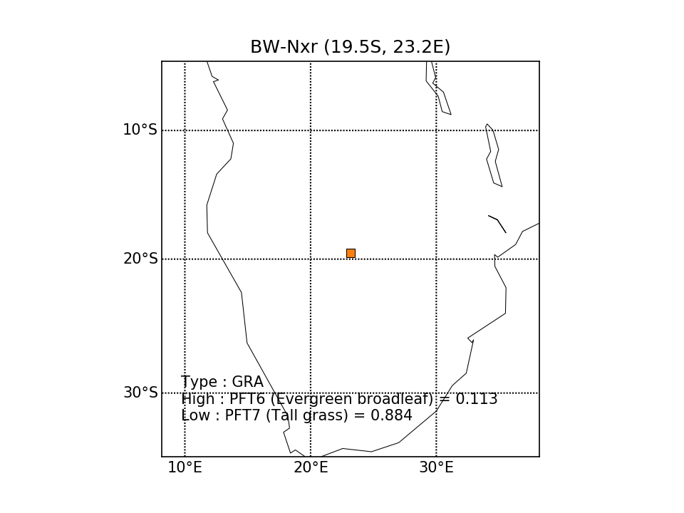 | 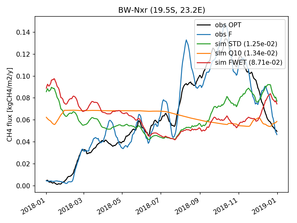 | 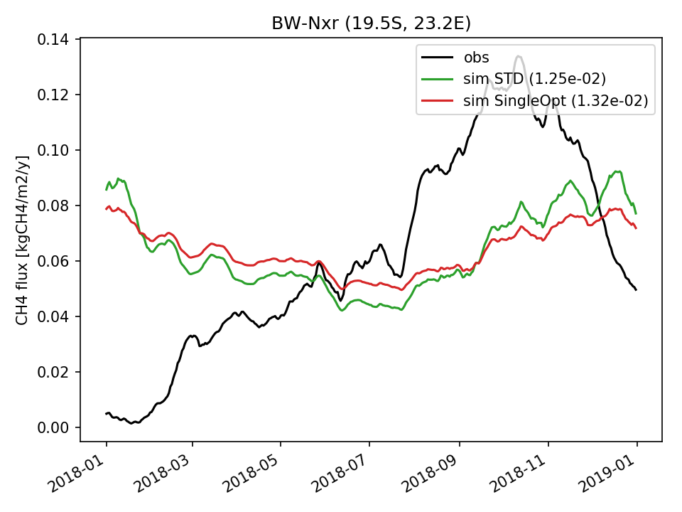 |  | 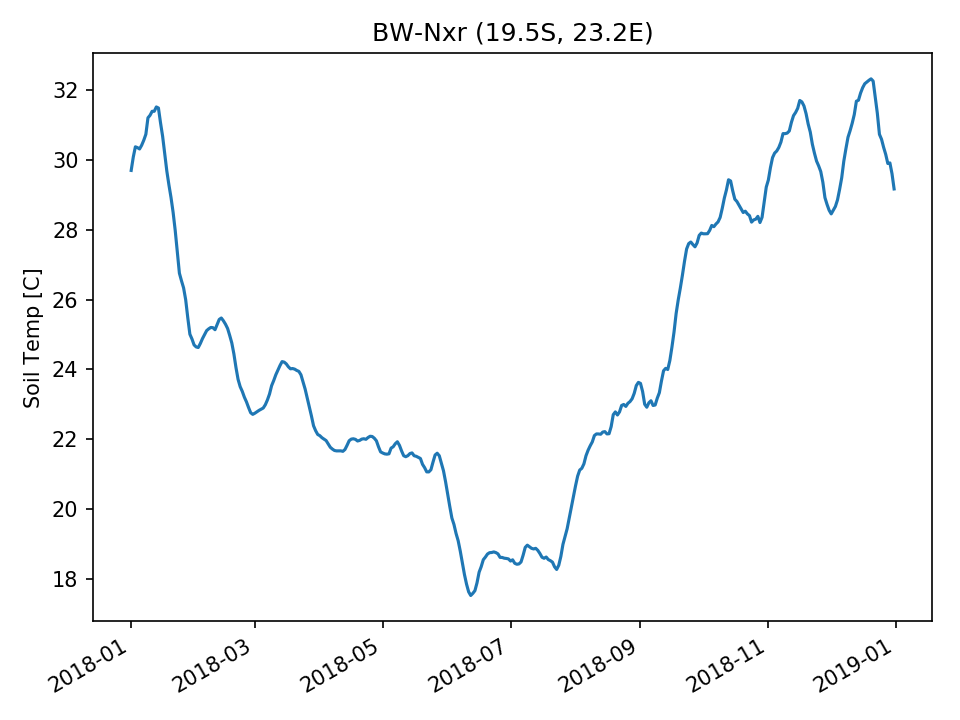 | 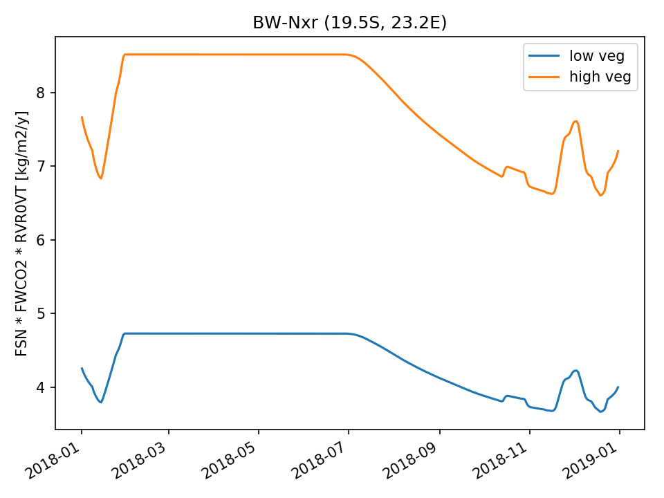 | 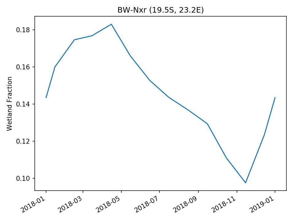 |
| USE | 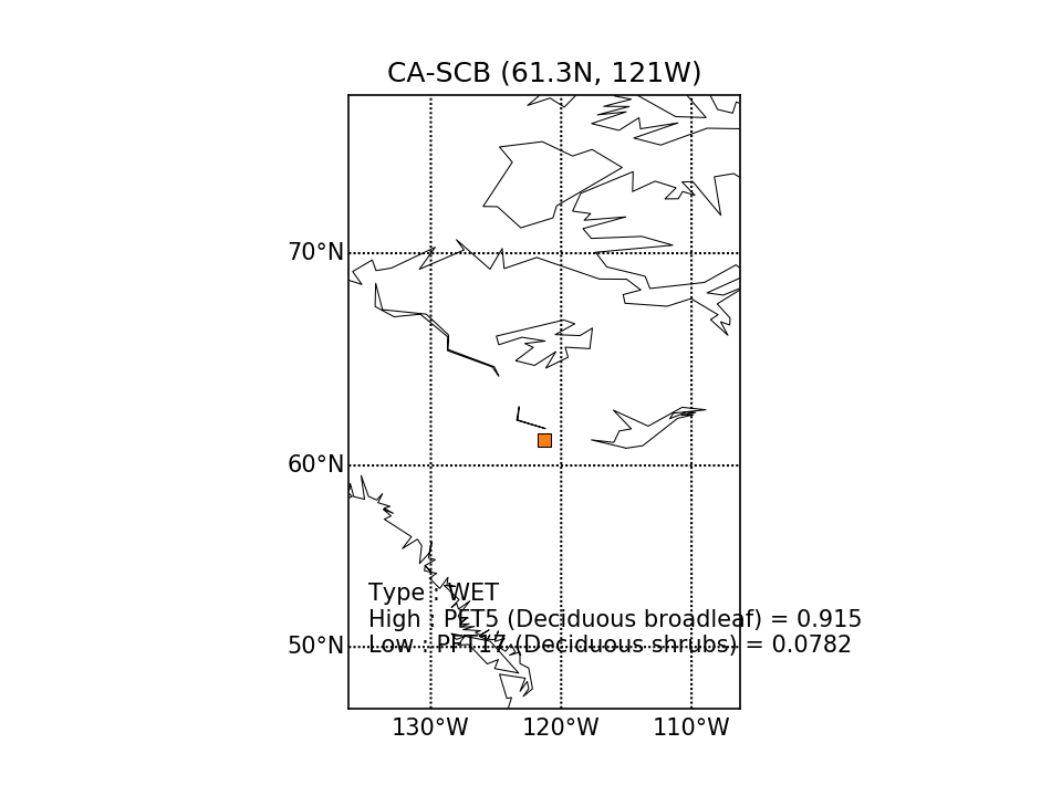 |  | 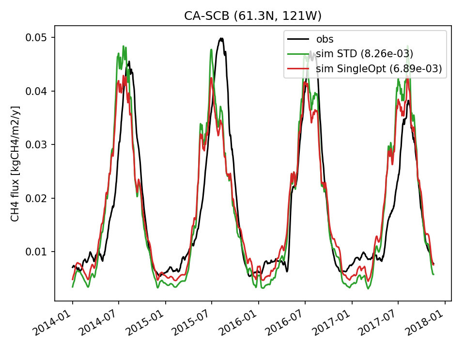 | 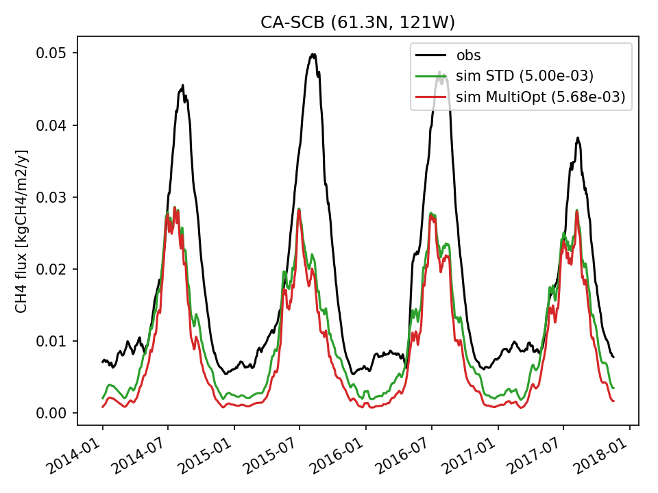 |  | 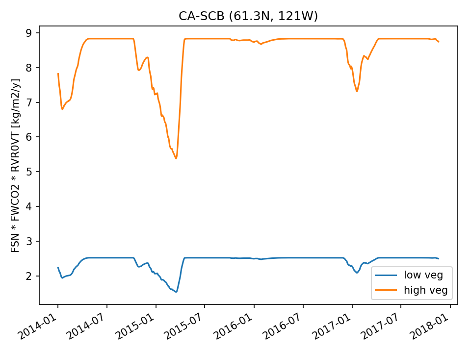 | 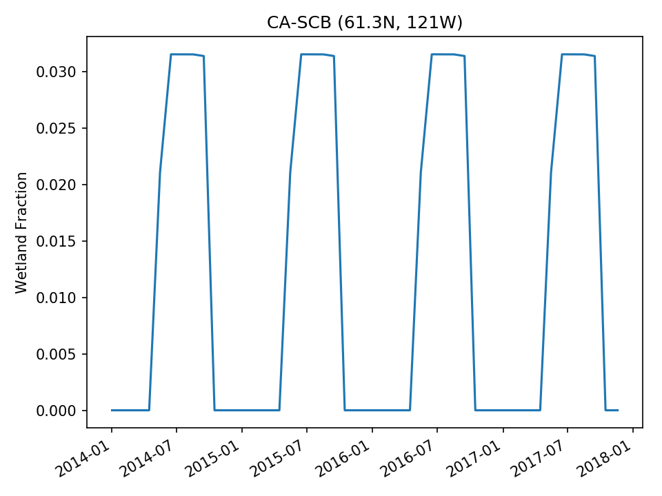 |
| USE | 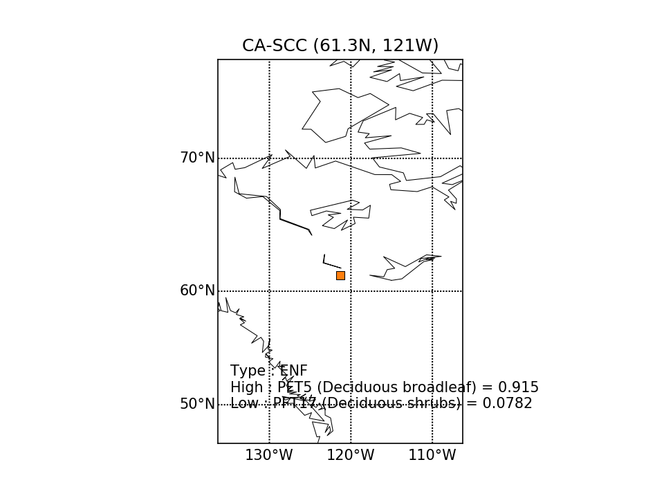 |  | 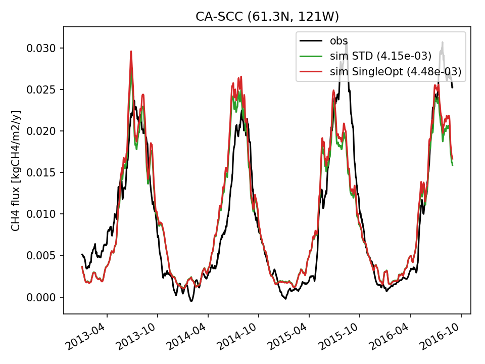 | 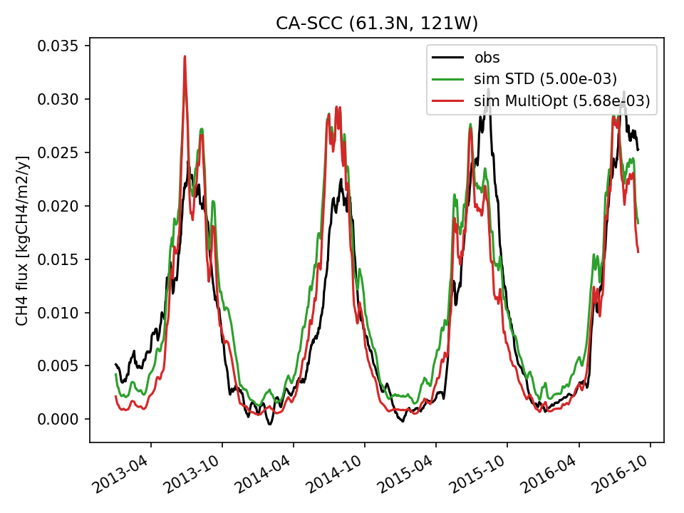 |  | 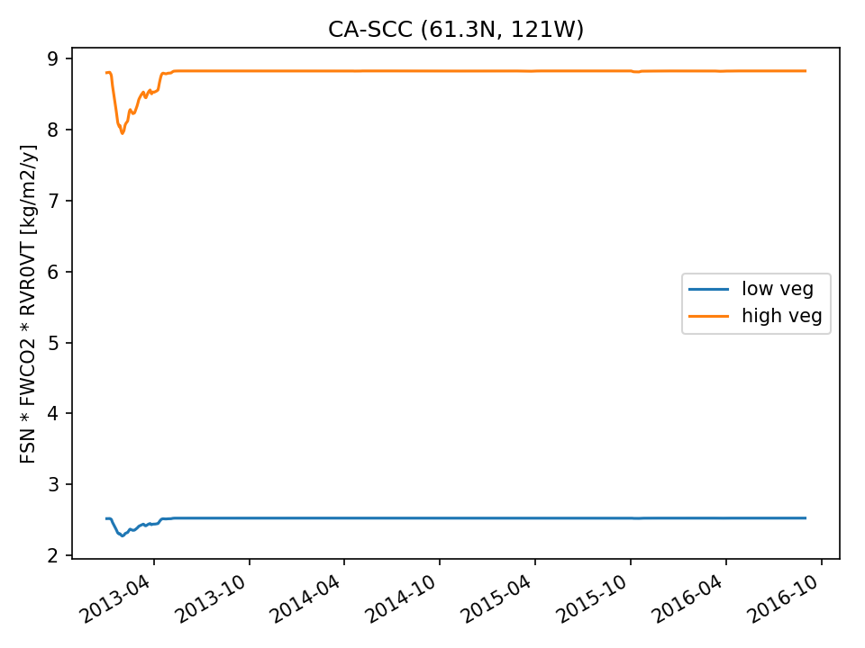 | 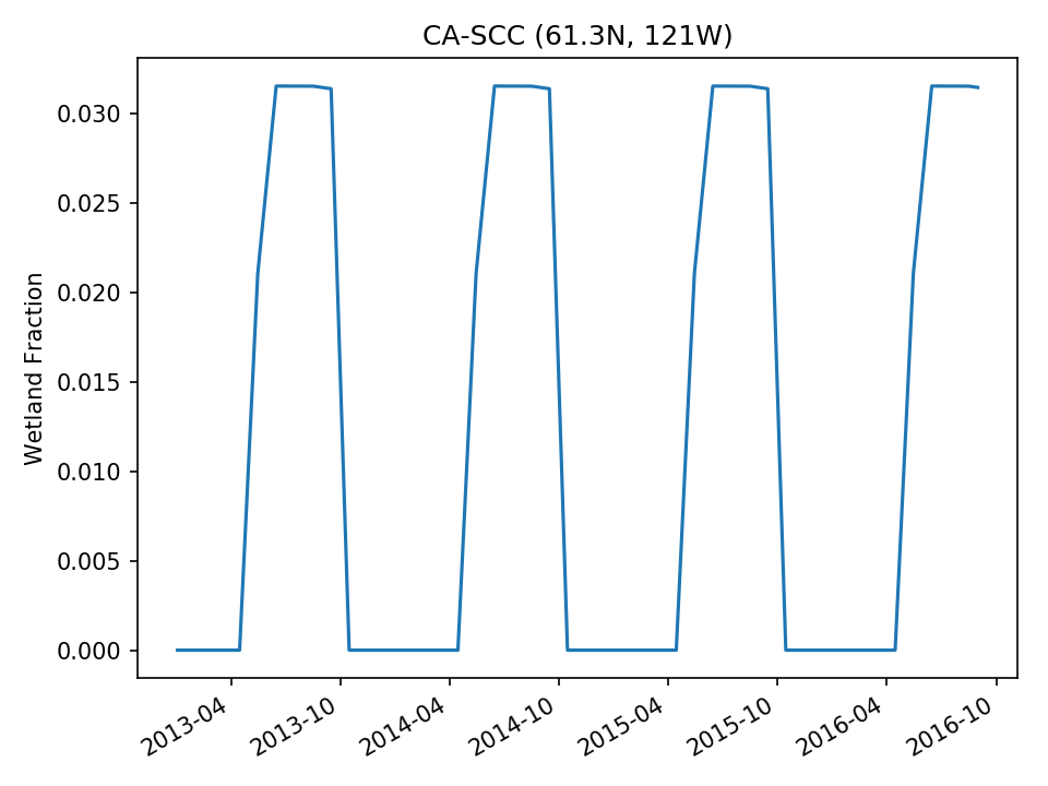 |
| USE | 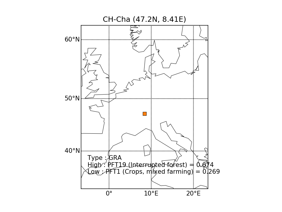 | 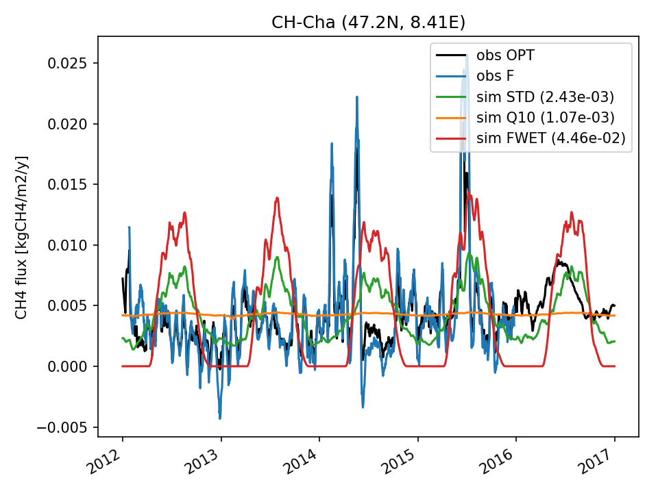 |  |  | 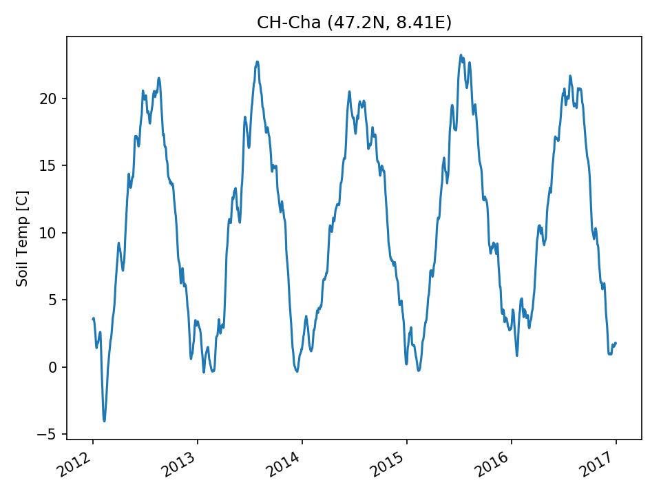 | 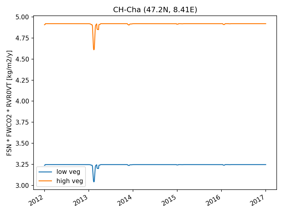 | 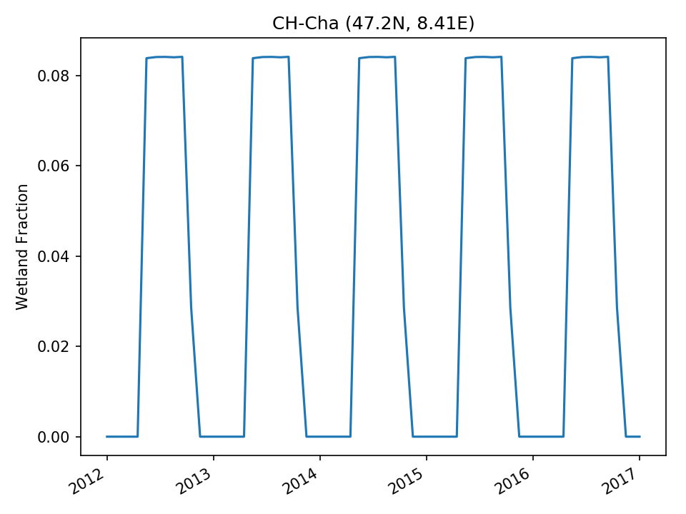 |
| DROP | 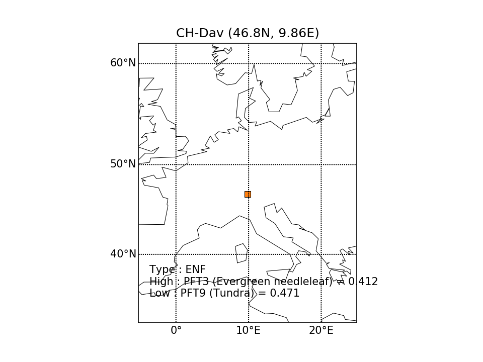 | 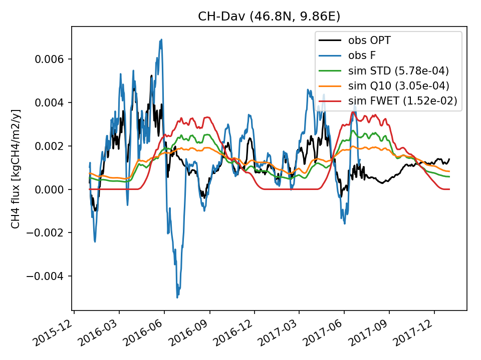 | 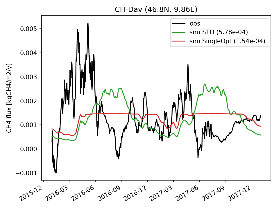 | 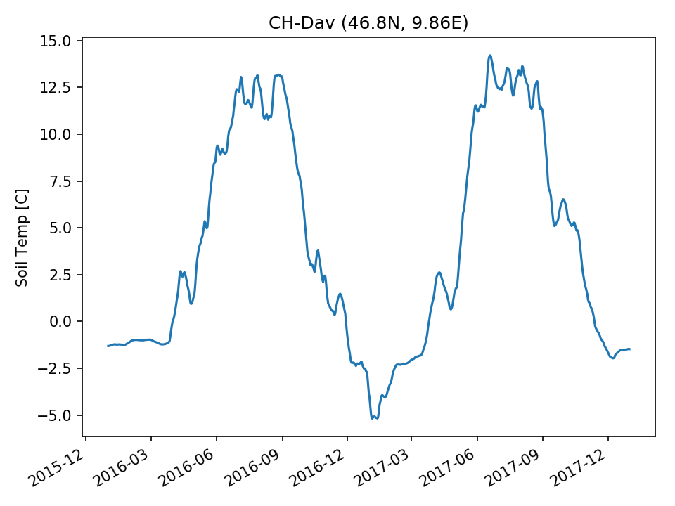 | 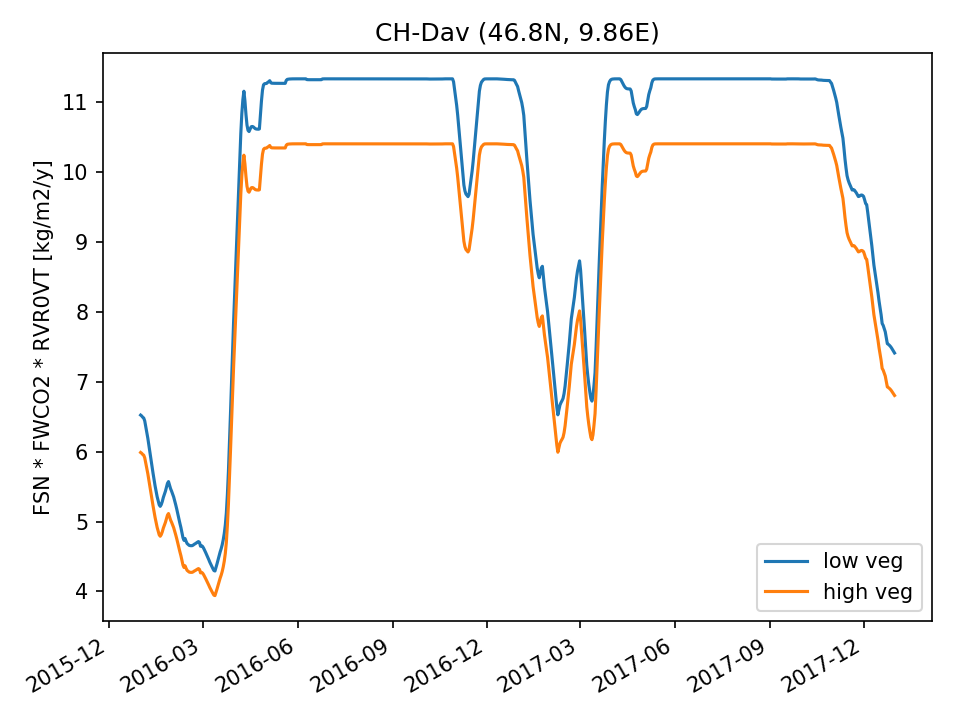 |  | |
| DROP | 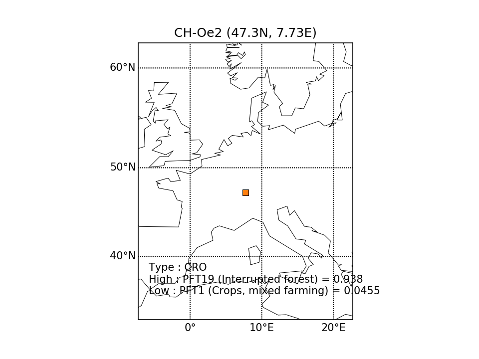 |  | 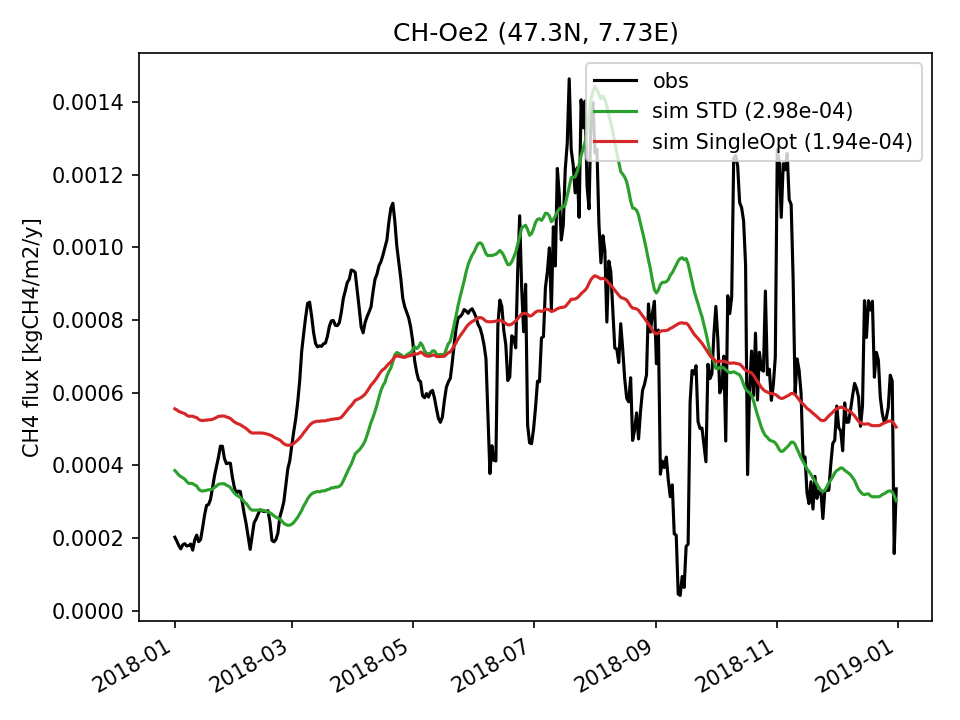 | 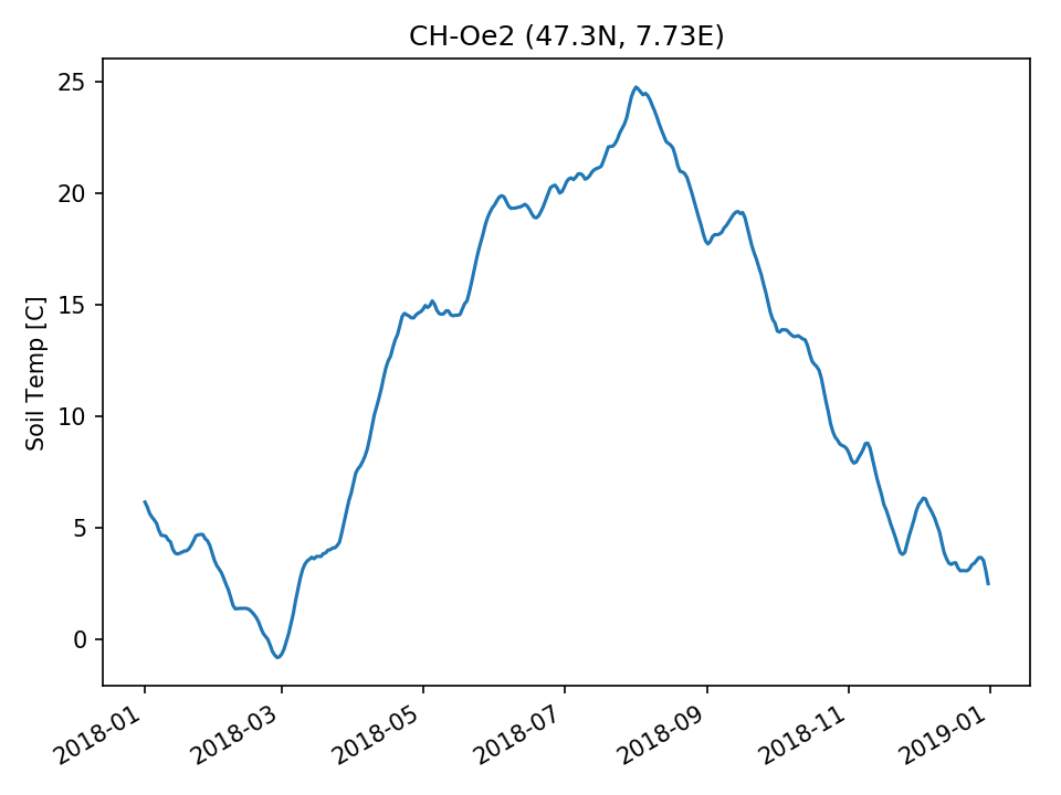 |  | 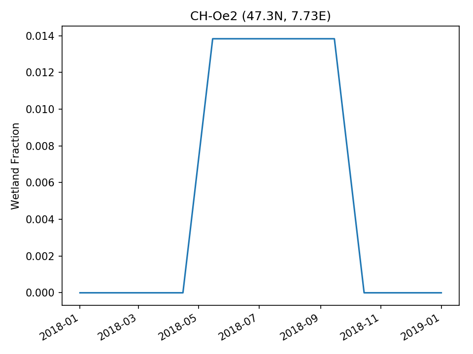 | |
| DROP | 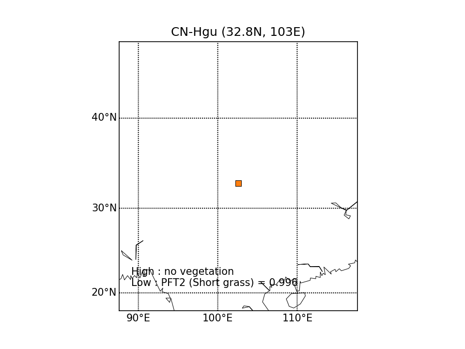 | 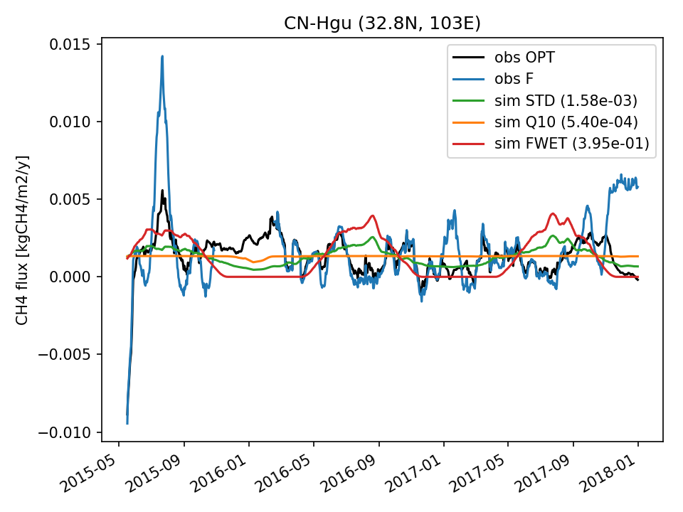 | 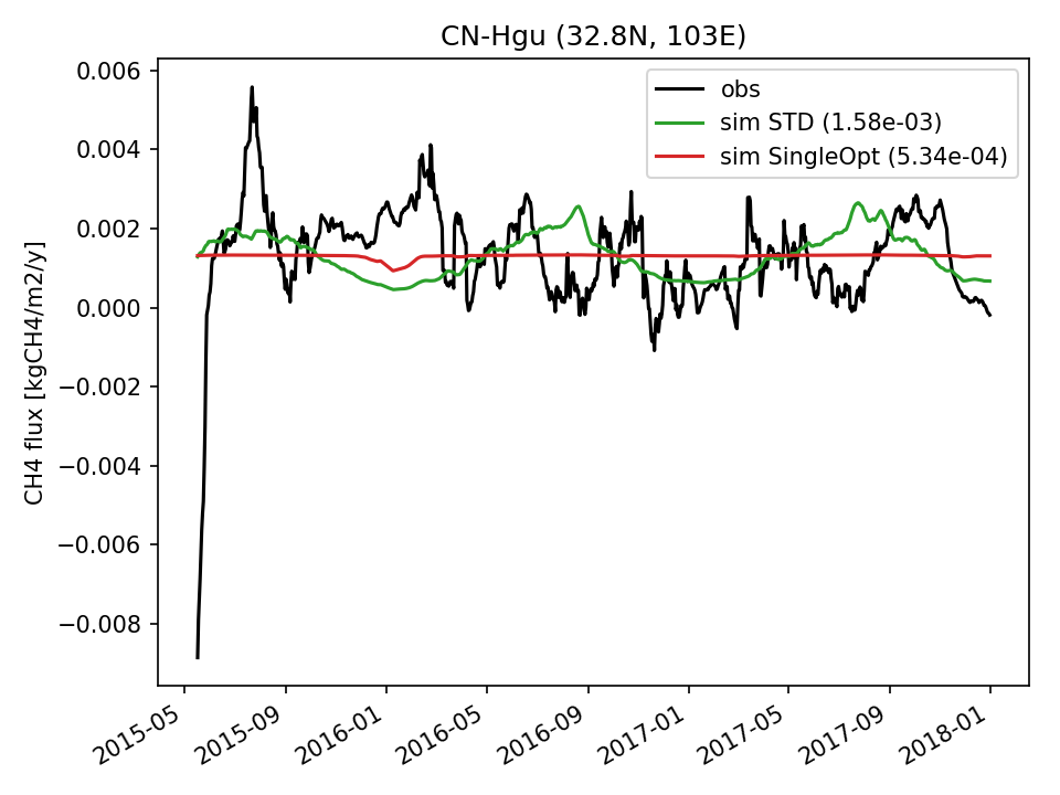 | 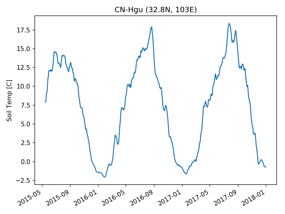 | 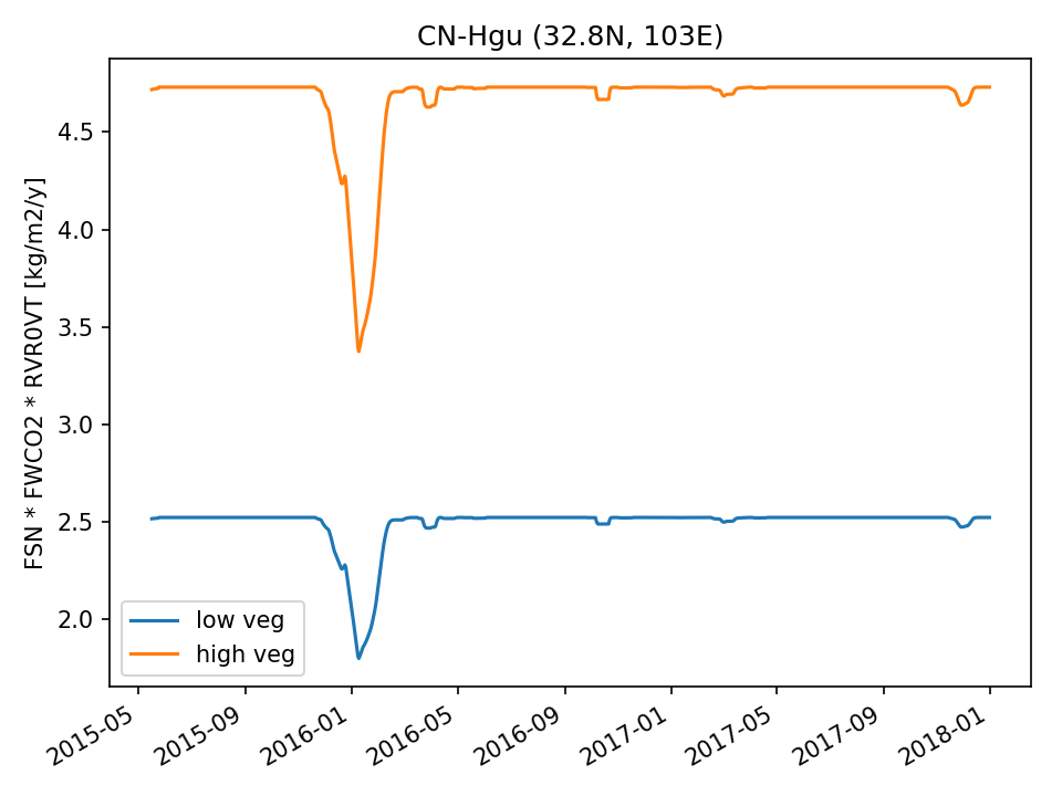 | 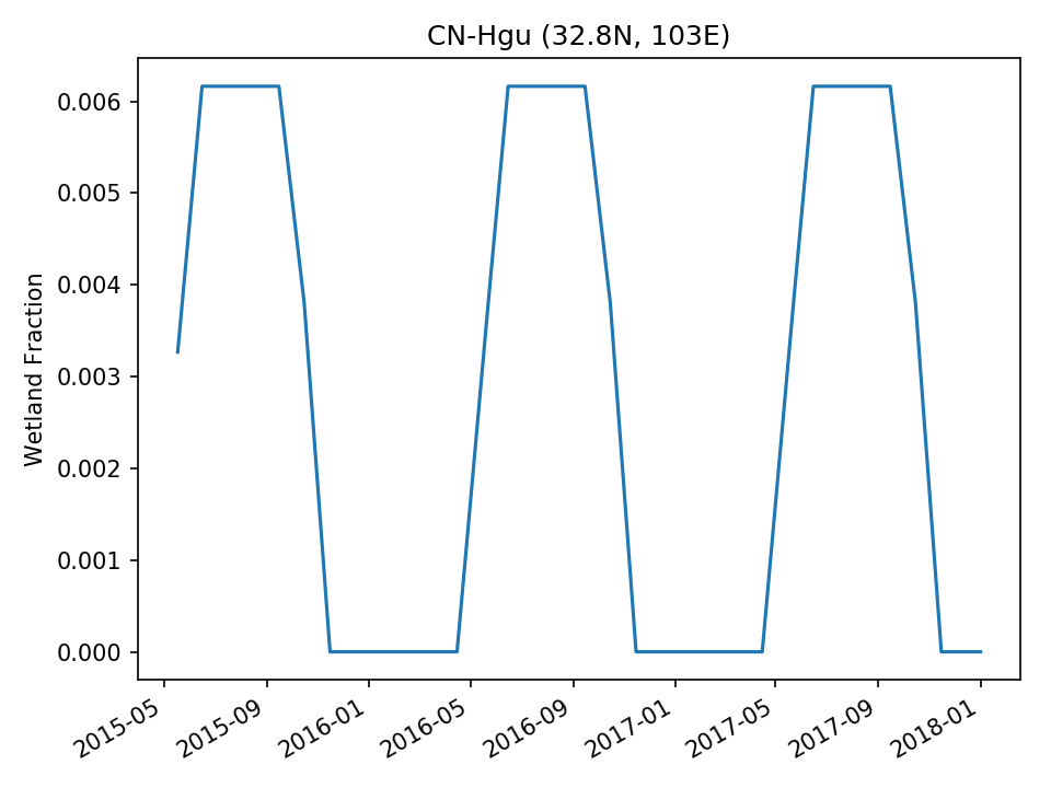 | |
| USE | 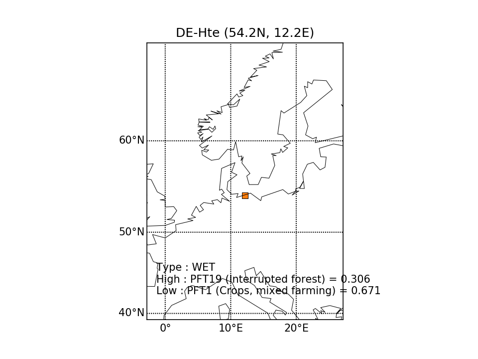 |  | 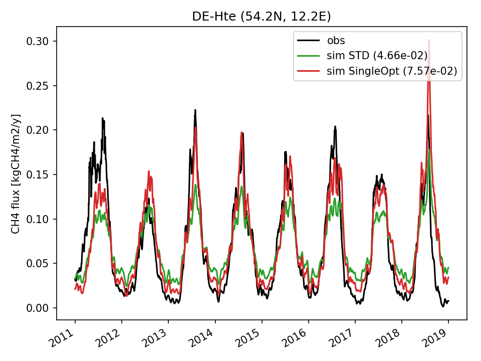 | 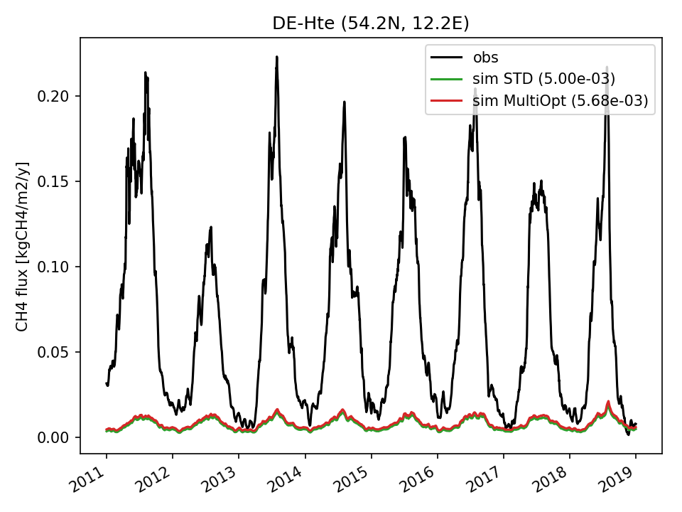 | 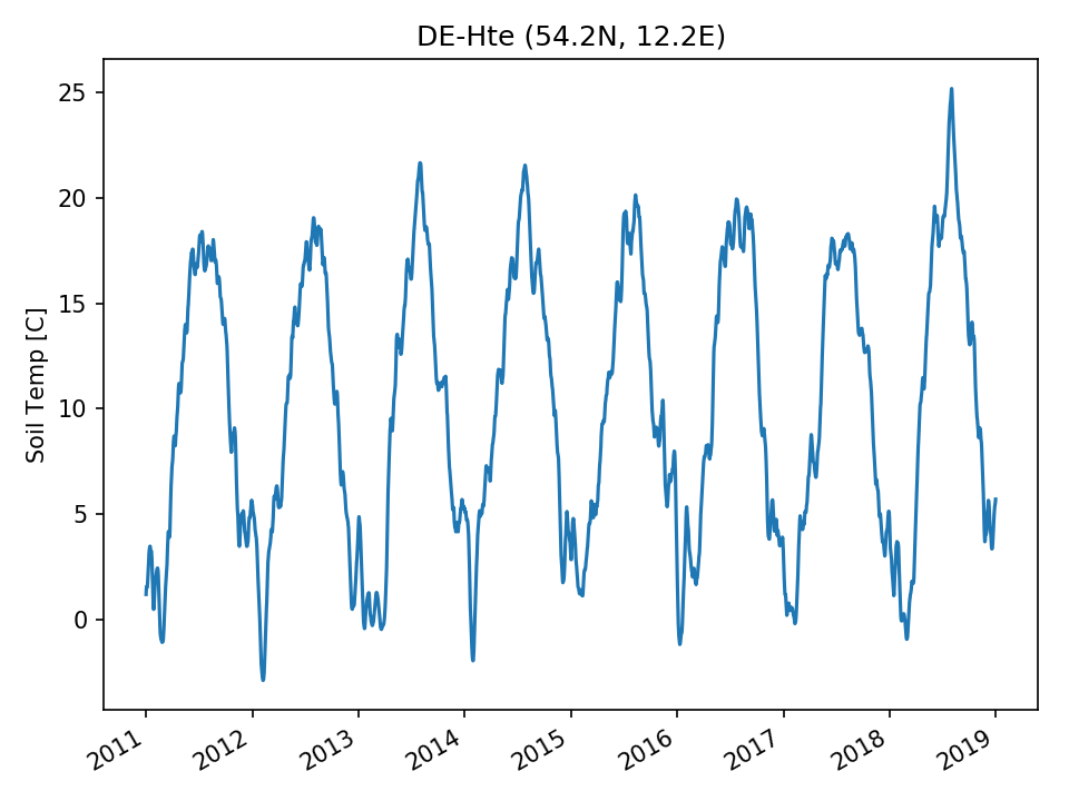 | 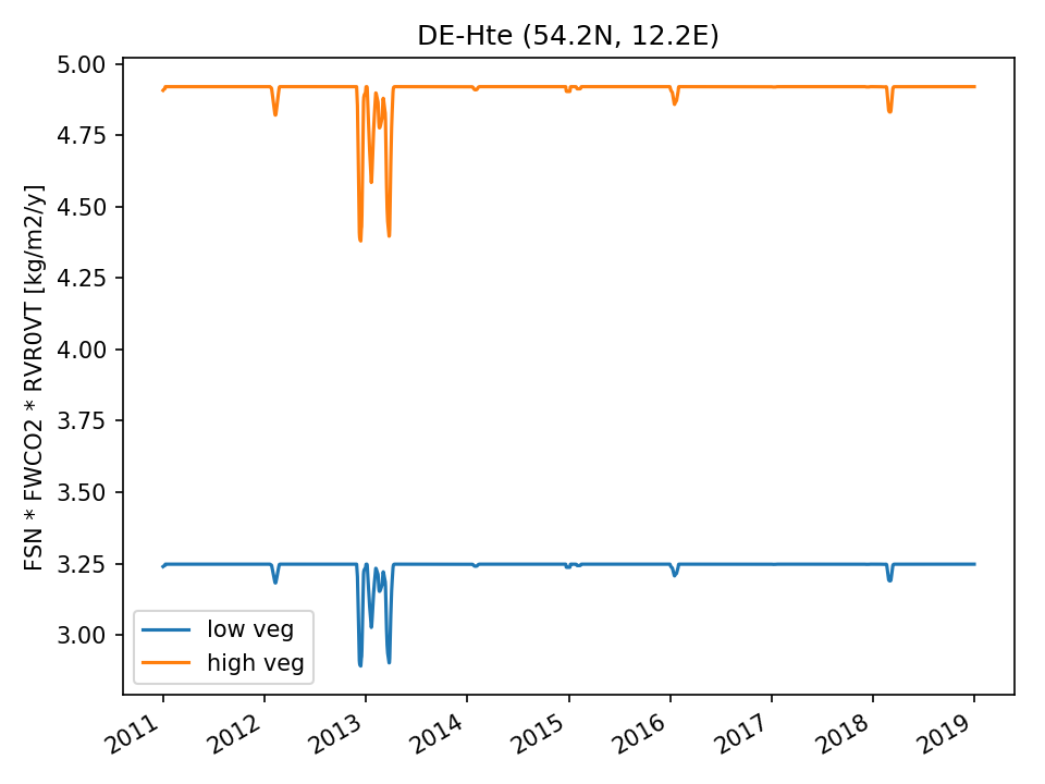 | 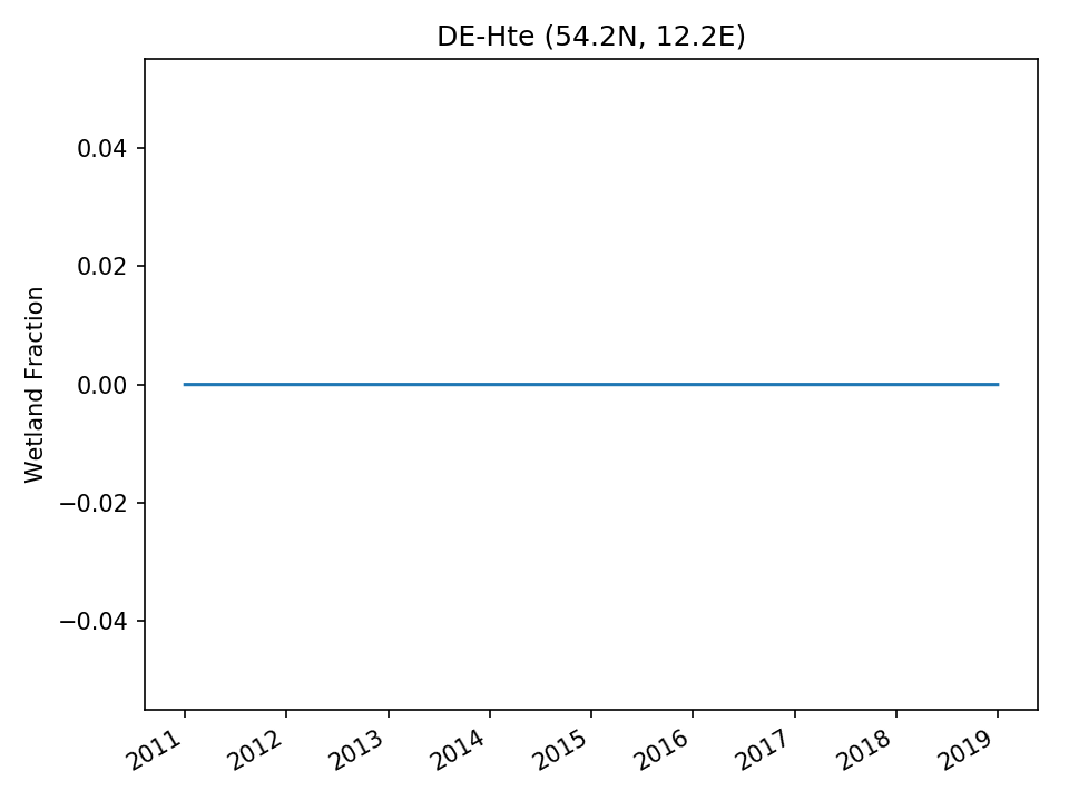 |
| USE | 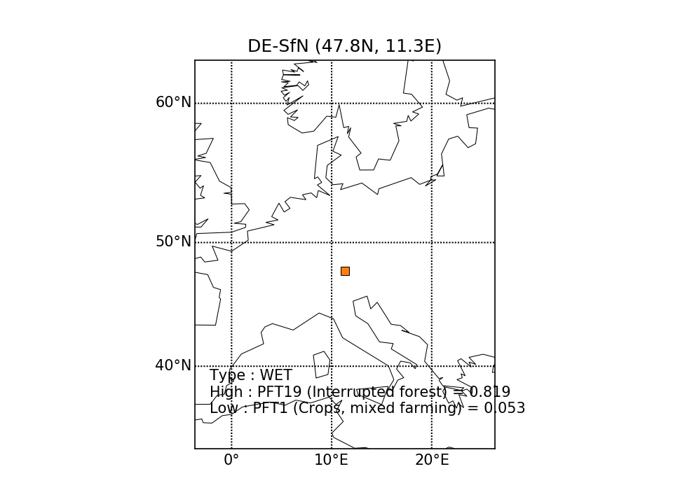 |  | 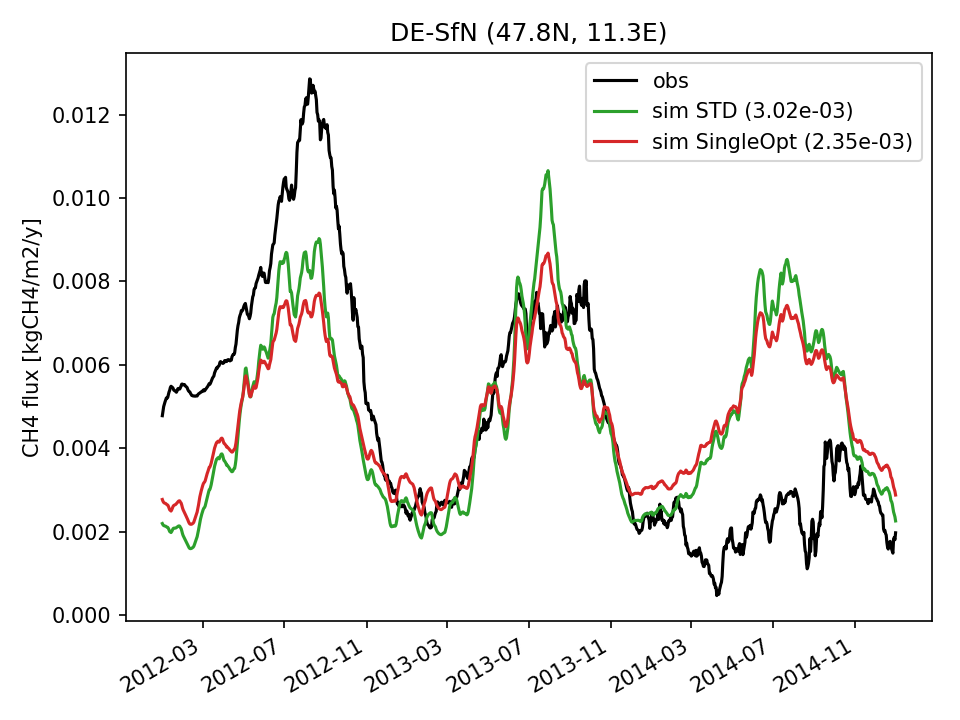 | 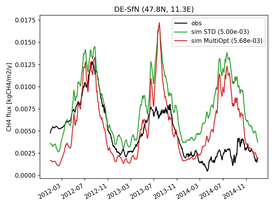 | 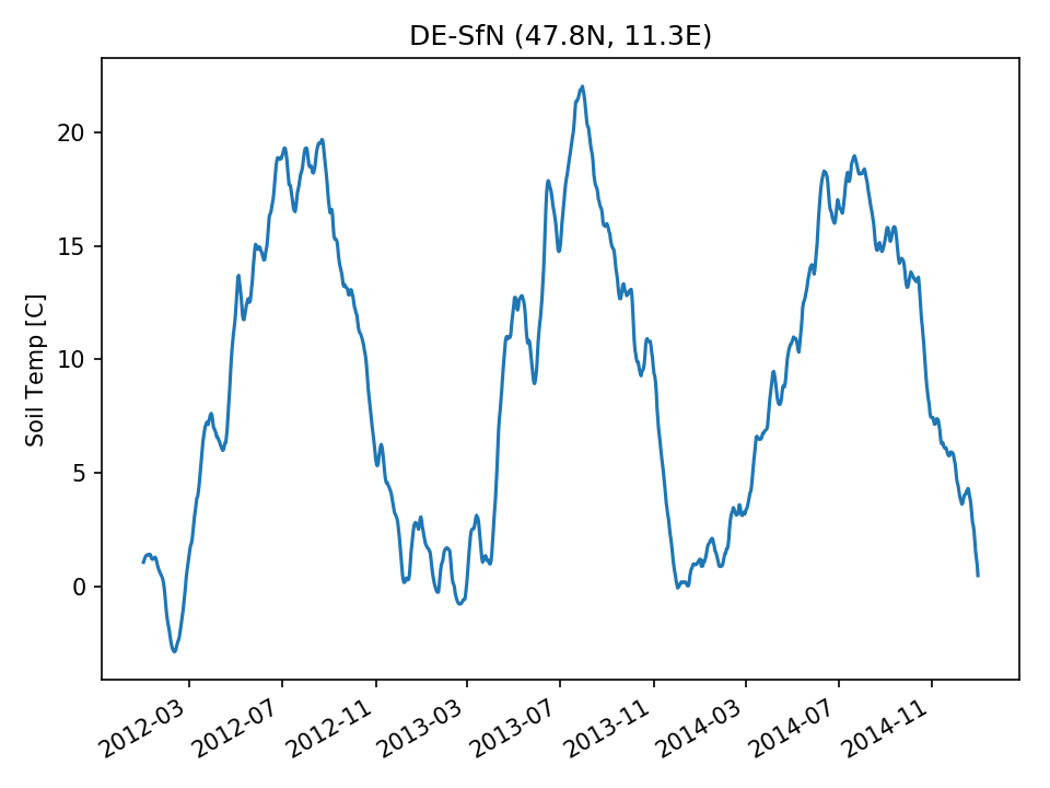 | 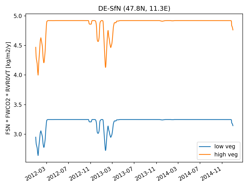 |  |
| DROP |  | 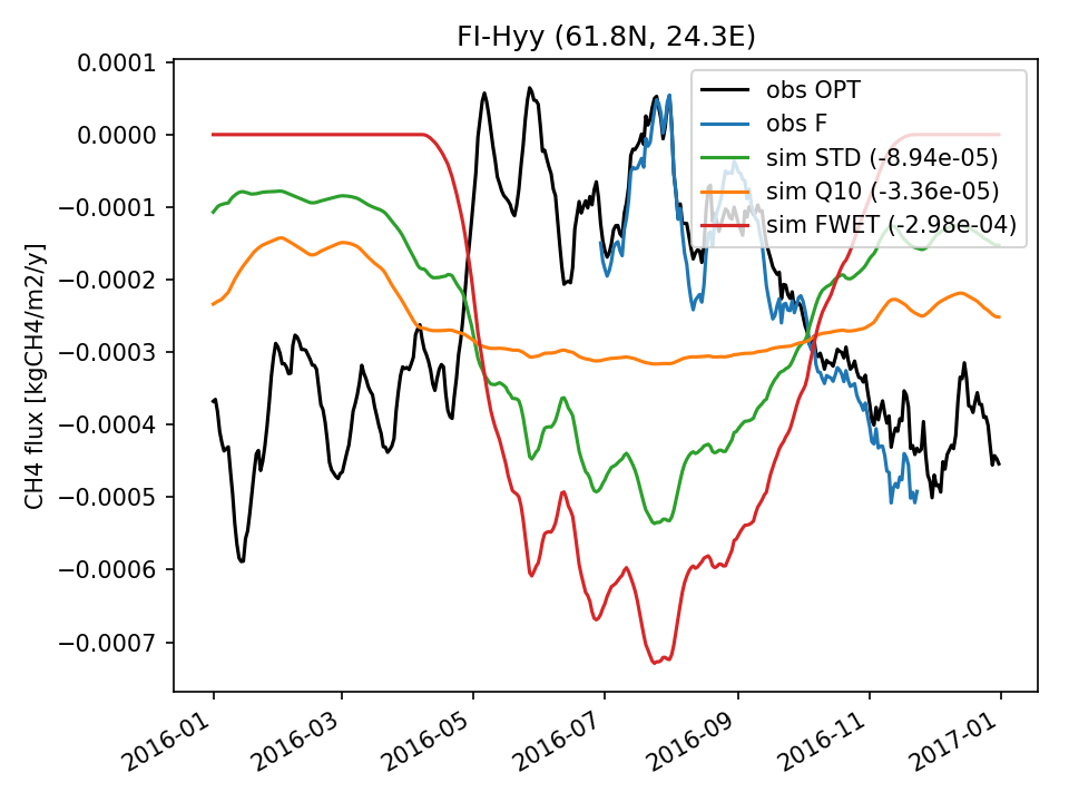 | 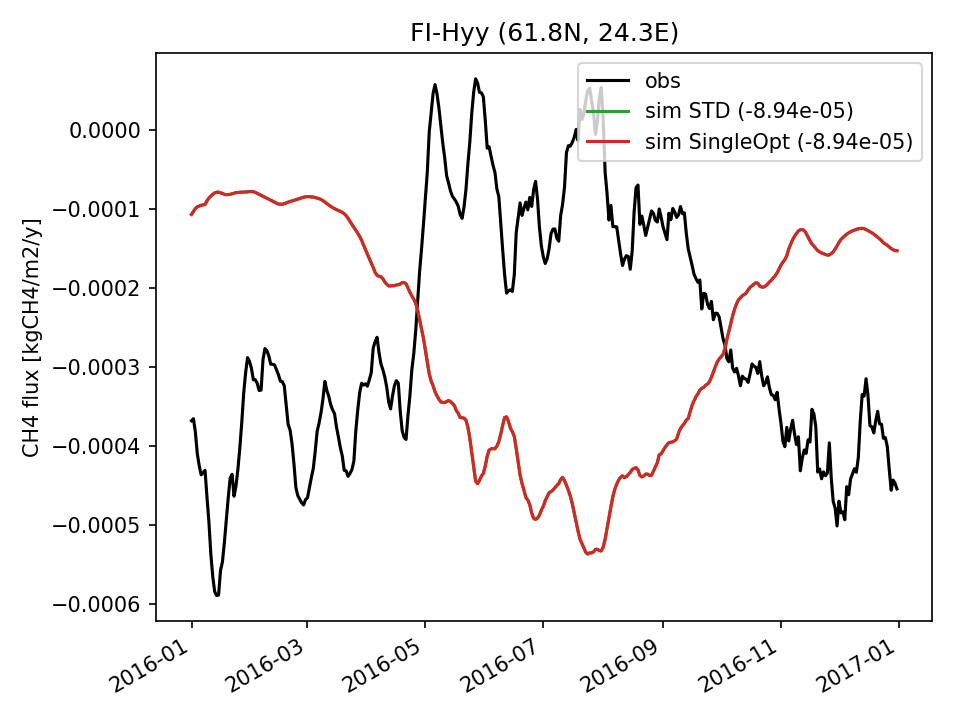 | 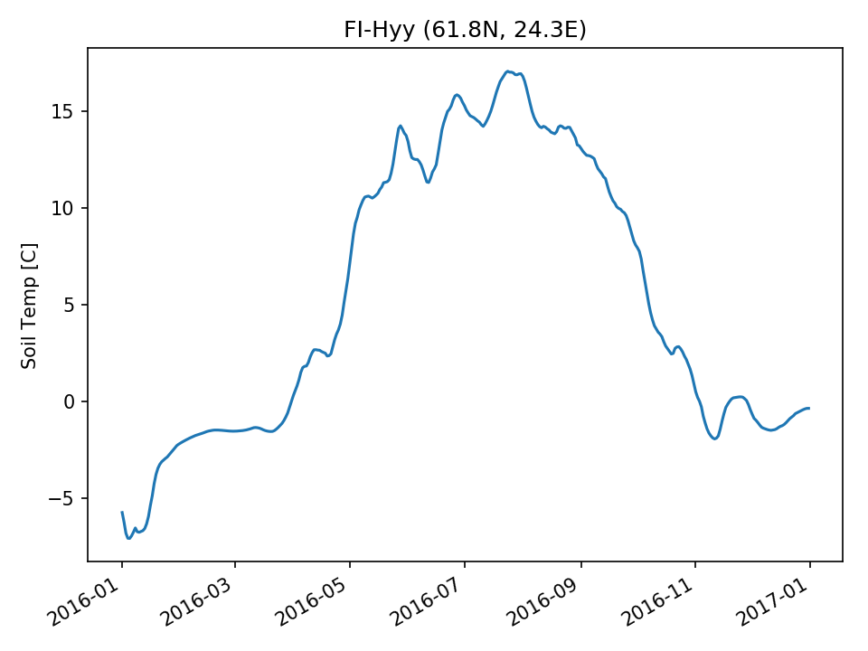 | 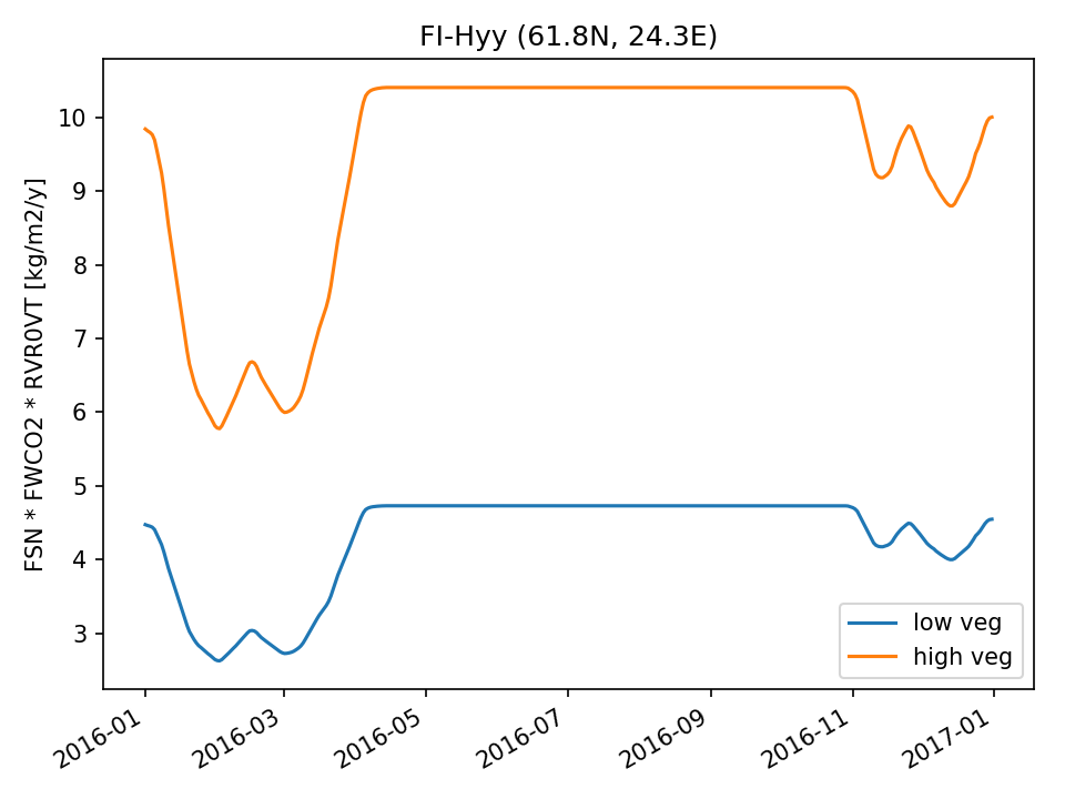 |  | |
| USE | 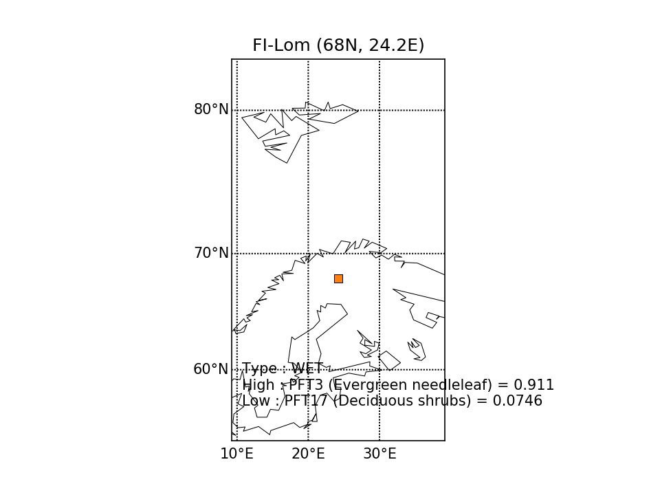 | 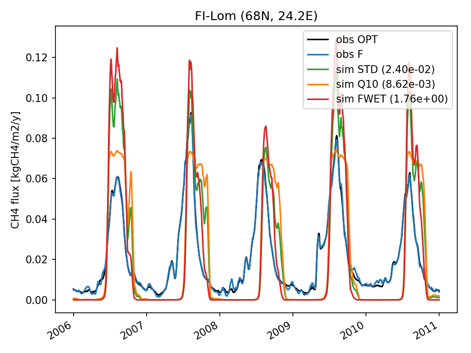 | 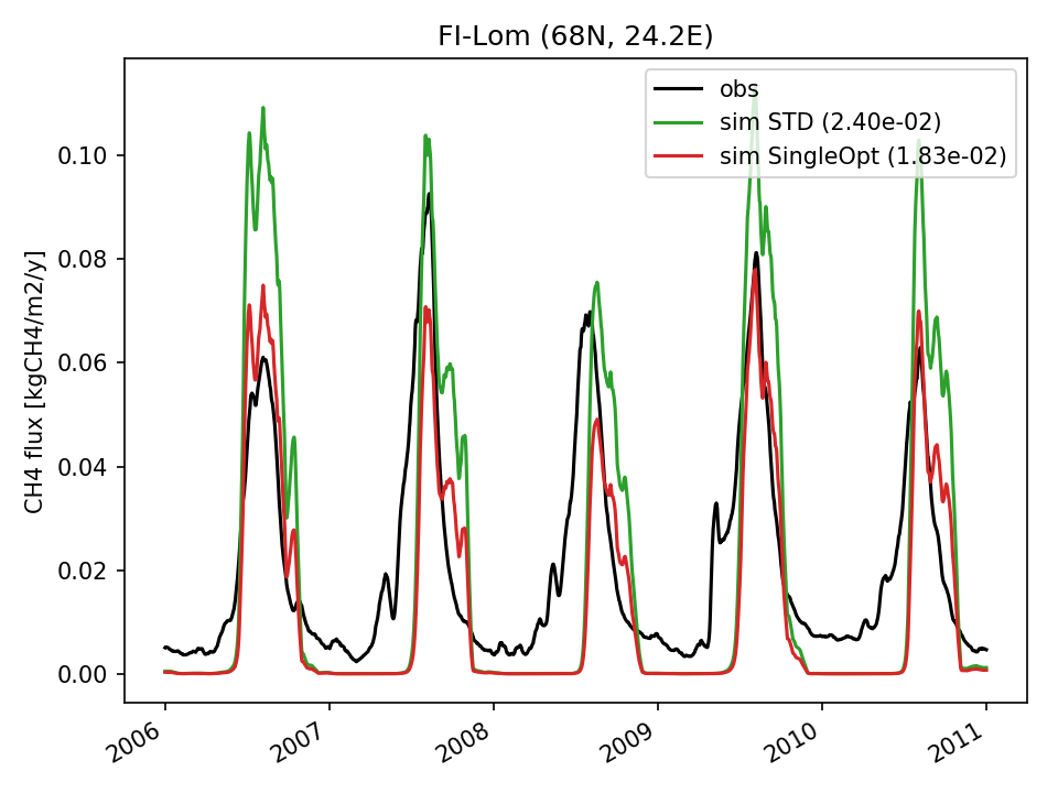 |  |  | 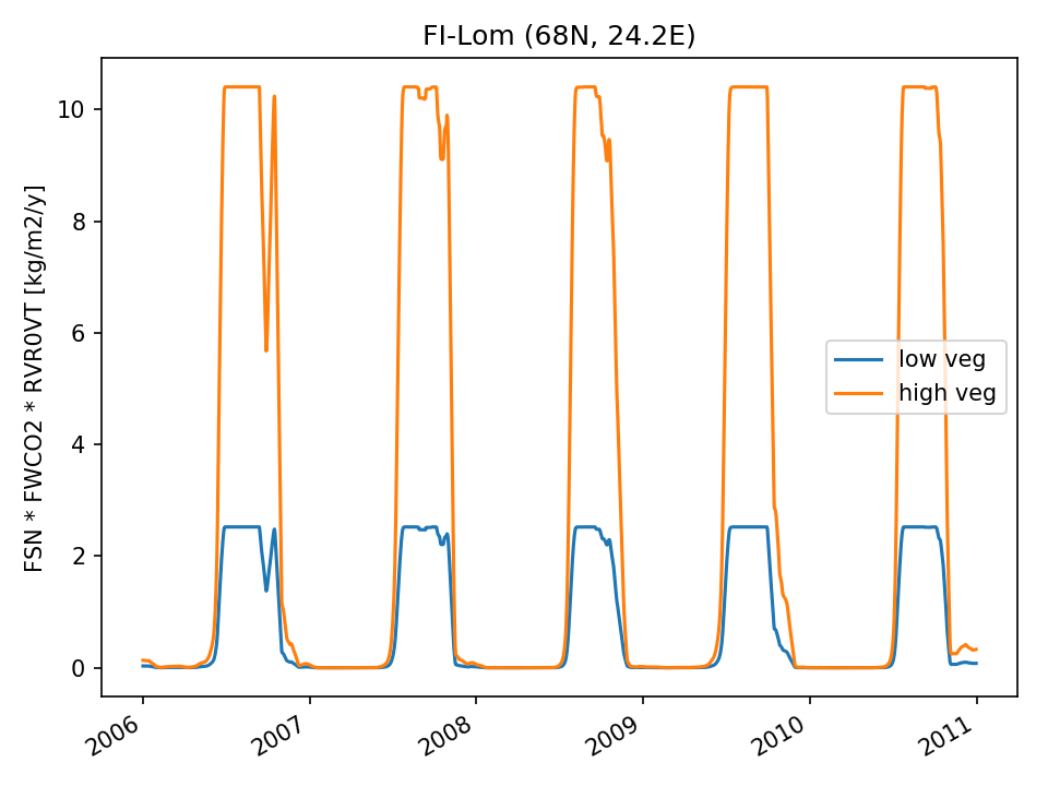 | 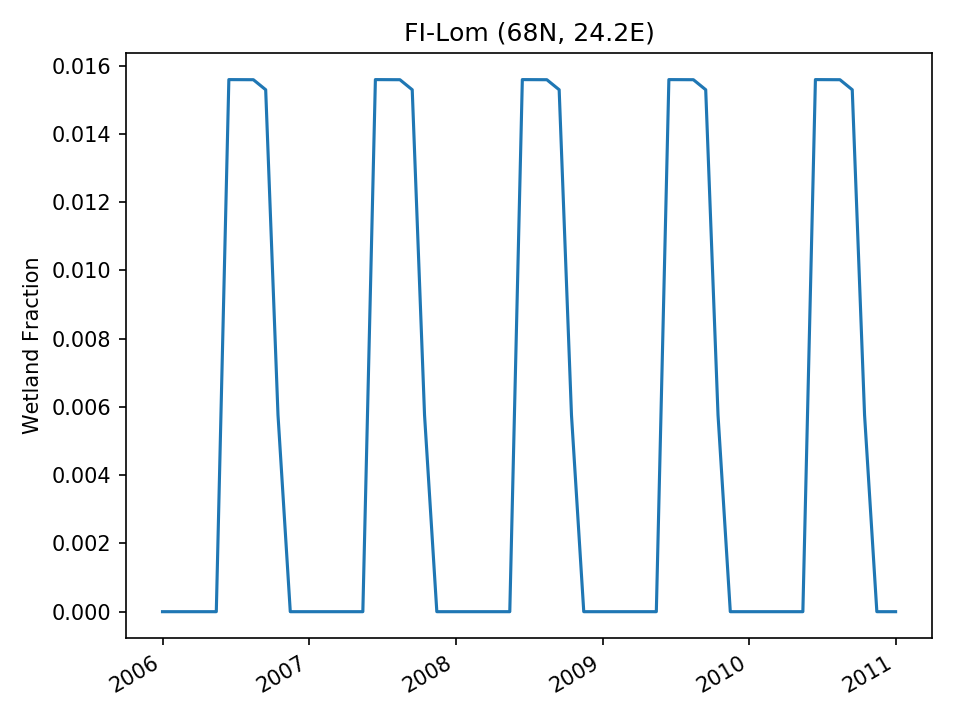 |
| USE |  | 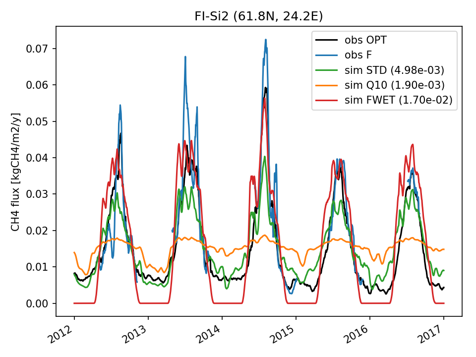 | 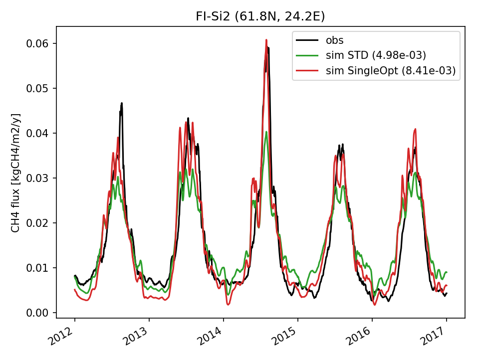 | 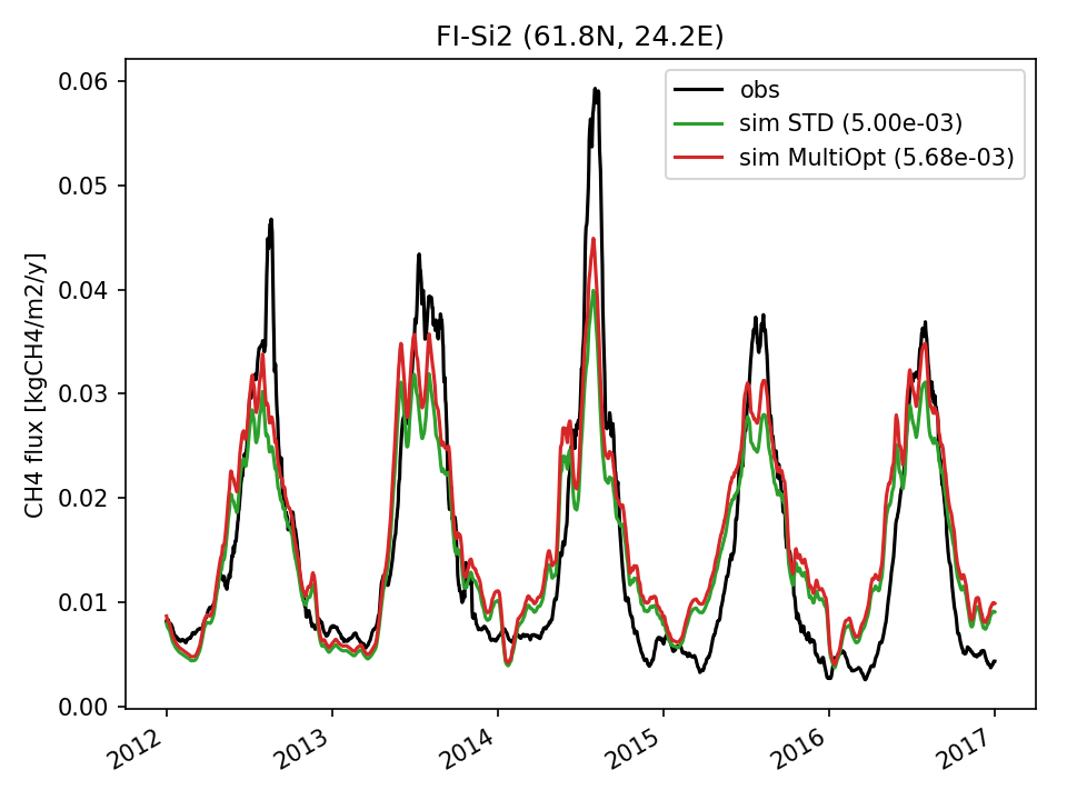 | 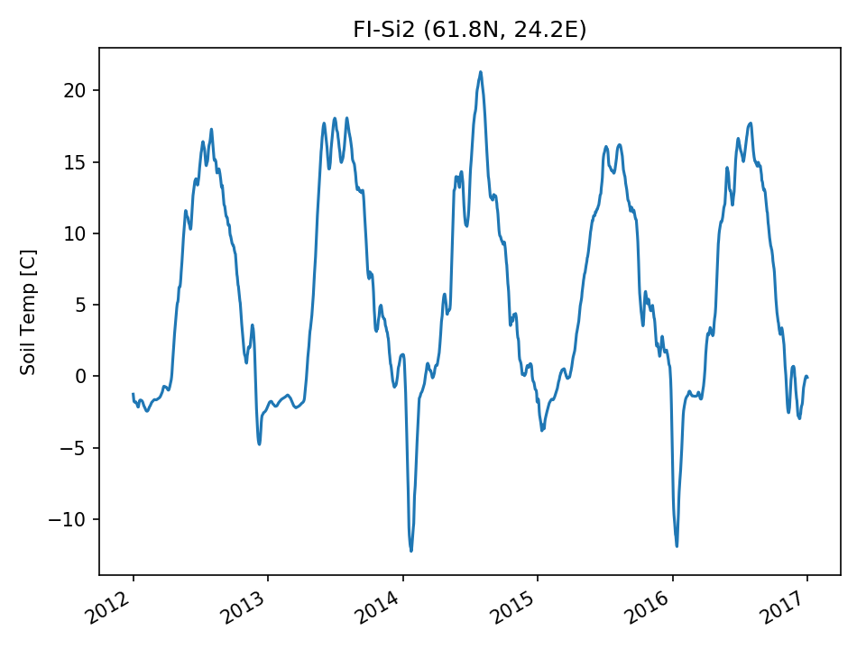 | 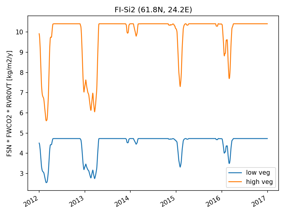 | 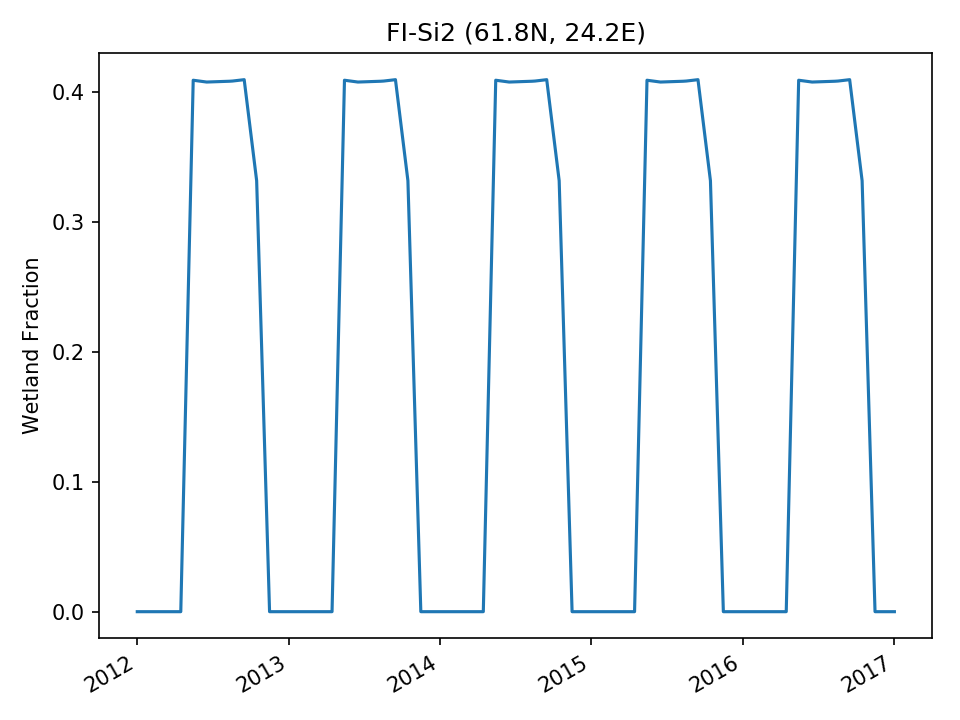 |
| USE | 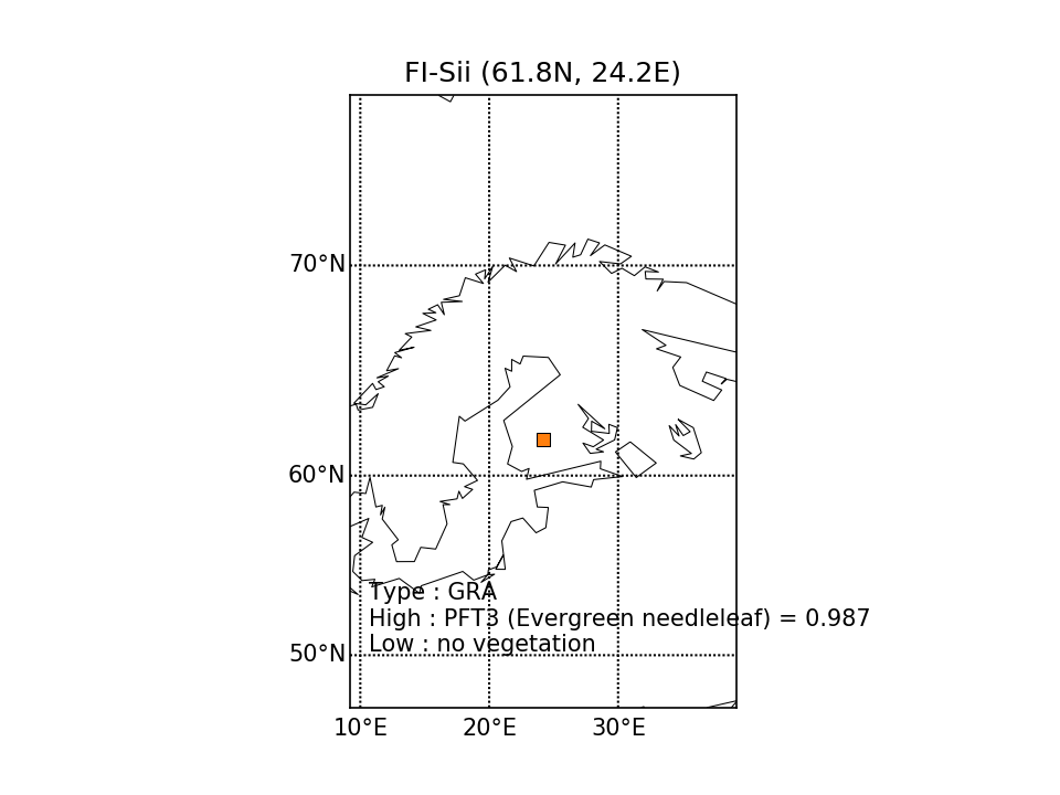 | 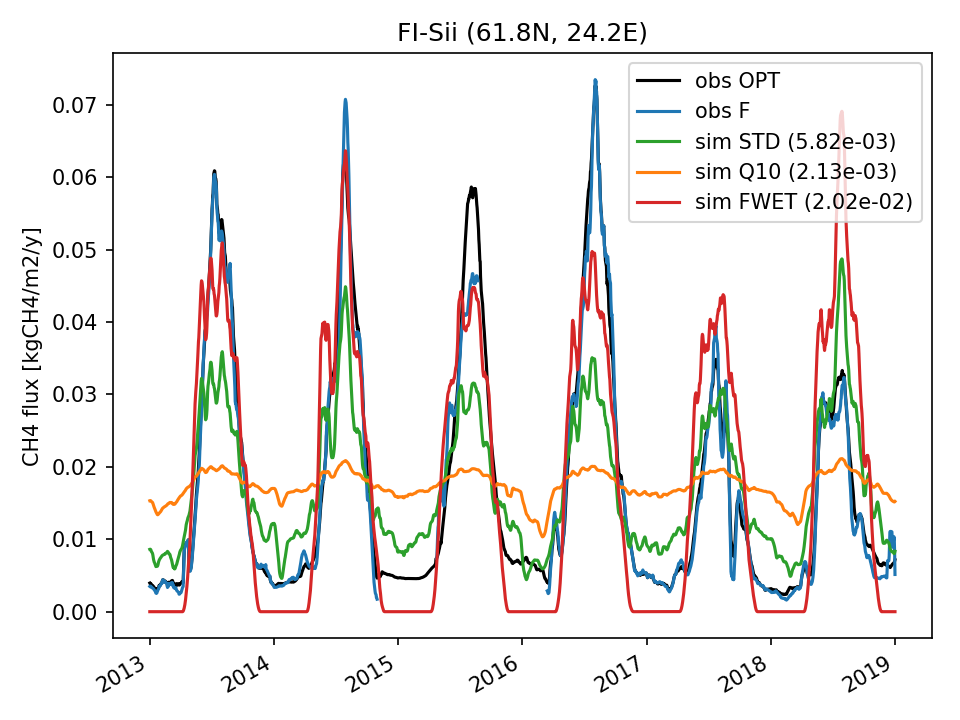 | 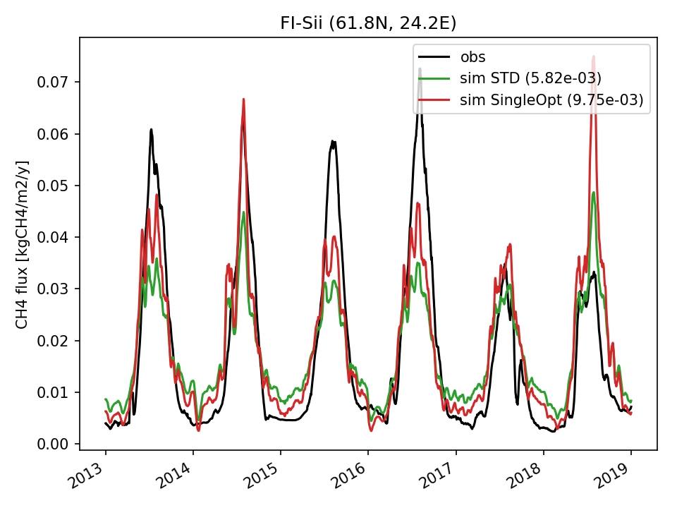 | 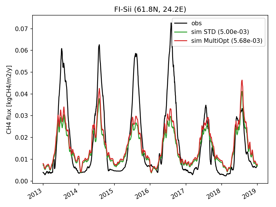 | 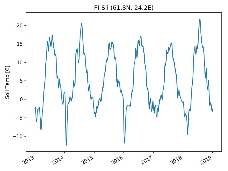 | 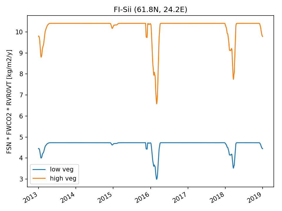 | 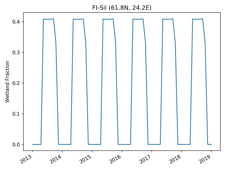 |
| USE | 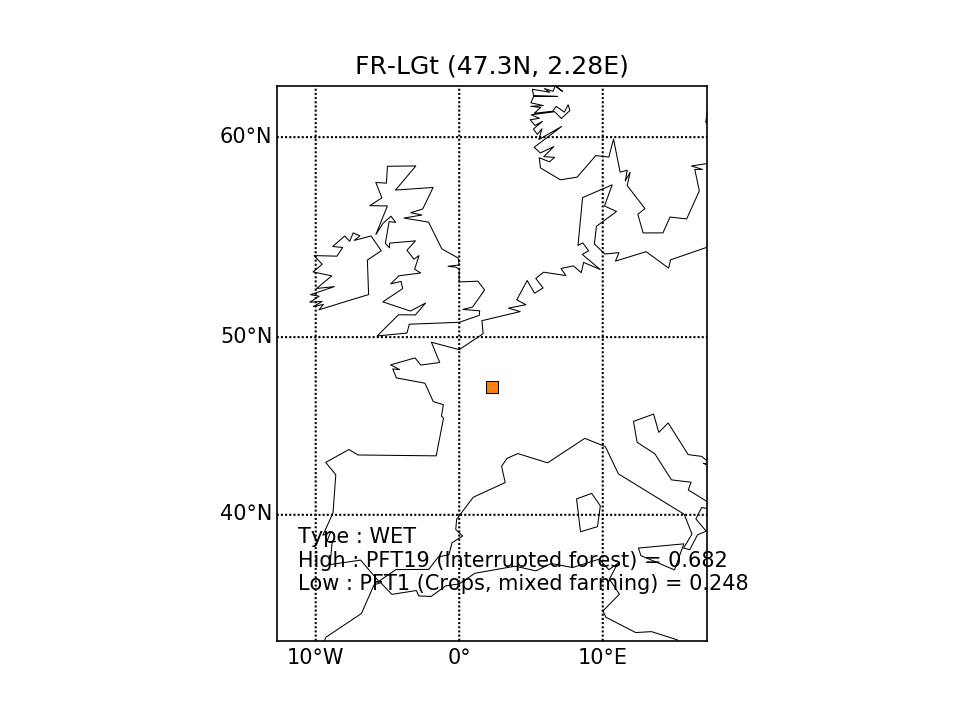 | 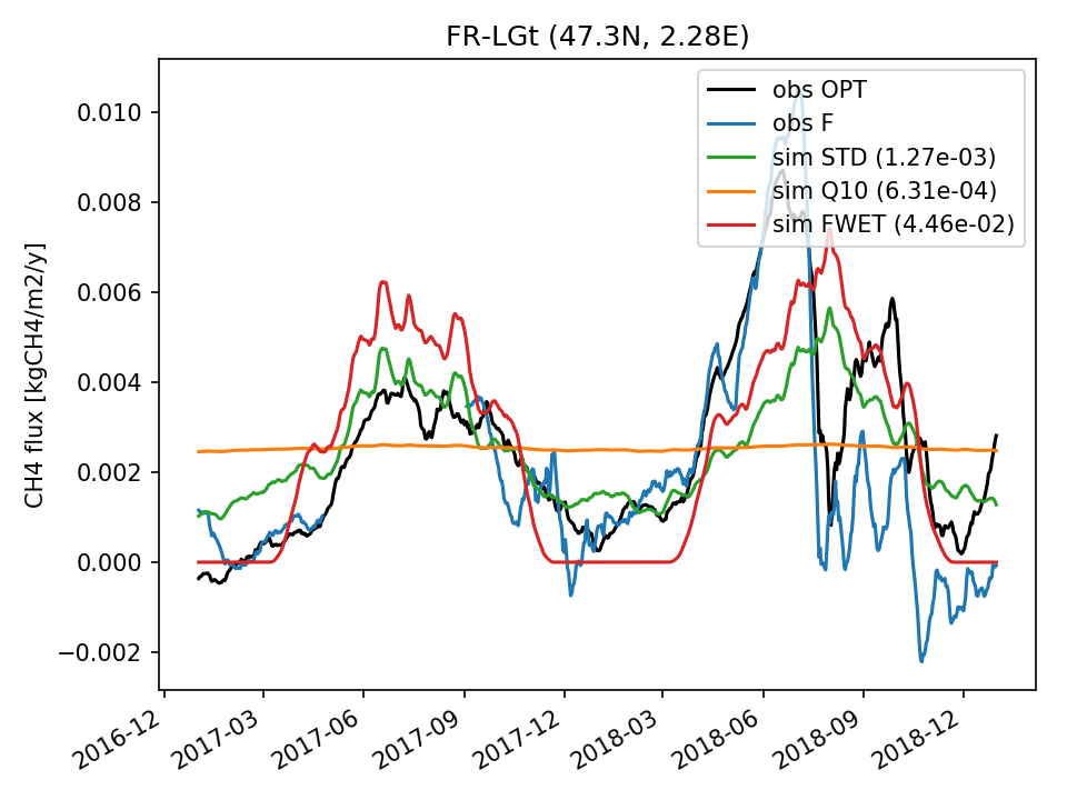 | 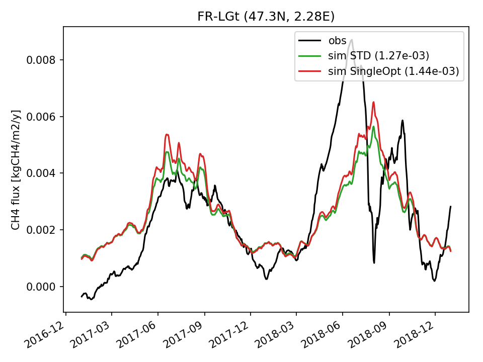 | 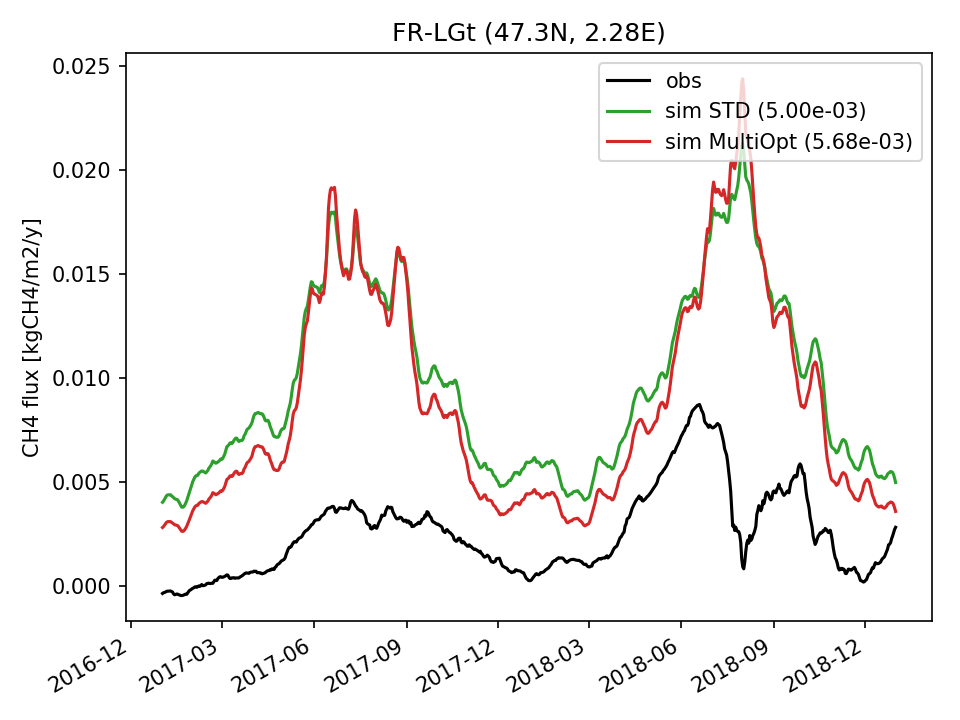 |  |  | 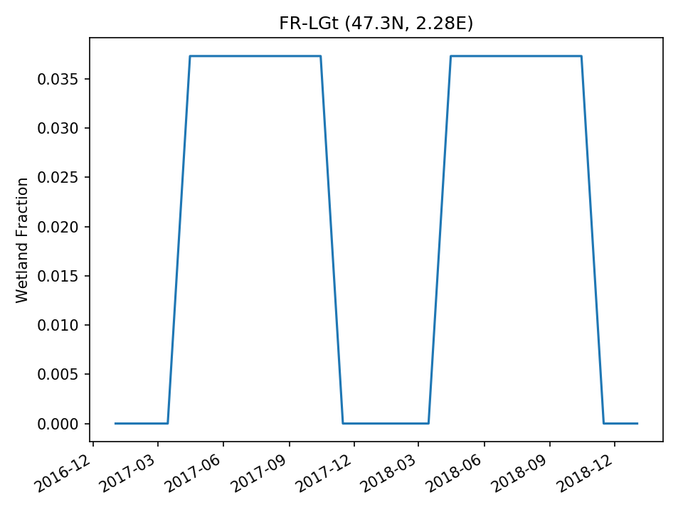 |
| DROP |  | 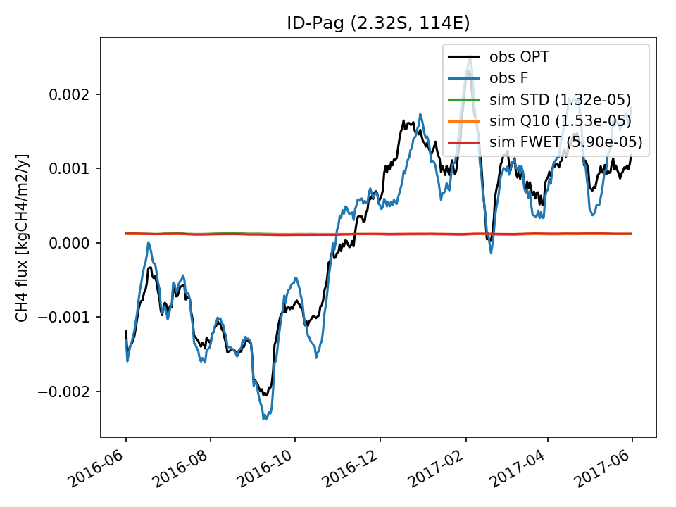 | 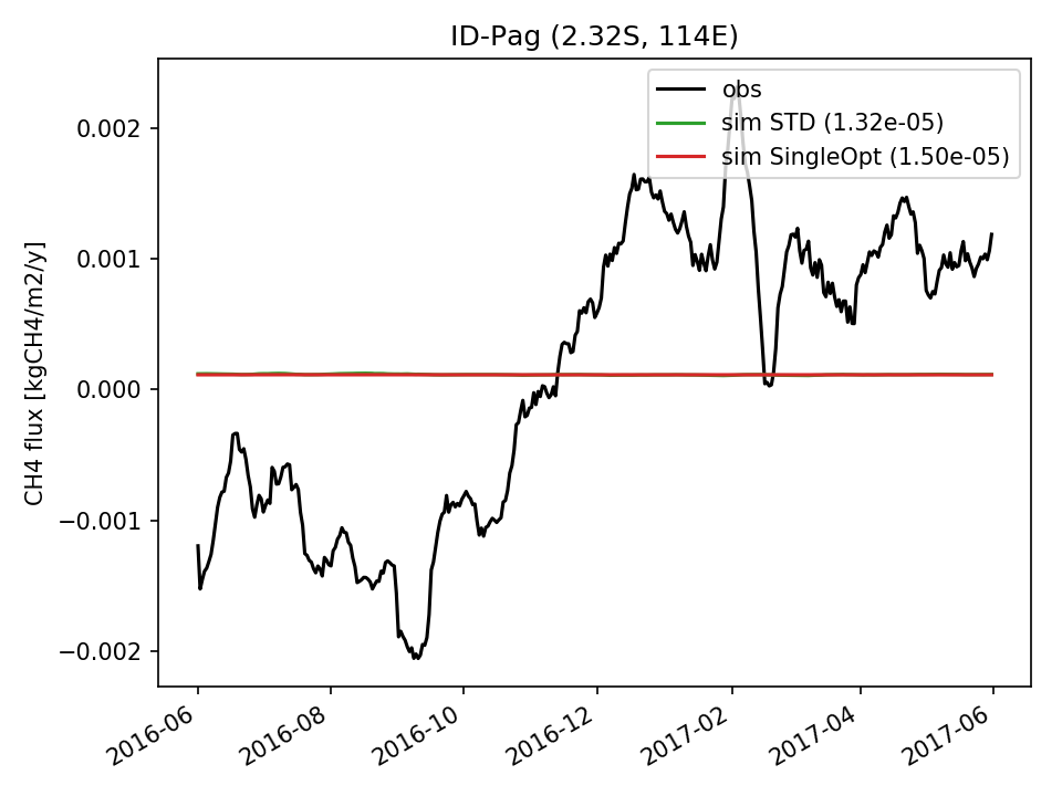 | 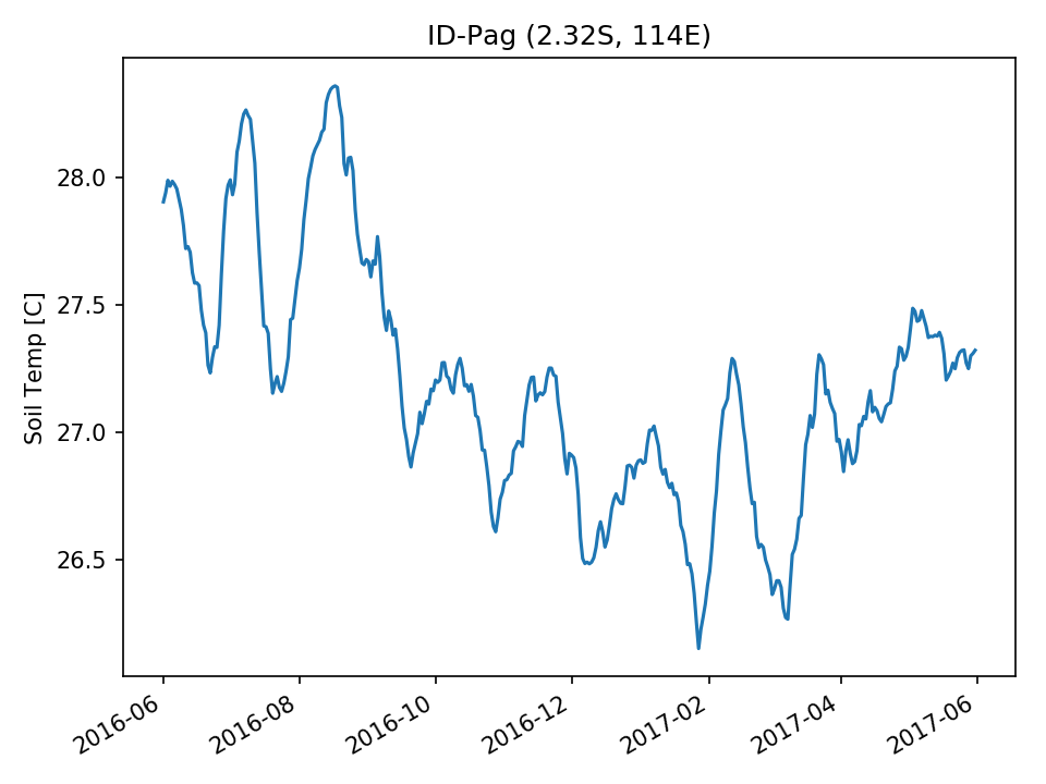 | 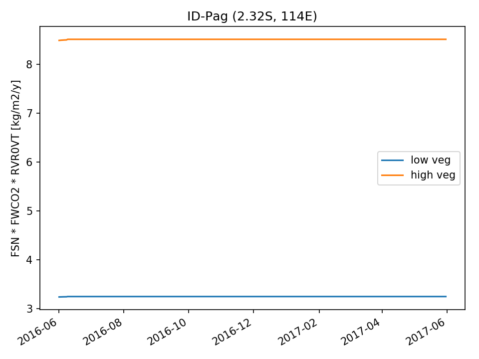 | 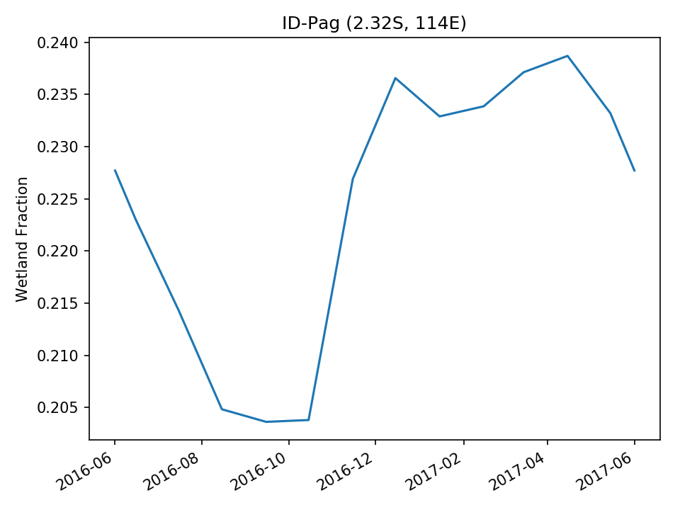 | |
| DROP |  | 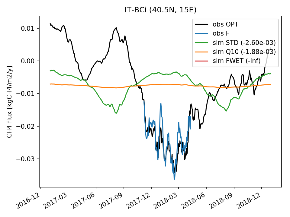 | 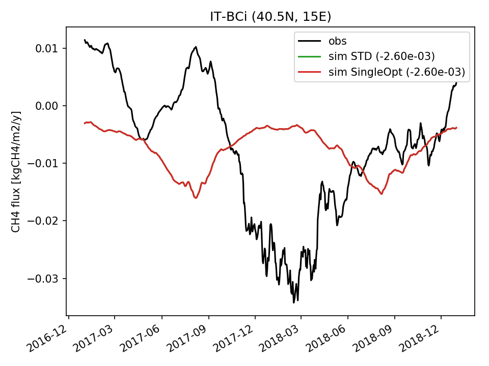 | 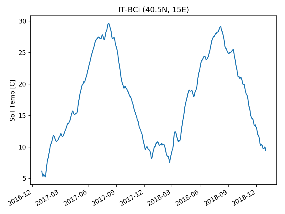 | 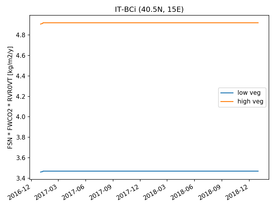 | 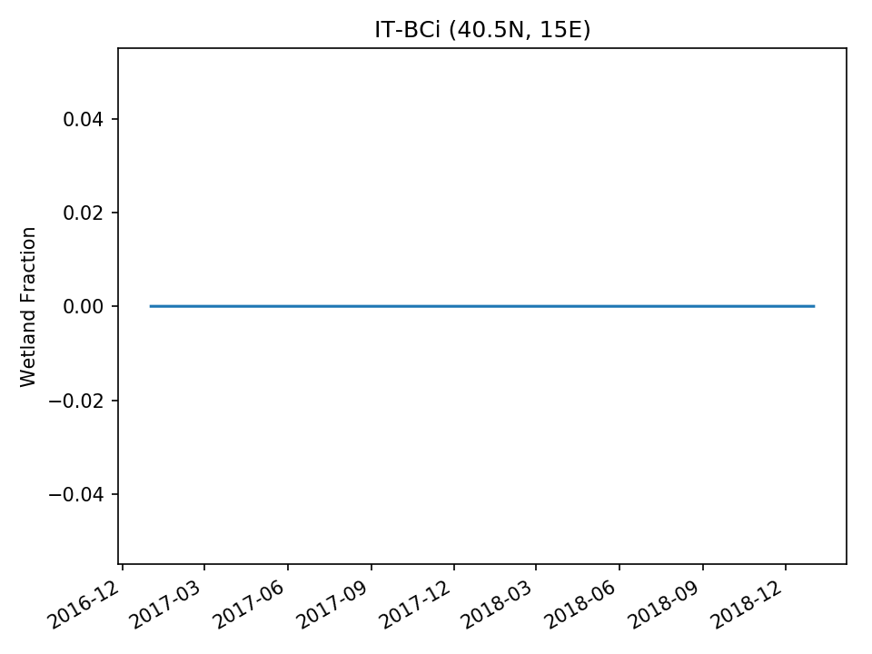 | |
| USE | 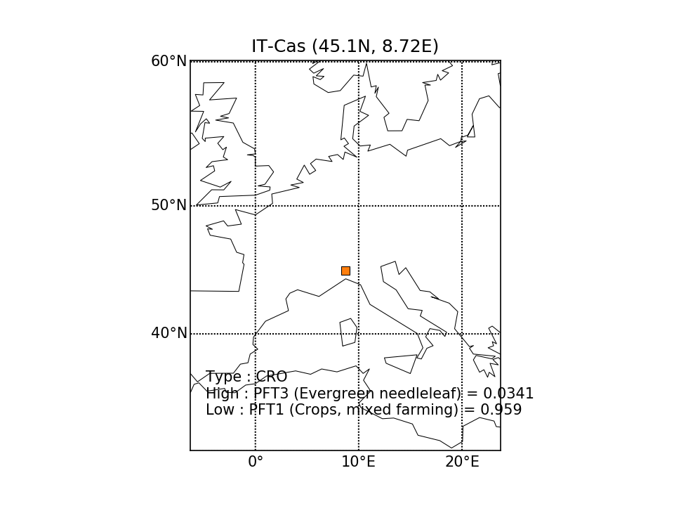 | 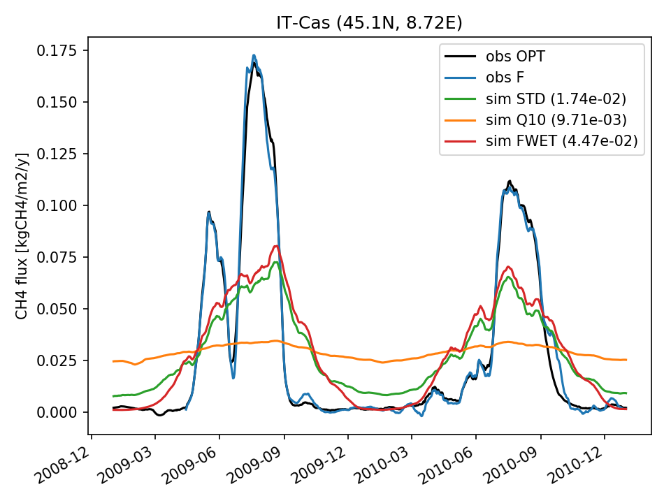 | 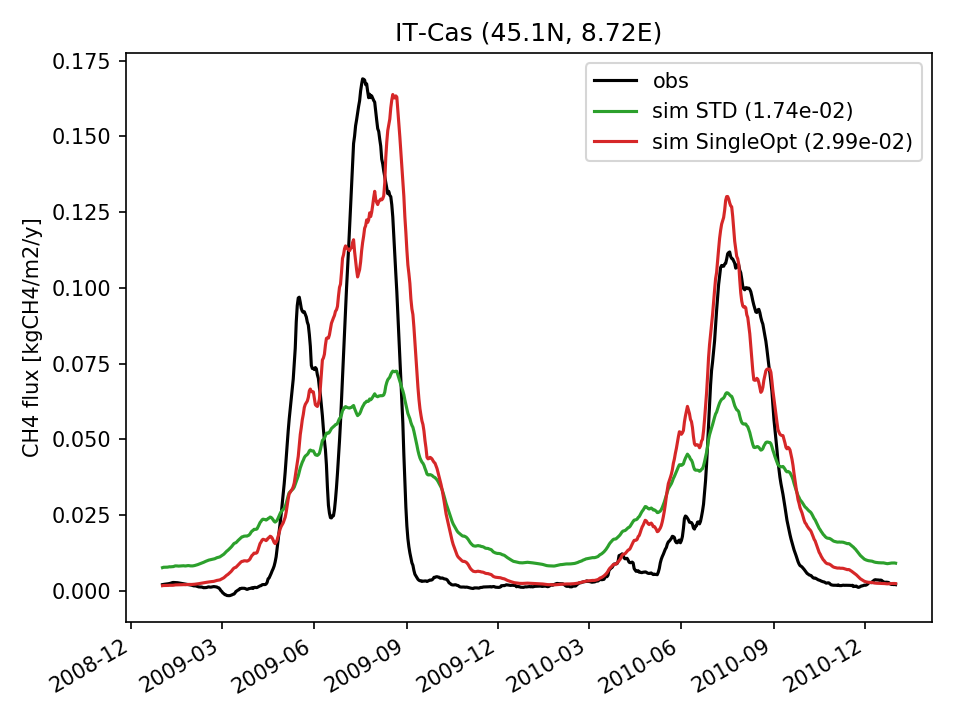 | 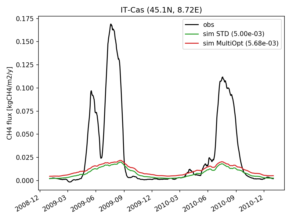 |  | 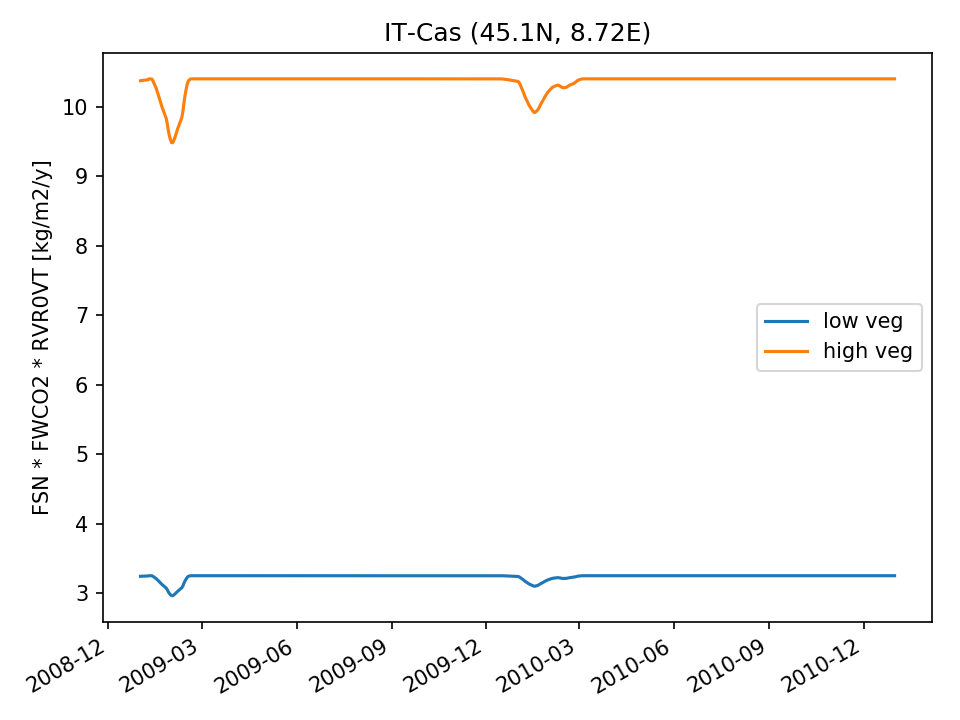 | 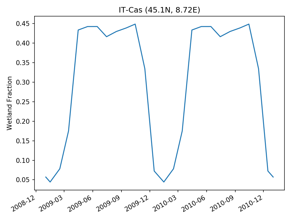 |
| USE | 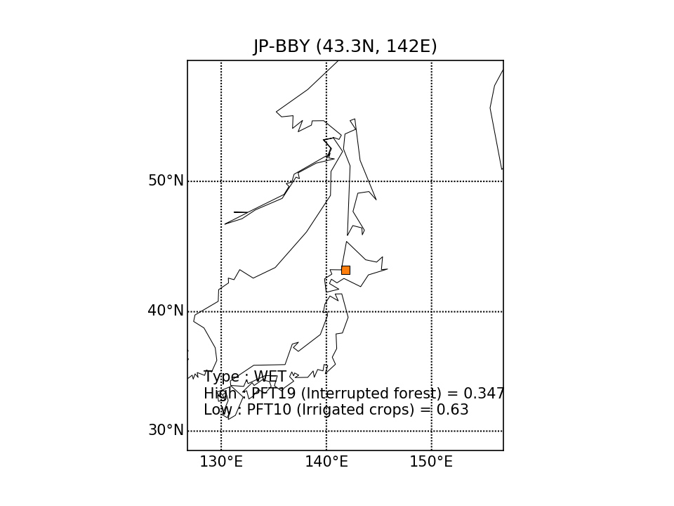 |  | 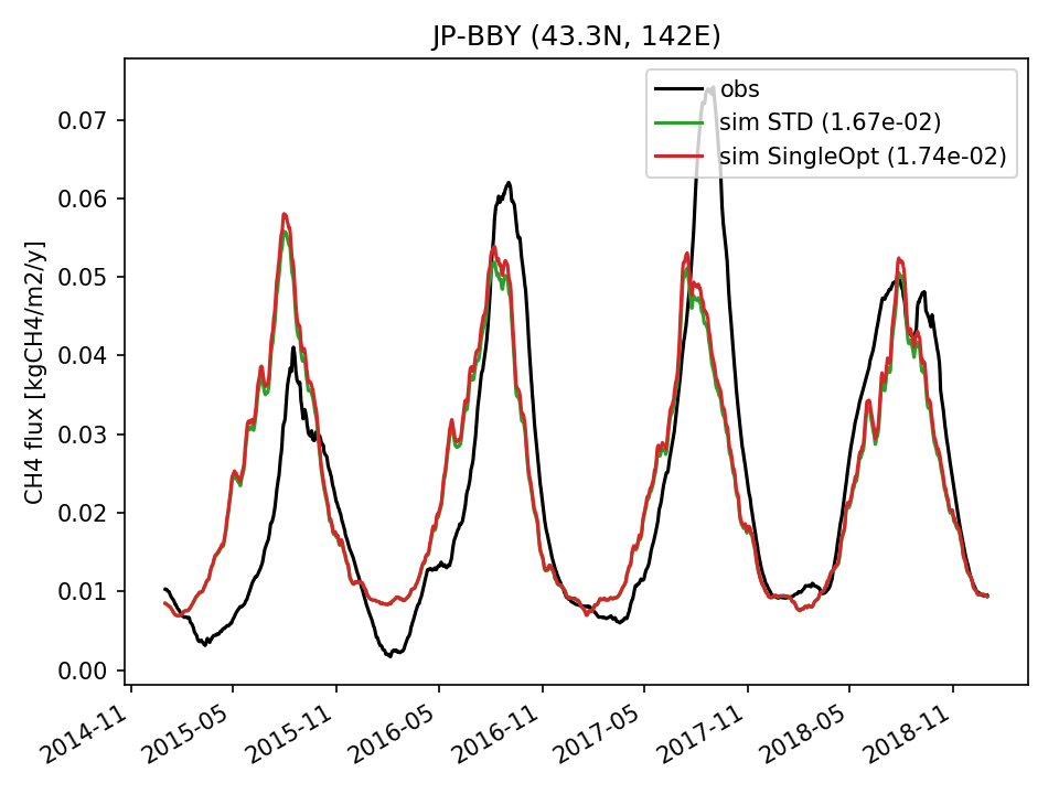 | 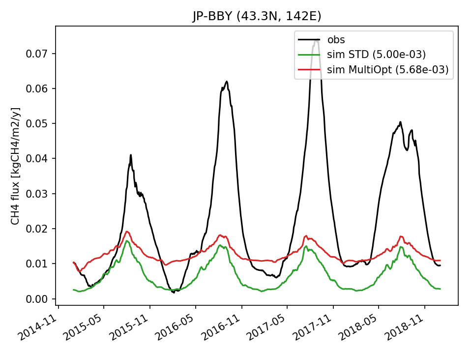 | 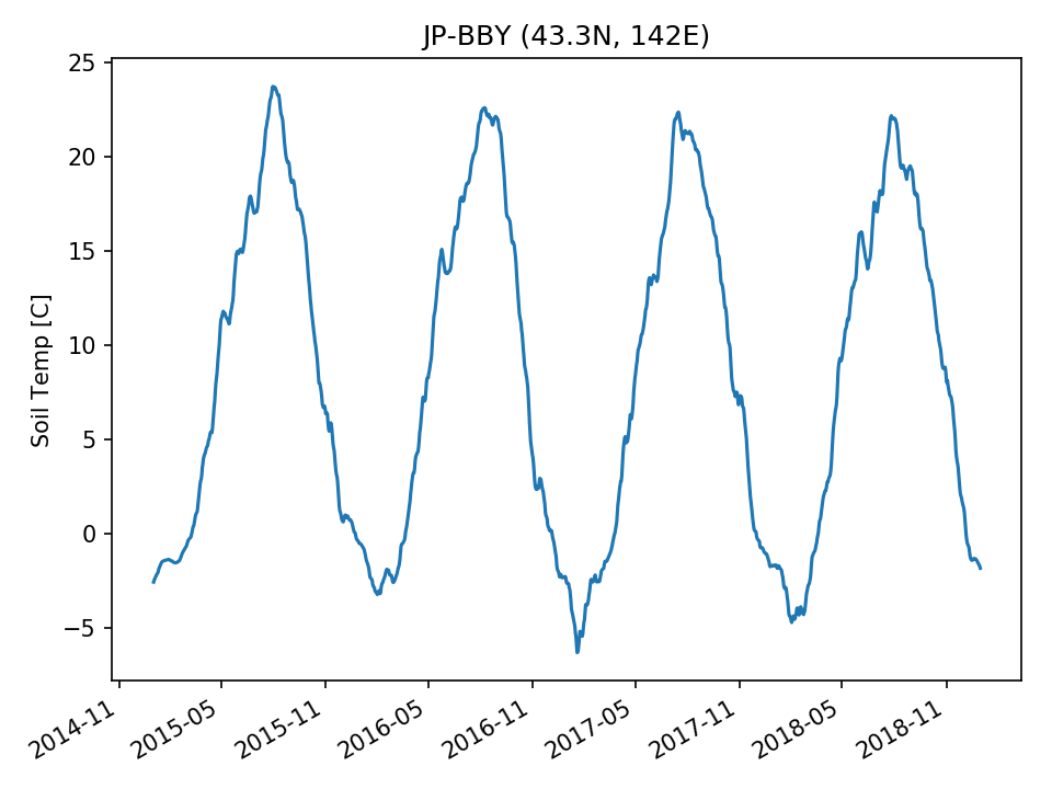 | 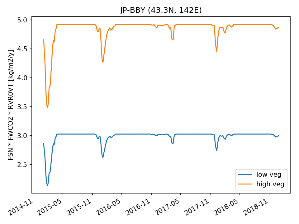 | 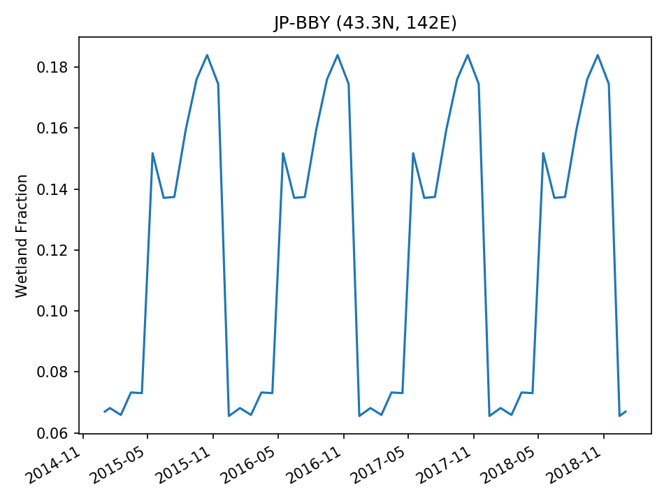 |
| USE | 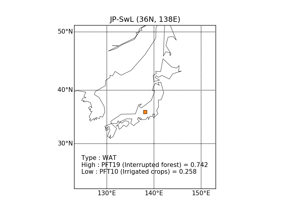 | 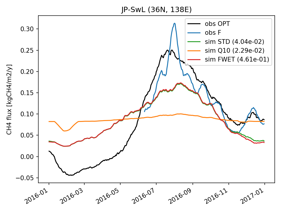 | 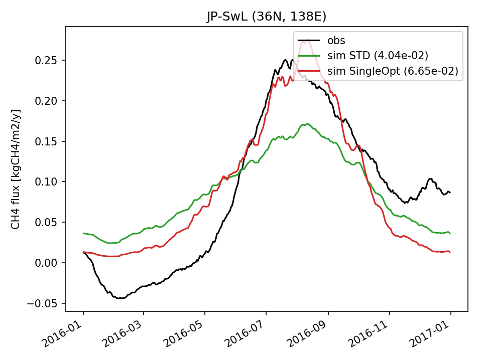 | 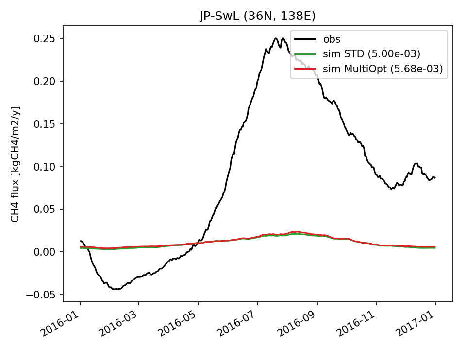 | 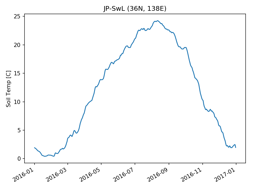 | 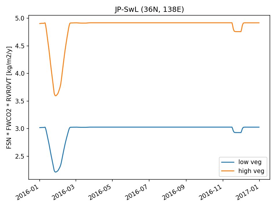 | 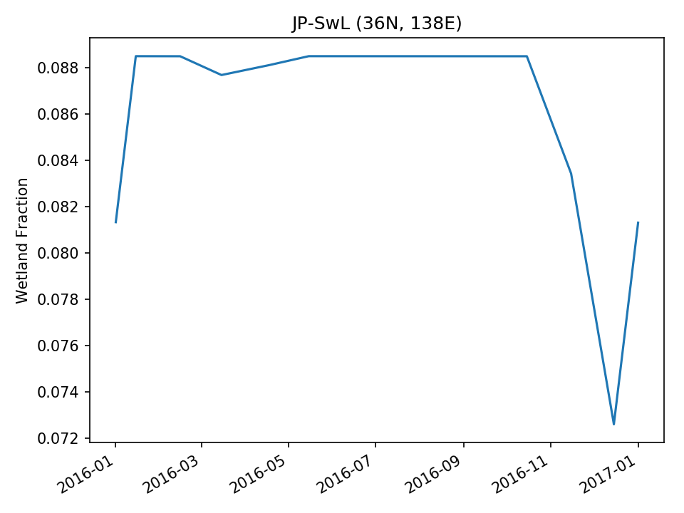 |
| USE | 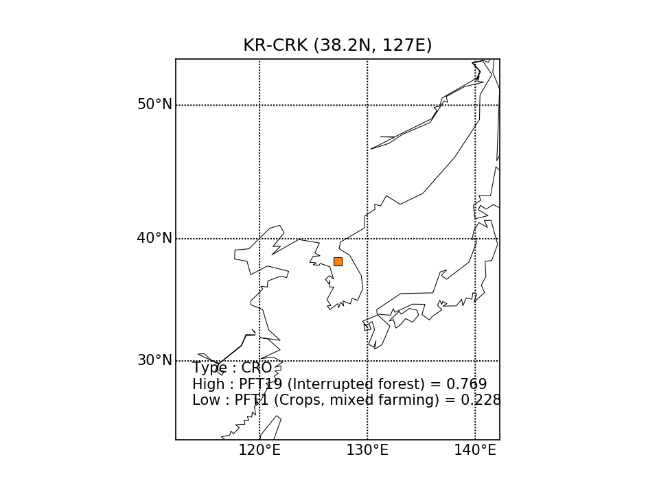 | 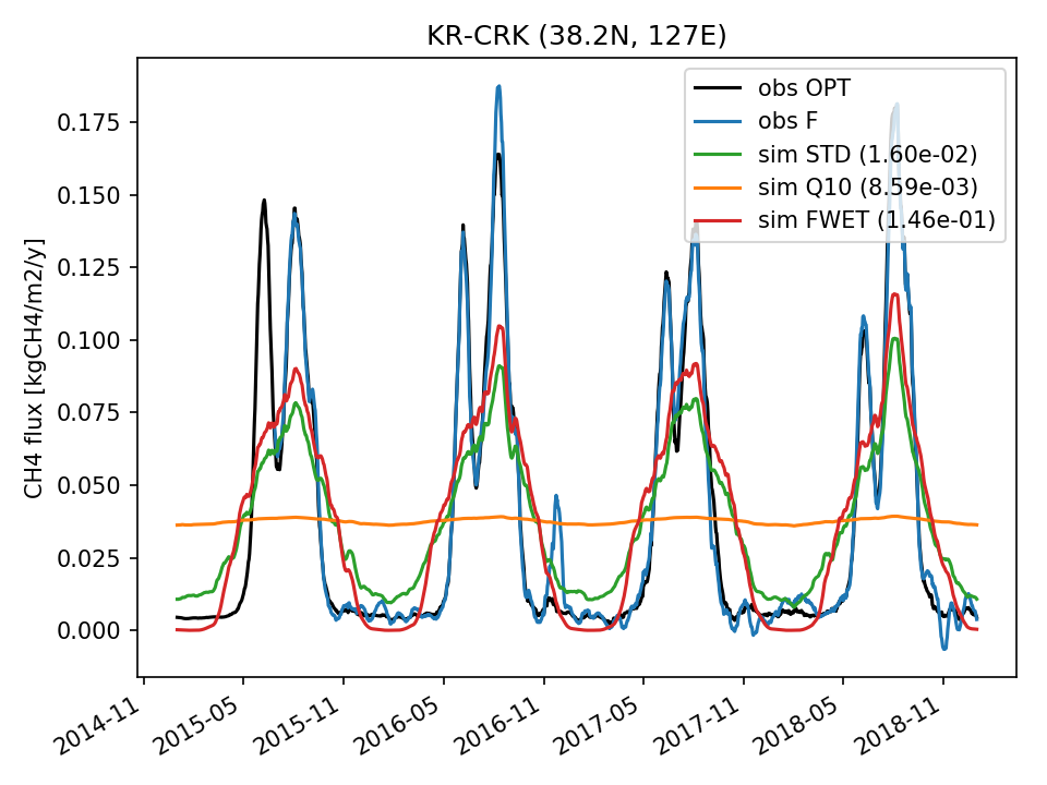 | 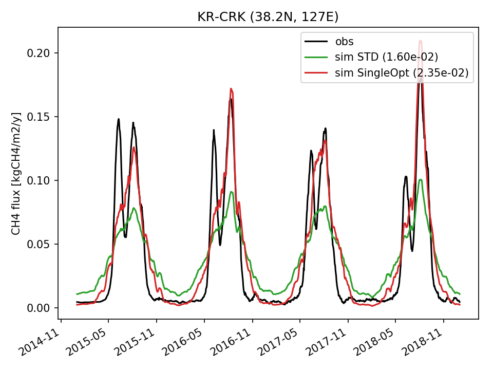 |  | 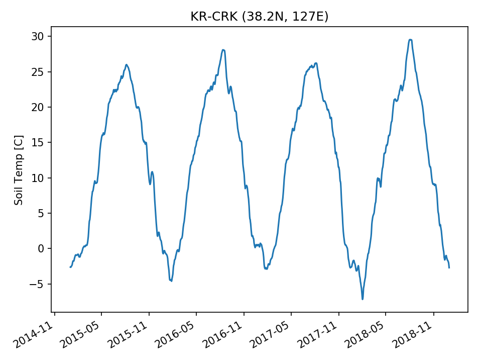 | 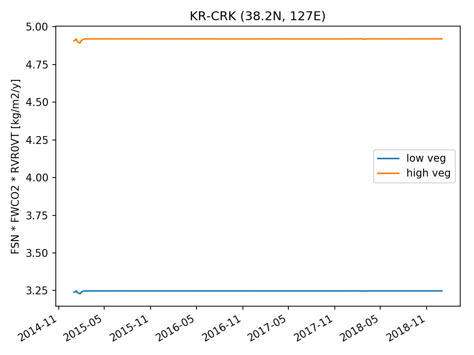 | 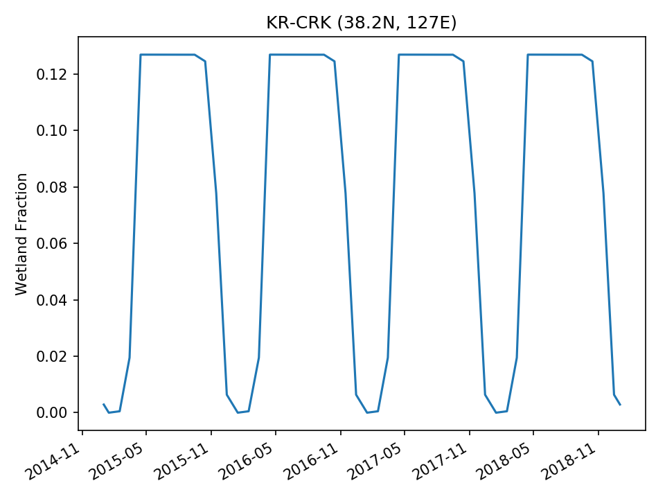 |
| DROP | 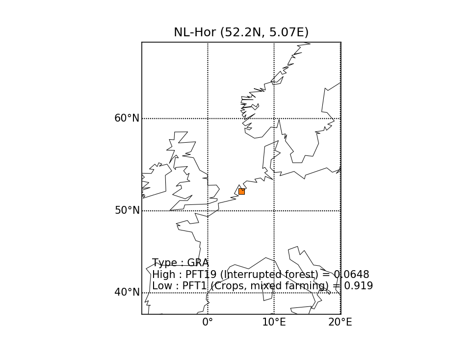 | 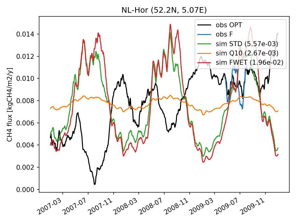 | 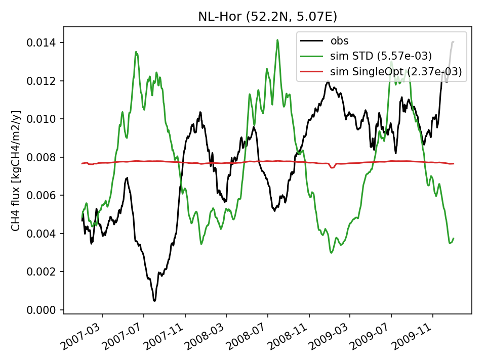 | 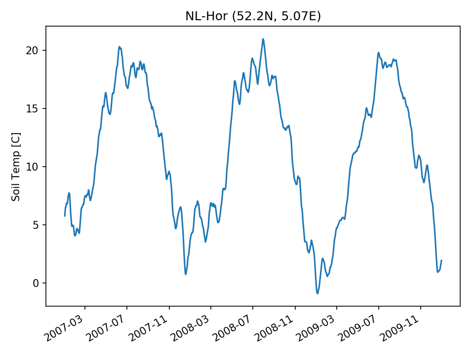 |  | 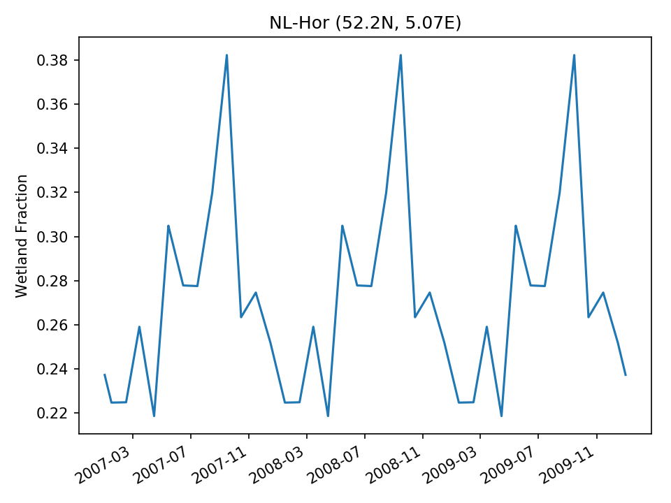 | |
| USE | 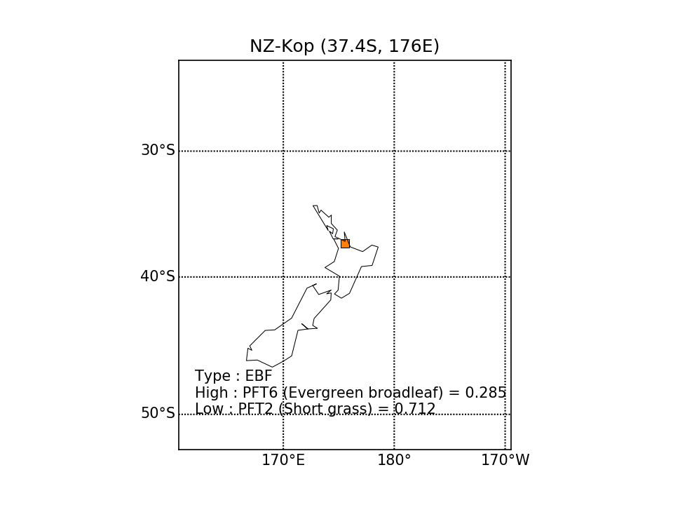 | 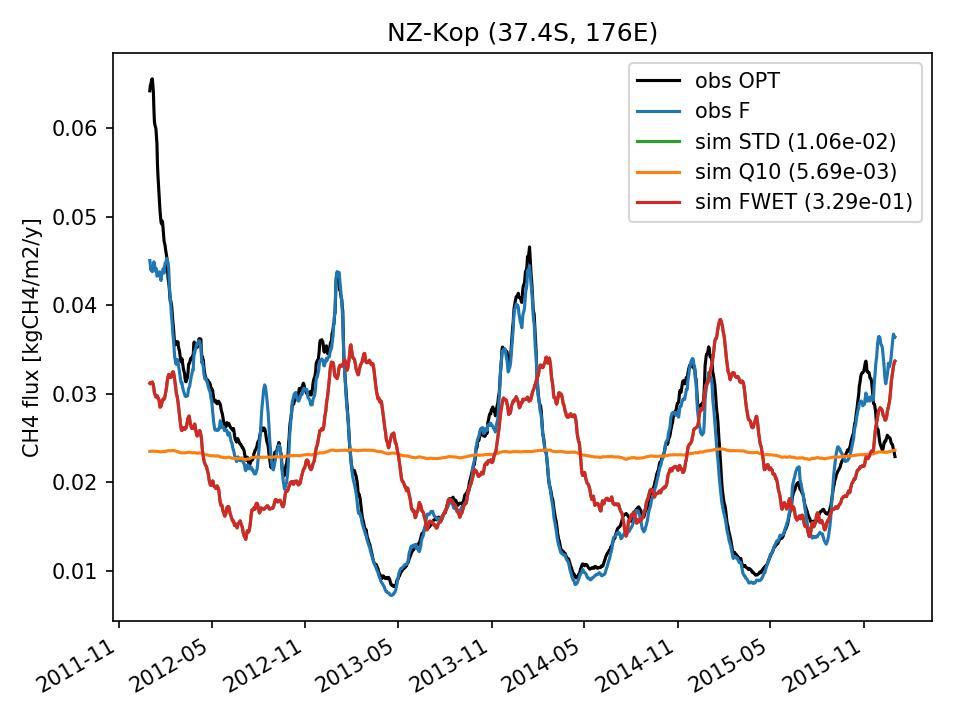 | 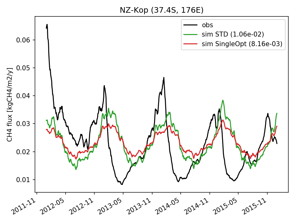 | 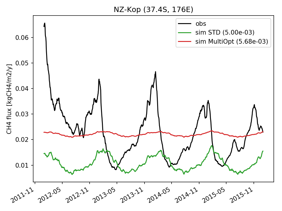 | 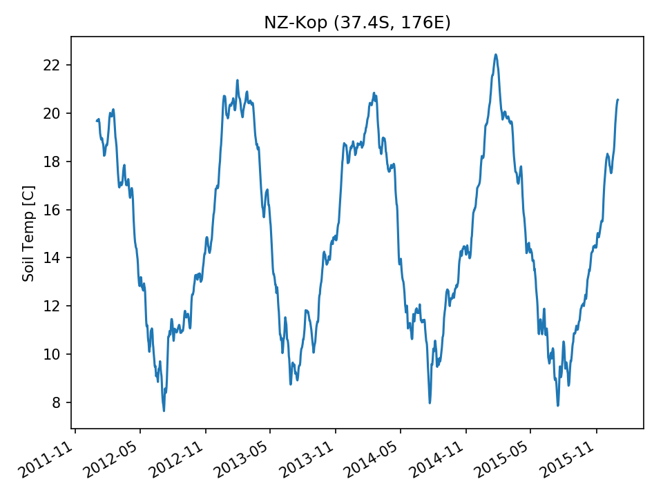 | 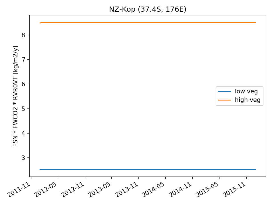 |  |
| DROP |  | 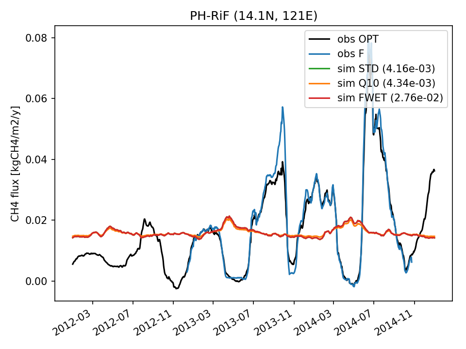 |  | 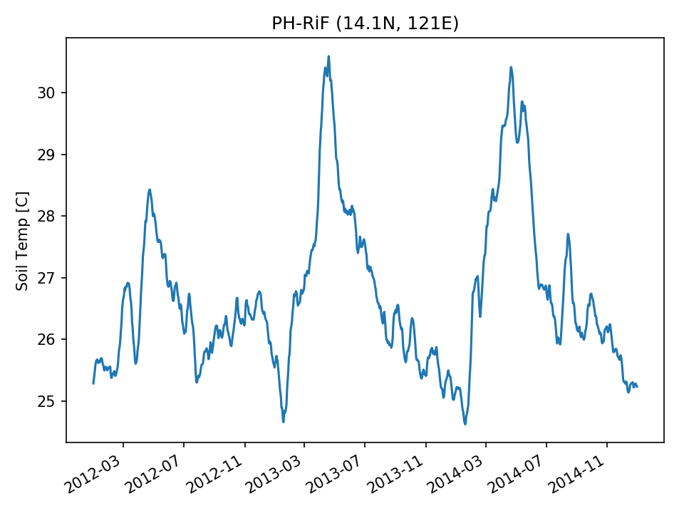 |  | 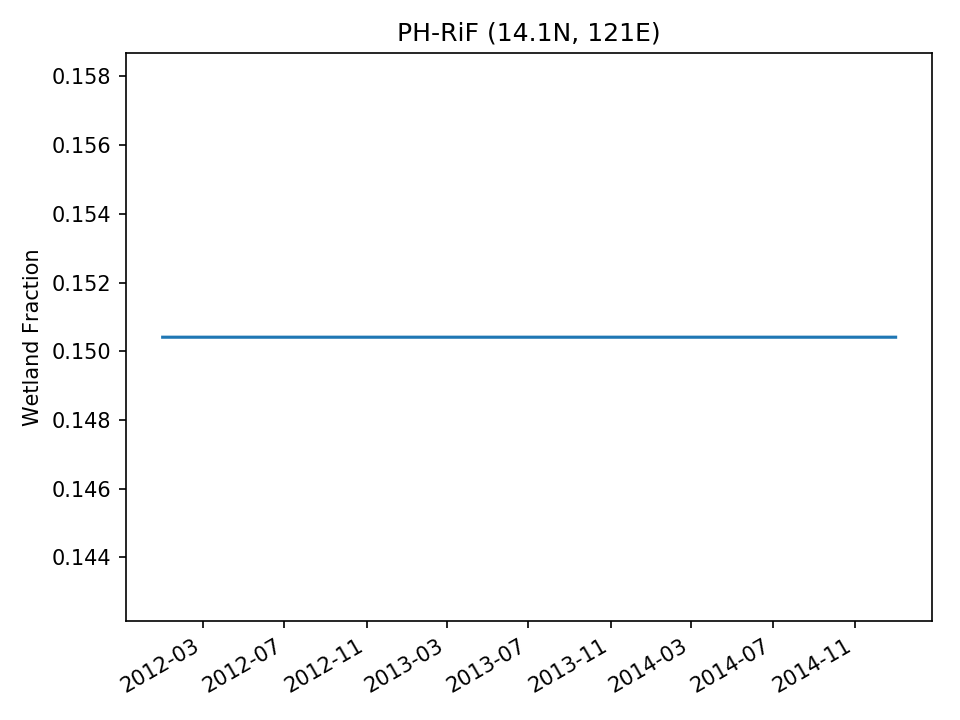 | |
| USE | 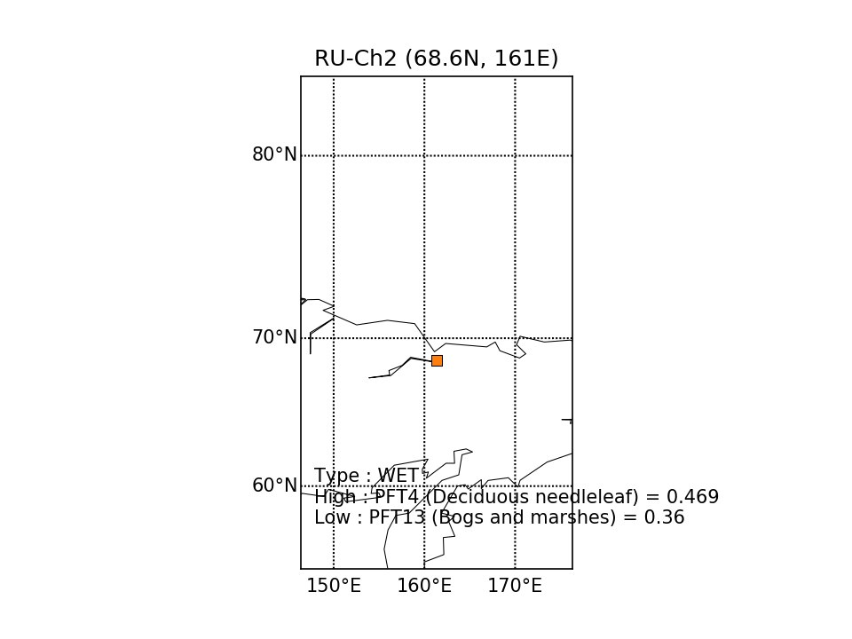 | 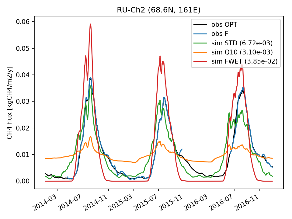 | 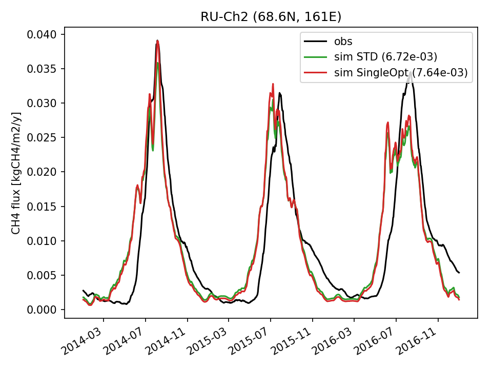 |  | 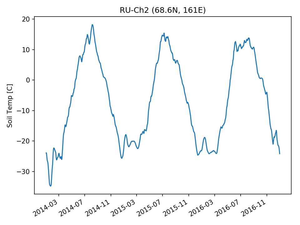 | 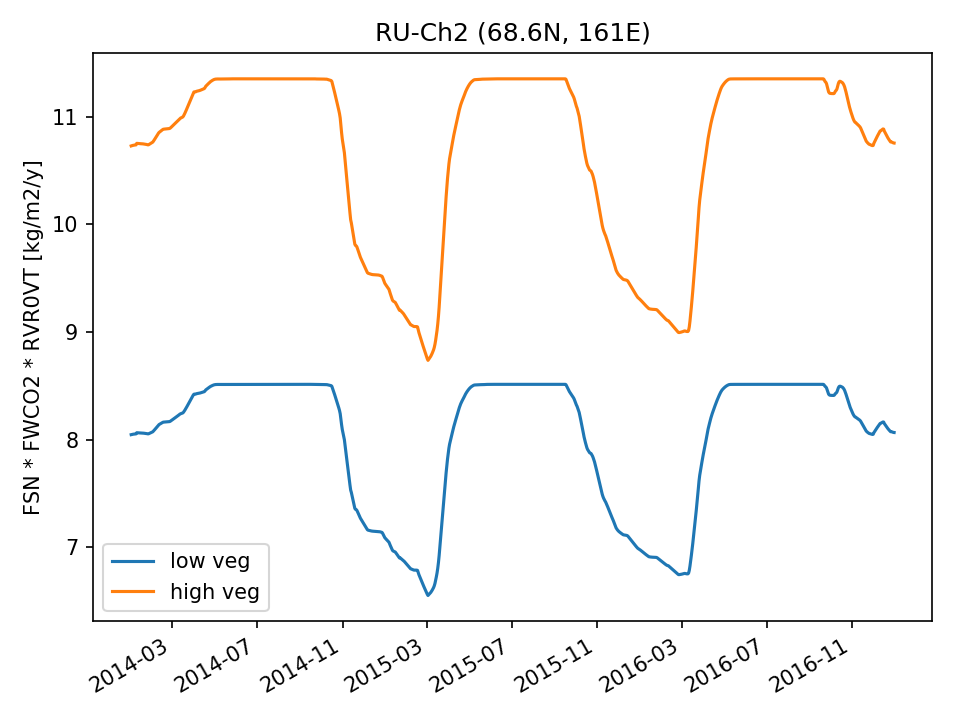 | 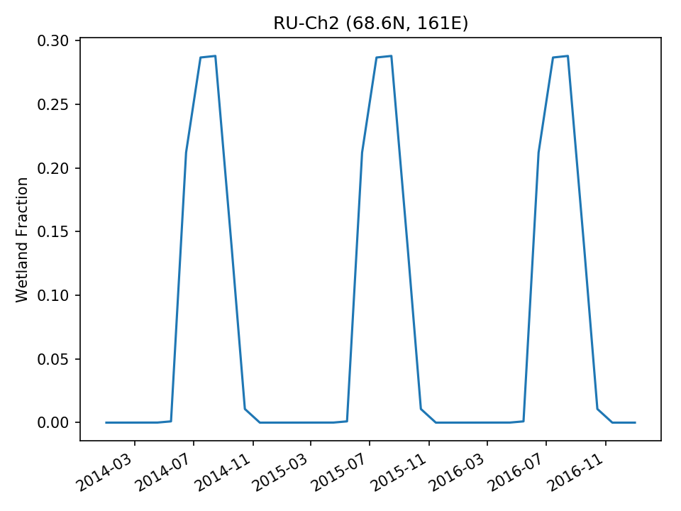 |
| USE |  | 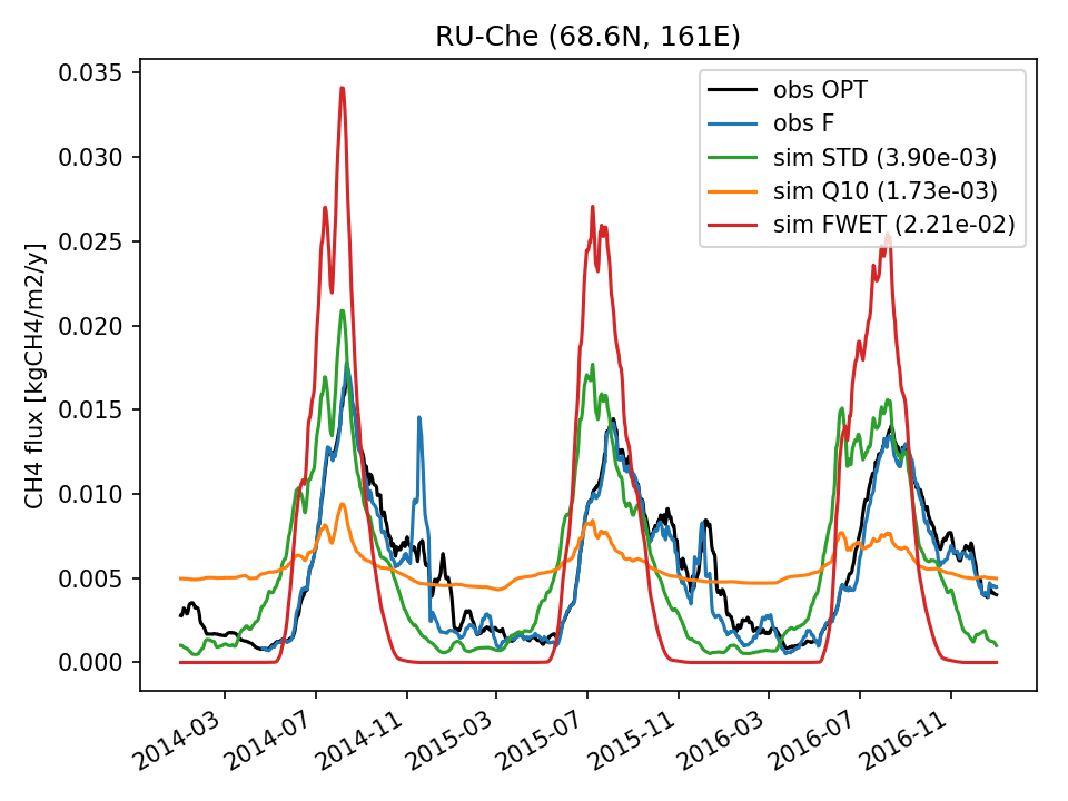 | 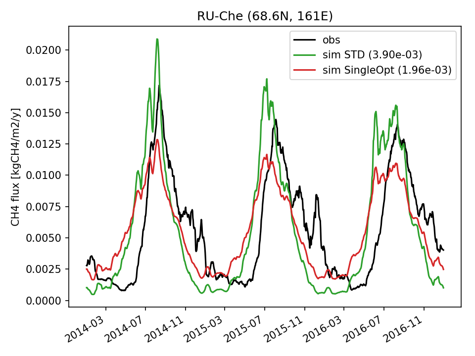 | 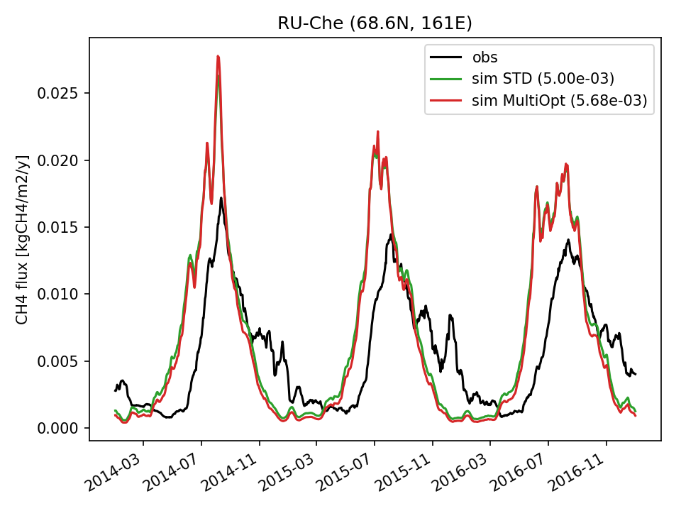 |  | 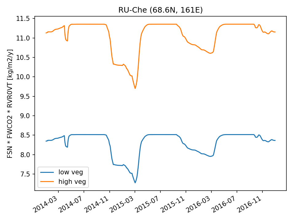 |  |
| USE | 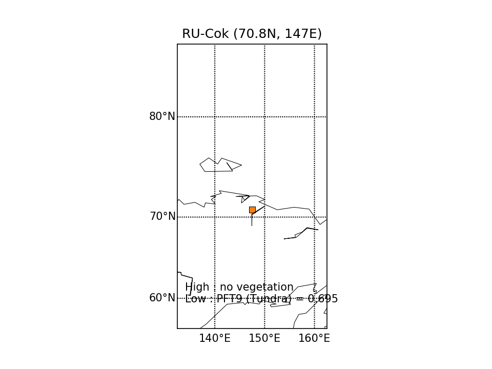 | 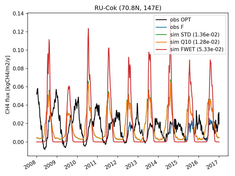 | 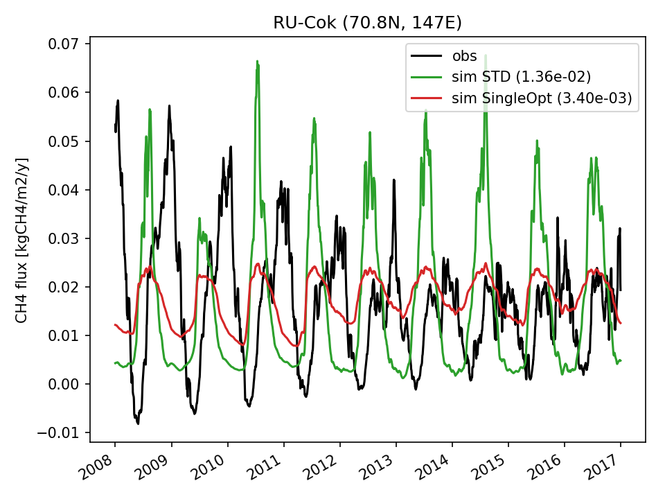 | 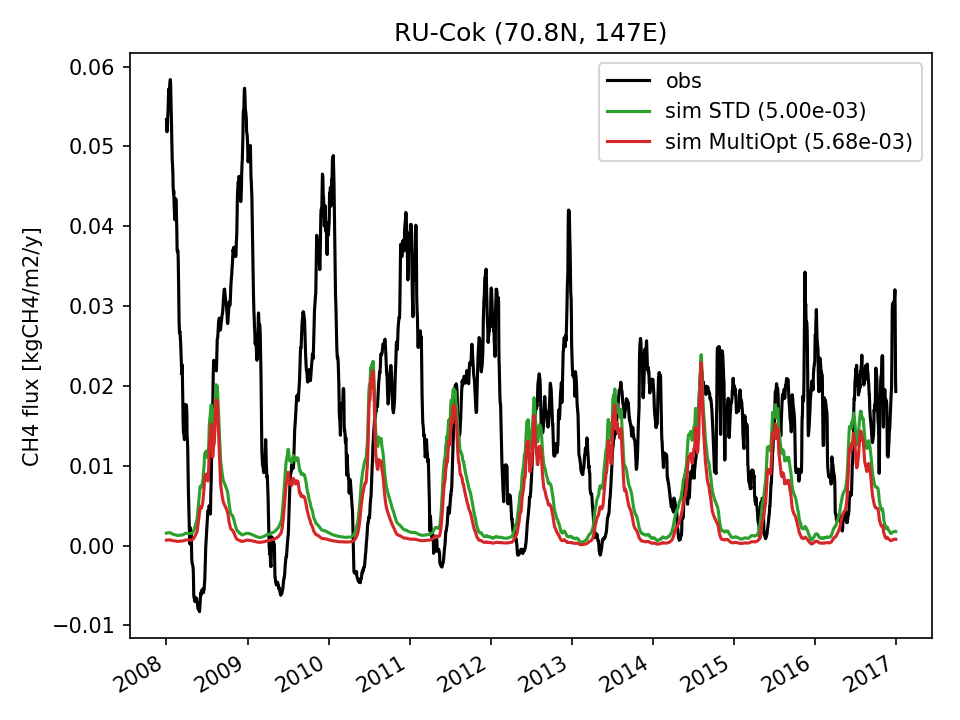 | 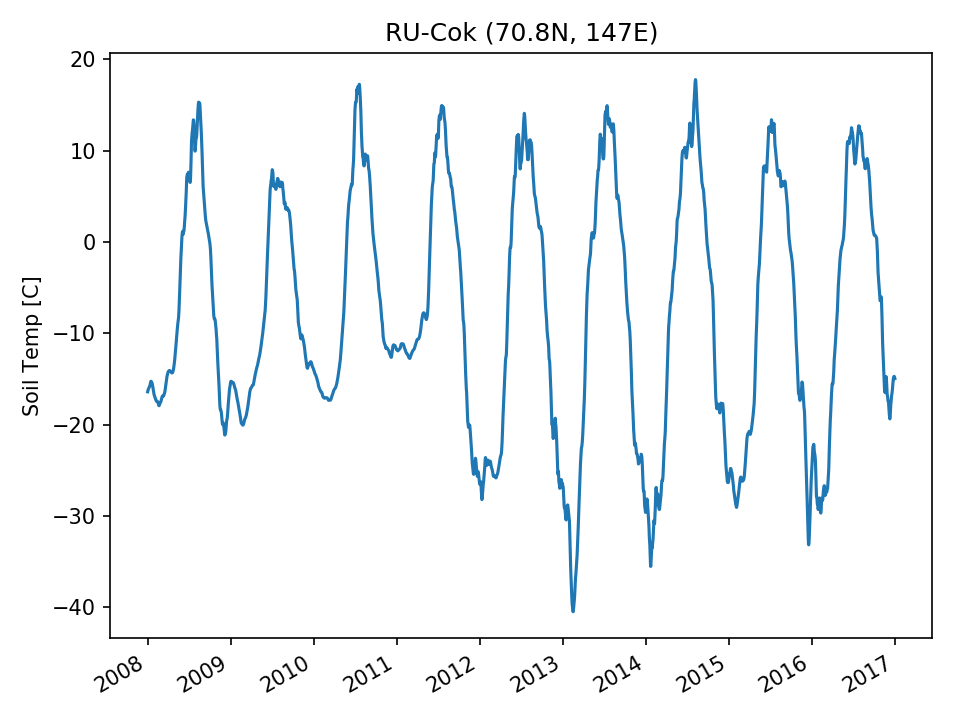 |  |  |
| DROP | 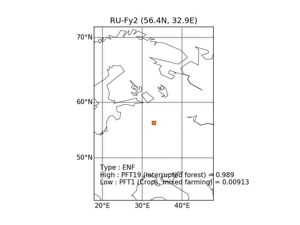 | 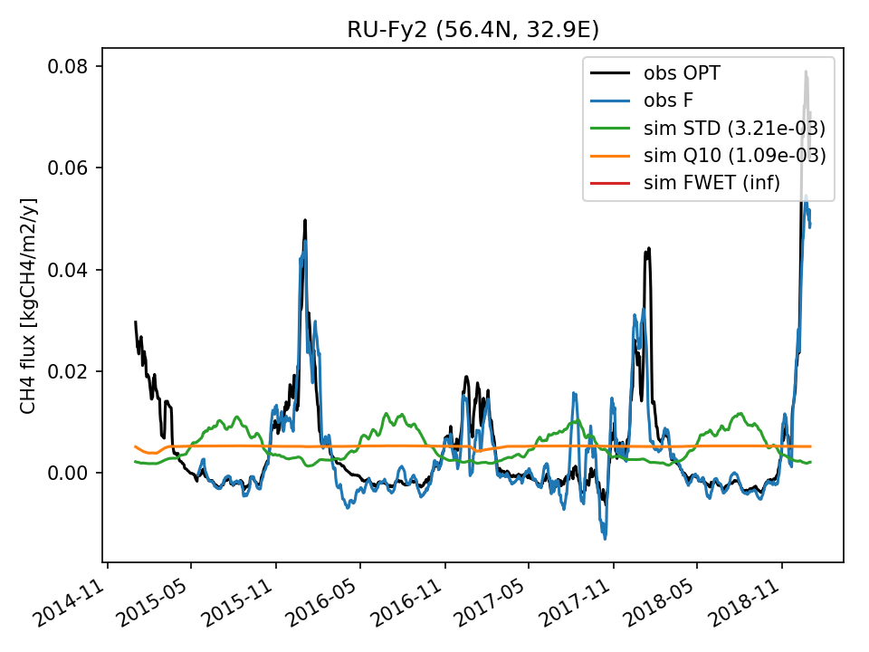 | 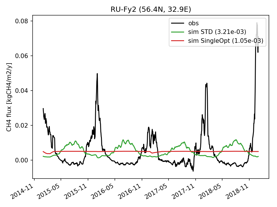 | 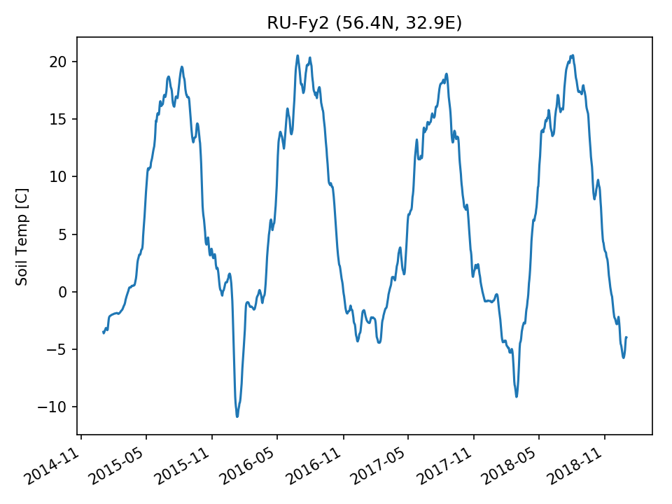 | 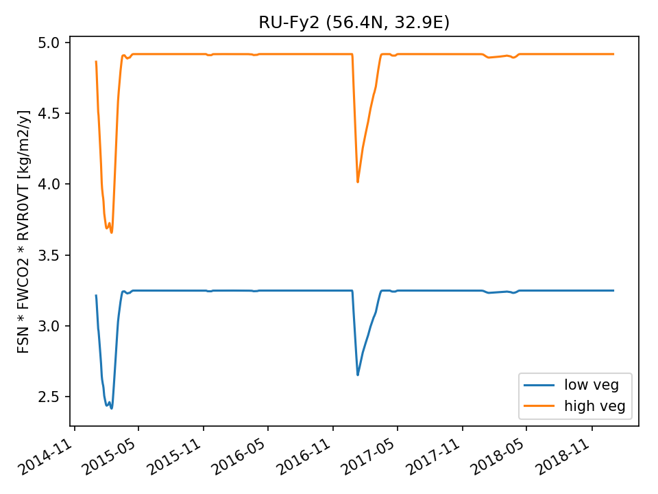 |  | |
| USE | 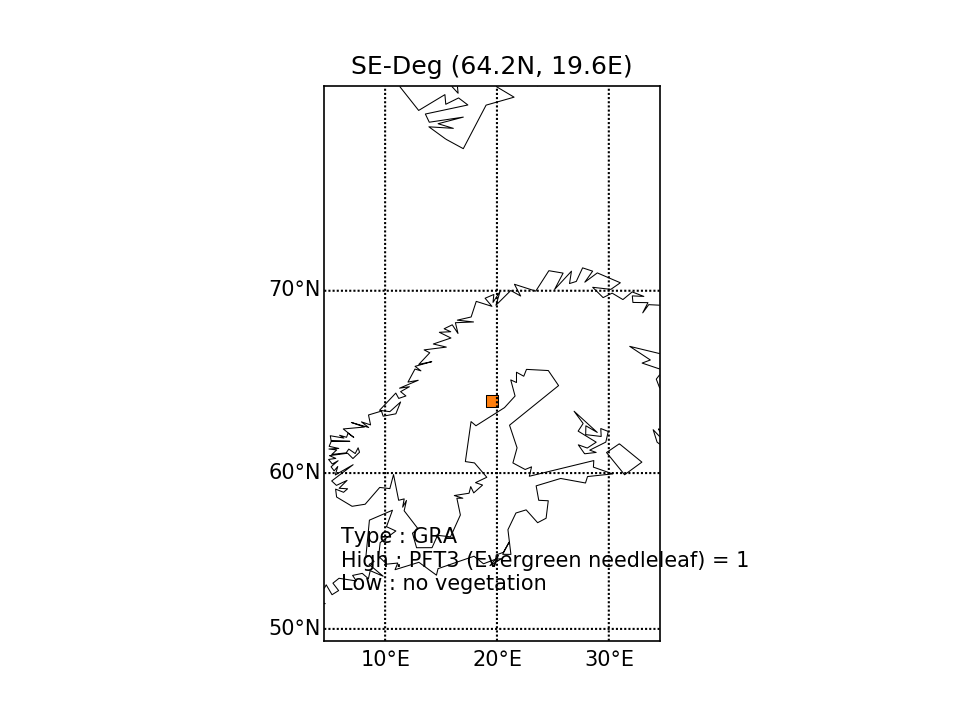 | 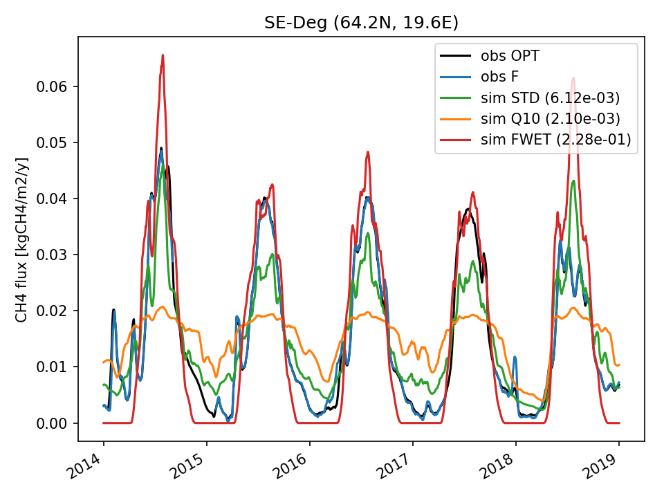 | 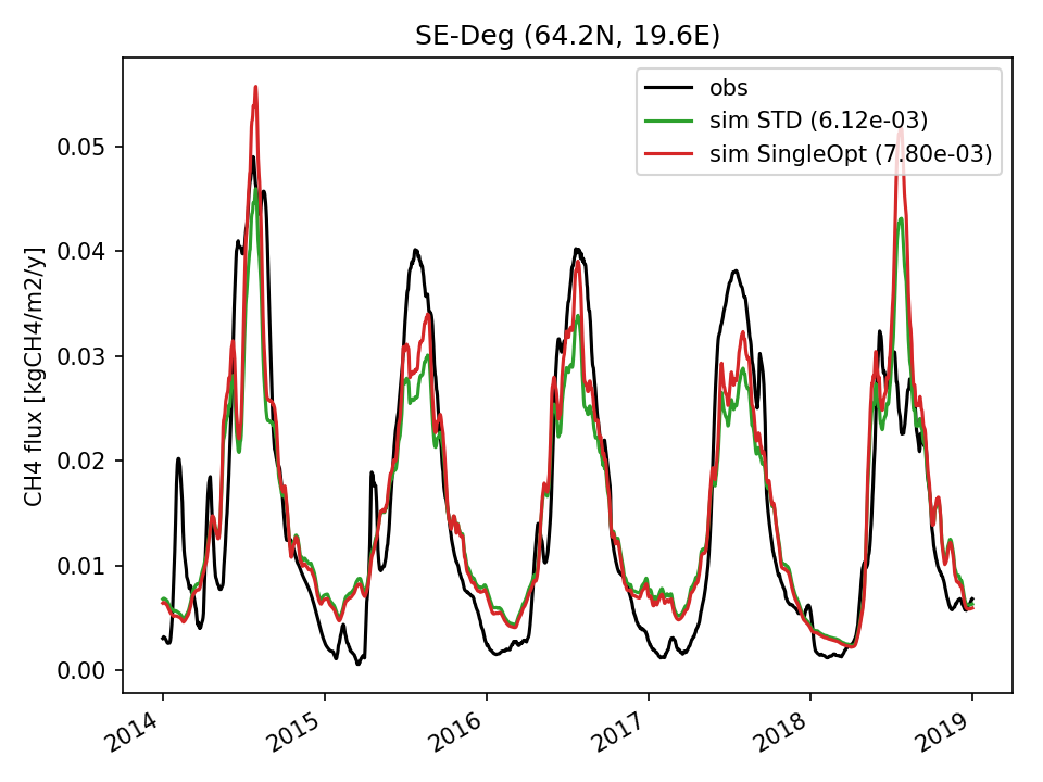 | 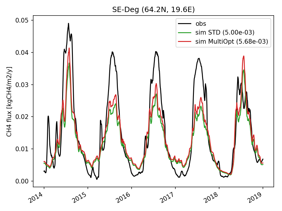 | 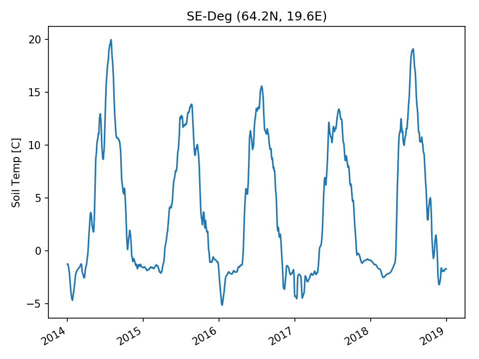 |  | 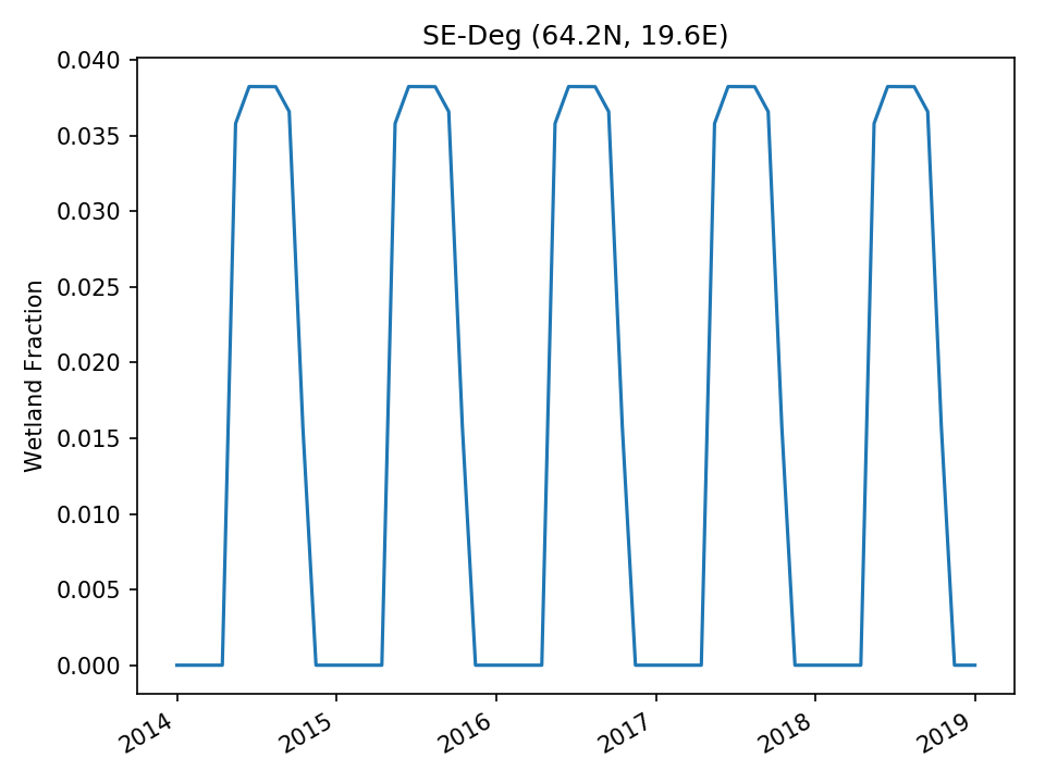 |
| DROP | 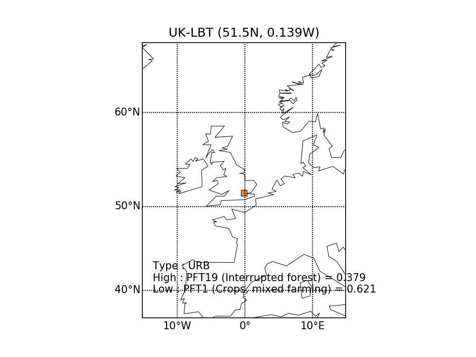 | 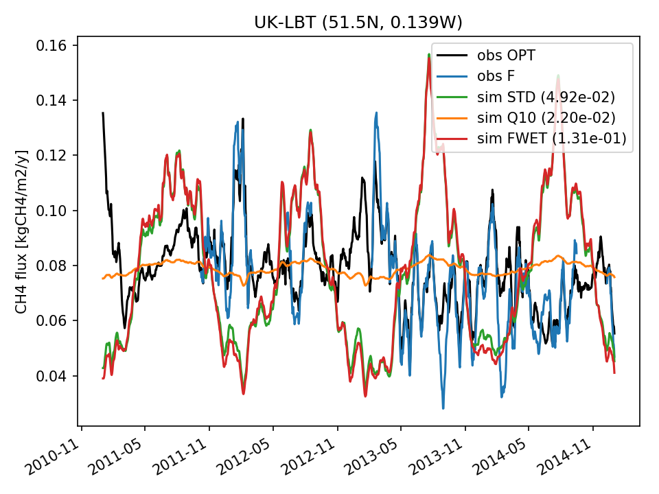 | 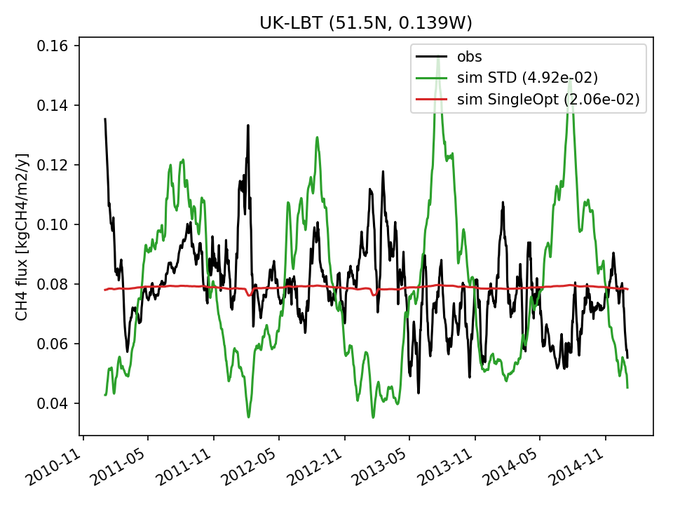 | 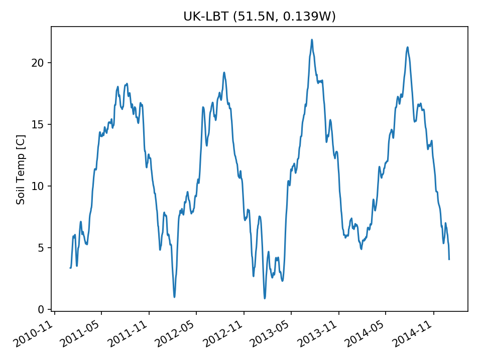 | 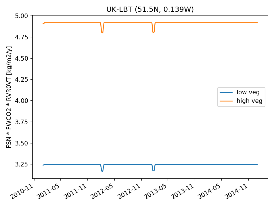 | 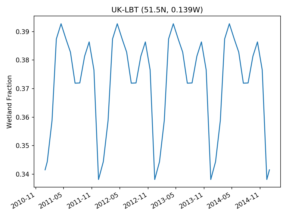 | |
| USE |  | 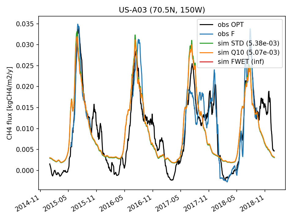 | 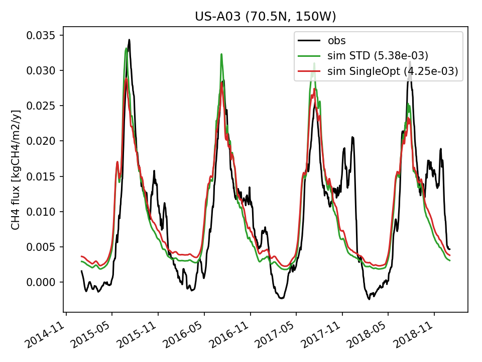 | 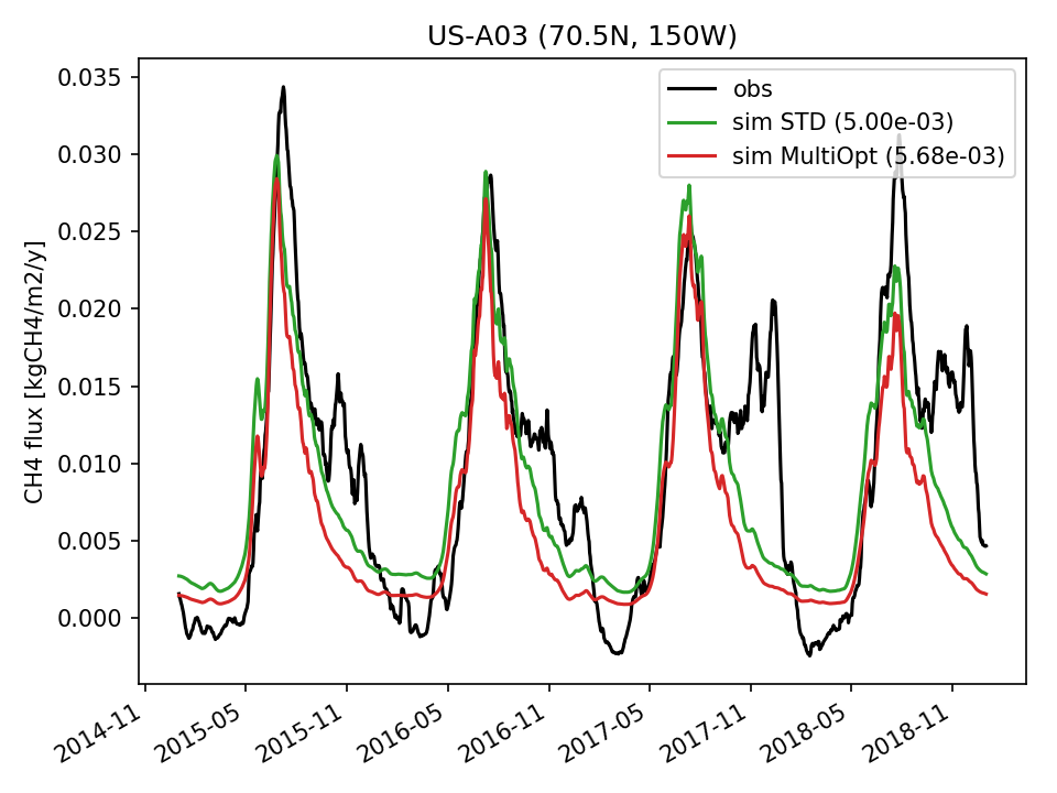 | 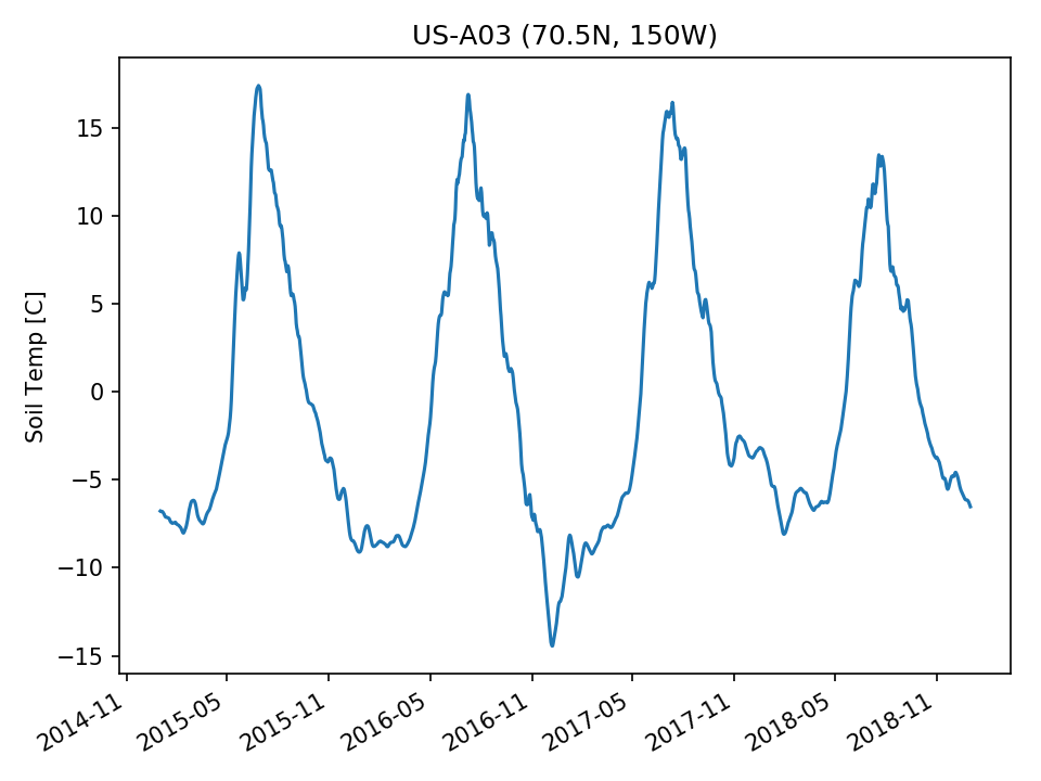 | 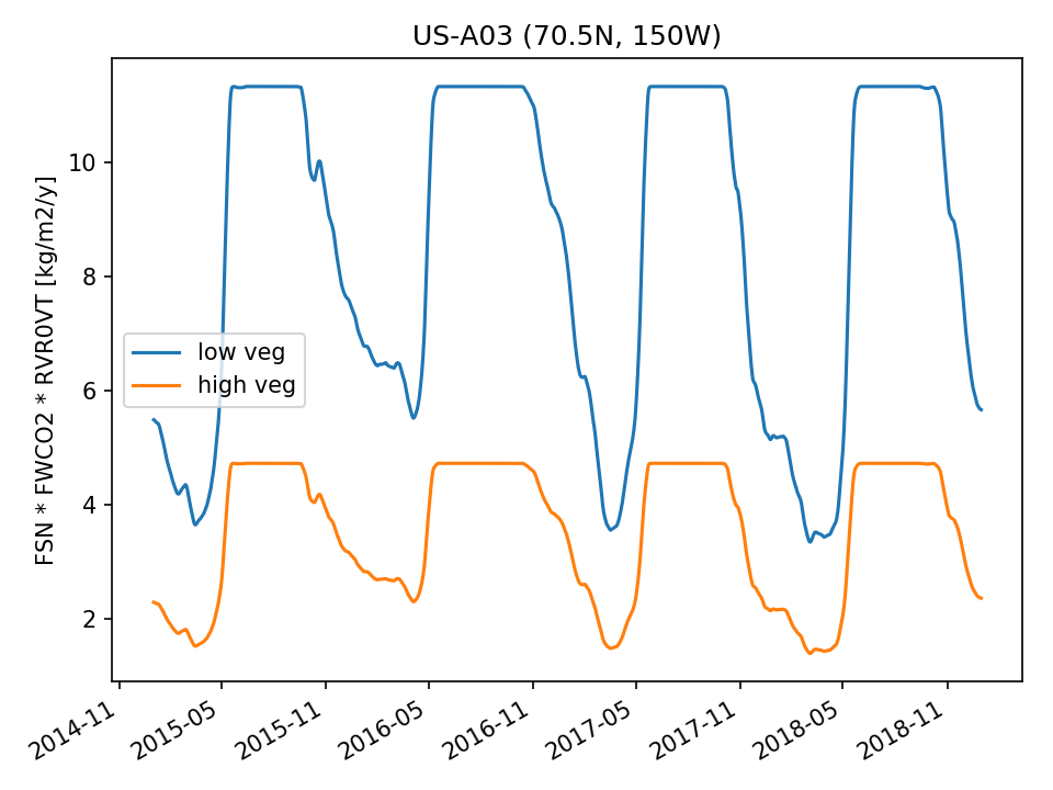 |  |
| USE | 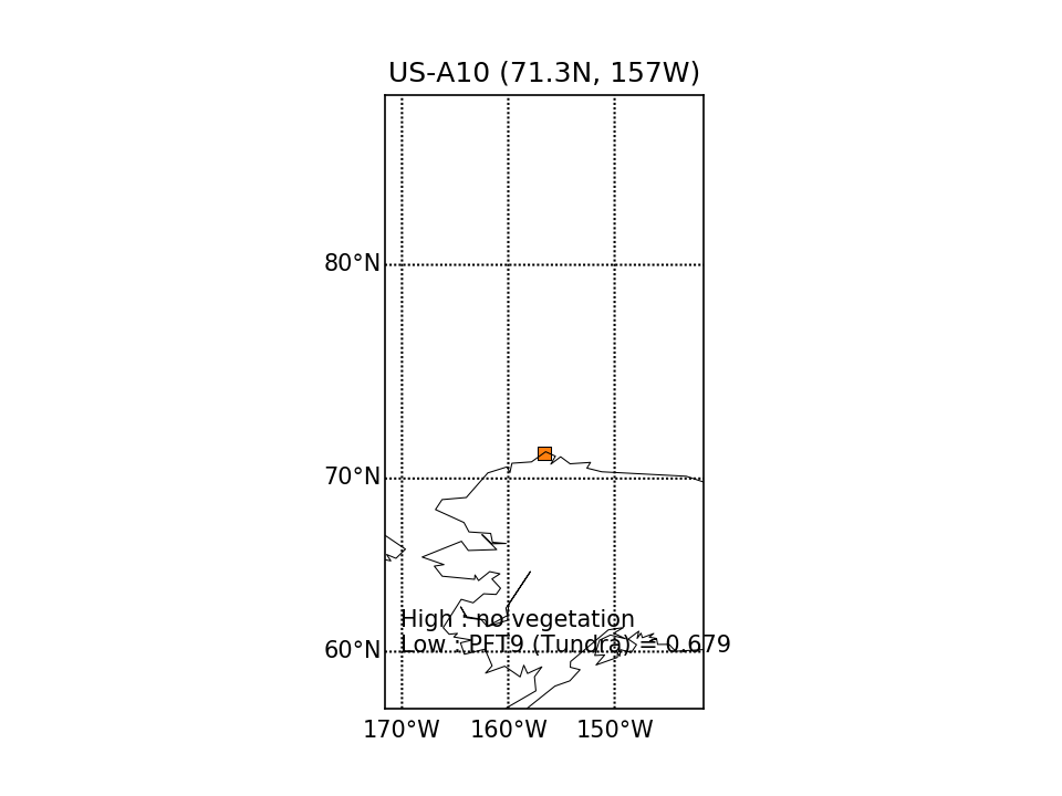 | 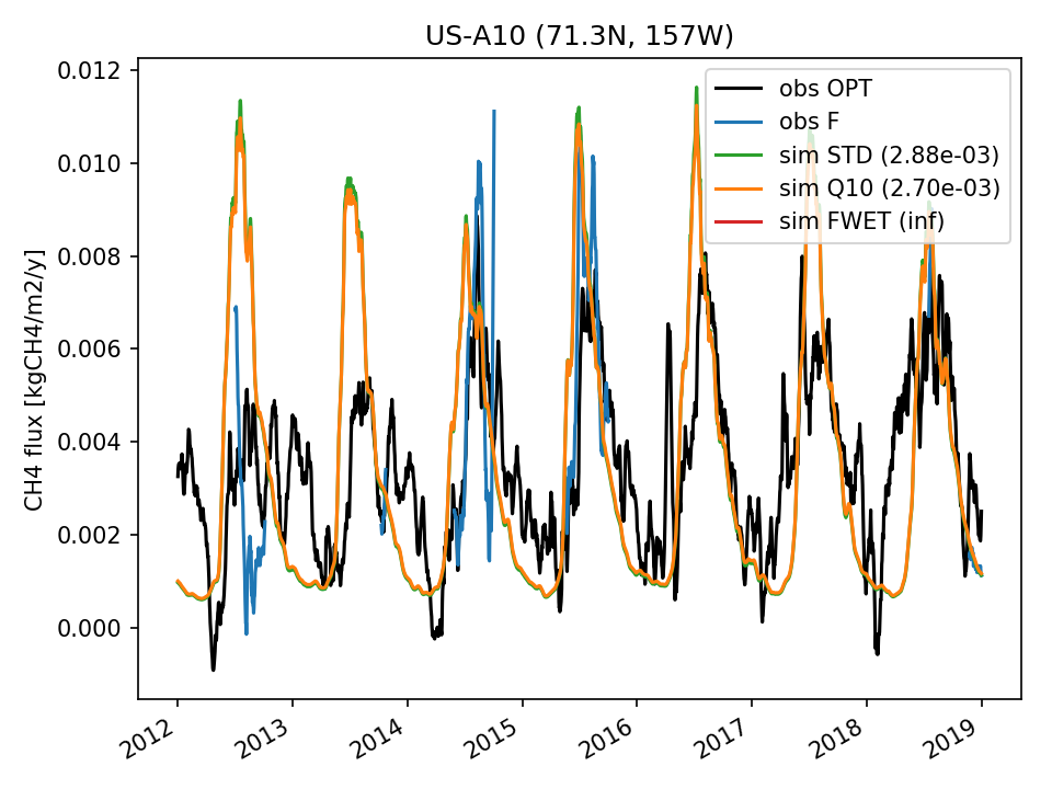 | 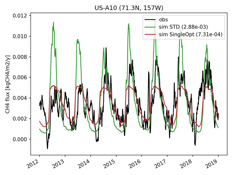 | 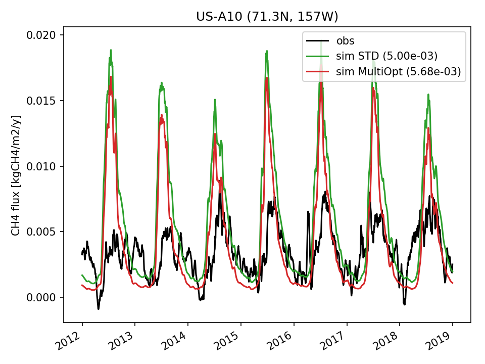 | 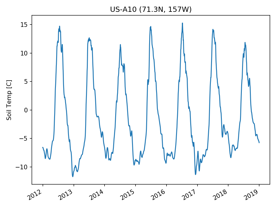 | 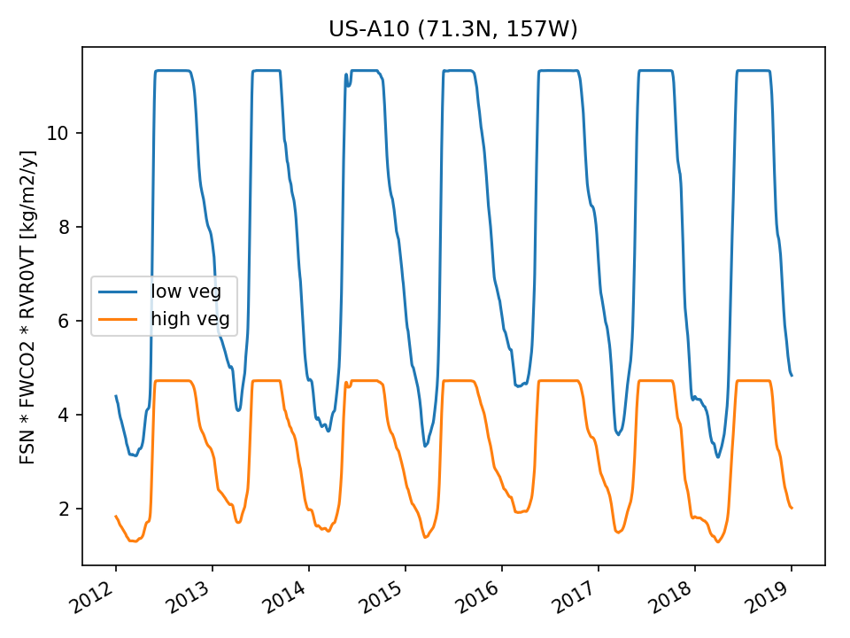 |  |
| USE | 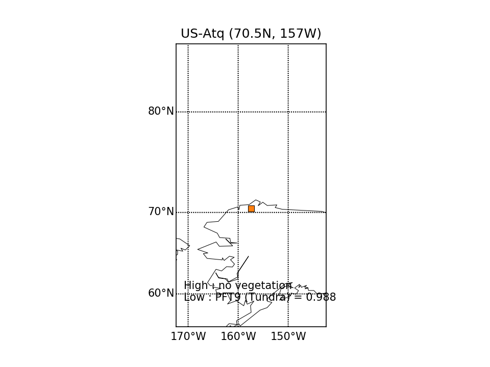 |  | 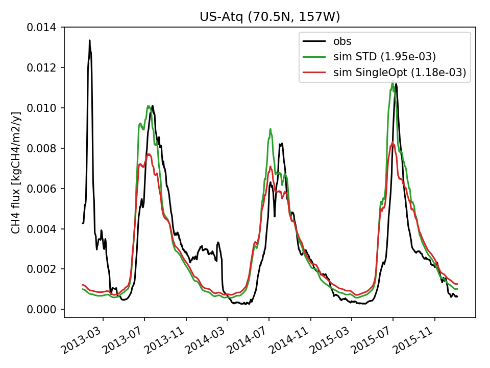 | 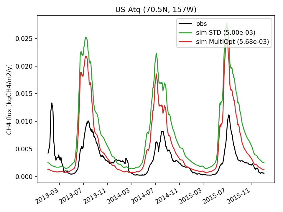 | 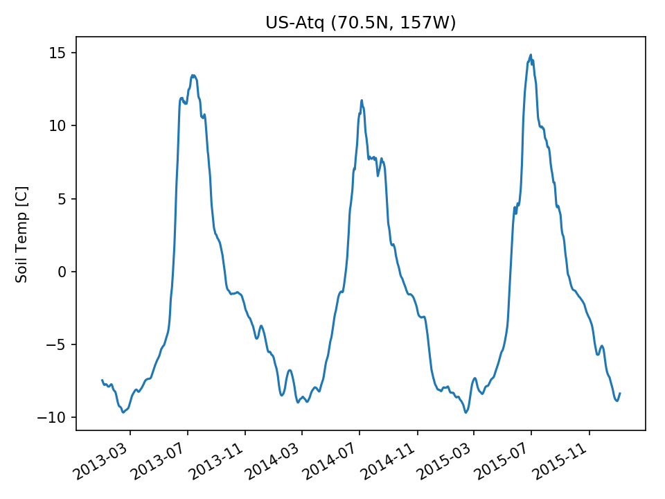 | 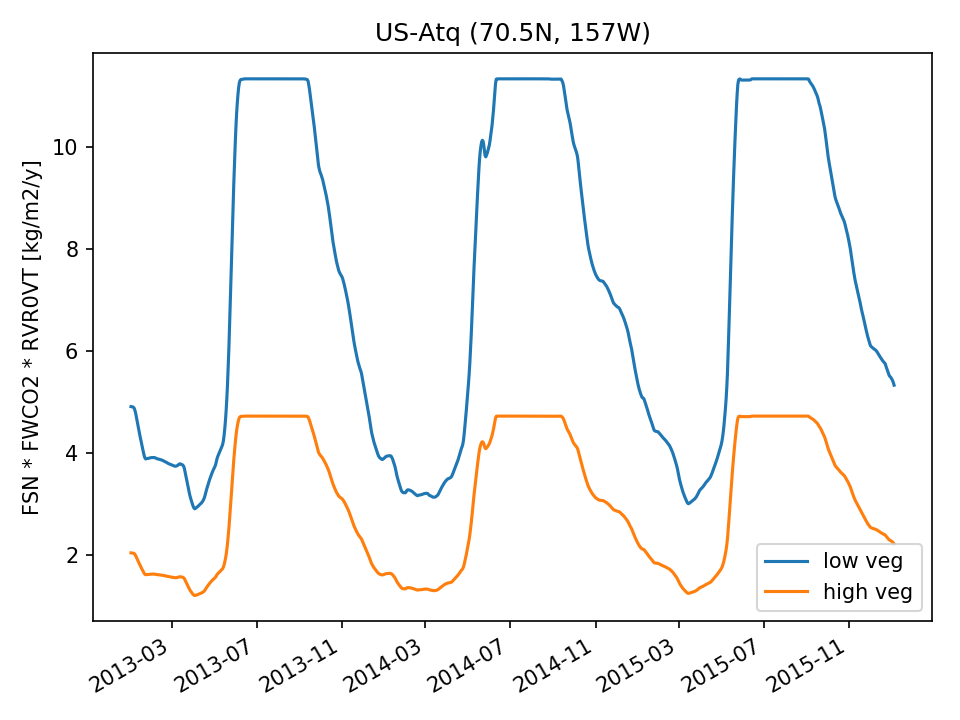 | 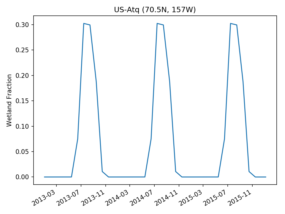 |
| USE |  |  | 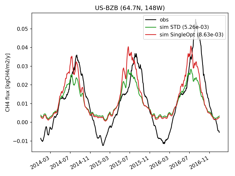 | 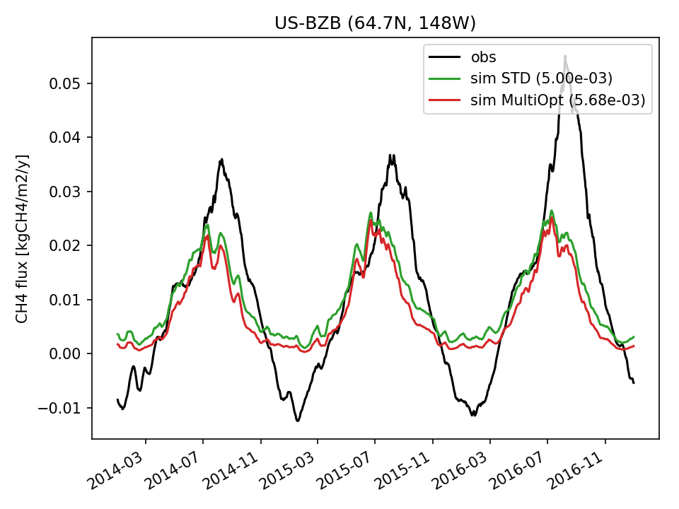 | 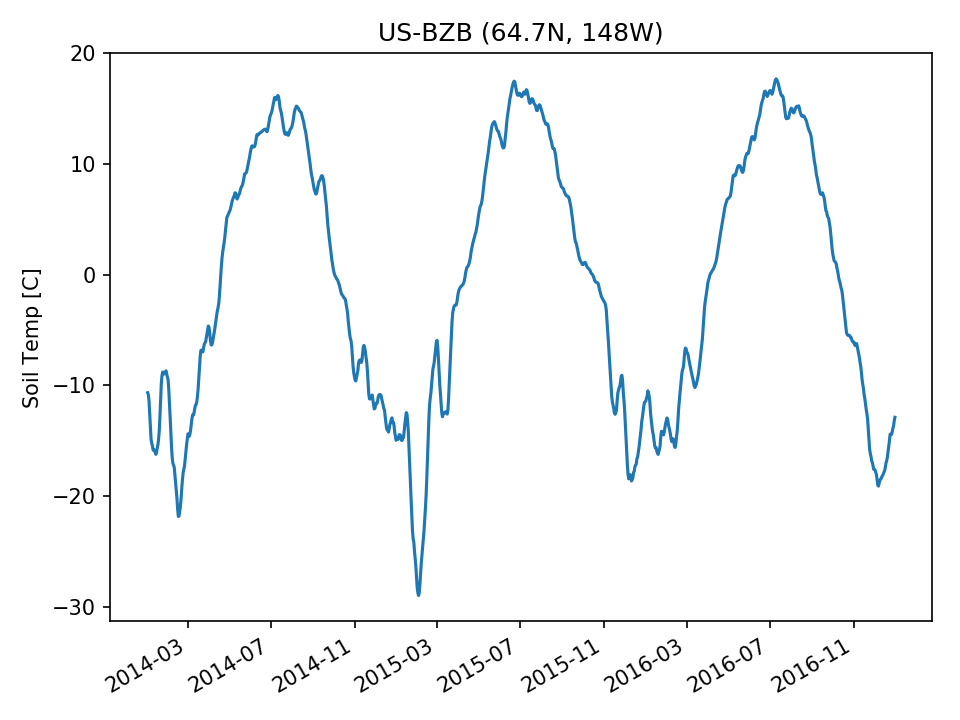 | 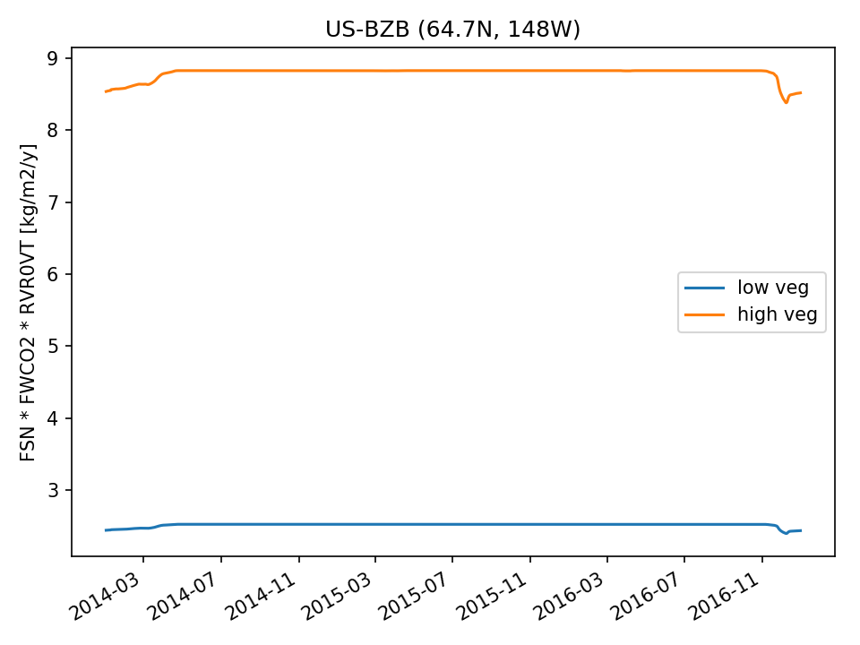 | 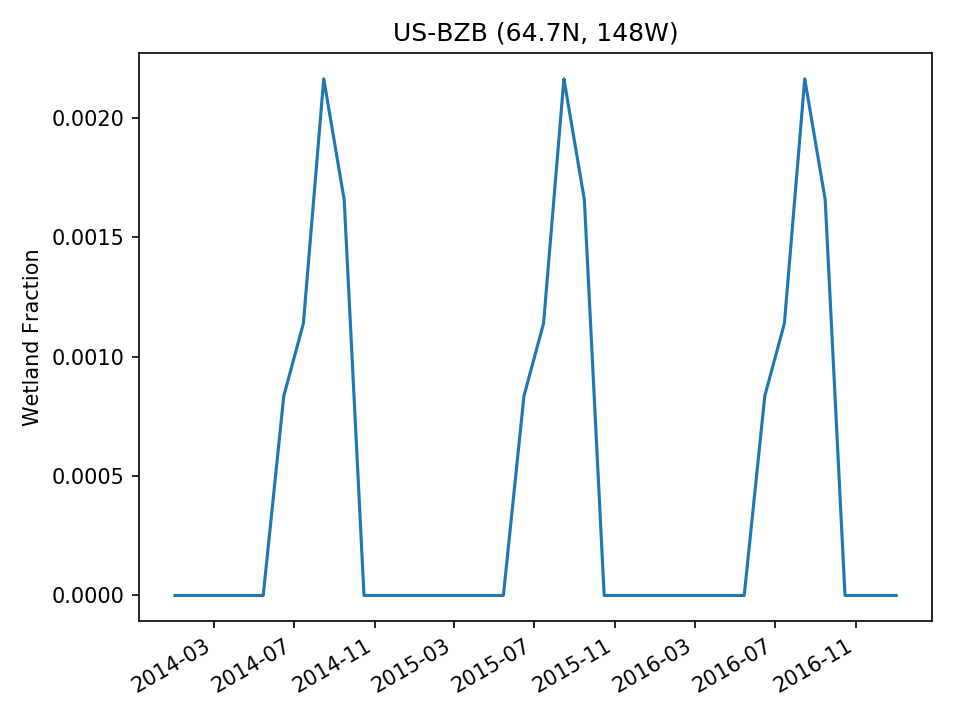 |
| USE |  |  |  | 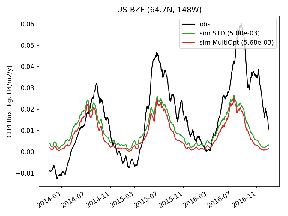 |  | 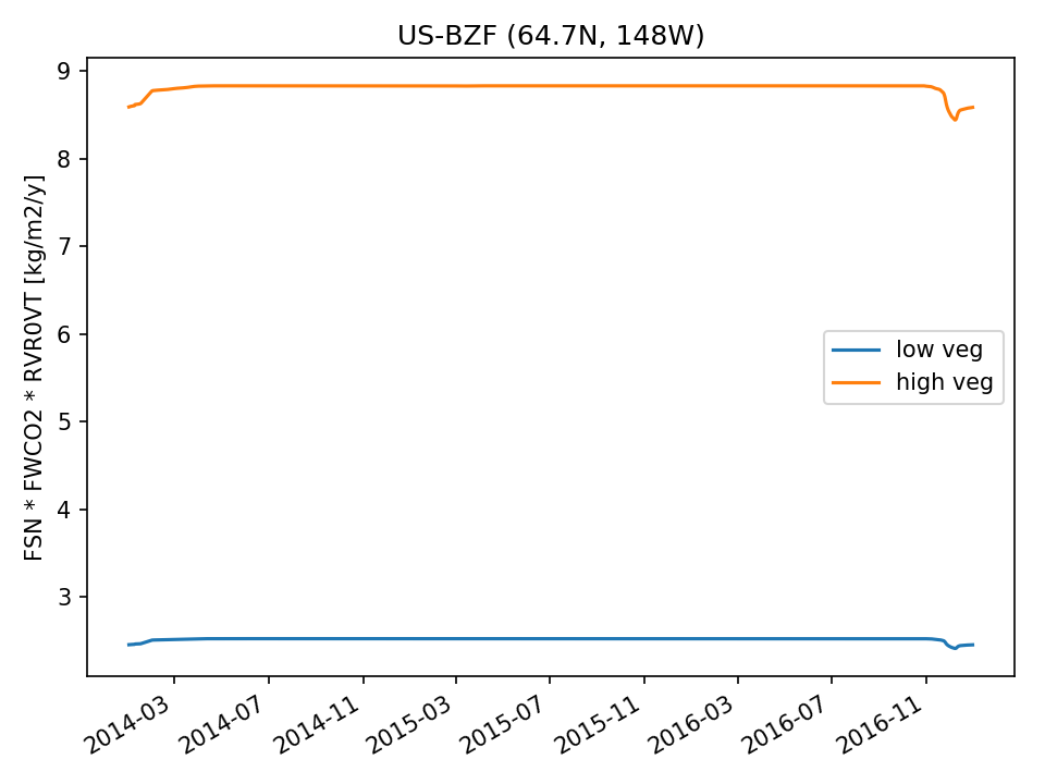 |  |
| USE | 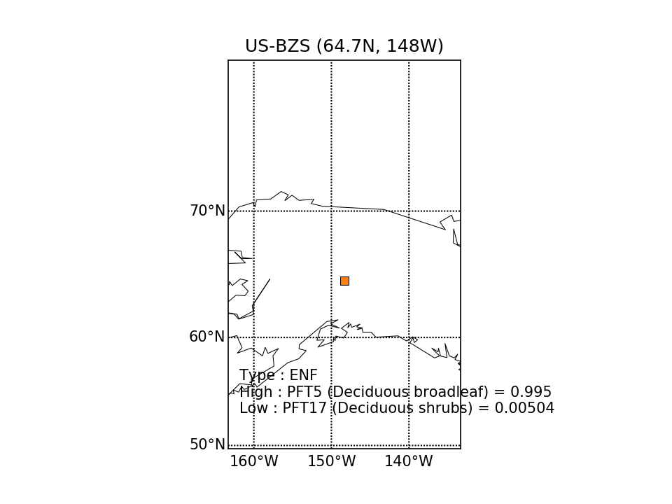 | 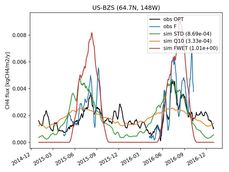 | 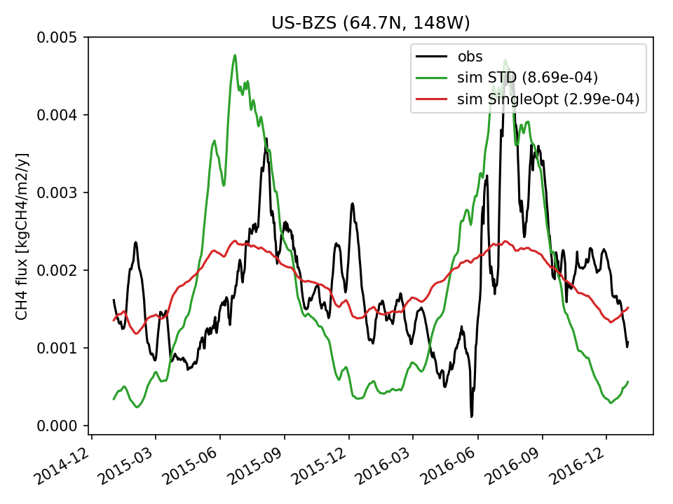 | 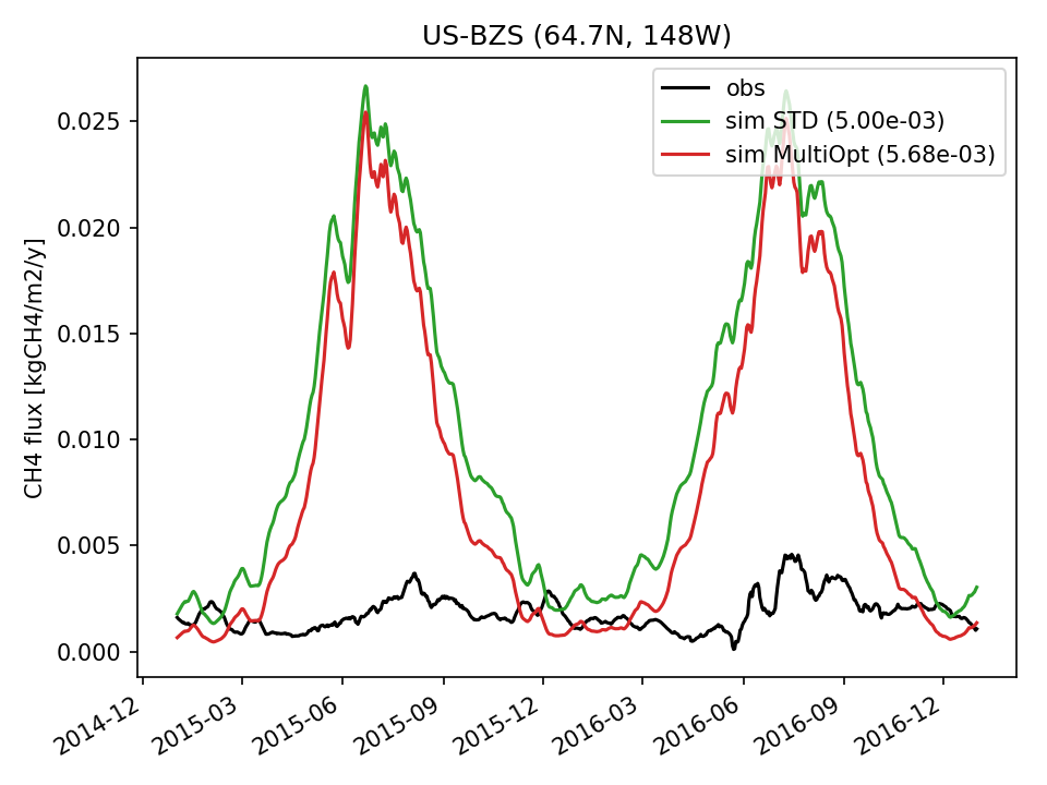 |  |  |  |
| USE |  | 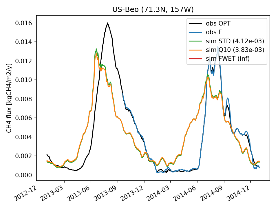 |  | 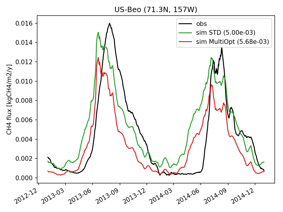 | 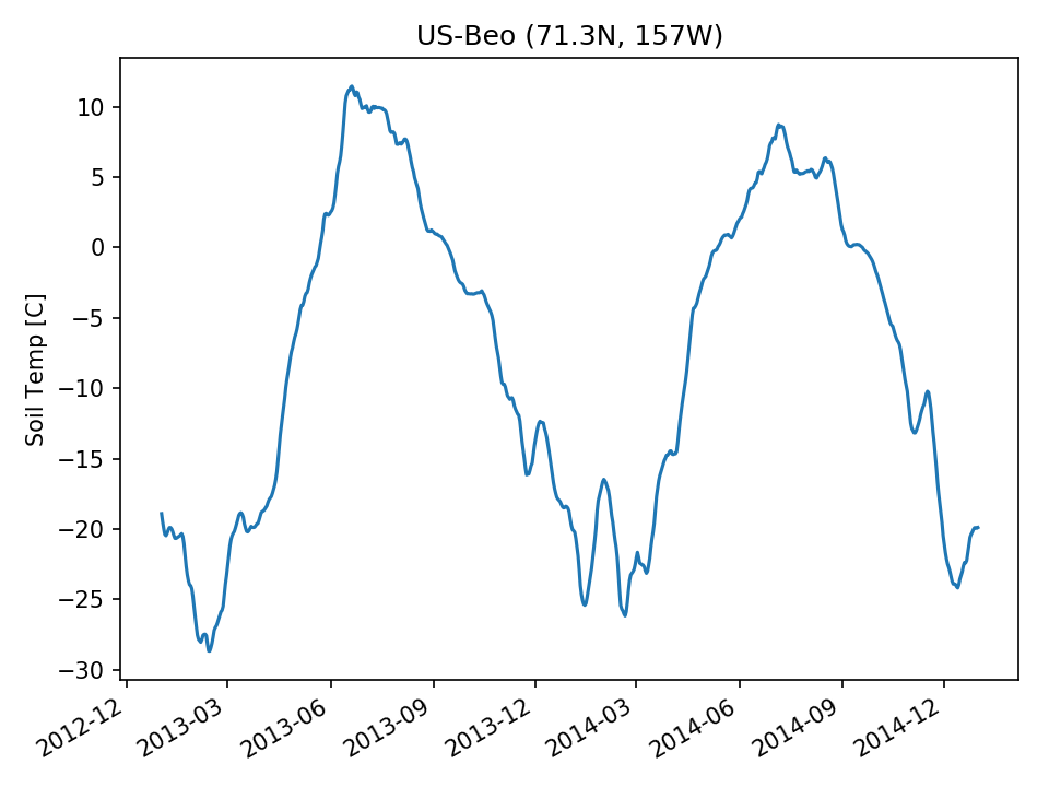 | 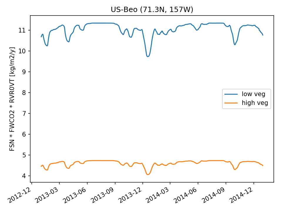 | 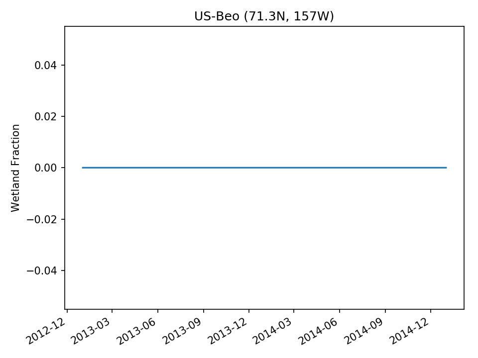 |
| DROP |  | 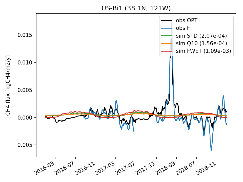 | 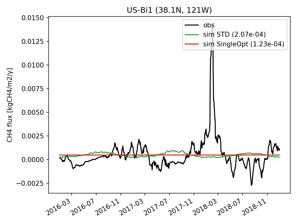 | 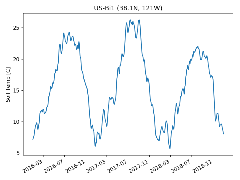 | 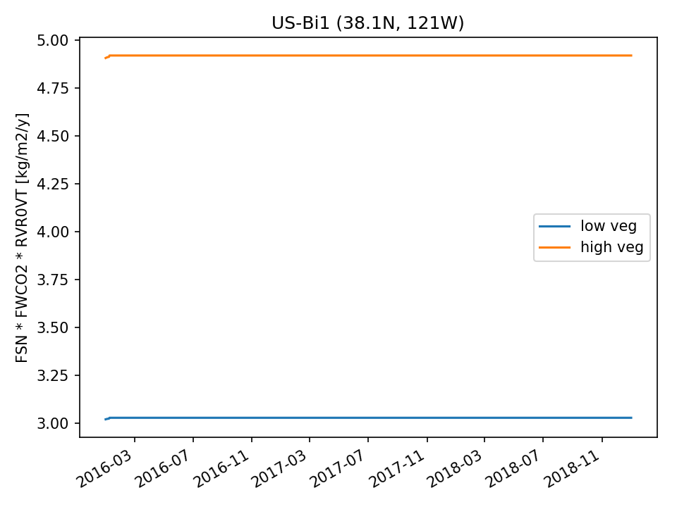 |  | |
| DROP |  | 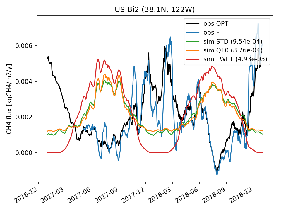 | 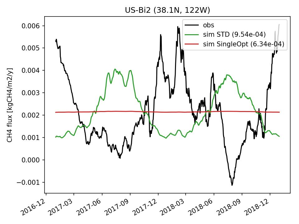 | 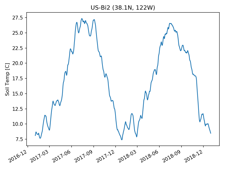 |  | 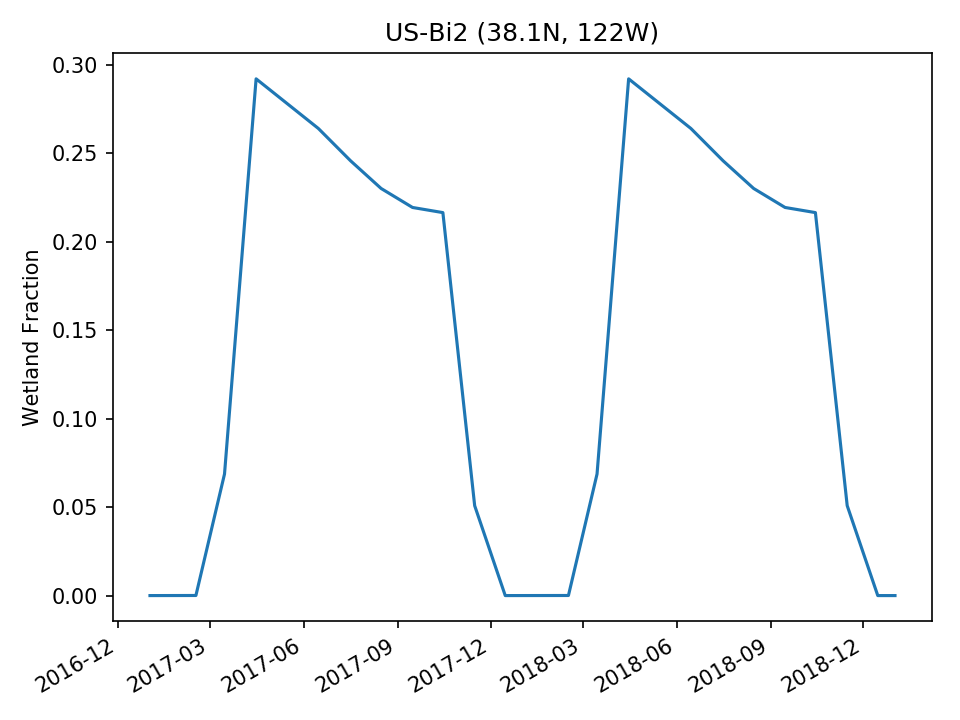 | |
| USE |  | 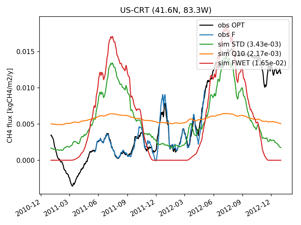 | 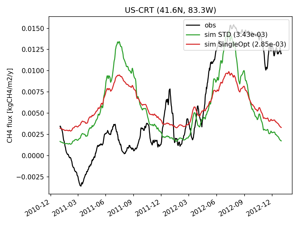 | 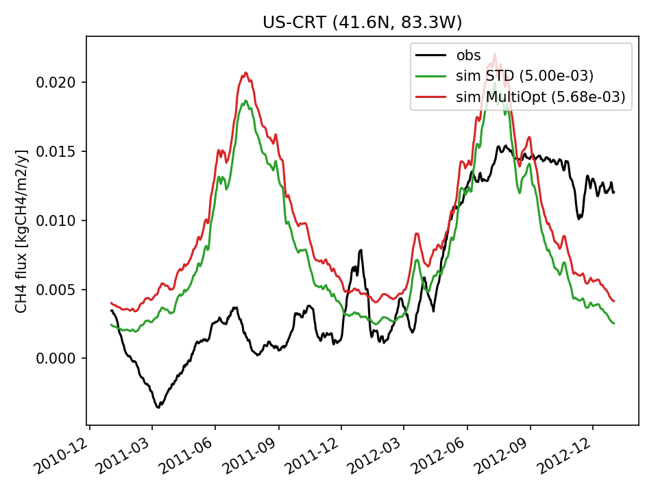 |  | 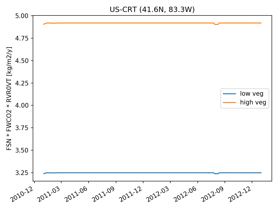 | 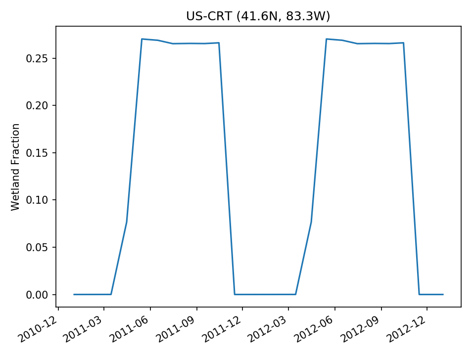 |
| USE | 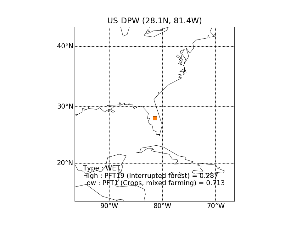 | 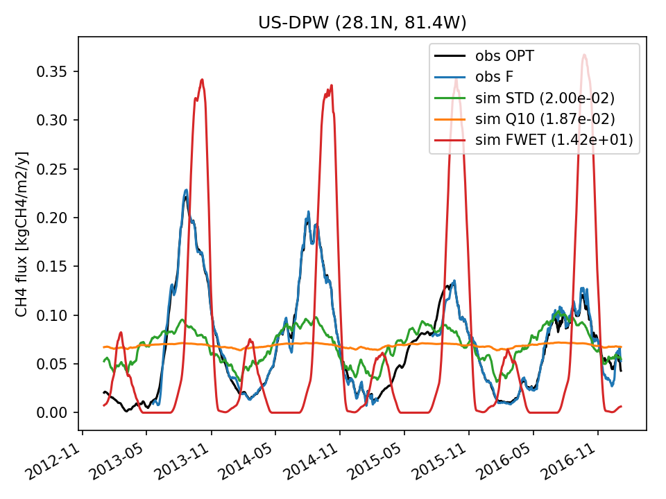 | 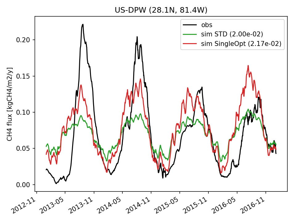 | 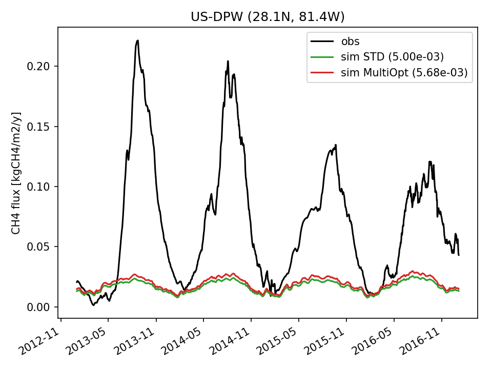 |  |  | 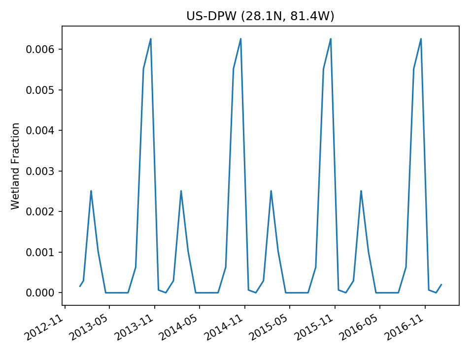 |
| DROP | 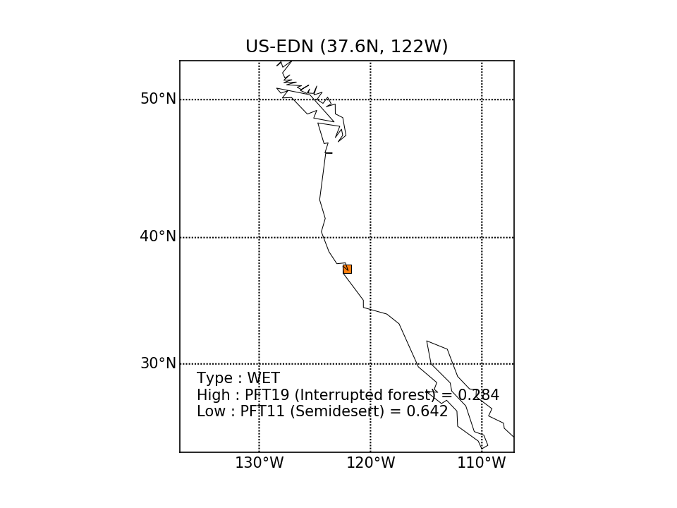 |  |  | 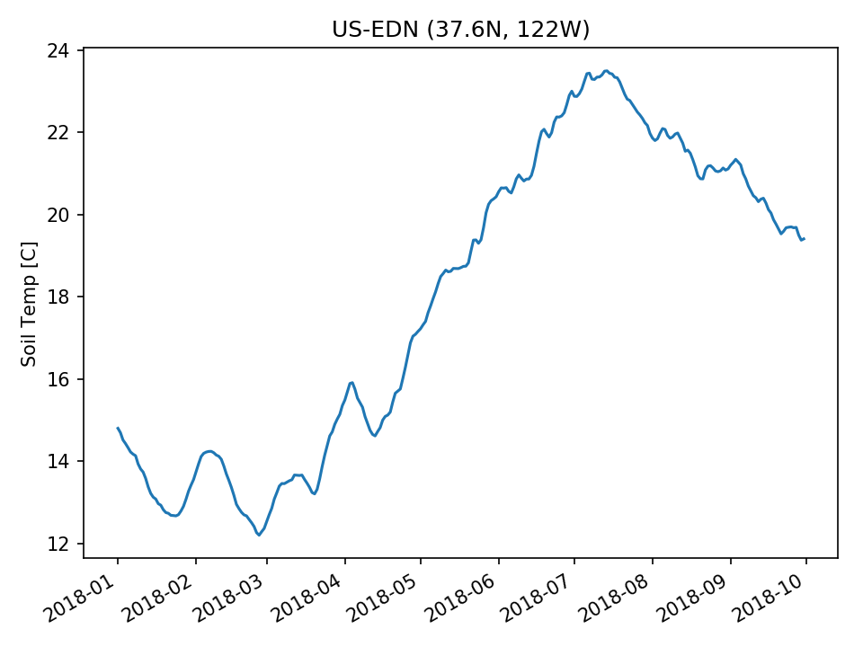 | 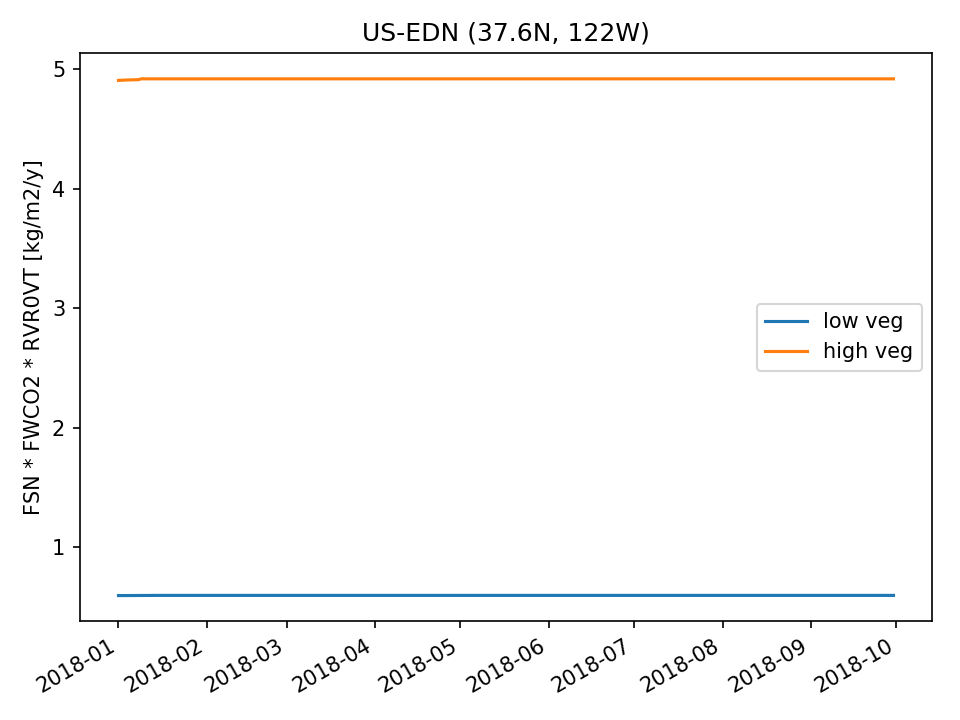 |  | |
| DROP |  |  |  | 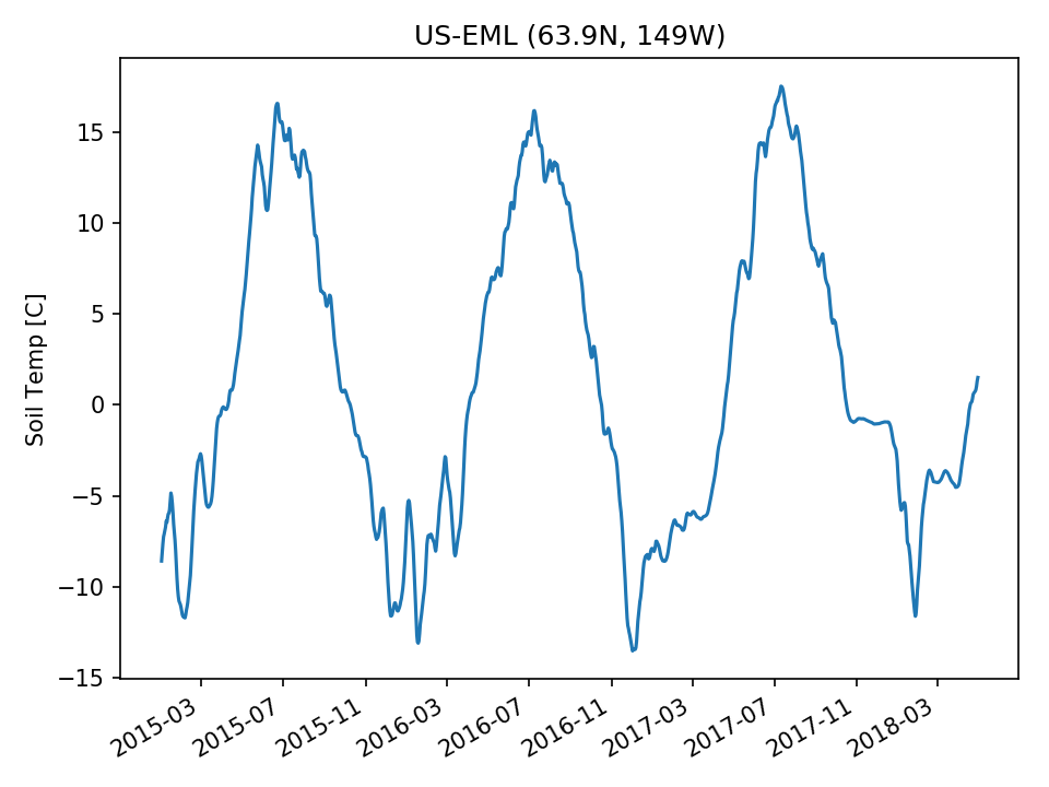 | 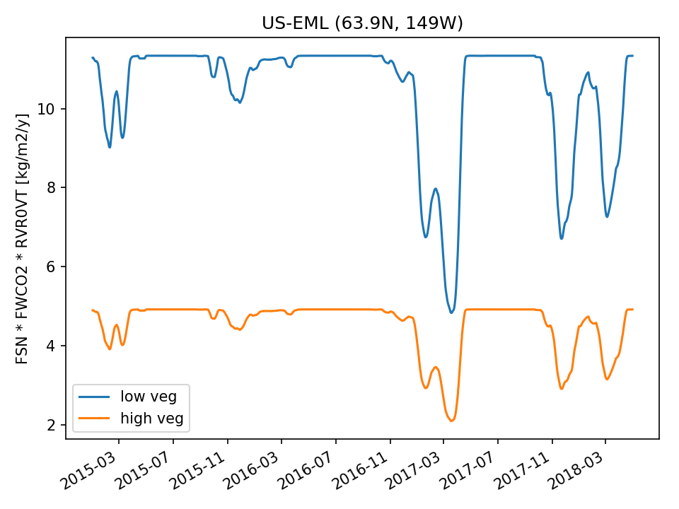 | 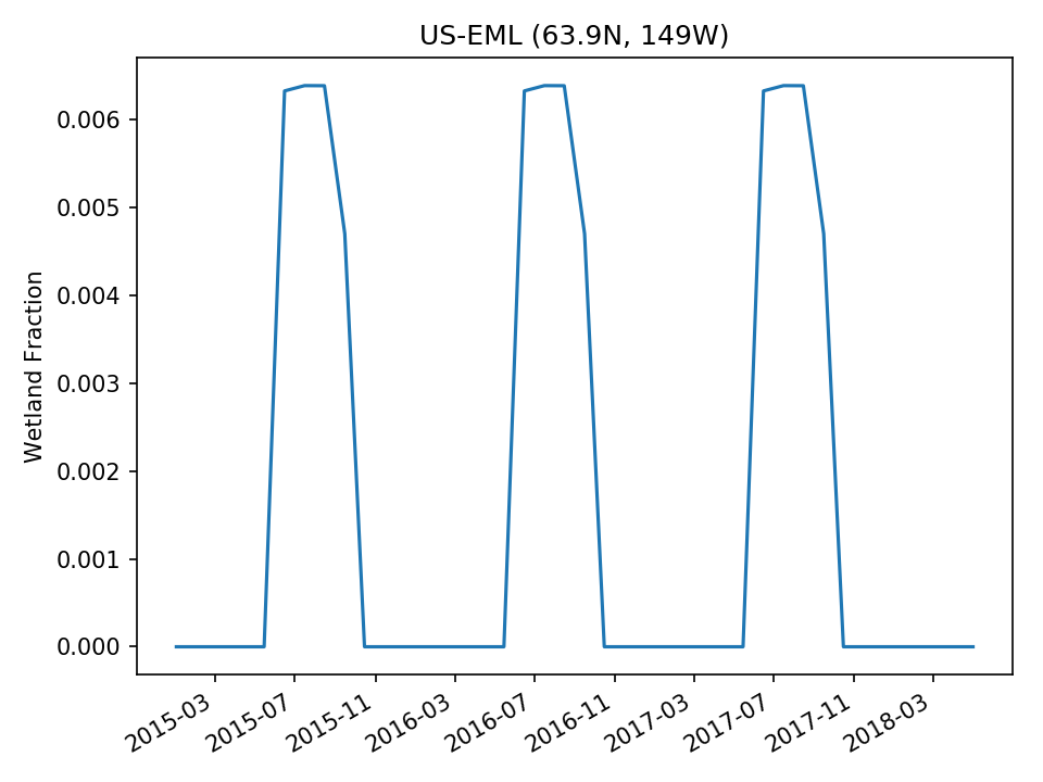 | |
| USE |  | 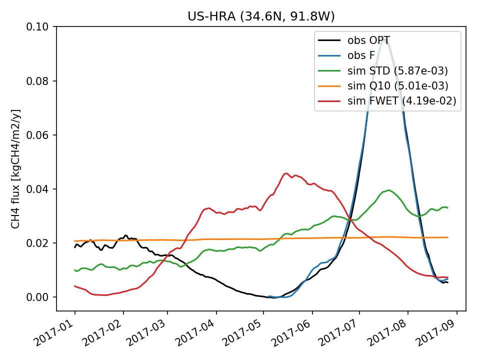 | 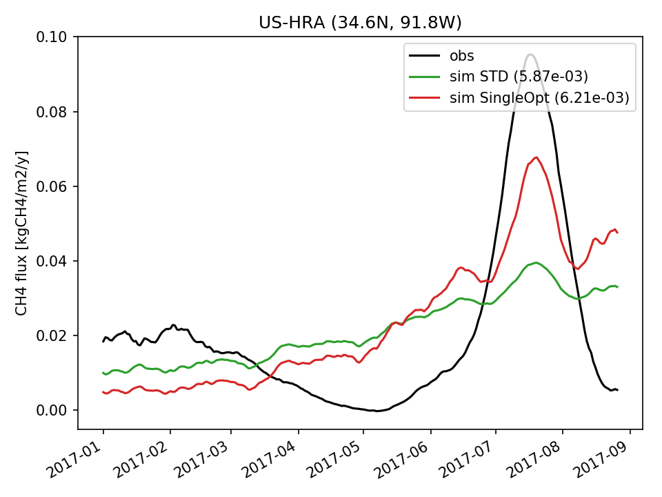 | 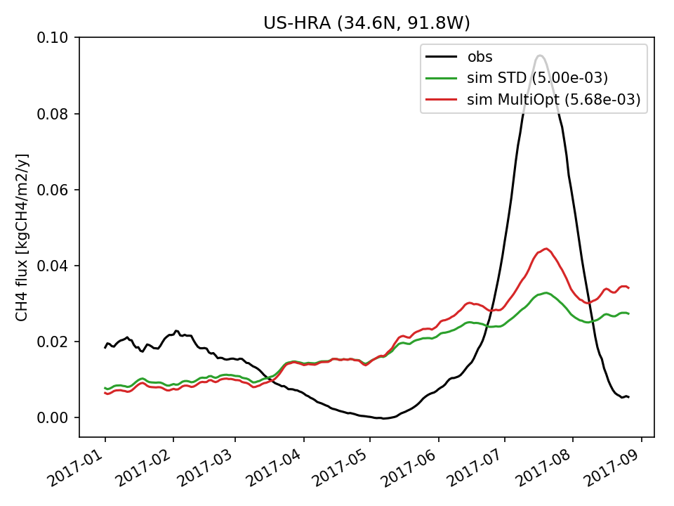 |  |  | 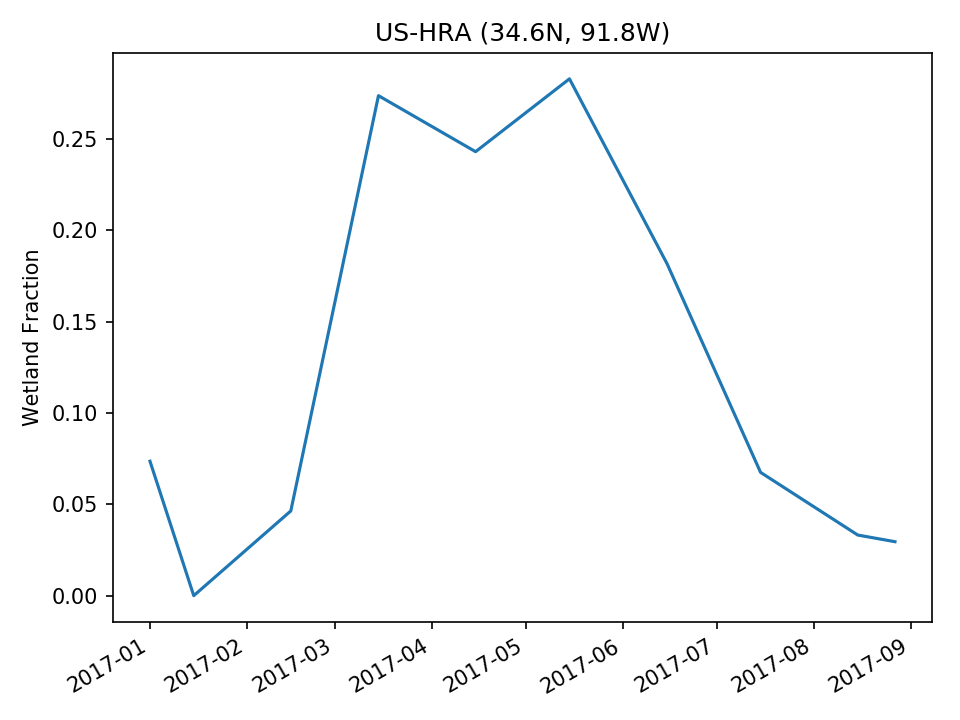 |
| USE |  | 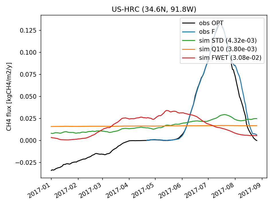 | 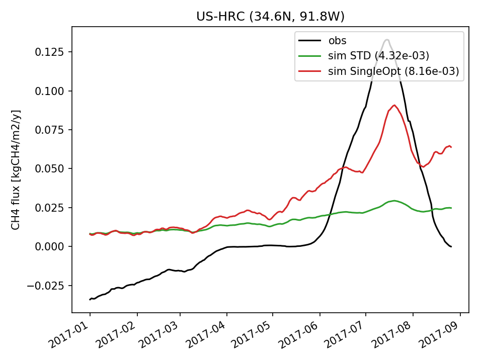 | 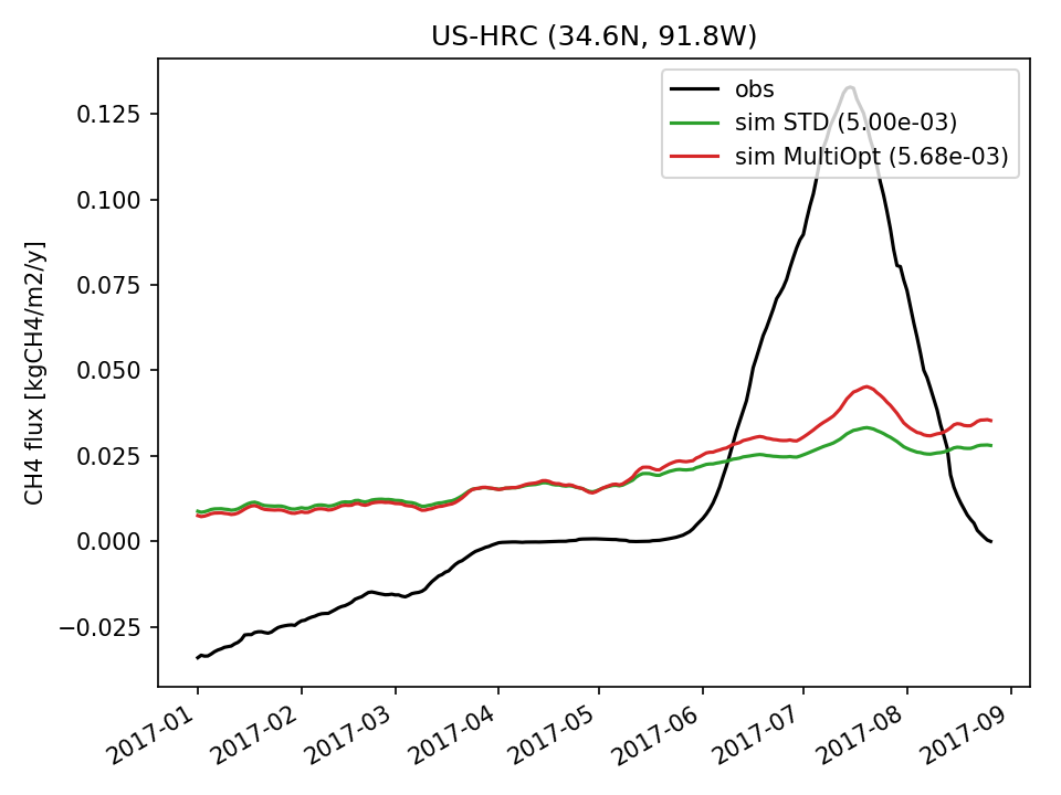 | 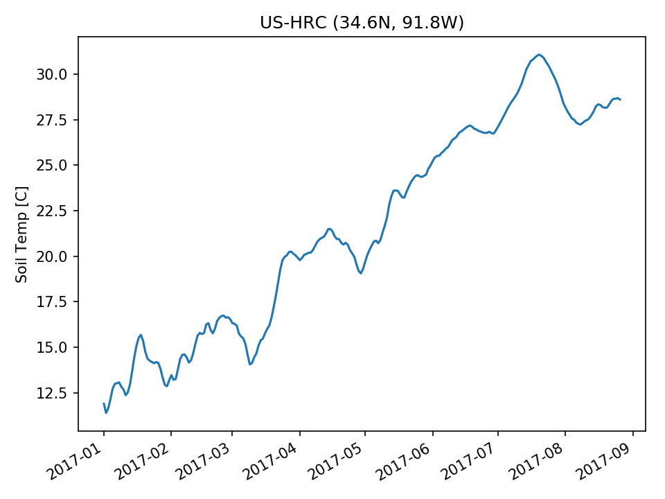 | 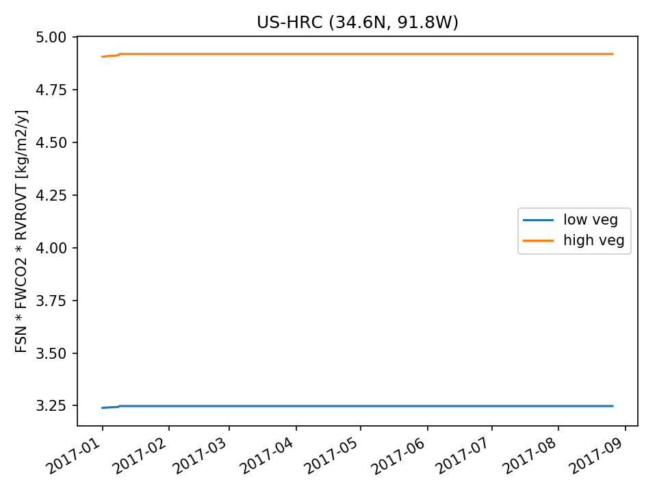 |  |
| DROP | 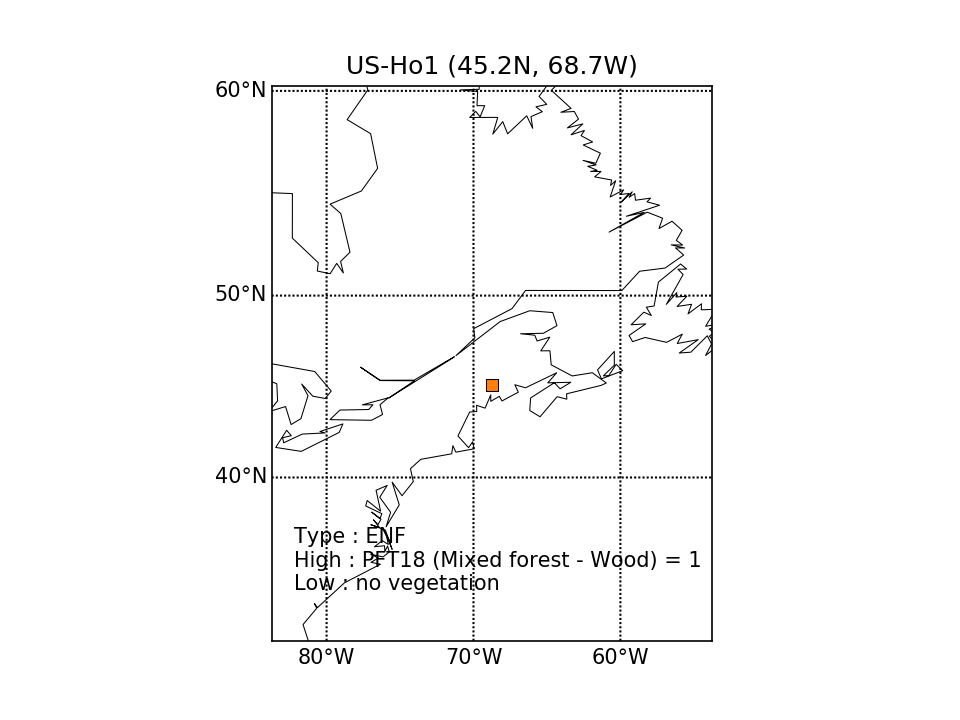 | 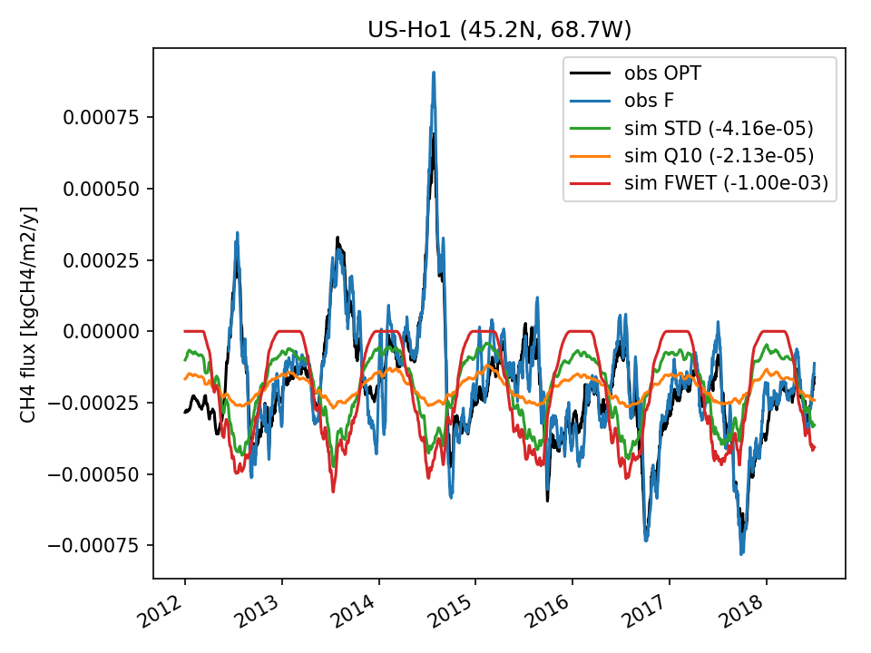 | 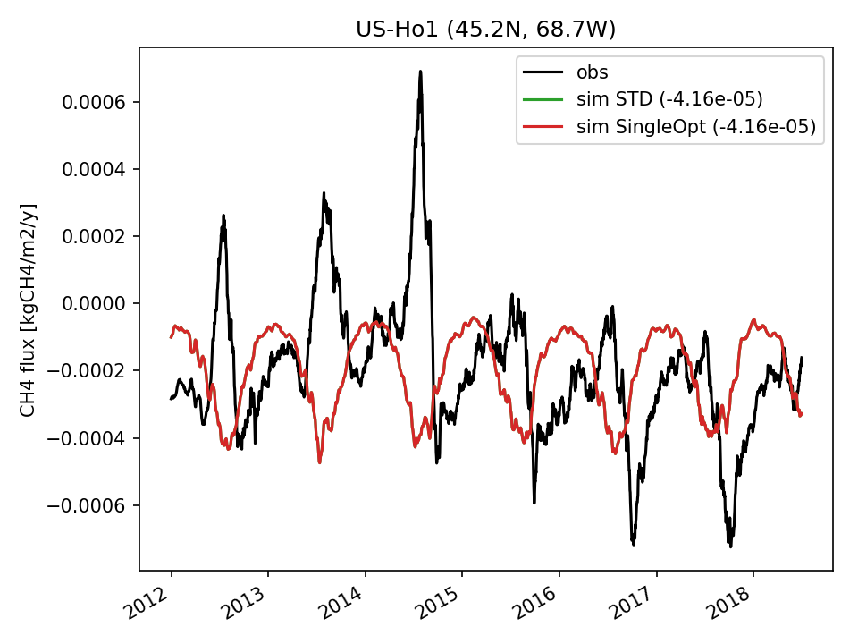 | 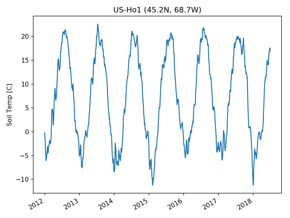 |  |  | |
| USE |  |  |  |  | 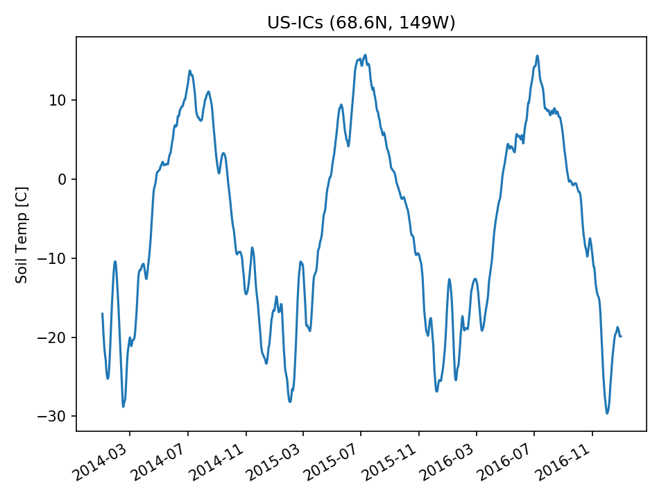 | 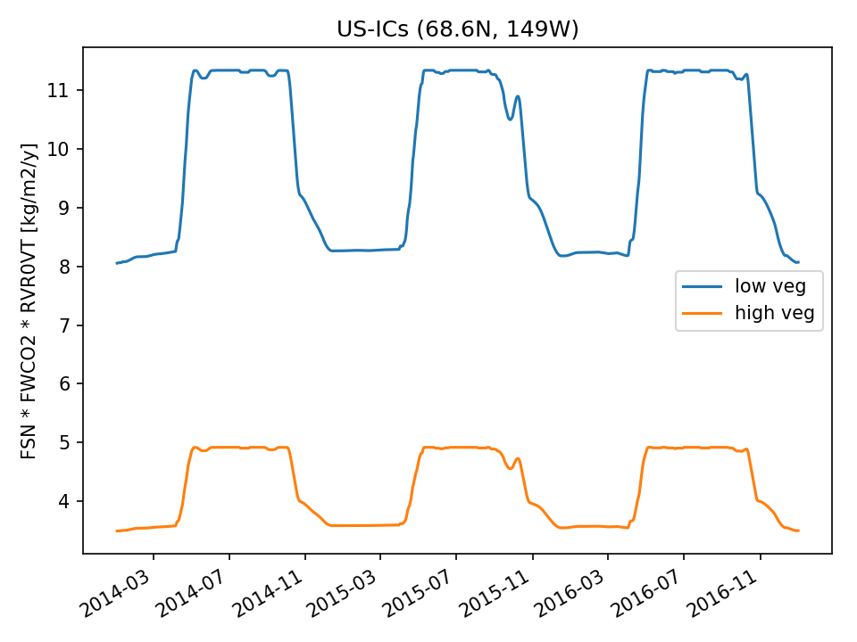 | 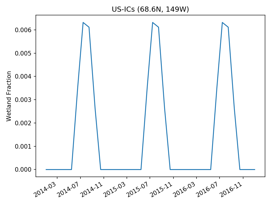 |
| USE |  | 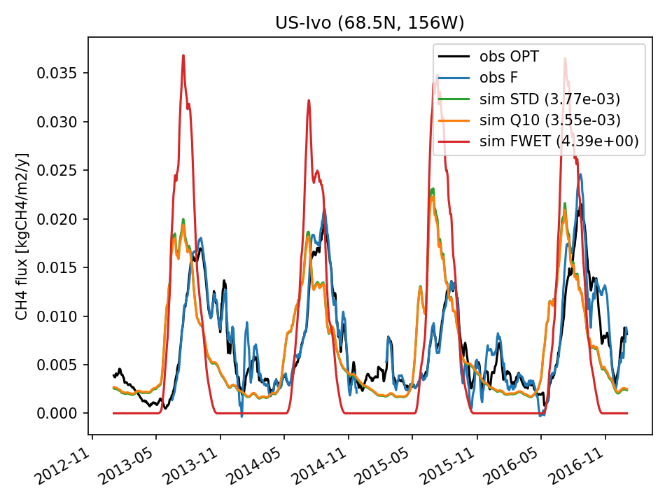 | 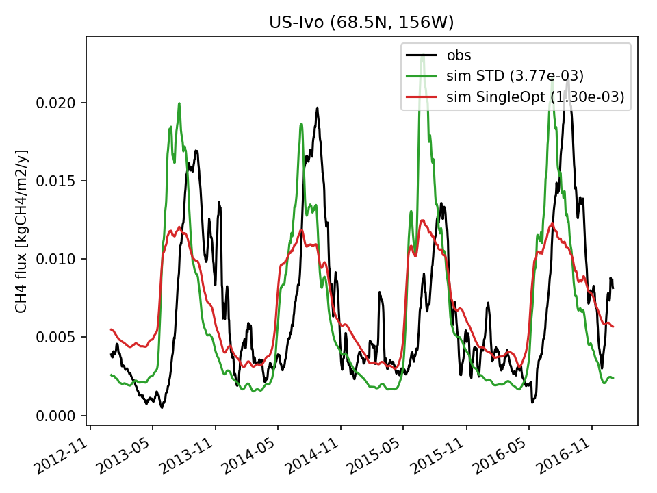 | 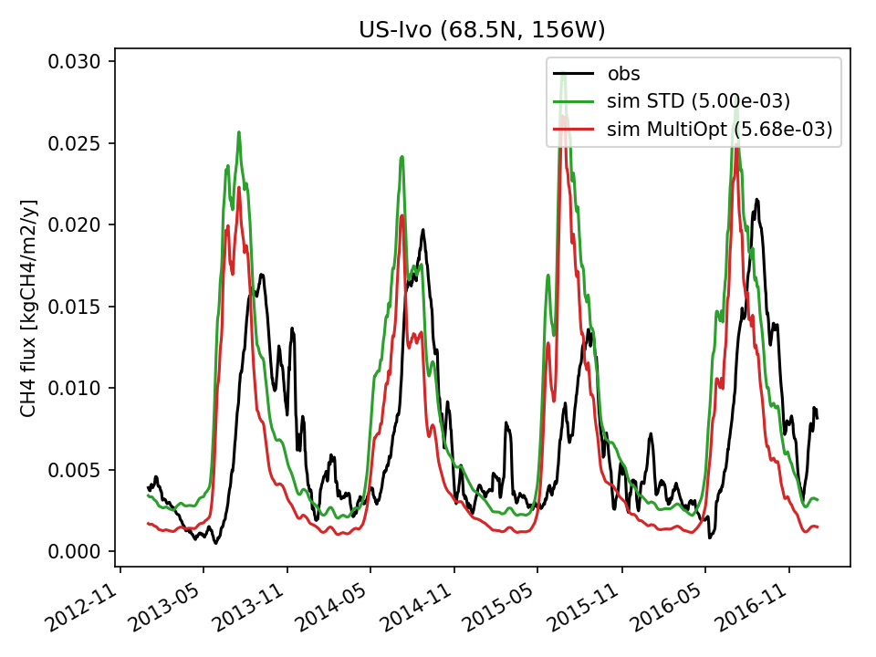 | 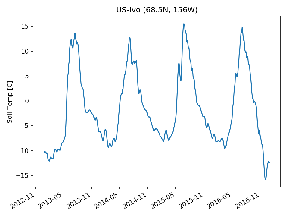 | 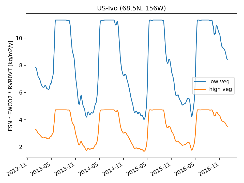 |  |
| DROP | 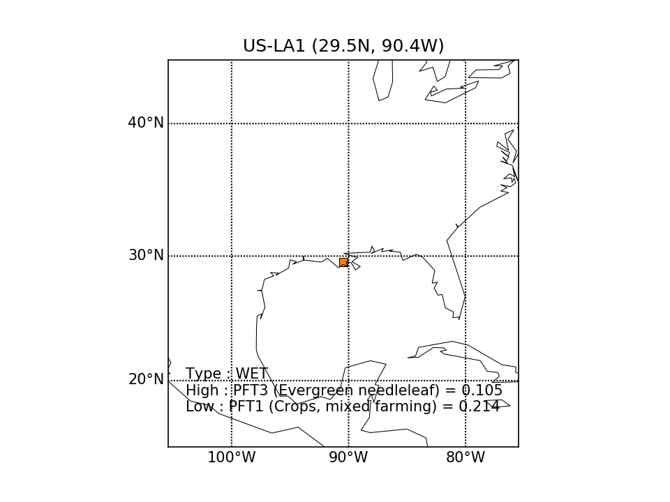 |  |  |  | 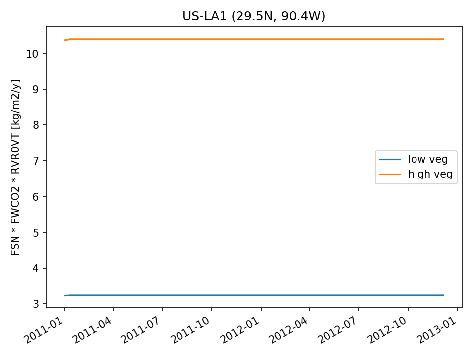 | 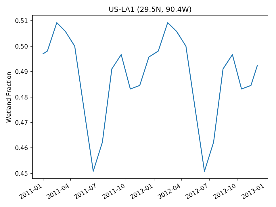 | |
| USE | 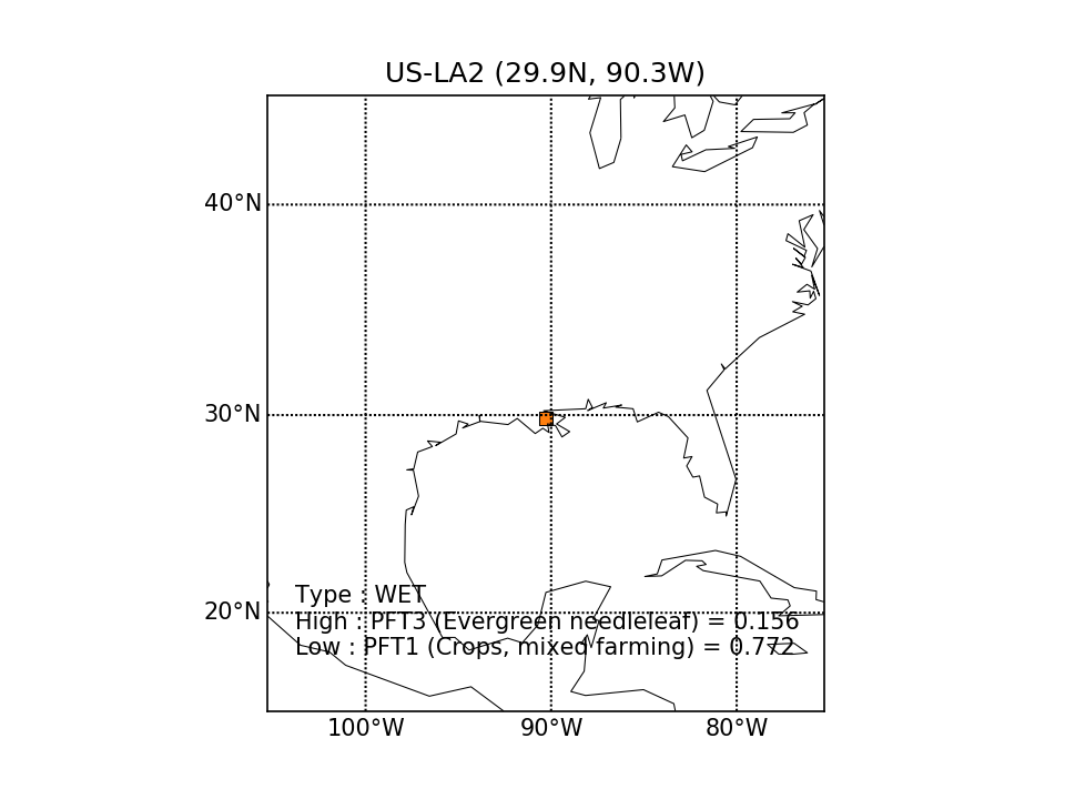 | 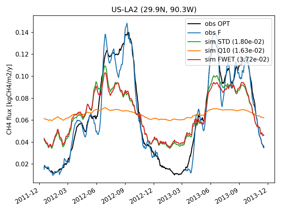 | 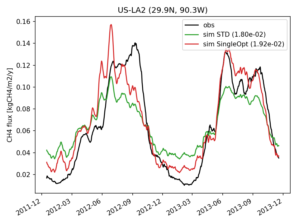 | 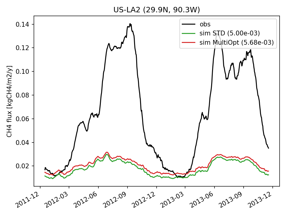 | 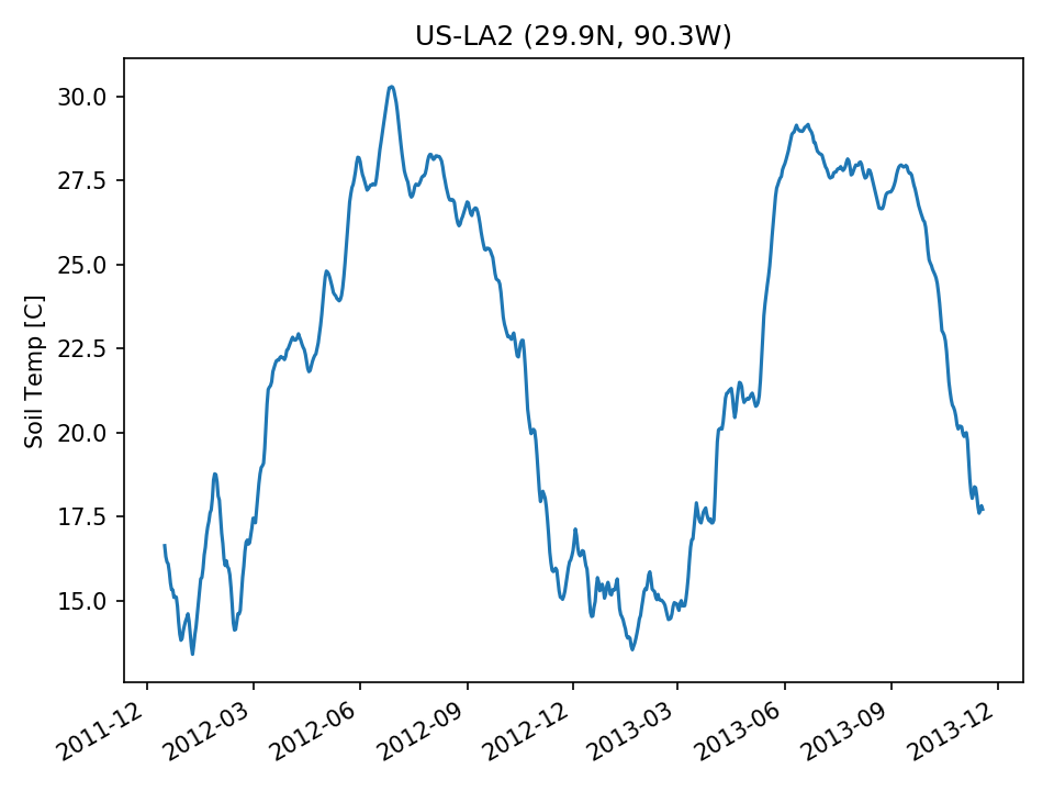 | 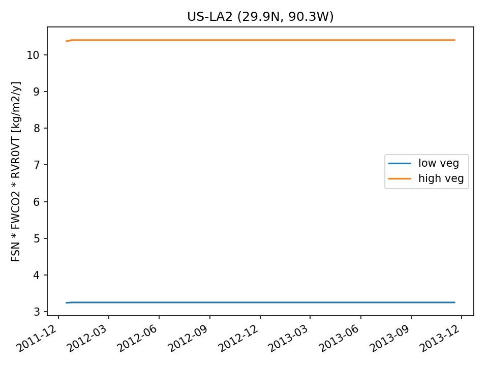 |  |
| USE | 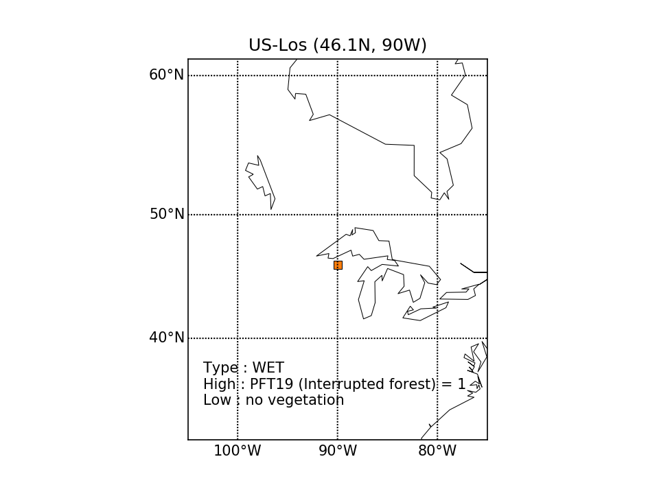 | 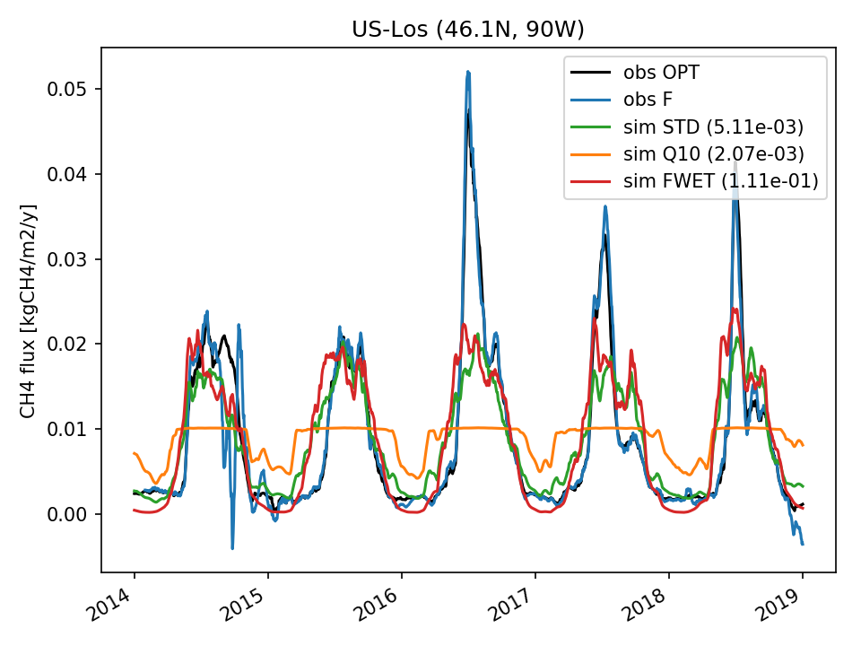 |  |  | 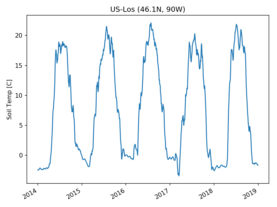 |  | 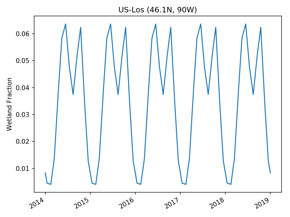 |
| USE |  | 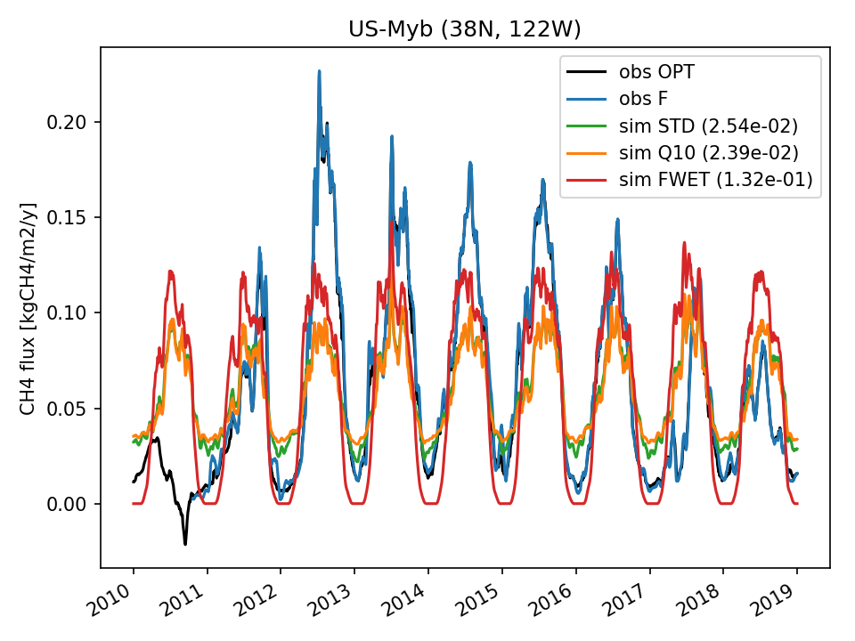 | 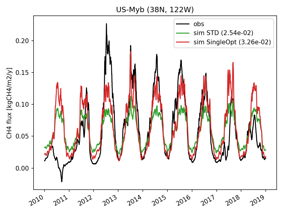 | 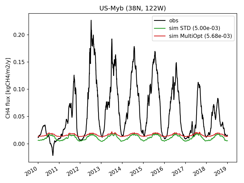 | 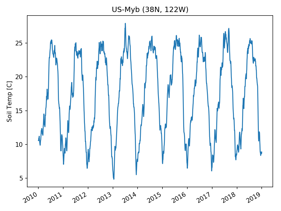 | 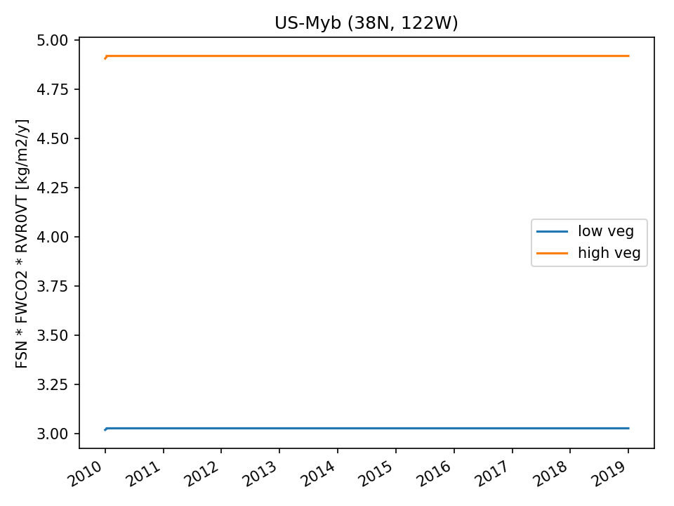 | 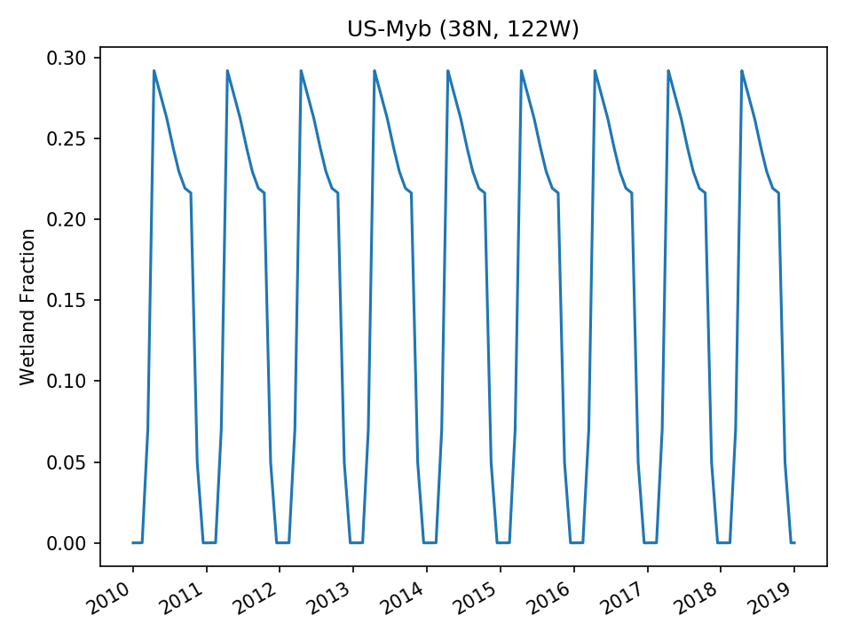 |
| USE | 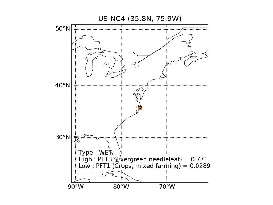 | 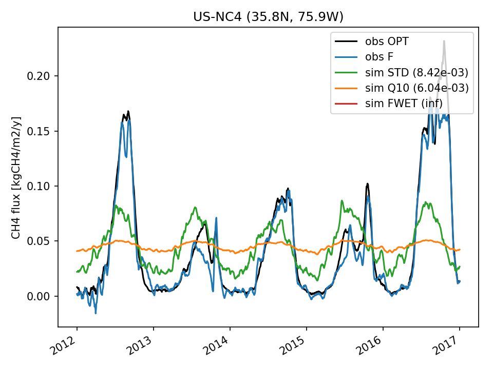 | 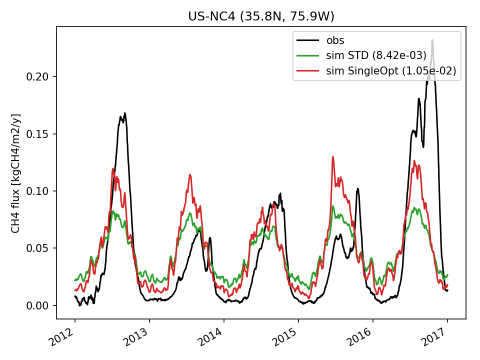 | 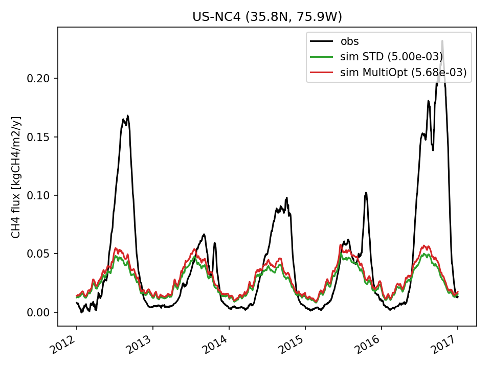 | 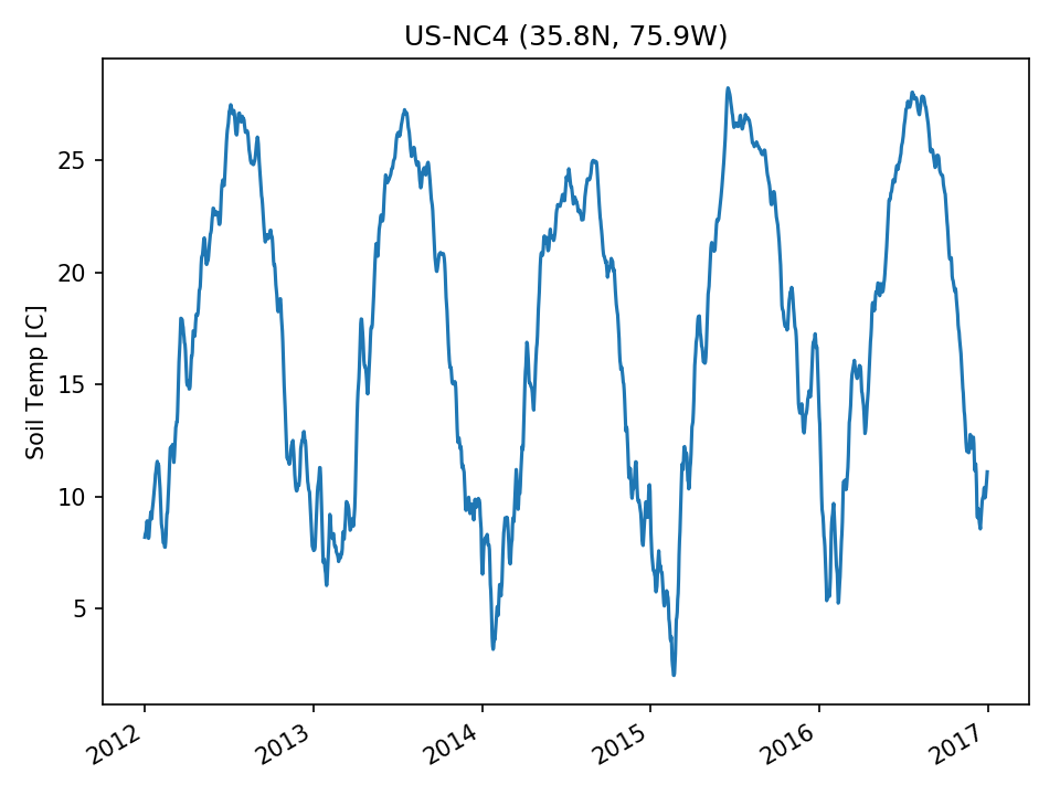 | 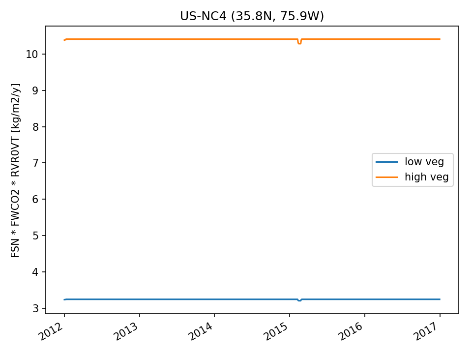 |  |
| USE | 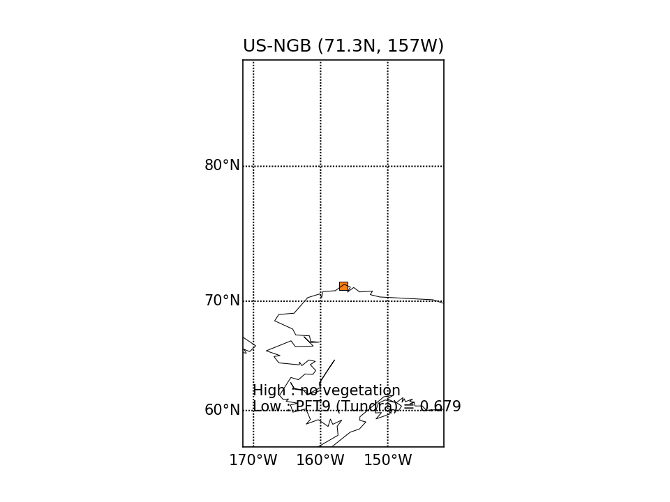 | 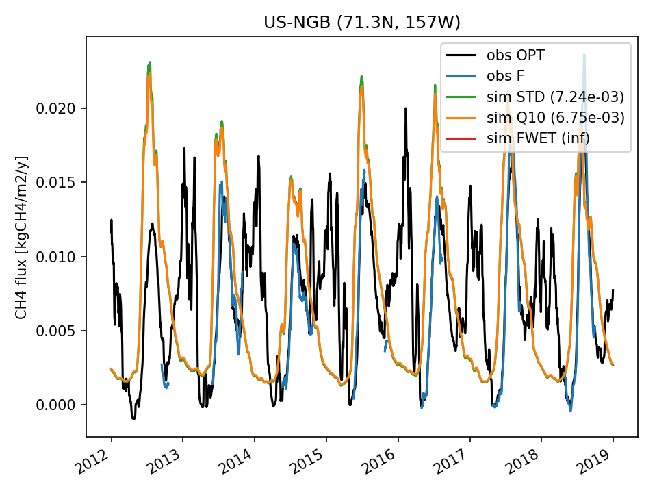 | 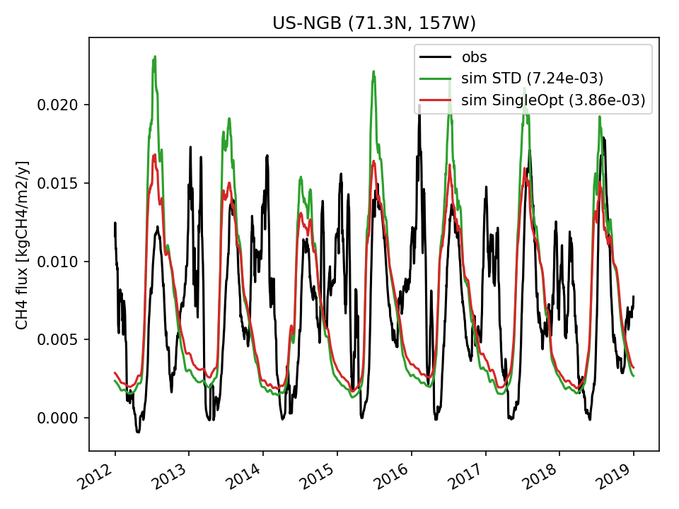 | 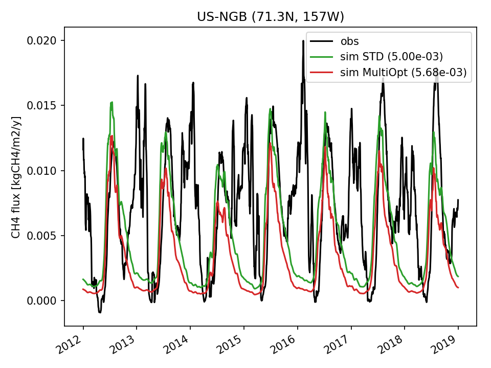 | 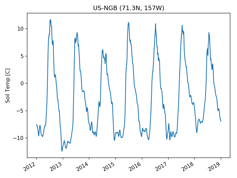 | 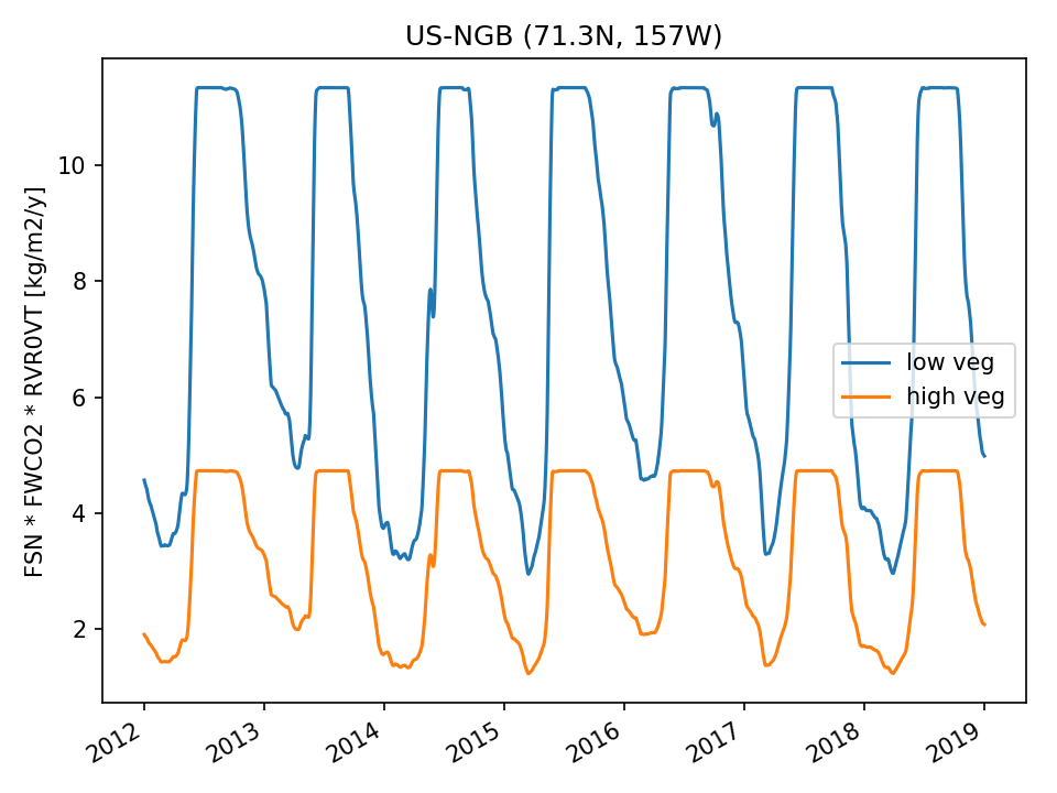 |  |
| DROP | 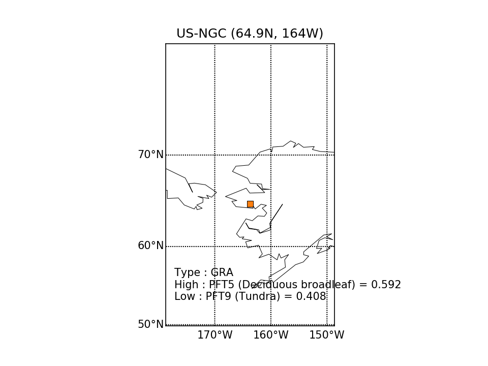 |  | 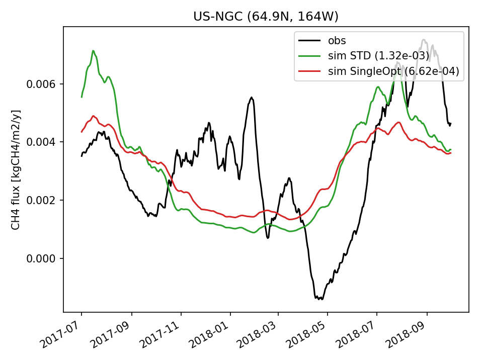 | 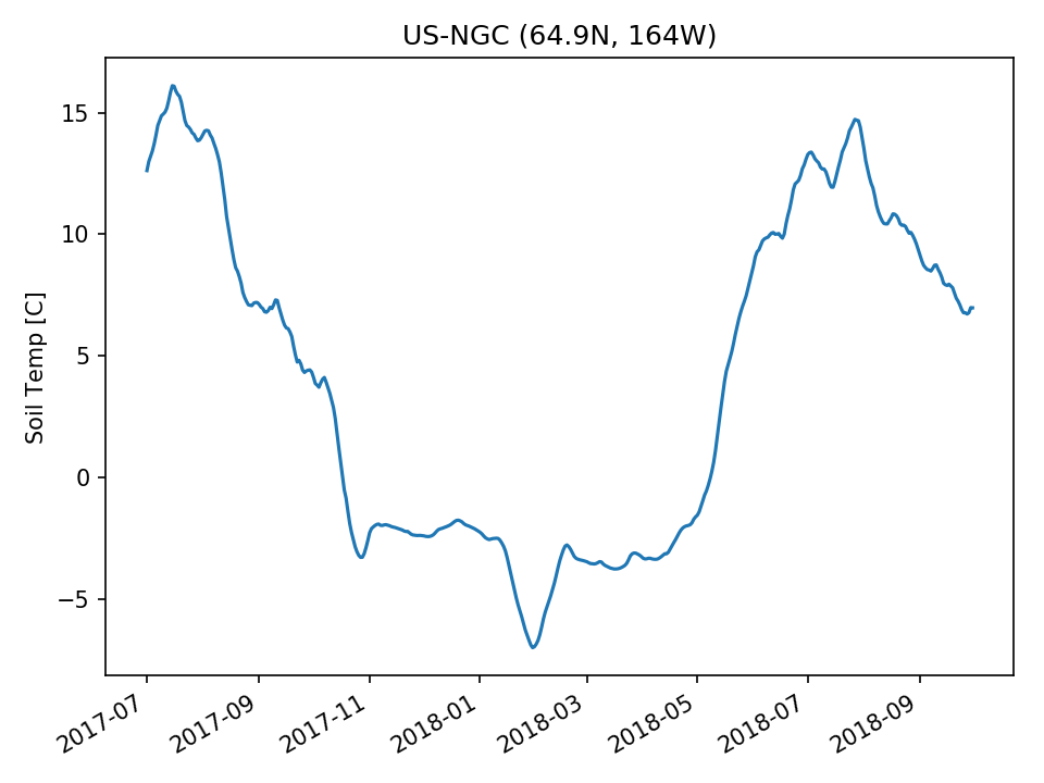 |  |  | |
| USE | 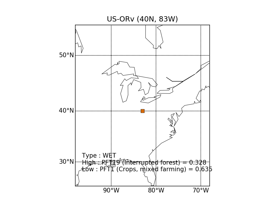 | 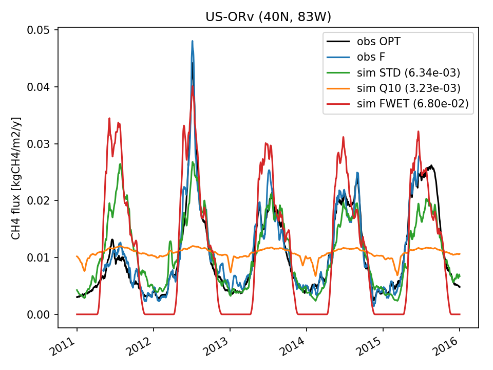 | 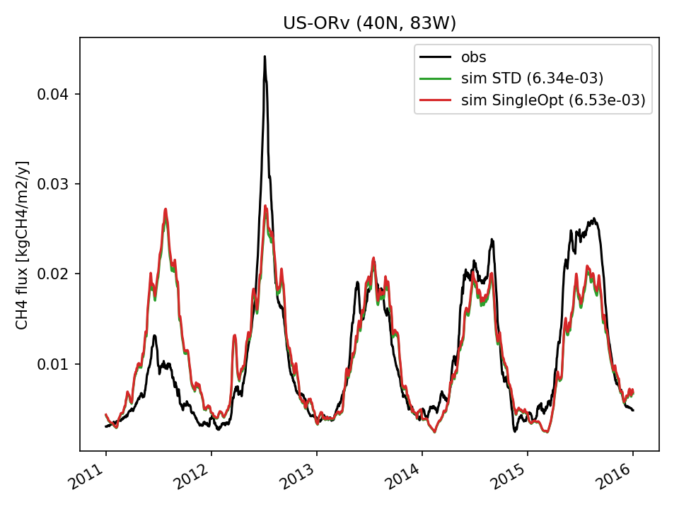 | 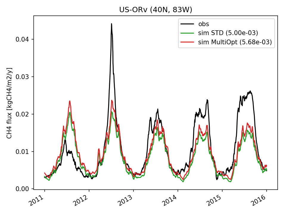 | 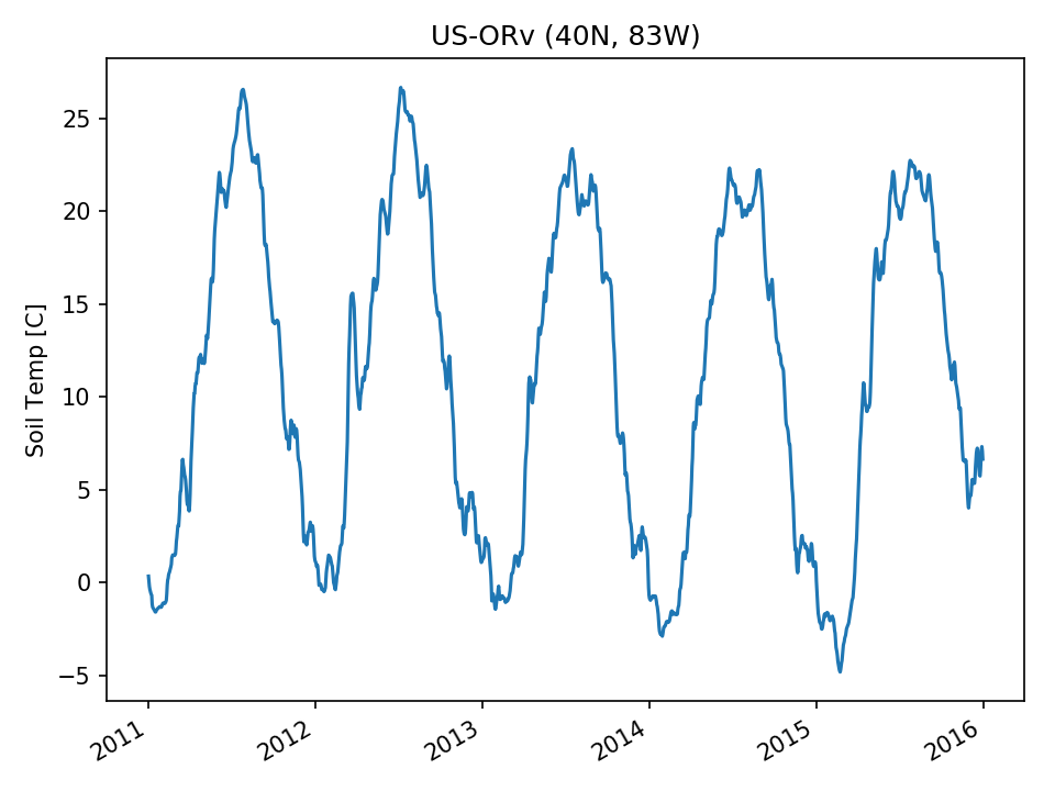 | 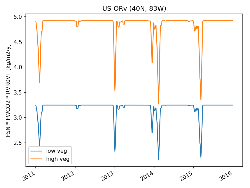 | 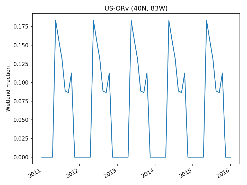 |
| USE |  | 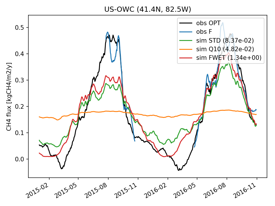 | 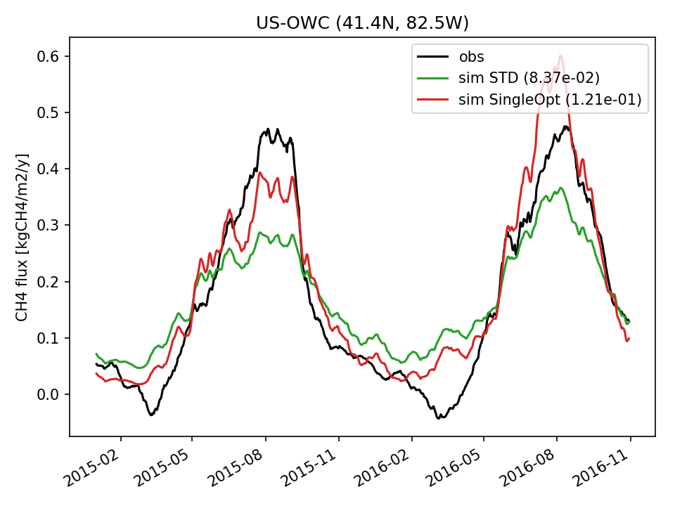 | 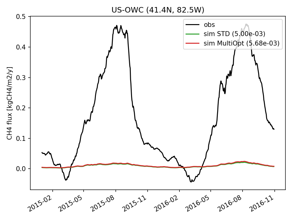 |  | 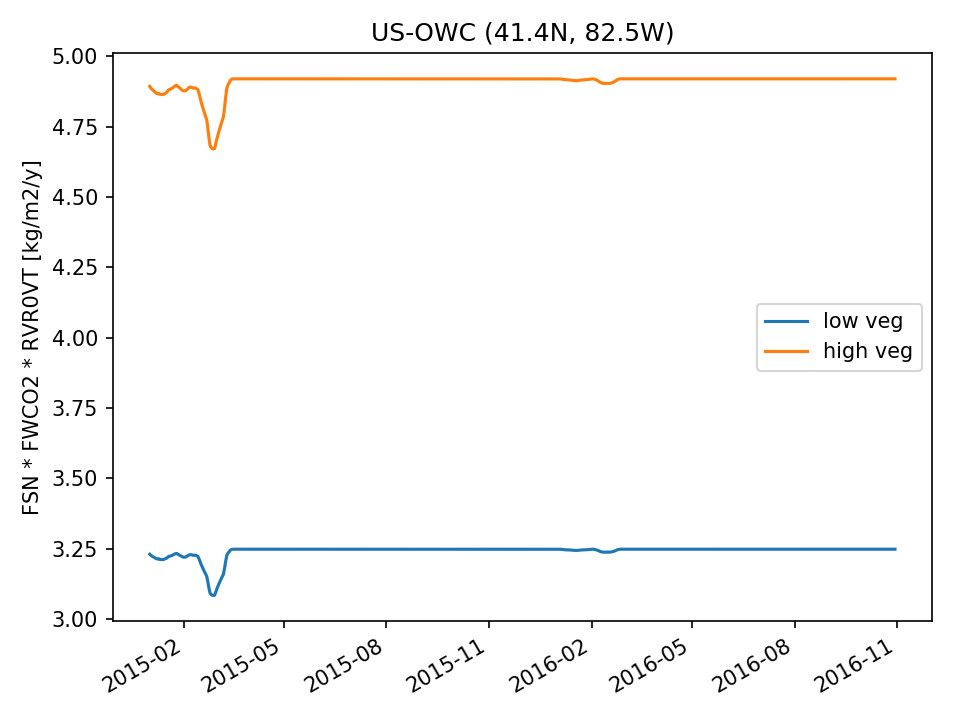 | 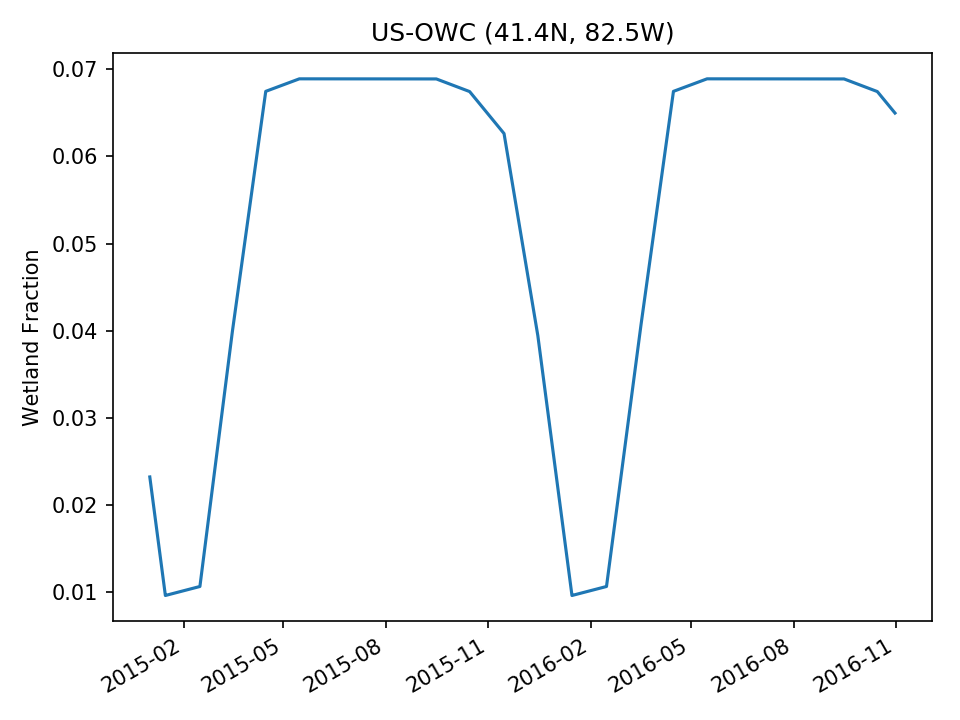 |
| USE |  | 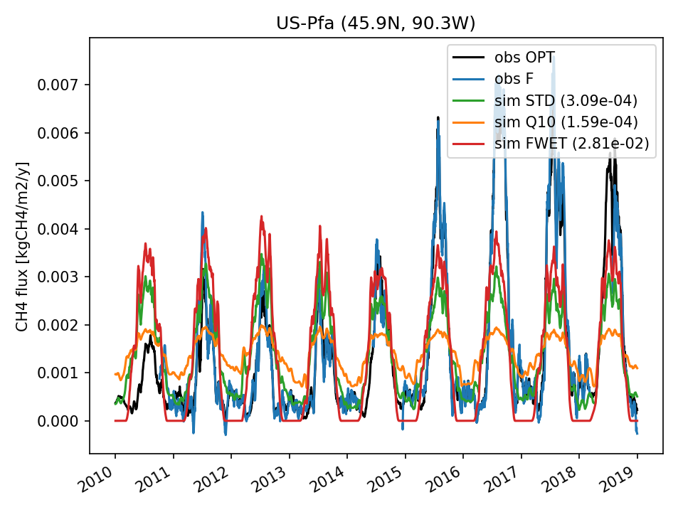 | 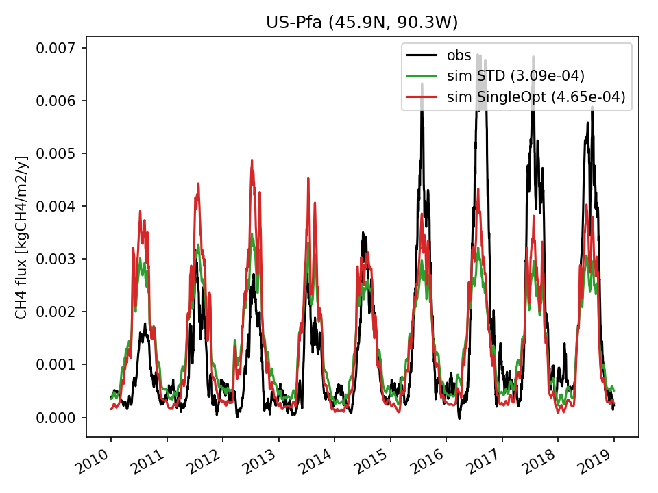 | 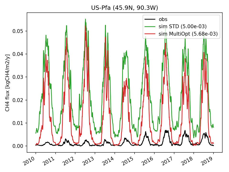 | 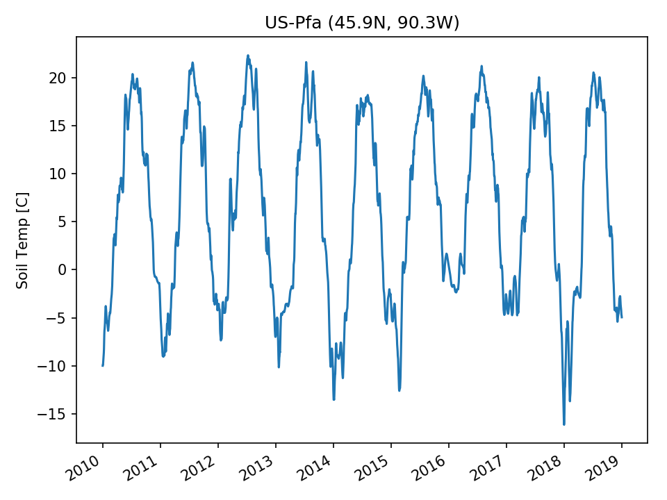 | 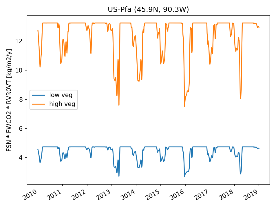 | 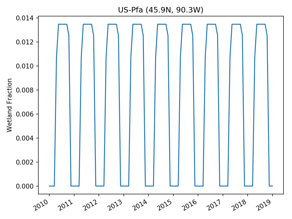 |
| DROP | 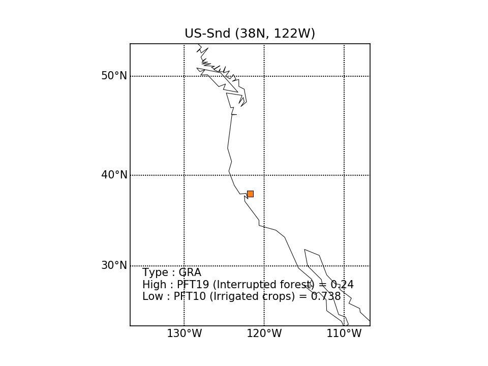 | 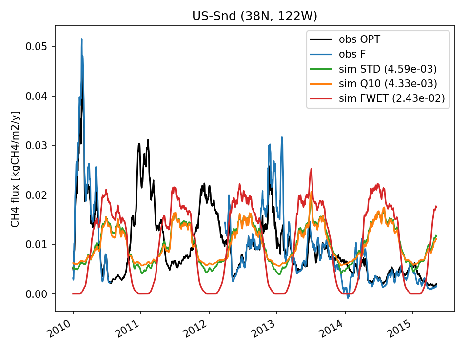 | 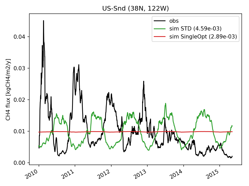 | 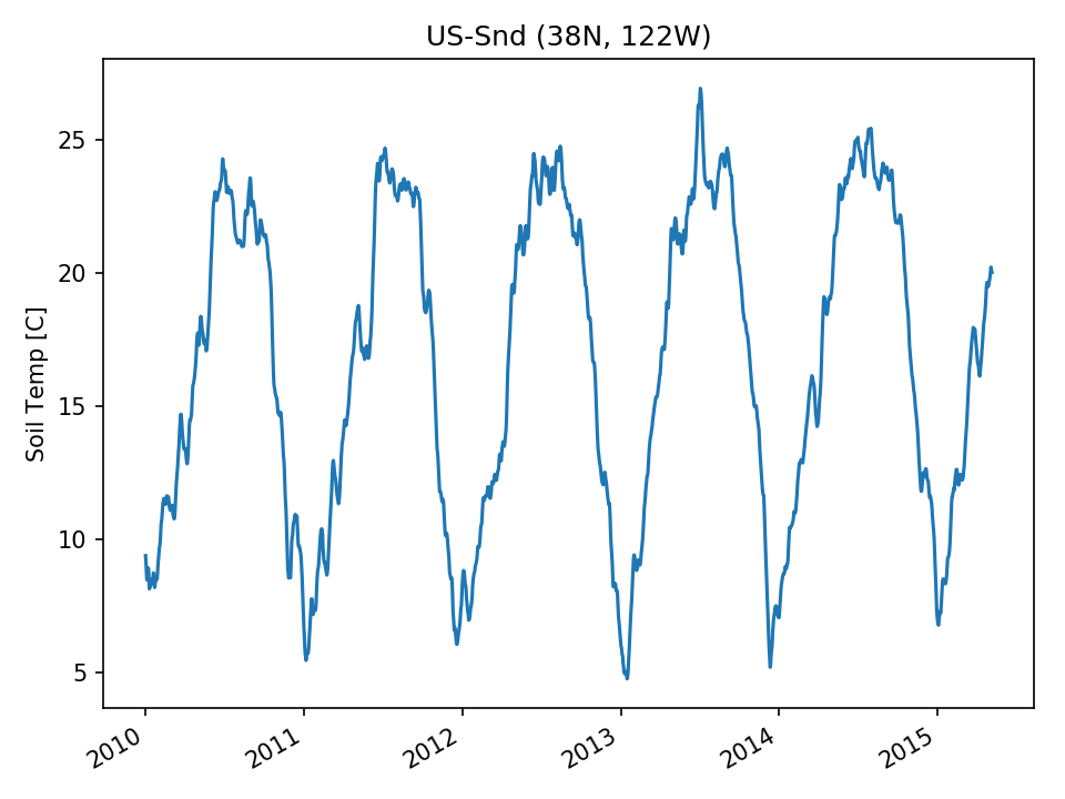 | 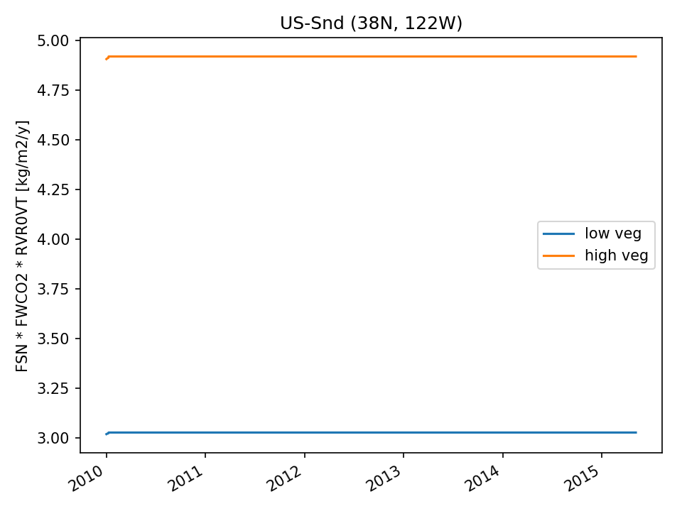 | 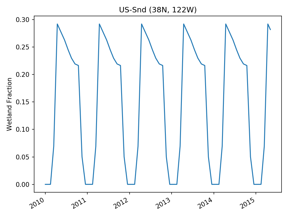 | |
| USE |  | 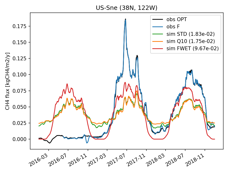 | 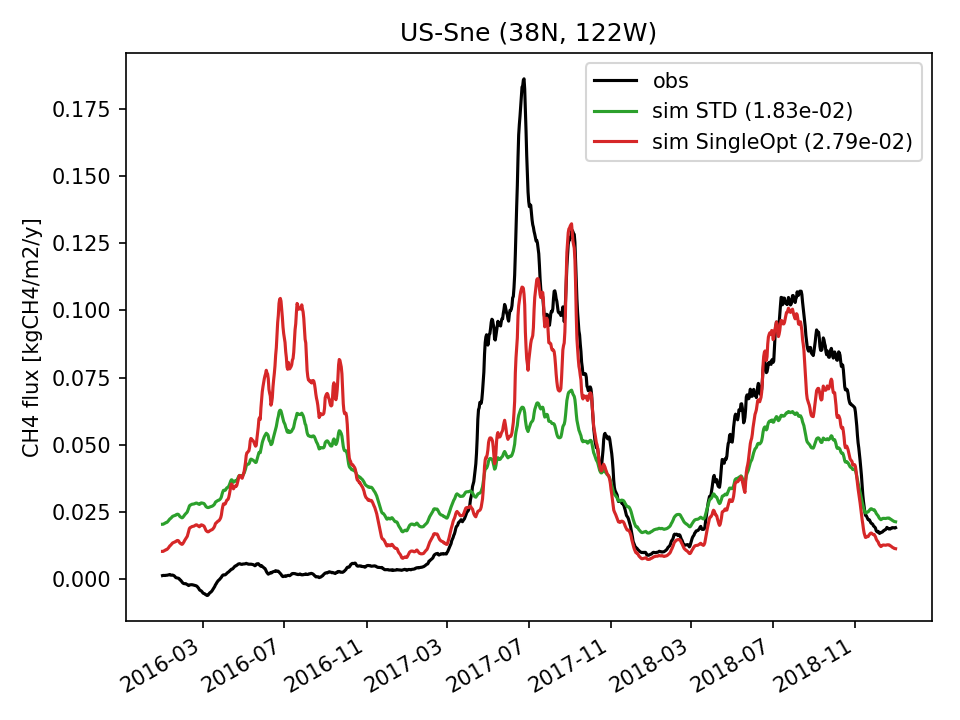 | 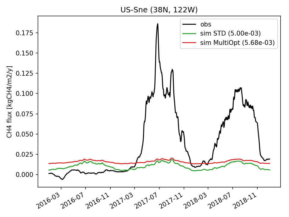 | 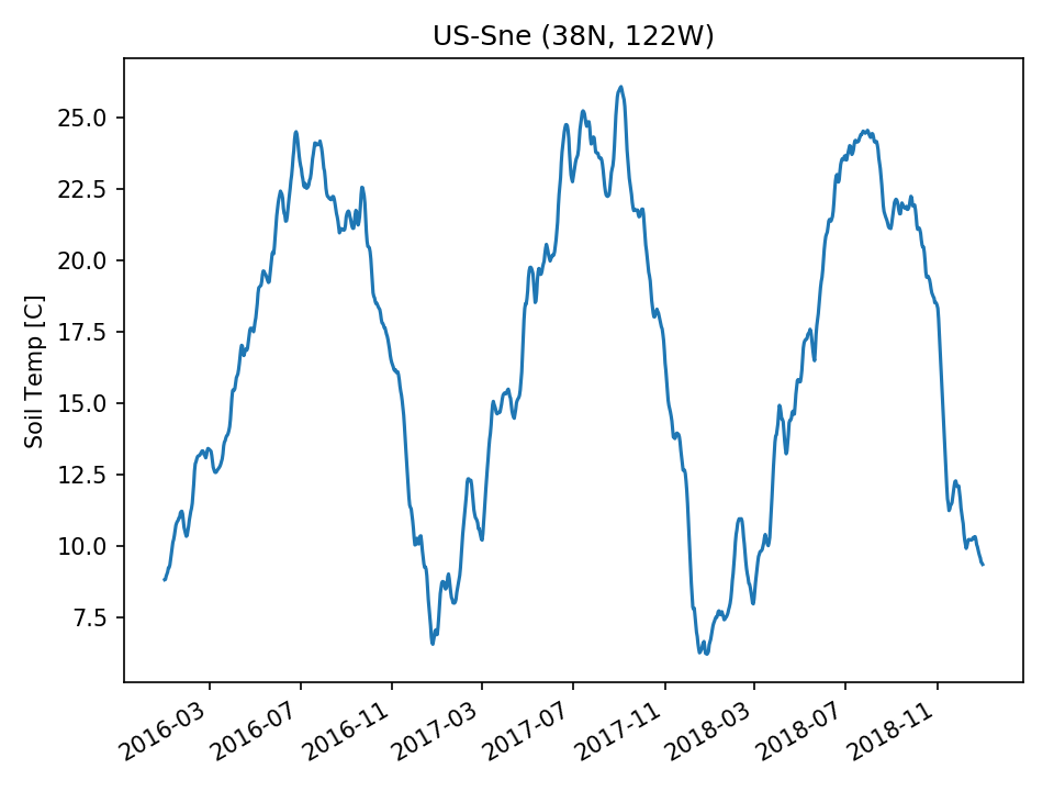 | 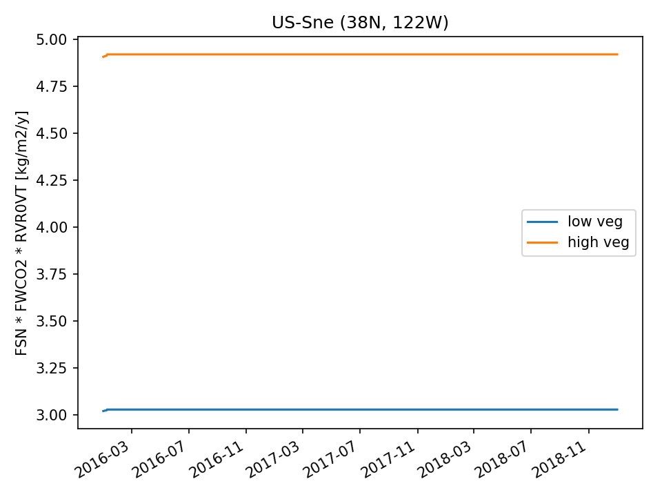 |  |
| USE | 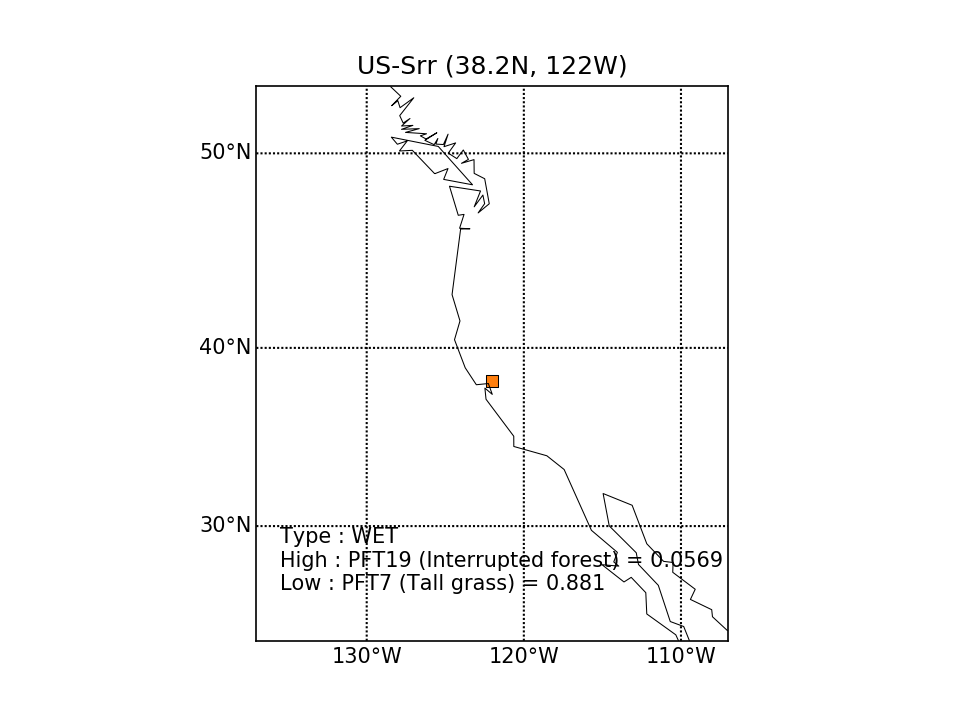 |  |  | 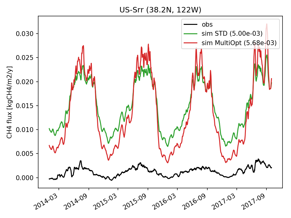 | 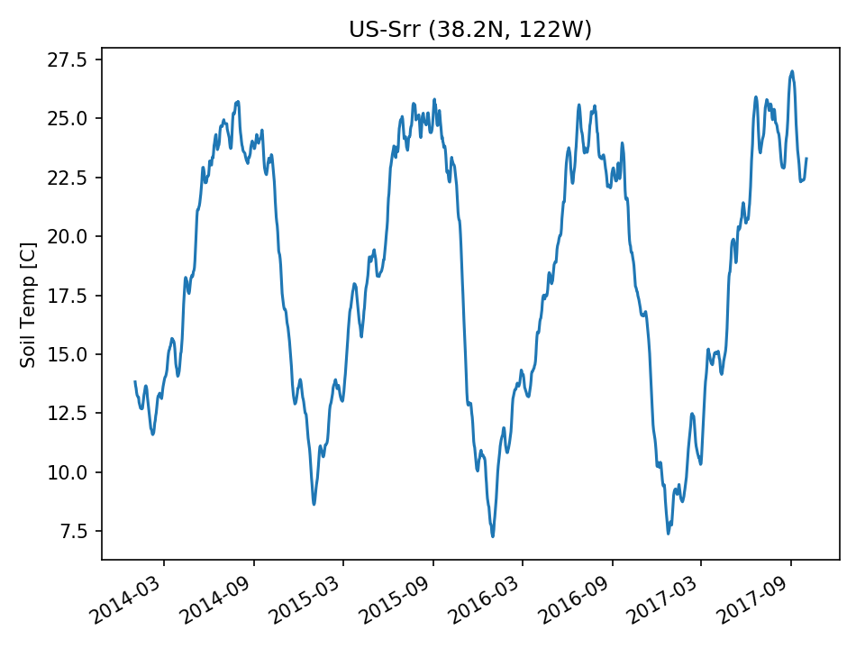 | 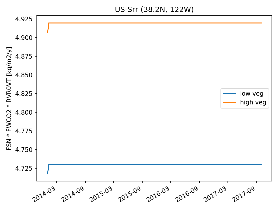 |  |
| USE | 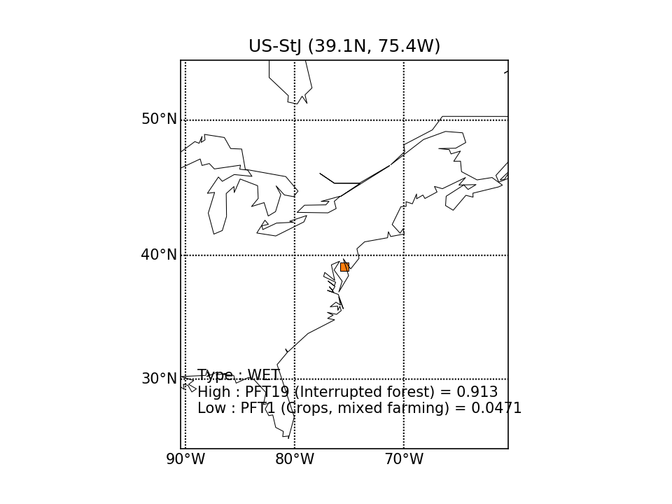 |  | 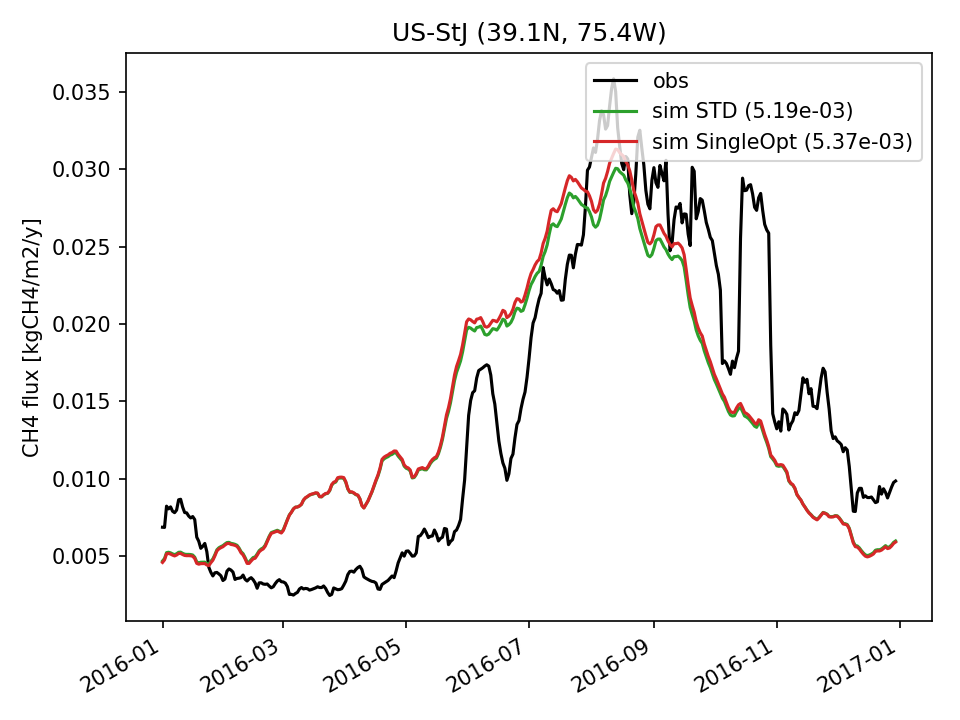 | 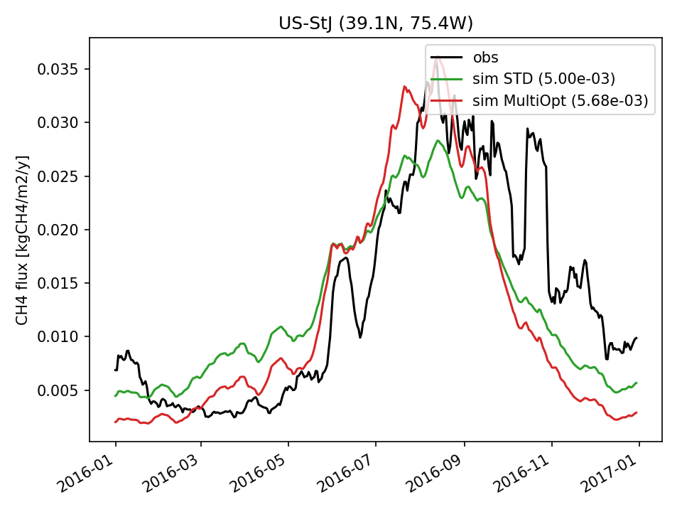 | 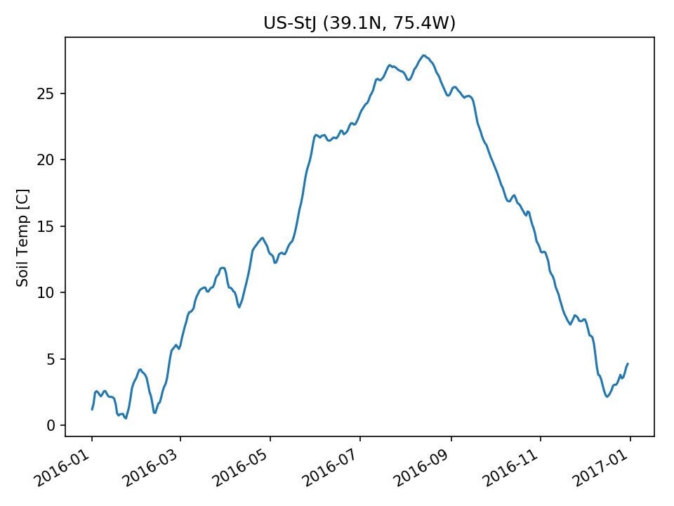 | 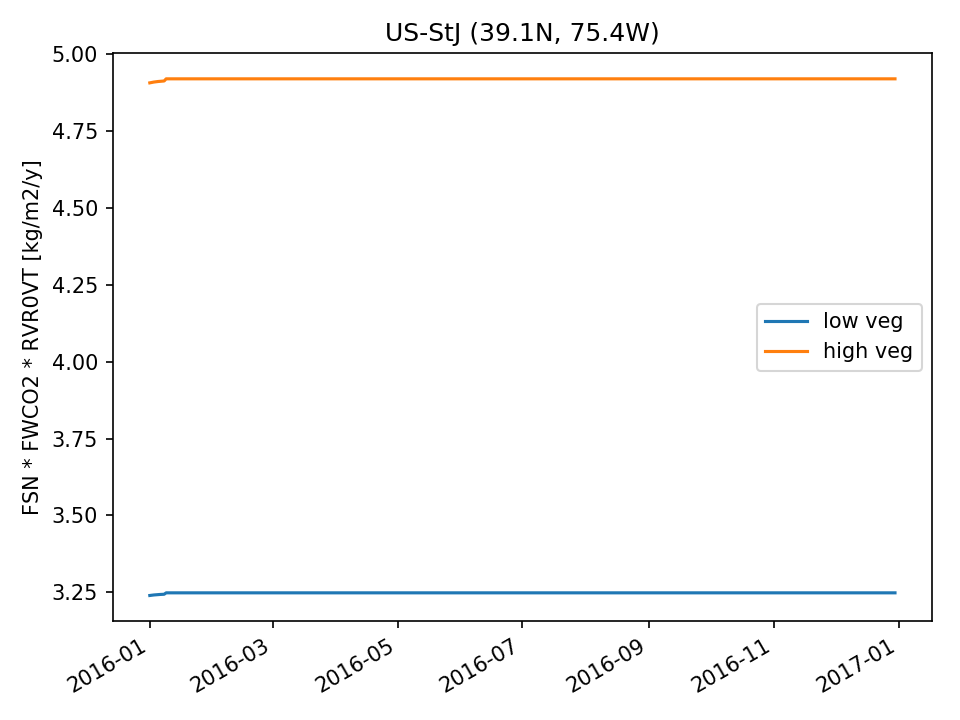 |  |
| USE | 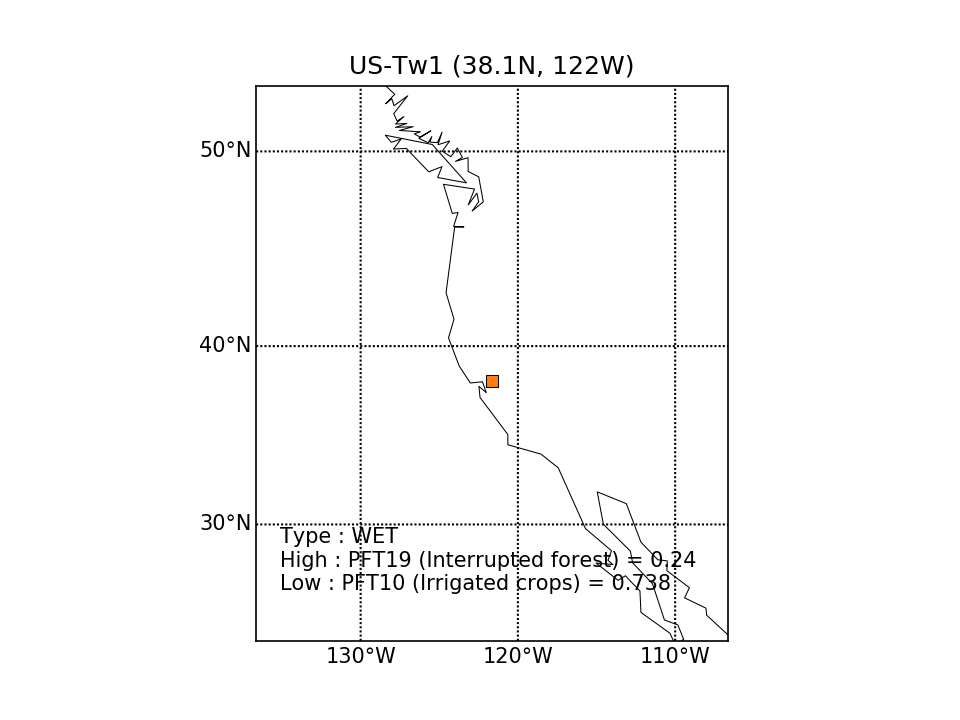 | 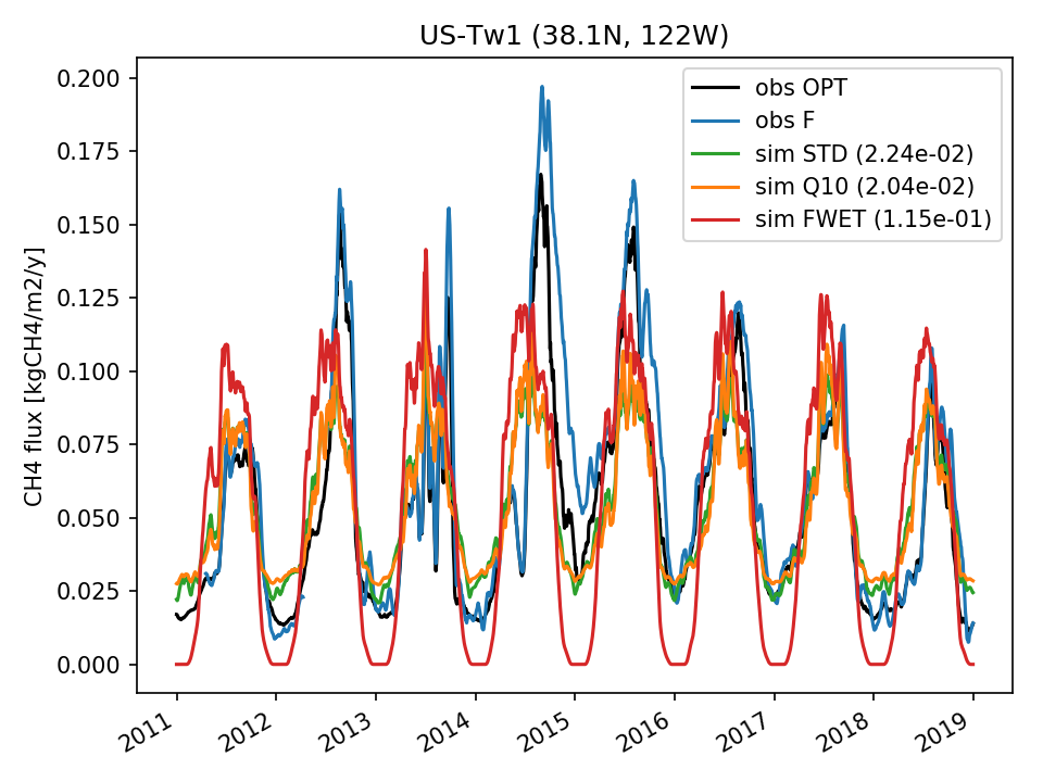 | 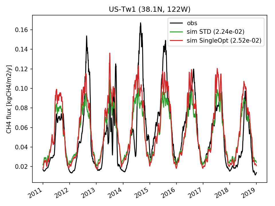 |  |  |  |  |
| DROP |  | 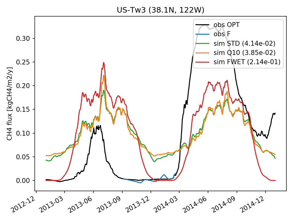 |  | 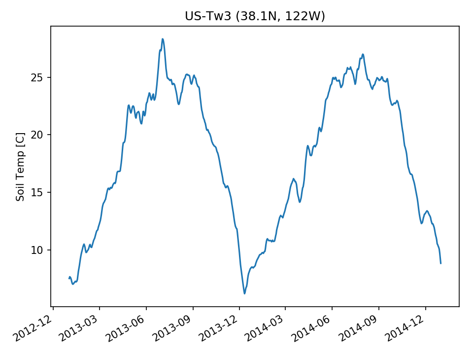 | 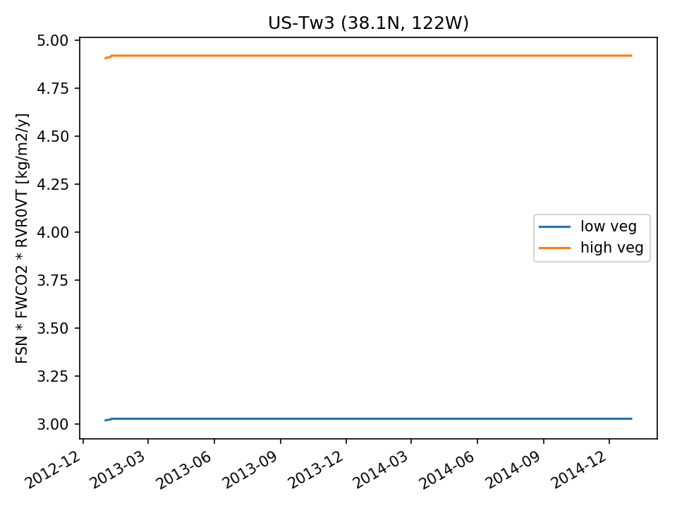 | 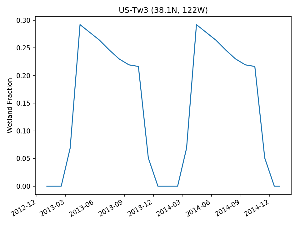 | |
| USE |  |  | 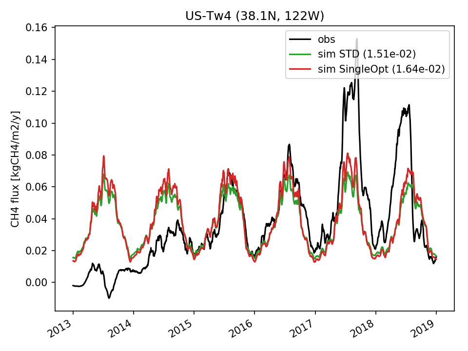 |  | 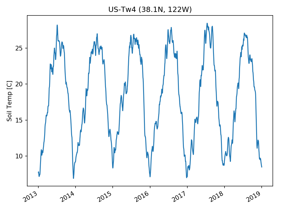 | 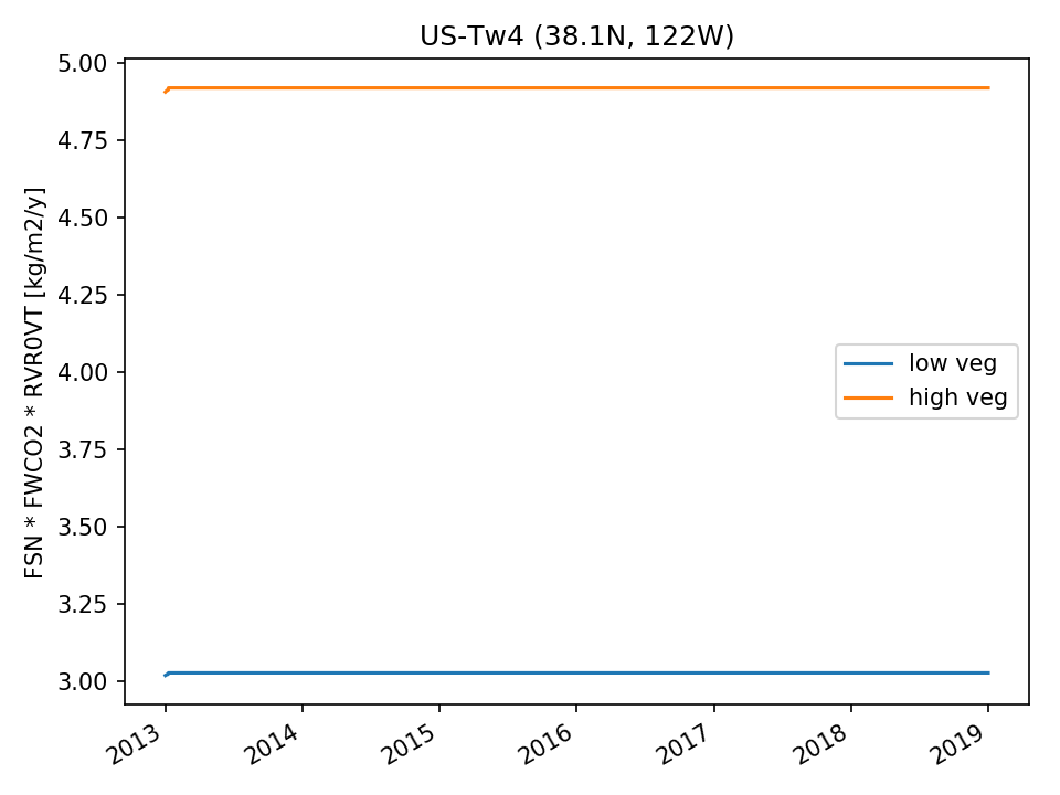 | 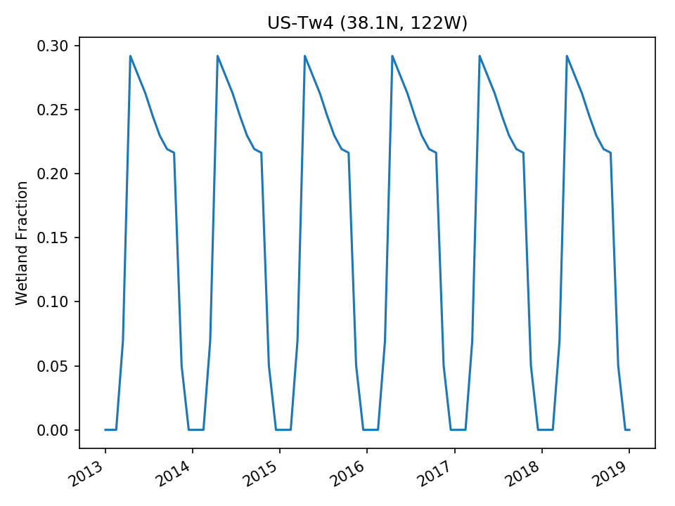 |
| USE |  | 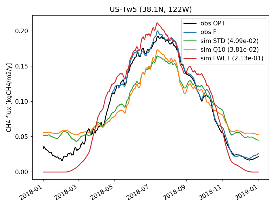 |  | 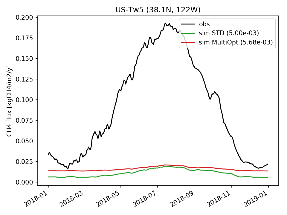 | 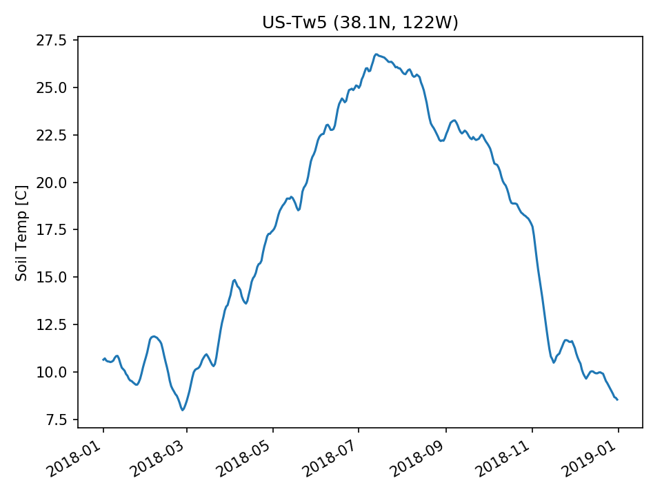 | 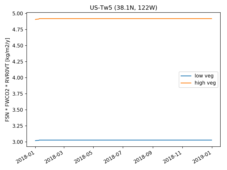 |  |
| DROP |  | 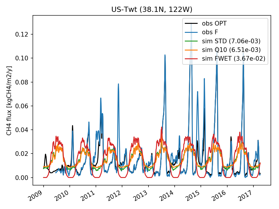 | 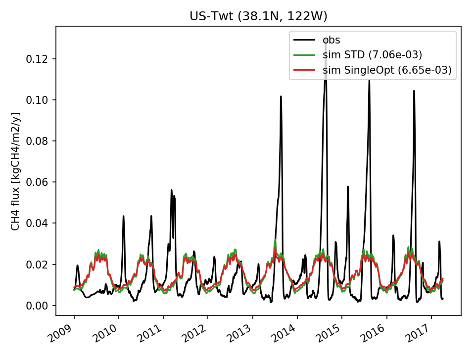 | 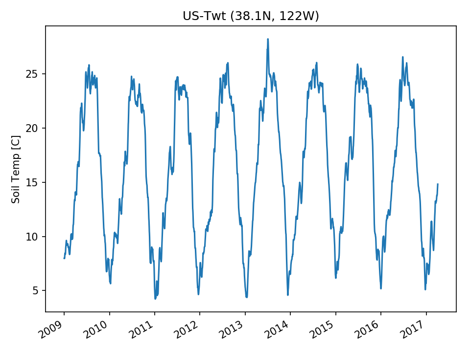 | 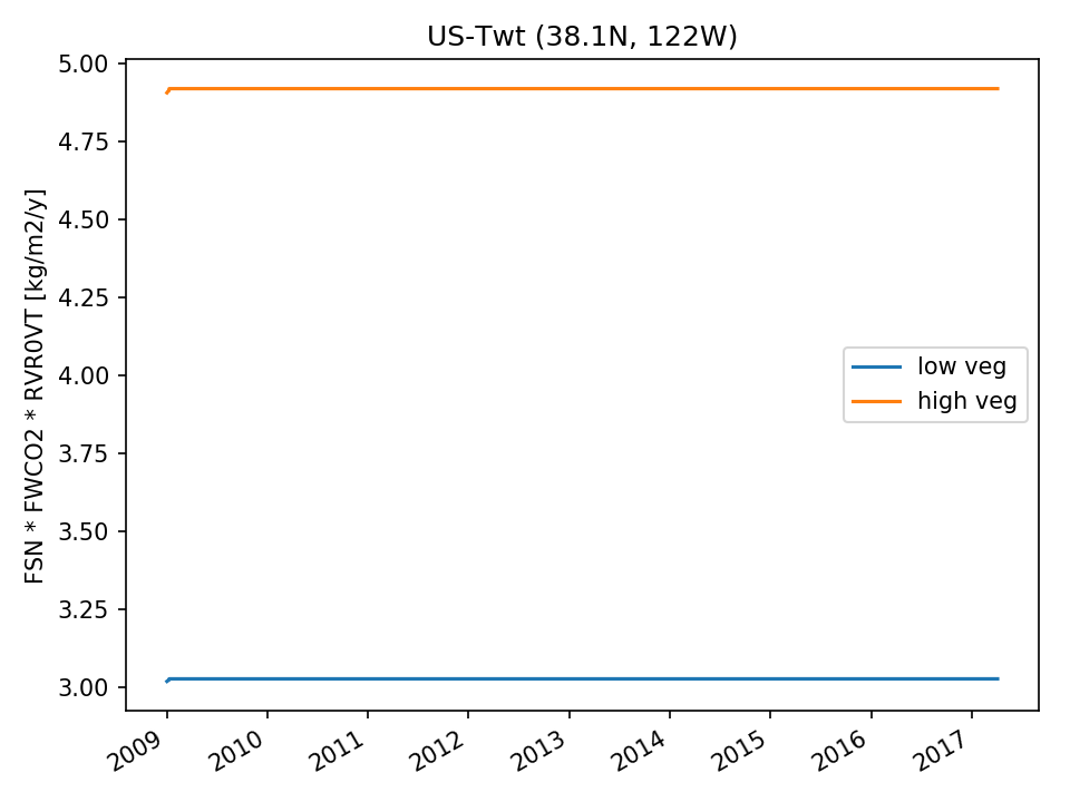 | 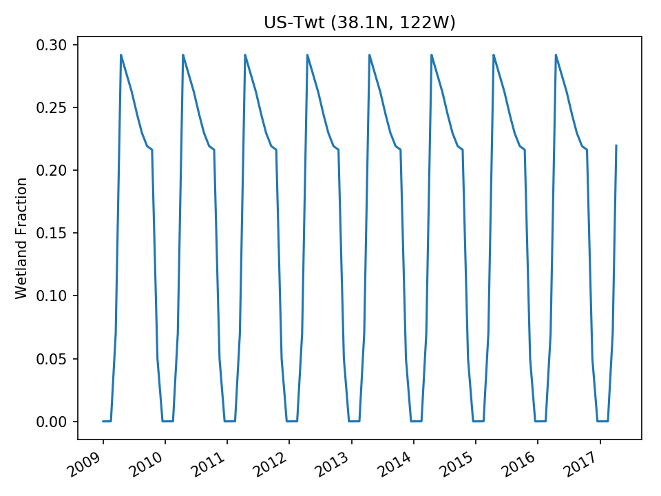 | |
| USE |  | 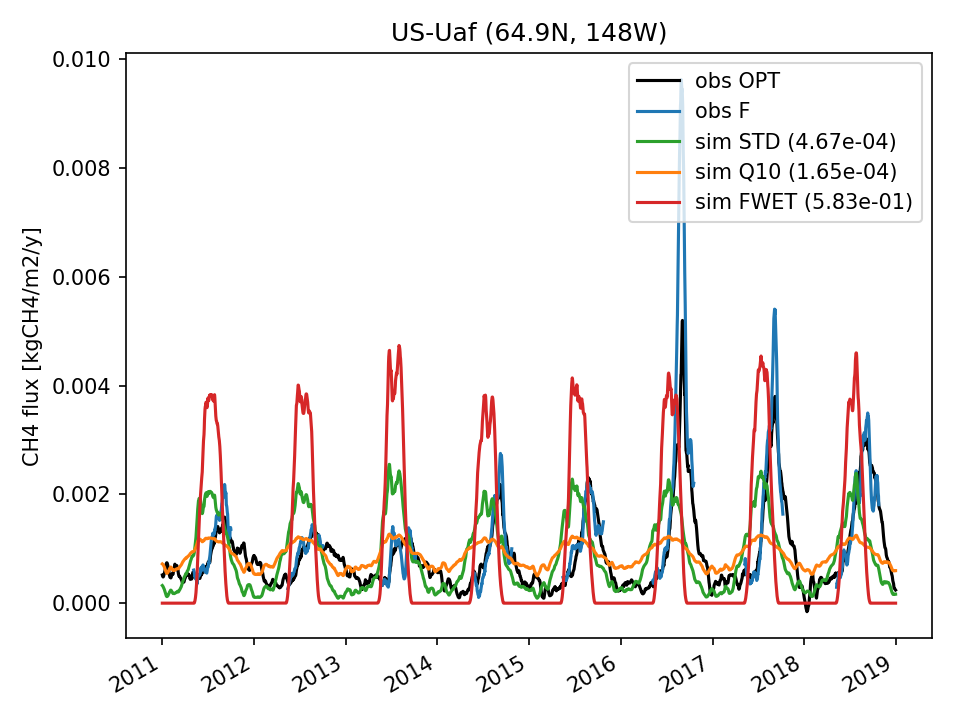 |  | 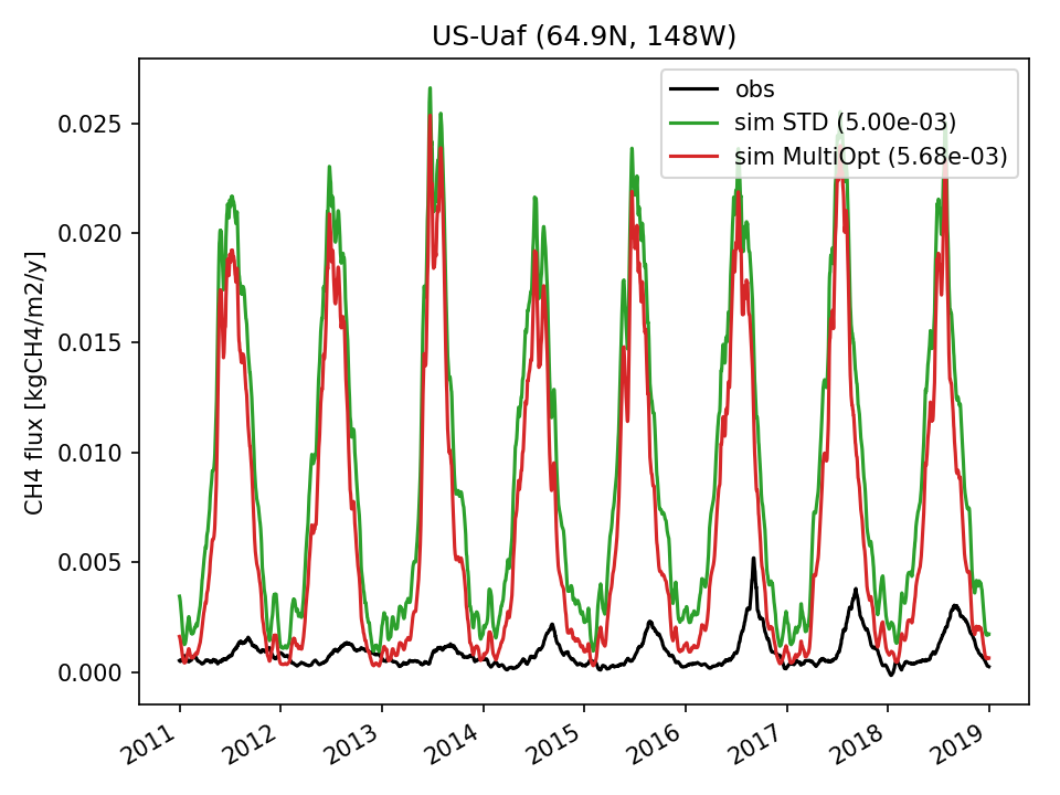 | 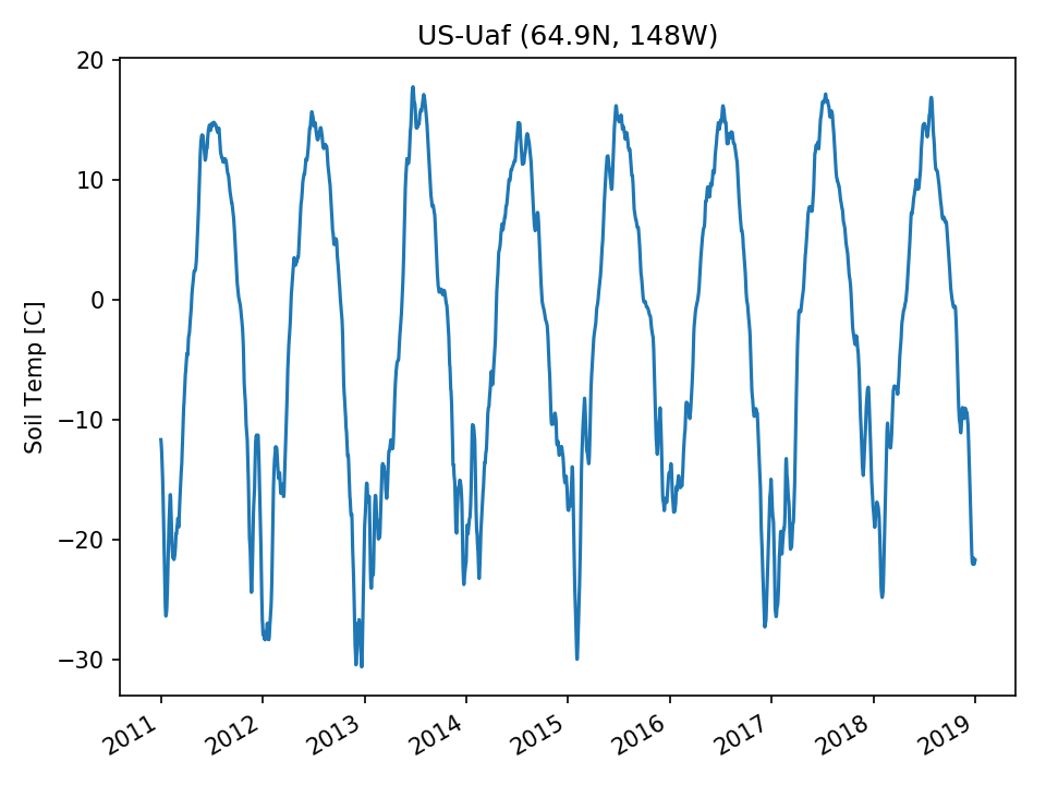 | 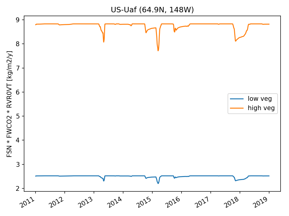 | 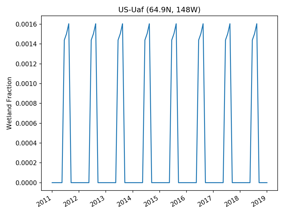 |
| USE | 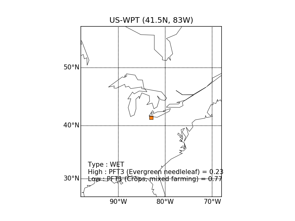 |  | 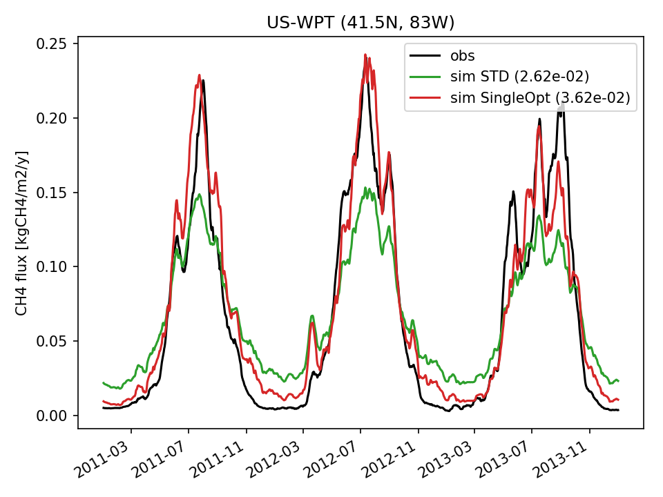 | 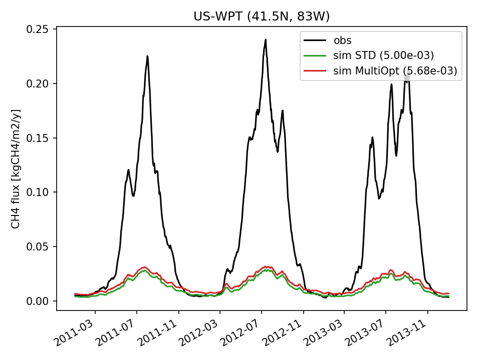 |  | 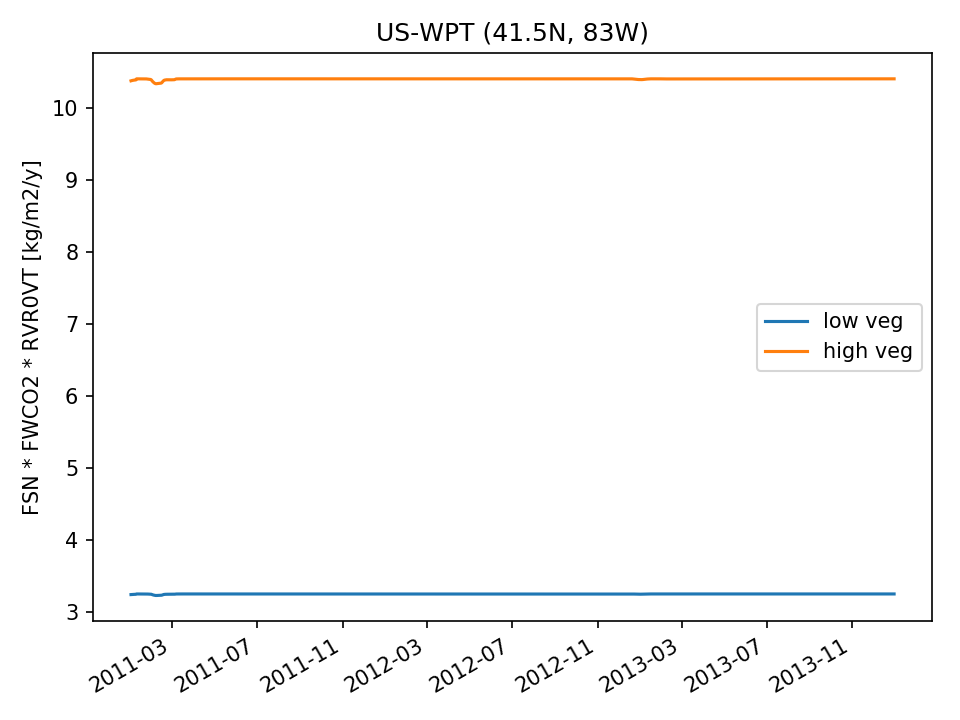 | 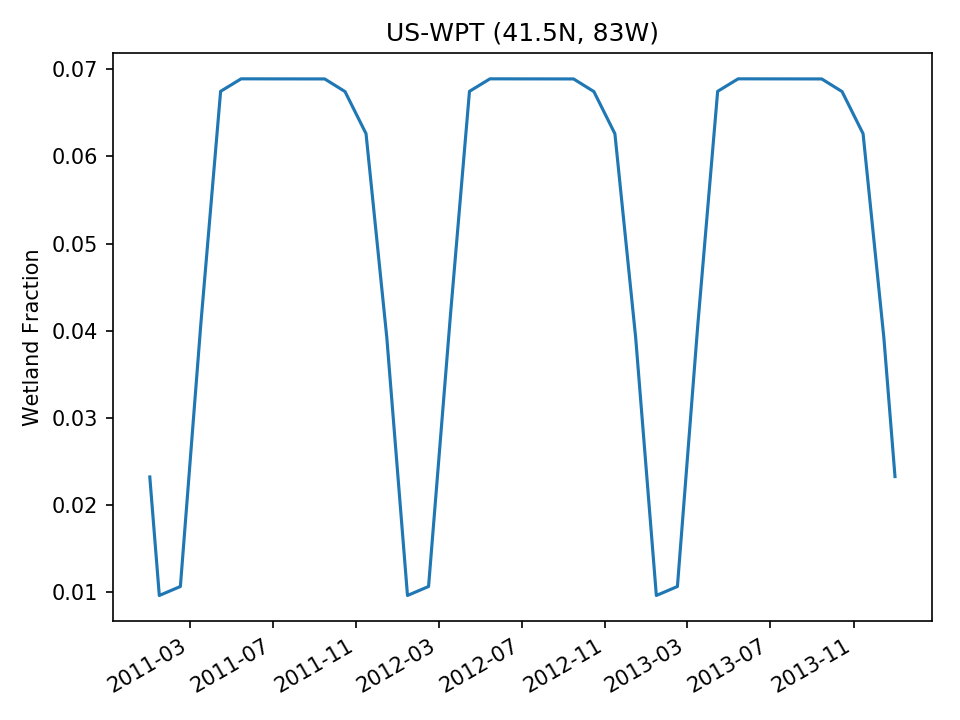 |
| Last modified: 24/06/2021 12:01:47 |
| ← Fluxnet-CH4b | Global → |